


Kml freeware
Kml
Added: January 25, 2010 | Visits: 1.477
 HoudahGPS allows you to transfer track log and waypoint data from your Garmin, Magellan or Wintec GPS devices. It connects via USB to the Garmin and Magellan devices. It interfaces with the Wintec WBT-100, WBT-101 and WBT-201 devices using Bluetooth. HoudahGPS may also be used to convert between...
Platforms: Mac
HoudahGPS allows you to transfer track log and waypoint data from your Garmin, Magellan or Wintec GPS devices. It connects via USB to the Garmin and Magellan devices. It interfaces with the Wintec WBT-100, WBT-101 and WBT-201 devices using Bluetooth. HoudahGPS may also be used to convert between...
Platforms: Mac
| License: Freeware | Download (122): HoudahGPS Download |
Released: May 28, 2012
|
Added: July 18, 2012 | Visits: 1.075
 RouteConverter displays, modifies, enriches and converts GPS data between over 75 formats. It works without installation under Linux, Mac OS X and Windows, automatically detects the format of a file, supports drag and drop, undo and redo, offers a map view onto the positions of routes, tracks and...
Platforms: Windows, Mac, *nix, Windows 7, Solaris,FreeBSD,OpenBSD,Java
RouteConverter displays, modifies, enriches and converts GPS data between over 75 formats. It works without installation under Linux, Mac OS X and Windows, automatically detects the format of a file, supports drag and drop, undo and redo, offers a map view onto the positions of routes, tracks and...
Platforms: Windows, Mac, *nix, Windows 7, Solaris,FreeBSD,OpenBSD,Java
| License: Freeware | Size: 6.61 MB | Download (162): RouteConverter Download |
Released: June 25, 2012
|
Added: June 25, 2012 | Visits: 877
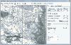
 The free AvisMap Viewer opens most GIS/CAD and raster image file types and most ArcView, ArcExplorer, and MapInfo projects. Besides just opening and viewing files, the Viewer supports an extensive list of features including visual layer properties control, legend control, thematic mapping,...
Platforms: Windows
The free AvisMap Viewer opens most GIS/CAD and raster image file types and most ArcView, ArcExplorer, and MapInfo projects. Besides just opening and viewing files, the Viewer supports an extensive list of features including visual layer properties control, legend control, thematic mapping,...
Platforms: Windows
| License: Freeware | Size: 23.17 MB | Download (449): Free Shapefile Viewer Download |
Released: October 20, 2012
|
Added: October 20, 2012 | Visits: 697
 Features:
View 24K or 100K topographic maps and other topographic data.
Displays maps in 2-D or 3-D, including elevation profiles.
View and rotate maps at any angle.
Create waypoints and routes on your computer and transfer maps, waypoints, routes, tracks and geotagged photos between your...
Platforms: Mac
Features:
View 24K or 100K topographic maps and other topographic data.
Displays maps in 2-D or 3-D, including elevation profiles.
View and rotate maps at any angle.
Create waypoints and routes on your computer and transfer maps, waypoints, routes, tracks and geotagged photos between your...
Platforms: Mac
| License: Freeware | Size: 51 MB | Download (67): Garmin BaseCamp for Mac OS Download |
Released: July 10, 2012
|
Added: July 10, 2012 | Visits: 423
Allows you to transfer track log and waypoint data from your Garmin, Magellan or Wintec GPS devices. It connects via USB to the Garmin and Magellan devices. It interfaces with the Wintec WBT-100, WBT-101 and WBT-201 devices using Bluetooth.
HoudahGPS may also be used to convert between the GPX,...
Platforms: Mac
| License: Freeware | Size: 1.3 MB | Download (53): HoudahGPS for Mac OS Download |
Released: September 02, 2012
|
Added: September 02, 2012 | Visits: 592
A ham radio logging application for Mac OS X. Aether includes tools to quickly and easily log QSOs while on the air, as well as organize, search and track your QSOs later. Aether was designed for Mac OS X, and has the same kind of clean, intuitive, friendly interface youve come to expect on the...
Platforms: Mac
| License: Freeware | Size: 10.7 MB | Download (483): Aether for Mac OS Download |
Released: August 14, 2012
|
Added: August 14, 2012 | Visits: 693
View your Analytics Georeports on a 3D Google Earth Globe in the integrated browser (which utilises the Google Earth Internet-Plugin) or export your data to a .kml file which you can import in the standalone version of Google Earth.Simply choose one of your Analytics profiles, specify a timeframe...
Platforms: Mac
| License: Freeware | Size: 931.84 KB | Download (441): Analytics to Earth for Mac OS Download |
Released: June 13, 2012
|
Added: June 13, 2012 | Visits: 452
 CycloGraph is a handy program to help you plot the gradient of roads using distances and heights. An Open Source alternative to Salitaker for plotting the profile of the roads you are planning to do with your bicycle. It also can import routes from kml. FEATURES: · import kml files · open...
Platforms: Windows
CycloGraph is a handy program to help you plot the gradient of roads using distances and heights. An Open Source alternative to Salitaker for plotting the profile of the roads you are planning to do with your bicycle. It also can import routes from kml. FEATURES: · import kml files · open...
Platforms: Windows
| License: Freeware | Size: 16.2 MB | Download (504): CycloGraph Download |
Released: July 09, 2012
|
Added: July 09, 2012 | Visits: 541
 Automatically extract from a geotagged image’s metadata, and then visually imprint (stamp), the GPS position, location description, altitude, date, date and time, or any combination of these or any other file metadata, onto a photo with no loss in image quality. It is a lossless JPEG process...
Platforms: Windows
Automatically extract from a geotagged image’s metadata, and then visually imprint (stamp), the GPS position, location description, altitude, date, date and time, or any combination of these or any other file metadata, onto a photo with no loss in image quality. It is a lossless JPEG process...
Platforms: Windows
| License: Freeware | Size: 11.9 MB | Download (406): GPStamper Download |
Released: October 09, 2012
|
Added: October 09, 2012 | Visits: 438
 OkCustomMap is a software to produce Garmin Custom Maps.
Supports many map formats:
- OkMap
- Ecw
- GeoTiff
- World files
- OziExplorer
- GpsTuner
You can customize:
- The quality of the output JPEG images (0=Bad, 100=Good)
- The KML transparency (0=Transparent, 255=Opaque)
- The KML draw...
Platforms: Windows
OkCustomMap is a software to produce Garmin Custom Maps.
Supports many map formats:
- OkMap
- Ecw
- GeoTiff
- World files
- OziExplorer
- GpsTuner
You can customize:
- The quality of the output JPEG images (0=Bad, 100=Good)
- The KML transparency (0=Transparent, 255=Opaque)
- The KML draw...
Platforms: Windows
| License: Freeware | Size: 3.22 MB | Download (56): OkCustomMap Download |
Released: December 16, 2012
|
Added: December 16, 2012 | Visits: 271
 Geofunctions is an open-source library of XSLT / functions, templates, stylesheets and classes devoted to the processing of geographic data in XML. The primary goal is to enable processing of GML, KML and GeoRSS in the XSLT langugage.
Platforms: Windows, Mac, Linux
Geofunctions is an open-source library of XSLT / functions, templates, stylesheets and classes devoted to the processing of geographic data in XML. The primary goal is to enable processing of GML, KML and GeoRSS in the XSLT langugage.
Platforms: Windows, Mac, Linux
| License: Freeware | Size: 7.87 MB | Download (44): Geofunctions Download |
Released: June 15, 2012
|
Added: June 15, 2012 | Visits: 394
 Application for geocaching or waymarking that allows you to import GPX or LOC files for editing. You can print out cheat sheets to take on the trail, export to KML or HTML, and send the data to your handheld GPS unit.
Platforms: Windows, Mac, Linux
Application for geocaching or waymarking that allows you to import GPX or LOC files for editing. You can print out cheat sheets to take on the trail, export to KML or HTML, and send the data to your handheld GPS unit.
Platforms: Windows, Mac, Linux
| License: Freeware | Size: 19.78 MB | Download (52): TinyGPX Download |
Released: September 20, 2012
|
Added: September 20, 2012 | Visits: 483
Divers’ Diary, the customized interface solution for ICON HD net ready Puck, Nemo Wide, Nemo Air, Nemo Excel and Matrix dive computers. Adds some interesting features that you are going to appreciate.
After downloading dives onto the Mac, Divers' Diary offers the possibility of viewing,...
Platforms: Mac
| License: Freeware | Size: 4.1 MB | Download (48): DiversDiary Download |
Added: May 10, 2013 | Visits: 293
These tracks are intended to be visualised on maps, plotted as distance/altitude profiles, have statistics derived from them, etc.The 'base' trackfield CCK field knows about latitude, longitude, altitude and distance.Due to the flexibility of the system, the distance/altitude pairs can be...
Platforms: Windows, Mac, *nix, PHP, BSD Solaris
| License: Freeware | Download (54): Trackfield 5.x-0.5 Download |
Added: May 10, 2013 | Visits: 311
Each provided sub-module in this package should be a self-contained single formatter. It curently contains the KML Formatter.Installation - Unpack in your modules folder (usually /sites/all/modules/) and enable under Administer > Site Building > Modules. Requirements: - Drupal 5.x
Platforms: Windows, Mac, *nix, PHP, BSD Solaris
| License: Freeware | Download (48): CCK Formatters Download |
Added: July 14, 2013 | Visits: 233
GESCATTER creates a .kml file that displays colored circles at the locations specified by the vectors LON and LAT similar to ML's builtin function, SCATTER.The color of the circles is scaled relative to the values provided in third input, C.I searched the FEX's many submissions dealing with...
Platforms: Matlab
| License: Freeware | Size: 10 KB | Download (48): GESCATTER Download |
Added: August 20, 2013 | Visits: 524
With this plugin you can have Instant GPS Tracking for your WordPress site. (Extended version of GEOTAG plugin.). You can add coordinates to your posts and display maps with these positions. On these maps you can also display KML/KMZ files or the geotags of the images of your post. The plugin...
Platforms: PHP
| License: Freeware | Size: 10 KB | Download (52): Transportlines.com Free Fleet GPS Tracking - Geotag Download |
Added: July 11, 2013 | Visits: 440
This plugin lets you save location information with posts, pages, and other WordPress objects. These objects can then be presented on interactive Google maps in many ways.ExamplesThere's a community sourced list of examples in action. People do all kinds of amazing things with Geo...
Platforms: PHP
| License: Freeware | Size: 419.84 KB | Download (51): Geo Mashup Download |
Added: July 28, 2013 | Visits: 347
Add GPSies Maps to your posts and pages.(Only for WordPress 2.5+) This plugin allows you to easily insert GPSies Maps and Track Details into your blog.This plugin is compliant with GPSies API (http://www.gpsies.com/api/GPSiesAPI_en.pdf) and permits to embed the following maps into your blog. 1....
Platforms: PHP
| License: Freeware | Size: 296.96 KB | Download (38): GPSies Embed Download |
Added: May 12, 2013 | Visits: 460
When editing a post or page, you will be able to set a physical location for that post and easily embed a Google map into your post. You can select the location by: 1. Clicking on the map of the world to position the point. 2. Searching for a location, town, city or address. 3. Entering the...
Platforms: PHP
| License: Freeware | Size: 440.32 KB | Download (54): WP Geo Download |