


Gps Spreadsheet freeware
Gps Spreadsheet
Added: May 26, 2006 | Visits: 4.202
 This program is a demo application for BitLevelGPS software library that provides a PC-based user application with access to a NMEA-183 compliant GPS receiver via a serial communications port. It provides navigational data update once per second, decoding NMEA sentences: $GPGGA (Global...
Platforms: Windows
| License: Freeware | Size: 300 KB | Download (335): BitLevelGPS Demo Download |
Released: July 17, 2006
|
Added: November 14, 2006 | Visits: 7.422
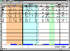
 XLCalendar is a calendar generator for Microsoft Excel that outputs calendars in Microsoft Excel spreadsheet format. Using XLCalendar, you can easily make various kinds of perpetual calendars, and custom calendars in your own language, holidays and styles.
Main features:
* Outputting...
XLCalendar is a calendar generator for Microsoft Excel that outputs calendars in Microsoft Excel spreadsheet format. Using XLCalendar, you can easily make various kinds of perpetual calendars, and custom calendars in your own language, holidays and styles.
Main features:
* Outputting...
Platforms: Windows
| License: Freeware | Size: 1 MB | Download (855): XLCalendar Download |
Released: January 07, 2012
|
Added: January 26, 2012 | Visits: 2.159
 Create a portfolio with this spreadsheet for Excel 97 or better. Enter your past and present stock holdings. See your gains and losses at a glance. Get on-line quotes from: CNN.com, Quicken.com, Quote.com, NASDAQ.com, MoneyCentral.com, Toronto (Yahoo), Yahoo India, Yahoo Hong Kong, Yahoo Deutschland
Platforms: Windows
| License: Freeware | Size: 3.75 MB | Download (391): StockWatch Download |
Released: December 29, 2010
|
Added: January 06, 2011 | Visits: 4.322
 OkMap is a GPS and map software that:
-Works with vectorial maps and calibrates raster maps
-Organizes paths by creating waypoints, routes and tracks
-Uploads/downloads data to/from your GPS
-Uses altitude DEM data
-Supports GPS real-time navigation
-Sends/receives vehicles position...
OkMap is a GPS and map software that:
-Works with vectorial maps and calibrates raster maps
-Organizes paths by creating waypoints, routes and tracks
-Uploads/downloads data to/from your GPS
-Uses altitude DEM data
-Supports GPS real-time navigation
-Sends/receives vehicles position...
Platforms: Windows
| License: Freeware | Size: 20.25 MB | Download (1277): OkMap Download |
Released: March 02, 2011
|
Added: March 08, 2011 | Visits: 3.147
 FileList is a command line utility that produces a list of files of the given path in CSV format, which can be imported in a spreadsheet or database. The list includes the file name, size, path, last access and change date, etc. Supported Windows versions: Windows 200*/XP/Vista.
Platforms: Windows
| License: Freeware | Size: 888.34 KB | Download (257): FileList Download |
Released: September 08, 2009
|
Added: September 14, 2009 | Visits: 3.877
 PhotoGPSEditor is an easy to use meta-data editor for photo (JPEG, RAW) files, plus it can match data from GPS (gpx or NMEA) files. The program is freeware, however, donations can be made to help support future development. With PhotoGPSEditor you can add location and summary details to a...
Platforms: Mac
| License: Freeware | Size: 2.39 MB | Download (1332): PhotoGPSEditor Download |
Released: January 14, 2010
|
Added: January 16, 2010 | Visits: 3.965
![]() The Picmeta Photo Tracker automatically geotags photos based on track information from any GPS device (.gpx files). It directly writes GPS EXIF data to .jpg, .tif, .crw, .dng, .nef, .pef, .jp2 formats. For other formats such as .cr2 it creates XMP sidecar files. The EXIFcare technology ensures...
The Picmeta Photo Tracker automatically geotags photos based on track information from any GPS device (.gpx files). It directly writes GPS EXIF data to .jpg, .tif, .crw, .dng, .nef, .pef, .jp2 formats. For other formats such as .cr2 it creates XMP sidecar files. The EXIFcare technology ensures...
Platforms: Windows
| License: Freeware | Size: 2.18 MB | Download (192): Picmeta Photo Tracker Download |
Added: September 04, 2010 | Visits: 1.267
kGpsImageTag reads gps data from a text file and correlates it with the photos in the same folder. Use Correlate data to correlate gps data with images. If an image does not have a gps entry, it is extrapolated. Use Hide/Show to hide/show all lines that do not correspond to an image.....
Platforms: *nix
| License: Freeware | Size: 409.6 KB | Download (97): kGpsImageTag Download |
Added: October 27, 2010 | Visits: 1.062
DateTime::Precise can perform common time and date operations with additional GPS operations. SYNOPSIS use DateTime::Precise; use DateTime::Precise qw(:TimeVars); # Constructors and ways to set time. $t1 = DateTime::Precise->new; $t2 = DateTime::Precise->new(1998. 4. 3 12:13:44.054);...
Platforms: *nix
| License: Freeware | Size: 34.82 KB | Download (95): DateTime::Precise Download |
Added: November 15, 2010 | Visits: 1.156
CleanSheets is a spreadsheet application for the Java platform. It features a formula language that closely resembles that of Microsoft Excel, and extensions for aiding end-user programmers in developing correct spreadsheets. The application is written in Java, and relies on ANTLR for...
Platforms: *nix
| License: Freeware | Download (149): CleanSheets Download |
Added: September 18, 2010 | Visits: 1.189
GNU Oleo is a lightweight spreadsheet application. It has internationalization support, an ncurses interface, a Motif/LessTif interface, and an autoconf/automake-based compilation process. Current enhancements include printing and plotting..
Platforms: *nix
| License: Freeware | Size: 788.48 KB | Download (110): GNU Oleo Download |
Added: July 09, 2010 | Visits: 819
Gnumeric is a powerful and easy to use spreadsheet using GNOME. Its goal is to provide a full featured spreadsheet and a smooth migration path for people and organizations currently using proprietary applications. Gnumeric provides more sheet functions and greatly improved accuracy when...
Platforms: *nix
| License: Freeware | Size: 16.5 MB | Download (113): Gnumeric Download |
Added: April 19, 2010 | Visits: 1.391
KSpread is a scriptable spreadsheet program which provides both table-oriented sheets and support for complex mathematical formulas and statistics.. K Desktop Environment Homepage, KDE.org
Platforms: *nix
| License: Freeware | Size: 54.4 MB | Download (305): KSpread Download |
Added: March 10, 2010 | Visits: 1.228
Geo::Spline is a Perl module to calculate geographic locations between GPS fixes. SYNOPSIS use Geo::Spline; my $p0={time=>1160449100.67, #seconds lat=>39.197807, #degrees lon=>-77.263510, #degrees speed=>31.124, #m/s heading=>144.8300}; #degrees clockwise from North my...
Platforms: *nix
| License: Freeware | Size: 20.48 KB | Download (141): Geo::Spline Download |
Added: June 21, 2010 | Visits: 1.471
QLandkarte can view and upload map files, track and waypoint data to your Garmin GPS receiver. Garmins MapSource software is hardly the only reason for me to boot into Windows and it does not look like Garmin ever wants to address Linux users by writing a portable piece of software. So I...
Platforms: *nix
| License: Freeware | Size: 972.8 KB | Download (116): QLandkarte Download |
Added: June 06, 2010 | Visits: 1.204
Happy Camel is intended to combine your digital camera with your GPS device. It you feed it a list of digital photos and a tracklog, it figures out where these images were taken. Happy Camel can embed this position in the EXIF-data of your photos and create a .kmz file for Google Earth...
Platforms: *nix
| License: Freeware | Size: 19.46 KB | Download (95): Happy Camel 1 Beta Download |
Added: January 06, 2010 | Visits: 979
GoooooPS is a Java MIDlet that displays a position obtained from a GPS receiver on a Google Map Tile..
Platforms: *nix
| License: Freeware | Size: 13.31 KB | Download (110): GoooooPS Download |
Added: November 15, 2010 | Visits: 1.248
WIGS is both an API to talk to a GPS receiver over the serial port via the NMEA protocol supported by most GPS receivers, as well as an application that use this API. The first phase of the WIGS project is now completed as weve published the API. The second phase is to make an application to...
Platforms: *nix
| License: Freeware | Download (127): WIGS Download |
Added: January 25, 2010 | Visits: 1.402
GPSUtility displays GPS data including speed, bearing, position and satellite information.
Platforms: Mac
| License: Freeware | Download (148): GPSUtility Download |
Added: January 25, 2010 | Visits: 1.129
TrackRunner is a GPS-enabled exercise logbook.Coupled with a GPS receiver and using LoadMyTracks from ClueTrust to connect to your GPS device, you'll be able to log your workouts and keep track of distance, time, elevation, heart-rate etc. Activities can be organized into categories, and by...
Platforms: Mac
| License: Freeware | Download (112): TrackRunner Download |