


Gps Navigator Map freeware
Gps Navigator Map
Released: November 16, 2012
|
Added: November 16, 2012 | Visits: 489
 Provides hours of entertainment by combining the technology in your phone with one of the fastest-growing international hide and seek games - geocaching (also known as "GPS treasure hunt"). By using your Nokia's GPS and built-in Internet, Geocache Navigator™ creates a seamless and exciting...
Platforms: Handheld/Mobile Other, Java
| License: Freeware | Size: 225.28 KB | Download (534): Geocache Navigator Download |
Released: October 25, 2012
|
Added: October 25, 2012 | Visits: 799
 StatPlanet Map Maker is a free program for creating highly interactive Flash maps which can be published online. A stand-alone offline version is also included. Data can be imported automatically, so new interactive maps can be created within minutes. Maps are completely customizable. Use the...
Platforms: Windows
| License: Freeware | Size: 7.4 MB | Download (534): StatPlanet Map Maker Download |
Released: August 25, 2012
|
Added: August 25, 2012 | Visits: 594
 VirtualGPS - is a free, small utility, which fully emulates GPS receiver and returns your location (by using cellular towers and wifi hotspots). Location accuracy is about 50-500m. TUTORIAL 1. Run VirtualGPS, wait less than 1 minute until GPS: ON (or OFF in bad case) will be shown. 2. Run...
Platforms: Windows, Mac, Palm OS 1.0, Palm OS 2.0, Palm OS 2.1, Palm OS 3.0, Palm OS 3.1, Palm OS 3.2
| License: Freeware | Size: 195 KB | Download (529): VirtualGPS Download |
Released: January 11, 2013
|
Added: January 11, 2013 | Visits: 733
 Super GPS Store Search Helps You Find The Best Deals On GPS's Search though thousands of GPS related products with ease. Shopping Secured By Amazon.com All this in this free application, requires no install, has no adware or spyware.
Platforms: Windows
| License: Freeware | Size: 756 KB | Download (517): Super GPS Store Search Software Download |
Released: November 10, 2012
|
Added: November 10, 2012 | Visits: 710
 Have a GPS and a laptop? Use this to find your way. Make patterns or a trail to share with others. When the application starts, you may pick your area of operations - be it North America, South America, Europe and Asia, or Australia. Your quadrant is determined by where you are in relation to the...
Platforms: Windows
| License: Freeware | Size: 4.56 MB | Download (503): LAS GPS Monitor LT Download |
Released: November 07, 2012
|
Added: November 07, 2012 | Visits: 621
 With this tool you can add GPS coordinates to vCards - electronic business cards - that you have previously exported from e. g. Microsoft Outlook. Therefore the tool uses the address data contained within the vCards and adds the exact GPS position on that basis to the vCard. This way you can use...
Platforms: Windows
| License: Freeware | Size: 1.47 MB | Download (503): GPS to vCard Download |
Released: October 11, 2012
|
Added: October 11, 2012 | Visits: 603
QLandkarte GT is a handy, easy to use program specially designed to offer users a ultimate outdoor aficionado's tool.
This application offers support for GPS maps in GeoTiff format as well as Garmin's img vector map format.
for WindowsXP, Vista, 7
Platforms: Windows, Windows Vista, 7
| License: Freeware | Download (498): QLandkarte GT Download |
Released: November 03, 2012
|
Added: November 03, 2012 | Visits: 487
POI Loader for Windows allows you to load custom points of interest into your unit. The input files can be downloaded from the internet or you can create your own. With POI Loader for Windows, you can configure the unit to alert you when you are within a certain distance of a point or if you are...
Platforms: Windows
| License: Freeware | Size: 16.6 MB | Download (495): er Download |
Added: August 25, 2008 | Visits: 1.167
Greenfish Relief Map Generator - This utility generates random images which resemble real relief maps. The randomized maps contain settlements with random names, hills, plains, lakes and seasides. The generated images are public domain and can be used anywhere. Note that the generated settlements...
Platforms: Windows
| License: Freeware | Size: 234 KB | Download (492): Greenfish Relief Map Generator Download |
Released: September 07, 2012
|
Added: September 07, 2012 | Visits: 682
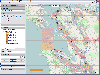
 GPS Converter will convert GPS coordinates between three different formats: 34.26965, -116.76783; N 34° 16.179', W 116° 46.07'; and N 34° 16' 10.74", W 116° 46' 4.2". Will map the results in Google Maps.
Platforms: Windows
| License: Freeware | Size: 1.14 MB | Download (491): GPS Converter Download |
Released: January 27, 2013
|
Added: January 27, 2013 | Visits: 1.105
 CMC Multimedia Sistem SRL ofera: Sisteme de Monitorizare Vehicule si Localizare prin GPS, Receptoare de ultima generatie GPS, Navigatie prin Sisteme GPS, Sisteme Urmarire GPS Auto, Abonamente GPS si Sisteme de Urmarire a Masinilor, GPS Tracking, Sisteme Navigatie Romania si International,...
Platforms: Windows, Mac, Unix, Linux, Palm OS 6.0, Pocket PC, RIM, Symbian, Handheld/Mobile Other, OpenVMS, Netware, BEOS, Java
| License: Freeware | Size: 974 KB | Download (476): Sisteme de Localizare, Monitorizare GPS Download |
Released: September 24, 2012
|
Added: September 24, 2012 | Visits: 844
Wallpaper for an amazing 3D arcade game "Adventures of Tuber: Map of Treasures". Getting the map of treasures, our great explorer, Tuber, finds himself in the underwater maze. Tuber’s aim is to find his way to a lost Halloween island. You should solve a series of mind-stretching tasks, using...
Platforms: Windows
| License: Freeware | Size: 4.05 MB | Download (472): Wallpapers: Map of Treasures Download |
Added: August 08, 2008 | Visits: 1.226
 einfodaily.com Navigator is an all-in-one internet and news navigation client that allows you to browse through all the news you need through easy one-click menu options as well as a easy-to-use news sidebar. To make your computer experience even smoother, an intelligent pop-up ad blocker is...
Platforms: Windows
| License: Freeware | Size: 2.58 MB | Download (471): einfodaily Navigator Download |
Released: October 23, 2012
|
Added: October 23, 2012 | Visits: 655
GPS Utility is an easy-to-use application that provides management and manipulation of GPS information. You can use it to transfer data to/from a GPS receiver and store the data in PC files in one of several text formats.
The program converts between different map datums and many coordinate...
Platforms: Windows
| License: Freeware | Size: 1.87 MB | Download (469): GPS Utility Download |
Released: October 24, 2012
|
Added: October 24, 2012 | Visits: 678
 QGIS supports vector, raster, and database formats and lets you browse and create map data on your computer.
Quantum GIS (QGIS) supports many common spatial data formats (e.g. ESRI ShapeFile, geotiff). QGIS supports plugins to do things like display tracks from your GPS.
QGIS aims to be an...
QGIS supports vector, raster, and database formats and lets you browse and create map data on your computer.
Quantum GIS (QGIS) supports many common spatial data formats (e.g. ESRI ShapeFile, geotiff). QGIS supports plugins to do things like display tracks from your GPS.
QGIS aims to be an...
Platforms: Linux
| License: Freeware | Size: 1024 KB | Download (460): Quantum GIS form Linux Download |
Released: October 11, 2012
|
Added: October 11, 2012 | Visits: 776
 QGIS supports vector, raster, and database formats and lets you browse and create map data on your computer.
Quantum GIS (QGIS) supports many common spatial data formats (e.g. ESRI ShapeFile, geotiff). QGIS supports plugins to do things like display tracks from your GPS.
QGIS aims to be an...
QGIS supports vector, raster, and database formats and lets you browse and create map data on your computer.
Quantum GIS (QGIS) supports many common spatial data formats (e.g. ESRI ShapeFile, geotiff). QGIS supports plugins to do things like display tracks from your GPS.
QGIS aims to be an...
Platforms: Windows
| License: Freeware | Size: 77.3 MB | Download (453): Quantum GIS Download |
Released: September 04, 2012
|
Added: September 04, 2012 | Visits: 752
 Mobile Atlas Creator (formerly known as TrekBuddy Atlas Creator) is an open source (GPL) program which creates offline atlases for GPS handhelds and cell phone applications like TrekBuddy, AndNav and other Android and WindowsCE based applications.
For the full list of supported applications...
Mobile Atlas Creator (formerly known as TrekBuddy Atlas Creator) is an open source (GPL) program which creates offline atlases for GPS handhelds and cell phone applications like TrekBuddy, AndNav and other Android and WindowsCE based applications.
For the full list of supported applications...
Platforms: Mac
| License: Freeware | Size: 1.6 MB | Download (448): Mobile Atlas Creator for Mac OS X Download |
Released: July 24, 2012
|
Added: July 24, 2012 | Visits: 784
 QGIS supports vector, raster, and database formats and lets you browse and create map data on your computer.
Quantum GIS (QGIS) supports many common spatial data formats (e.g. ESRI ShapeFile, geotiff). QGIS supports plugins to do things like display tracks from your GPS.
QGIS aims to be an...
QGIS supports vector, raster, and database formats and lets you browse and create map data on your computer.
Quantum GIS (QGIS) supports many common spatial data formats (e.g. ESRI ShapeFile, geotiff). QGIS supports plugins to do things like display tracks from your GPS.
QGIS aims to be an...
Platforms: Mac
| License: Freeware | Size: 1024 KB | Download (440): Quantum GIS form Mac Download |
Released: June 03, 2012
|
Added: June 03, 2012 | Visits: 729
The Genome Positioning System (GPS) is a software tool to study protein-DNA interaction using ChIP-Seq data. GPS builds a probabilistic mixture model to predict the most likely positions of binding events at single-base resolution.
GPS is a Java software, so it runs on multiple platforms,...
Platforms: Windows
| License: Freeware | Download (430): GPS Download |
Released: July 01, 2012
|
Added: July 01, 2012 | Visits: 758
 Atom GPS freeware easily geotags your photos directly from your GPS device or track log. By simply connecting your GPS Device to Atom GPS and selecting your photos you can add their geolocation in one click. This action allows you to write the geolocation data to your photos exifs (information...
Platforms: Windows
| License: Freeware | Size: 7.58 MB | Download (430): ATOM GPS Download |