


Gps Coordinates Conversion freeware
Gps Coordinates Conversion
Released: September 07, 2012
|
Added: September 07, 2012 | Visits: 683
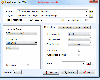
 GPS Converter will convert GPS coordinates between three different formats: 34.26965, -116.76783; N 34° 16.179', W 116° 46.07'; and N 34° 16' 10.74", W 116° 46' 4.2". Will map the results in Google Maps.
Platforms: Windows
GPS Converter will convert GPS coordinates between three different formats: 34.26965, -116.76783; N 34° 16.179', W 116° 46.07'; and N 34° 16' 10.74", W 116° 46' 4.2". Will map the results in Google Maps.
Platforms: Windows
| License: Freeware | Size: 1.14 MB | Download (491): GPS Converter Download |
Released: November 07, 2012
|
Added: November 07, 2012 | Visits: 622
 With this tool you can add GPS coordinates to vCards - electronic business cards - that you have previously exported from e. g. Microsoft Outlook. Therefore the tool uses the address data contained within the vCards and adds the exact GPS position on that basis to the vCard. This way you can use...
Platforms: Windows
With this tool you can add GPS coordinates to vCards - electronic business cards - that you have previously exported from e. g. Microsoft Outlook. Therefore the tool uses the address data contained within the vCards and adds the exact GPS position on that basis to the vCard. This way you can use...
Platforms: Windows
| License: Freeware | Size: 1.47 MB | Download (503): GPS to vCard Download |
Added: August 18, 2013 | Visits: 525
 A collection of utilities for translating GPS coordinates to related coordinate systems (Earth Centere Fixed, Topocentric, UTM) with auxiliary routins for horizon computation and ray ellipsoid intercepts.
Platforms: Matlab
A collection of utilities for translating GPS coordinates to related coordinate systems (Earth Centere Fixed, Topocentric, UTM) with auxiliary routins for horizon computation and ray ellipsoid intercepts.
Platforms: Matlab
| License: Freeware | Size: 1.28 MB | Download (57): GPS Coordinate Transformations Download |
Added: February 15, 2010 | Visits: 2.256
GPS Tracker project allows someone to track a GPS enabled cell phone using Google maps. For this project I used a Motorola i355 cell phone on the Sprint/Nextel network. You need to have a data plan so that you can make updates to your website from the cellphone. Please read the ReadMe.txt file...
Platforms: *nix
| License: Freeware | Download (203): GPS Tracker Download |
Added: June 06, 2010 | Visits: 1.206
Happy Camel is intended to combine your digital camera with your GPS device. It you feed it a list of digital photos and a tracklog, it figures out where these images were taken. Happy Camel can embed this position in the EXIF-data of your photos and create a .kmz file for Google Earth...
Platforms: *nix
| License: Freeware | Size: 19.46 KB | Download (95): Happy Camel 1 Beta Download |
Released: November 23, 2012
|
Added: November 23, 2012 | Visits: 525
 The main purpose of this popular tool is to quickly and easily resize photos from a digital camera to a smaller size for further use (especially to share the photos on web or by email). Nevertheless, Jpeg Resampler 2010 also offers many other features such as
* convert between image formats...
Platforms: Windows
The main purpose of this popular tool is to quickly and easily resize photos from a digital camera to a smaller size for further use (especially to share the photos on web or by email). Nevertheless, Jpeg Resampler 2010 also offers many other features such as
* convert between image formats...
Platforms: Windows
| License: Freeware | Size: 1.3 MB | Download (55): JPEG Resampler Download |
Released: November 02, 2012
|
Added: November 02, 2012 | Visits: 519
 The main purpose of this popular tool is to quickly and easily resize photos from a digital camera to a smaller size for further use (especially to share the photos on web or by email). Nevertheless, Jpeg Resampler 2010 also offers many other features such as * convert between image formats (JPG,...
Platforms: Windows
The main purpose of this popular tool is to quickly and easily resize photos from a digital camera to a smaller size for further use (especially to share the photos on web or by email). Nevertheless, Jpeg Resampler 2010 also offers many other features such as * convert between image formats (JPG,...
Platforms: Windows
| License: Freeware | Size: 1.3 MB | Download (52): JPEG Resampler 2010 Download |
Added: July 28, 2013 | Visits: 262
libchamplain is a C library created to provide a GTK+ widget to display rasterized maps. Here are some key features of "libchamplain": ?*A* Display a map (OpenStreetMap Mapnik) ?*A* Tiles are downloaded and cached ?*A* You can drag to move (la Google Maps) ?*A* without or with kinetic...
Platforms: *nix
| License: Freeware | Size: 655.36 KB | Download (39): libchamplain Download |
Added: June 28, 2013 | Visits: 373
gpx2map reads a gps track in GPX format (as produced by e.g. gpsbabel) and writes out an Google Map or or OpenStreetMaps mash-up containing the route and a height profile. gpx2map can also show GPS-tagged photos along the map. Installation Just copy (or link) the file gpx2map into your path or...
Platforms: *nix
| License: Freeware | Size: 92.16 KB | Download (45): gpx2map Download |
Released: August 08, 2012
|
Added: August 08, 2012 | Visits: 432
An all-in-one solution for resizing your images and getting them ready for online publication. With WaterThumber you can create High-Quality thumbnails and smaller versions of your images. You can also add a custom watermark to your images.
Important Features includes:
- Brightness/ Contrast/...
Platforms: Mac
| License: Freeware | Size: 5.6 MB | Download (436): WaterThumber for Mac OS Download |
Added: May 10, 2013 | Visits: 502
GPSTk project provides you an open source library for the satellite navigation management. The GPSTk library provides the base functionality for the GPSTk applications and for a number of other independent projects. There are several categories of functions in the GPSTk library: - GPS time....
Platforms: Windows, Mac, *nix, C/C++, BSD Solaris
| License: Freeware | Download (53): GPSTk Library Download |
Added: July 12, 2010 | Visits: 1.312
Geo::Coordinates::OSGB is a Perl module that can convert coordinates from Lat/Long to UK Grid. A UK-specific implementation of co-ordinate conversion, following formulae from the Ordnance Survey of Great Britain (hence the name). SYNOPSIS use Geo::Coordinates::OSGB qw(ll2grid grid2ll); #...
Platforms: *nix
| License: Freeware | Size: 4.1 KB | Download (113): Geo::Coordinates::OSGB Download |
Added: August 19, 2010 | Visits: 1.231
GPS::Babel is a Perl interface to gpsbabel. SYNOPSIS use GPS::Babel; my $babel = GPS::Babel->new(); # Read an OZIExplorer file into a data structure my $data = $babel->read(route.ozi, ozi); # Convert a file automatically choosing input and output # format based on extension...
Platforms: *nix
| License: Freeware | Size: 10.24 KB | Download (121): GPS::Babel Download |
Added: May 13, 2010 | Visits: 1.346
GPS::Lowrance is a Perl module connect to Lowrance and Eagle GPS devices. REQUIREMENTS The following modules are required to use this module: Carp::Assert GPS::Lowrance::LSI 0.23 Parse::Binary::FixedFormat Win32::SerialPort or Device::SerialPort If you will be using the...
Platforms: *nix
| License: Freeware | Size: 22.53 KB | Download (139): GPS::Lowrance Download |
Added: August 20, 2013 | Visits: 524
With this plugin you can have Instant GPS Tracking for your WordPress site. (Extended version of GEOTAG plugin.). You can add coordinates to your posts and display maps with these positions. On these maps you can also display KML/KMZ files or the geotags of the images of your post. The plugin...
Platforms: PHP
| License: Freeware | Size: 10 KB | Download (52): Transportlines.com Free Fleet GPS Tracking - Geotag Download |
Added: October 19, 2010 | Visits: 1.261
OpenInteract2::Conversion::ActionConfig is a Perl module that can convert old action.perl files into INI configurations. SYNOPSIS use OpenInteract2::Conversion::ActionConfig; my $old_config_text = join( , ); print OpenInteract2::Conversion::ActionConfig ->new( $old_config_text )...
Platforms: *nix
| License: Freeware | Size: 7.17 KB | Download (109): OpenInteract2::Conversion::ActionConfig Download |
Added: February 10, 2010 | Visits: 1.968
Iris is a video conversion utility in C++ that works as a front-end to mencoder. Iris Video Conversion Utility can run in command-line or graphical modes and currently supports conversion to DVD MPEG, DivX AVI and VCD MPEG This software intends to ease video conversion to common formats. Help...
Platforms: *nix
| License: Freeware | Size: 122.88 KB | Download (107): Iris Video Conversion Utility Download |
Added: March 24, 2010 | Visits: 1.188
GPS::SpaceTrack is a package for calculating the position of GPS satellites. SYNOPSIS use GPS::SpaceTrack; my $obj=GPS::SpaceTrack->new(filename=>"gps.tle"); print join("t", qw{Count PRN ELEV Azim SNR USED}), "n"; foreach ($obj->getsatellitelist({lat=>38.870997, lon=>-77.05596})) { print...
Platforms: *nix
| License: Freeware | Size: 52.22 KB | Download (117): GPS::SpaceTrack Download |
Added: July 10, 2010 | Visits: 1.480
GPS::PRN is a package for PRN - Object ID conversions. SYNOPSIS use GPS::PRN; my $obj = GPS::PRN->new(); print "PRN: ", $obj->prn_oid(22231), "n"; print "OID: ", $obj->oid_prn(1), "n"; This module maps GPS PRN number to Satellite OID and vice versa. Object Identification Number (OID)...
Platforms: *nix
| License: Freeware | Size: 4.1 KB | Download (230): GPS::PRN Download |
Added: October 25, 2010 | Visits: 974
Geo::Coordinates::VandH is a Perl module that can convert and manipulate telco V and H coordinates. SYNOPSIS To convert V: 5498 H: 2895 to lat/long coordinates: use Geo::Coordinates::VandH; $blah=new Geo::Coordinates::VandH; ($lat,$lon) = $blah->vh2ll(5498,2895); printf...
Platforms: *nix
| License: Freeware | Size: 4.1 KB | Download (115): Geo::Coordinates::VandH Download |