


Geography freeware
Geography
Released: October 24, 2012
|
Added: October 24, 2012 | Visits: 624
 FotoMaps is compact flash gallery designed to help you display your pictures on an interactive map. The user can choose any map, then place each photo at the exact location where it was taken.
This geographical context gives your photographs more meaning. It allows them to tell a story....
Platforms: Windows
FotoMaps is compact flash gallery designed to help you display your pictures on an interactive map. The user can choose any map, then place each photo at the exact location where it was taken.
This geographical context gives your photographs more meaning. It allows them to tell a story....
Platforms: Windows
| License: Freeware | Download (48): FotoMaps Download |
Released: June 20, 2012
|
Added: June 20, 2012 | Visits: 699
 Make graph into Googlr Earth to illustrate your presentations, papers, etc. GE-Graph was developed to generate graphs from kml files saved by GE. The file generated by GE-Graph can be exported to Google Earth. Make Bars graph Make graph with geometrical shapes (circles, squares, triangles, etc)....
Platforms: Windows
Make graph into Googlr Earth to illustrate your presentations, papers, etc. GE-Graph was developed to generate graphs from kml files saved by GE. The file generated by GE-Graph can be exported to Google Earth. Make Bars graph Make graph with geometrical shapes (circles, squares, triangles, etc)....
Platforms: Windows
| License: Freeware | Size: 1.81 MB | Download (57): GE-Graph Download |
Released: June 21, 2012
|
Added: June 21, 2012 | Visits: 912
 Commonly referred to as GRASS, this is a free Geographic Information System (GIS) used for geospatial data management and analysis, image processing, graphics/maps production, spatial modeling, and visualization. GRASS is currently used in academic and commercial settings around the world, as...
Platforms: Mac
Commonly referred to as GRASS, this is a free Geographic Information System (GIS) used for geospatial data management and analysis, image processing, graphics/maps production, spatial modeling, and visualization. GRASS is currently used in academic and commercial settings around the world, as...
Platforms: Mac
| License: Freeware | Size: 59 MB | Download (57): Grass GIS for Mac OS X Download |
Released: September 08, 2012
|
Added: September 08, 2012 | Visits: 472
Anki is a program which makes remembering things easy. Because it is a lot more efficient than traditional study methods, you can either greatly decrease your time spent studying, or greatly increase the amount you learn.
Anyone who needs to remember things in their daily life can benefit from...
Platforms: Linux
| License: Freeware | Size: 1024 KB | Download (46): Anki for Linux Download |
Released: July 09, 2012
|
Added: July 09, 2012 | Visits: 343
Take a spin across the USA! Package of challenging puzzles for the states and capitals of the United States. Used in schools and homes around the world; geography scores improve rapidly. Serves as level one for the worldwide version "GeoPuzzle!"
Platforms: Windows
| License: Freeware | Size: 853 KB | Download (500): USAPuzzle! Windows 2K+ Download |
Released: October 25, 2012
|
Added: October 25, 2012 | Visits: 799
 StatPlanet Map Maker is a free program for creating highly interactive Flash maps which can be published online. A stand-alone offline version is also included. Data can be imported automatically, so new interactive maps can be created within minutes. Maps are completely customizable. Use the...
Platforms: Windows
StatPlanet Map Maker is a free program for creating highly interactive Flash maps which can be published online. A stand-alone offline version is also included. Data can be imported automatically, so new interactive maps can be created within minutes. Maps are completely customizable. Use the...
Platforms: Windows
| License: Freeware | Size: 7.4 MB | Download (534): StatPlanet Map Maker Download |
Released: June 02, 2012
|
Added: June 02, 2012 | Visits: 427
 OpenCards is a free award-winning flashcard learning software. The basic idea of OpenCards is to use PowerPoint presentations (*.ppt) as flashcard sets. Thereby, slide-titles are considered as questions and the slide contents as their answers. Based on state-of-the-art memorization and scheduling...
Platforms: Linux
OpenCards is a free award-winning flashcard learning software. The basic idea of OpenCards is to use PowerPoint presentations (*.ppt) as flashcard sets. Thereby, slide-titles are considered as questions and the slide contents as their answers. Based on state-of-the-art memorization and scheduling...
Platforms: Linux
| License: Freeware | Size: 16.7 MB | Download (517): OpenCards for Linux Download |
Released: July 03, 2012
|
Added: July 03, 2012 | Visits: 439
 OpenCards is a free award-winning flashcard learning software. The basic idea of OpenCards is to use PowerPoint presentations (*.ppt) as flashcard sets. Thereby, slide-titles are considered as questions and the slide contents as their answers. Based on state-of-the-art memorization and scheduling...
Platforms: Mac
OpenCards is a free award-winning flashcard learning software. The basic idea of OpenCards is to use PowerPoint presentations (*.ppt) as flashcard sets. Thereby, slide-titles are considered as questions and the slide contents as their answers. Based on state-of-the-art memorization and scheduling...
Platforms: Mac
| License: Freeware | Size: 16.7 MB | Download (507): OpenCards for Mac OS X Download |
Released: November 26, 2012
|
Added: November 26, 2012 | Visits: 410
Anki is a program which makes remembering things easy. Because it is a lot more efficient than traditional study methods, you can either greatly decrease your time spent studying, or greatly increase the amount you learn.
Anyone who needs to remember things in their daily life can benefit from...
Platforms: Mac
| License: Freeware | Size: 24.96 MB | Download (596): Anki for Mac Download |
Released: December 16, 2012
|
Added: December 16, 2012 | Visits: 500
 OpenCards is a free award-winning flashcard learning software. The basic idea of OpenCards is to use PowerPoint presentations (*.ppt) as flashcard sets. Thereby, slide-titles are considered as questions and the slide contents as their answers. Based on state-of-the-art memorization and scheduling...
Platforms: Windows
OpenCards is a free award-winning flashcard learning software. The basic idea of OpenCards is to use PowerPoint presentations (*.ppt) as flashcard sets. Thereby, slide-titles are considered as questions and the slide contents as their answers. Based on state-of-the-art memorization and scheduling...
Platforms: Windows
| License: Freeware | Size: 16.7 MB | Download (693): OpenCards Download |
Released: June 04, 2012
|
Added: June 04, 2012 | Visits: 475
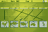 In this game there will be some country names and some maps of countries. Your task is to match the country names with the correct maps. You match them by using the mouse to draw a line to connect the dots of the country names and the maps. There are a total of 5 levels and each level will be...
Platforms: Windows
In this game there will be some country names and some maps of countries. Your task is to match the country names with the correct maps. You match them by using the mouse to draw a line to connect the dots of the country names and the maps. There are a total of 5 levels and each level will be...
Platforms: Windows
| License: Freeware | Size: 262 KB | Download (451): Mapping Maps Download |
Released: October 11, 2012
|
Added: October 11, 2012 | Visits: 222
GML4J was an experimental (i.e. hacked together quickly) Java API for work with the Geography Markup Language (GML). There has been no development since 2001/2. See https://sourceforge.net/projects/gascom/ for an API with a similar purpose.
Platforms: Windows, Mac, Linux
| License: Freeware | Size: 3.14 MB | Download (46): GML4J Download |
Added: May 10, 2013 | Visits: 341
GNU Gama is a package for adjustment of geodetic free networks (acronym Gama is formed from words geodesy and mapping). GNU Gama is written in C and currently supports only adjustment in a local carthesian coordinate system; adjustment in global coordinate system is part of new development...
Platforms: *nix, C/C++, BSD
| License: Freeware | Download (62): GNU Gama Download |
Added: May 10, 2013 | Visits: 327
GeoClass helps you to handle georeferenced data (latitude and longitude values for a location). It enables the connection to databases which provide these data or you can easily create your own GeoObjects. Features are: circumference search in (relational) databases, handlers for NIMA-DB and...
Platforms: Windows, Mac, *nix, PHP, BSD Solaris
| License: Freeware | Download (60): GeoClass Download |
Added: April 10, 2013 | Visits: 798
Ever used a yellow highlighter? It's the most natural publishing tool that was missing on the Web until now.To Try it: 1. Upon clicking the highlighter button (e.g. on this page itself), visitor's mouse cursor changes to a pen and s/he can highlight any part of your website in color. Mouse over...
Platforms: PHP
| License: Freeware | Size: 10 KB | Download (50): Instant Highlighter: Social Bookamrking with a TinyUrl that shows individual yellow highlights Download |
Added: July 03, 2013 | Visits: 341
Gumnut is a piece of communication software which may be used by a group of people to find an agreed positive direction for any decisions which affect the group. The group may be any size and associated by geography, common interest or both. The display is currently a simple text based interface...
Platforms: *nix
| License: Freeware | Size: 532.48 KB | Download (38): gumnut for Linux Download |
Added: September 21, 2013 | Visits: 474
A pluggable GeoDjango app with the boundaries of United States counties. Geography, loosely coupled. Features * A ready-to-serve model with all the counties in the United States * Geometry fields for three of the most common SRIDs. * Simplified geometry fields that thin down the data and...
Platforms: *nix
| License: Freeware | Size: 10.24 KB | Download (33): latimes-pluggablemaps-uscounties Download |
Added: June 21, 2013 | Visits: 454
Vocabularium is a tool for creating audio podcasts to help you learn Spanish vocabulary. It essentially works as follows: * from the options screen, you select the vocabulary topic of your podcast (note that new releases of the software will periodically be made with more topics); * each topic...
Platforms: *nix
| License: Freeware | Size: 92.16 KB | Download (37): Vocabularium Download |