


Geographic freeware
Geographic
Added: July 14, 2013 | Visits: 503
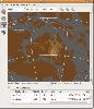
 Function that convert geographic coordinates to North azimuthal equal-area map with 25 kmresolution pixel (EASE-Grid projection or NL). That projection is used mainly in remote sensing and cover the northern hemisphere.If you want to know the corresponding pixel in the EASE-Grid projection to a...
Platforms: Matlab
| License: Freeware | Size: 10 KB | Download (51): geo2easeGrid Download |
Released: June 25, 2012
|
Added: June 25, 2012 | Visits: 306
The Research Geographic Information Kernel developed by Charles Ehlschlaeger and team.
Platforms: Windows, Mac, Linux
| License: Freeware | Size: 2.28 MB | Download (51): Ehlschlaeger RGIK Download |
Released: November 05, 2012
|
Added: November 05, 2012 | Visits: 467
About OpenMap
A mapping application and a Java Beans based toolkit for building applications and applets displaying geographic information. Using OpenMap components, you can access data from legacy applications, in-place, in a distributed setting. At its core, OpenMap is a set of Swing components...
Platforms: Mac
| License: Freeware | Size: 18.8 MB | Download (51): OpenMap 4.6.1 Download |
Added: July 11, 2013 | Visits: 439
This plugin lets you save location information with posts, pages, and other WordPress objects. These objects can then be presented on interactive Google maps in many ways.ExamplesThere's a community sourced list of examples in action. People do all kinds of amazing things with Geo...
Platforms: PHP
| License: Freeware | Size: 419.84 KB | Download (51): Geo Mashup Download |
Added: July 10, 2013 | Visits: 334
A module to provide a common interface for geoparsing services such as Yahoo!'s Placemaker and various CCK fields.Geoparsing?Geoparsing is the process by which structured geographic locations and their identifiers (eg placenames, lat-long coordinates) are extracted from unstructured content, such...
Platforms: PHP
| License: Freeware | Size: 10 KB | Download (51): Geoparser Download |
Released: July 15, 2012
|
Added: July 15, 2012 | Visits: 846
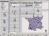
Geodata of the European and International countries offers you municipalities and postal codes. Georeferences as UTM- and geographic coordinates (WGS84, ETRS89). Suitable for branch searches, periphery searches and distance computations.
International Geo Data with geo referenced localities and...
Platforms: Windows
| License: Freeware | Download (50): Geo Data International Admin Download |
Released: November 20, 2012
|
Added: November 20, 2012 | Visits: 393
 GPlates is an interactive plate-tectonics visualisation program. GPlates enables interactive visualisation and manipulation of the plate-tectonic reconstructions of geological and paleo-geographic features through geological time.
Platforms: Windows, Mac, Linux
| License: Freeware | Size: 5.51 MB | Download (50): GPlates Download |
Added: July 03, 2013 | Visits: 369
GeoPress adds geographic tagging of your posts and pages. You can enter an address, points on a map, or enter latitude & longitude using the post interface. You can also include the post location within the body itself to make it easy to geotag using emailed posts and desktop clients. Maps can be...
Platforms: PHP
| License: Freeware | Size: 10 KB | Download (50): GeoPress Download |
Released: July 11, 2012
|
Added: July 11, 2012 | Visits: 555
GeographicLib is a small, handy set of C++ classes specially designed to help you convert between geographic, UTM, UPS, MGRS, geocentric, and local cartesian coordinates, for geoid calculations, and for computing geodesic.
The emphasis is on returning accurate results with errors close to...
Platforms: Windows
| License: Freeware | Download (49): GeographicLib Download |
Released: June 16, 2012
|
Added: June 16, 2012 | Visits: 478
CatMDEdit is a metadata editor tool for describing resources, mainly geographic information. Developed by IAAA (University of Zaragoza) and GeoSpatiumLab S.L., sponsored by IGN Spain. Technical details: Java, XML, multiplatform, multilingual.
Platforms: Windows, Mac, Linux
| License: Freeware | Size: 80.58 MB | Download (49): CatMDEdit - metadata editor Download |
Released: August 12, 2012
|
Added: August 12, 2012 | Visits: 322
 GeOxygene aims at providing an open framework which implements OGC/ISO specifications for the development and deployment of geographic (GIS) applications. It is a open source contribution of the COGIT lab. at the IGN (the French National Mapping Agency).
Platforms: Windows, Mac, Linux
| License: Freeware | Size: 1.11 MB | Download (49): GeOxygene Download |
Released: October 26, 2012
|
Added: October 26, 2012 | Visits: 608
iGuide - China Travel is multi-functional audio software designed for iPod. It covers comprehensive knowledge including some basic geographic knowledge in China. This software lists in detail the famous sights of more than 10 classic tourist tours and their folk customs. It can help you find out...
Platforms: Mac
| License: Freeware | Size: 14.3 MB | Download (49): iGuide - China Travel for iPod Download |
Added: June 30, 2013 | Visits: 398
A set of functions to calculate coordinate transformations between different reference ellipsoids and different projections, including tools on:- transformation from cartesian to geographic coordinates and back- transformation from geographic coordinates to transverse mercator mapping or lambert...
Platforms: Matlab
| License: Freeware | Size: 614.4 KB | Download (49): Geodetic Transformations Toolbox Download |
Released: June 08, 2012
|
Added: June 08, 2012 | Visits: 447
Mapyrus is software to plot Geographic Information System data to PostScript, PDF, SVG and web image files. Mapyrus combines a BASIC-like scripting language, reading GIS datasets and running as either a utility program, a Java Servlet, or as a webser
Platforms: Windows, Mac, Linux
| License: Freeware | Size: 3.27 MB | Download (48): mapyrus Download |
Added: May 10, 2013 | Visits: 675
CNStats STD (CNStats Standard) is a flexible and versatile system for accumulation and analysis of a site statistics attendance. More than 50 base reports are available via web-interface. CNStats STD works at any hosting which supports MySQL and PHP.CNStats STD suits to upcoming projects...
Platforms: PHP
| License: Freeware | Size: 2.68 MB | Download (48): CNStats STD for Scripts Download |
Released: August 06, 2013
|
Added: October 08, 2013 | Visits: 581
 MapCute turns yourself into a cutie! So you can socialize in a real geographic manner on map with hidden real identity under your cutie. Enjoy the freedom of geographic socializing while you are travelling without the awkwardness of being too shy! Key features include: Make yourself a cutie on...
Platforms: Windows, Mac, *nix, Windows 8, Windows Phone, Windows 7, iOS, Android, Handheld, Other,BlackBerry,iPhone,iPod,iTouch
| License: Freeware | Size: 14.67 MB | Download (48): MapCute Download |
Released: June 03, 2012
|
Added: June 03, 2012 | Visits: 487
 A web based Geographic Metadata Catalog for data description and discovery. It implements international standards (e.g. ISO19115/19139, Z39.50, CSW 2.0, OGC). It originates from the United Nations and is used by many governments as geoportal software
Platforms: Windows, Mac, Linux
| License: Freeware | Size: 201.06 MB | Download (47): GeoNetwork - Geographic Metadata Catalog Download |
Released: August 05, 2012
|
Added: August 05, 2012 | Visits: 593
Web Geostatistics is a free, open-source desktop application that displays website or application usage statistics using a 3D model of Planet Earth, with all the statistics based on the geographic location of the events. It runs on Windows and Linux operating systems, because it is developed...
Platforms: Windows
| License: Freeware | Size: 41.6 MB | Download (47): Web Geostatistics Download |
Released: October 19, 2012
|
Added: October 19, 2012 | Visits: 428
 Enigeo is a great way to learn countries and capitals around the world in a fun way. You can either play enigeo in quiz mode and try to answer questions about countries and captitals or you can just explore the world and learn about different countries.
Features:
* two modes: quiz mode and...
Enigeo is a great way to learn countries and capitals around the world in a fun way. You can either play enigeo in quiz mode and try to answer questions about countries and captitals or you can just explore the world and learn about different countries.
Features:
* two modes: quiz mode and...
Platforms: Windows
| License: Freeware | Download (47): Enigeo Download |
Released: October 20, 2012
|
Added: October 20, 2012 | Visits: 478
Pace & Place is an application for managing and visualizing GPS data and sports training data. It empowers the user to track training events and combine them with geographic data. Map, waypoint, track visualizations and geo-referencing of photos.
Platforms: Windows, Mac, Linux
| License: Freeware | Size: 38.31 MB | Download (47): Pace & Place Download |