


Geographic freeware
Geographic
Added: August 23, 2008 | Visits: 969
 Hipoqih is a new geographic location service that lets you detect and follow any person, or yourself, wherever you go anywhere in the world.Basically, the Hipoqih idea is to record georeference markers and receive them in mobile devices like phones, PDAs etc. The geographic location system is...
Platforms: Windows
| License: Freeware | Size: 5 KB | Download (134): Hipoqih Download |
Added: August 20, 2008 | Visits: 978
Copiks PhotoMapper helps you organize your photos by adding geographic information to the EXIF - data of the image called geotagging.The information can be inserted manually or using GPS data that you can import to the program.The location, photo thumbnails and GPS polygons can be exported...
Platforms: Windows
| License: Freeware | Size: 4 KB | Download (119): Copiks PhotoMapper Download |
Added: August 04, 2008 | Visits: 1.688
Welcome all seismology lovers! Earthquake 3D 3.03 is a geographic tool that continually offers you information about earthquakes (or small seismic movements) that happen all over the world, almost in real time.The program is connected to the Internet to have the information continually updated,...
Platforms: Windows
| License: Freeware | Size: 9 KB | Download (352): Earthquake 3D Download |
Added: August 16, 2008 | Visits: 947
Thuban is an interactive viewer for geographic data (GIS), that offers its users diverse advanced ways and means to view and explore this type of material.It is not only a free geographical information explorer but also of open code. So, you can freely use it and also modify it if you wish. Here...
Platforms: Windows
| License: Freeware | Size: 4 KB | Download (145): Thuban Download |
Added: August 17, 2008 | Visits: 1.004
IPSearchLight is a software component used to identify the geographic location of website visitors, often within a few miles from the exact location. The process utilizes each visitor's IP address; this technique is silent and unintrusive. IPSearchLight is ideal for practical applications like...
Platforms: Windows
| License: Freeware | Size: 8.74 KB | Download (447): IPSearchLight GeoLocator for ASP.NET 2.0 Download |
Added: April 24, 2010 | Visits: 1.026
WebService::Mappoint is a client SOAP implementation for Mappoint, Microsofts geographic maps web service, based on SOAP::Lite. SYNOPSIS Map fetch example for use with Mappoint 3.0 service. use WebService::Mappoint; use MIME::Base64; my $render = new WebService::Mappoint::Render(); my...
Platforms: *nix
| License: Freeware | Size: 8.19 KB | Download (119): WebService::Mappoint Download |
Added: March 03, 2010 | Visits: 1.360
Geo::Inverse is a Perl module to calculate geographic distance from a lat & lon pair. SYNOPSIS use Geo::Inverse; my $obj = Geo::Inverse->new(); # default "WGS84" my ($lat1,$lon1,$lat2,$lon2)=(38.87, -77.05, 38.95, -77.23); my ($faz, $baz, $dist)=$obj->inverse($lat1,$lon1,$lat2,$lon2);...
Platforms: *nix
| License: Freeware | Size: 4.1 KB | Download (152): Geo::Inverse Download |
Added: September 17, 2010 | Visits: 1.163
PostGIS adds support for geographic objects to the PostgreSQL object-relational database. In effect, PostGIS "spatially enables" the PostgreSQL server, allowing it to be used as a backend spatial database for geographic information systems (GIS), much like ESRIs SDE or Oracles Spatial extension....
Platforms: *nix
| License: Freeware | Size: 1.4 MB | Download (98): PostGIS Download |
Added: April 24, 2010 | Visits: 913
Geolizer is a patch for Webalizer that uses the GeoIP library to generate faster and more reliable geographic statistics than the default DNS suffix method. It is recommended that DNS reversal be disabled on your HTTP server for improved performance and more accurate statistics. It can be...
Platforms: *nix
| License: Freeware | Size: 76.8 KB | Download (93): Geolizer Download |
Added: January 25, 2010 | Visits: 1.228
ArcExplorer is a lightweight GIS data viewer developed by ESRI. This freely available software offers an easy way to perform basic GIS functions. ArcExplorer is used for a variety of display, query, and data retrieval applications and supports a wide variety of standard data sources. It can be...
Platforms: Mac
| License: Freeware | Size: 13.3 MB | Download (161): ArcExplorer Download |
Added: January 25, 2010 | Visits: 1.035
TrailRunner is a route planning software for all kinds of long distance sports like running, biking, hiking, inline-skating, skiing and more. If you ever asked yourself how long your workout routes are and what route you should choose for this evening - then TrailRunner should be your...
Platforms: Mac
| License: Freeware | Download (123): TrailRunner Download |
Released: August 16, 2012
|
Added: August 16, 2012 | Visits: 529
uDig is a user-friendly desktop Internet GIS, a core element in an internet aware Geographic Information System.
The application is an open source spatial data viewer / editor, that comes with a special emphasis on the OpenGIS standards for internet GIS, the Web Map Server and Web Feature Server...
Platforms: Windows
| License: Freeware | Download (439): uDig Download |
Released: November 05, 2012
|
Added: November 05, 2012 | Visits: 678
Bring National Geographic to life in Lilly Wu and the Terra Cotta Mystery, and lead a forensic expedition to settle a 2,000 year-old mystery. Emperor Qin was the first Emperor of China who died under mysterious circumstances. Was it an accident, or an assassination? Two thousand years later, the...
Platforms: Mac
| License: Freeware | Size: 192 MB | Download (502): Lilly Wu & the Terra Cotta Mystery for Mac OS Download |
Released: November 03, 2012
|
Added: November 03, 2012 | Visits: 994
Explore rainforest scenes and find clues to follow the trail of a missing National Geographic researcher, and discover the Lost City of the Amazon. Using the tools and clues you find along the way, trace the paths of explorers who searched for an ancient civilization. Decipher mysterious messages...
Platforms: Mac
| License: Freeware | Size: 124 MB | Download (506): Lost City of Z for Mac OS Download |
Released: October 01, 2012
|
Added: October 01, 2012 | Visits: 948
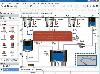 Visual Graph is a standard ActiveX component for developing graphics-related applications of various industries, such as power, coal, chemical, automation monitor, simulation, graphical modeling, graphical topology analysis, vector drawing, tables, geographic information system (GIS), workflow,...
Platforms: Windows
| License: Freeware | Size: 6.66 MB | Download (68): Visual Graph ActiveX Component Download |
Released: June 21, 2012
|
Added: June 21, 2012 | Visits: 911
 Commonly referred to as GRASS, this is a free Geographic Information System (GIS) used for geospatial data management and analysis, image processing, graphics/maps production, spatial modeling, and visualization. GRASS is currently used in academic and commercial settings around the world, as...
Platforms: Mac
| License: Freeware | Size: 59 MB | Download (57): Grass GIS for Mac OS X Download |
Released: August 05, 2012
|
Added: August 05, 2012 | Visits: 593
Web Geostatistics is a free, open-source desktop application that displays website or application usage statistics using a 3D model of Planet Earth, with all the statistics based on the geographic location of the events. It runs on Windows and Linux operating systems, because it is developed...
Platforms: Windows
| License: Freeware | Size: 41.6 MB | Download (47): Web Geostatistics Download |
Released: September 12, 2012
|
Added: September 12, 2012 | Visits: 655
 New Zealand is notable for its geographic isolation and extraordinary fauna and flora. Due to the low population New Zealand still looks like the unpolluted paradise with clear shores, crisp waters, pure white snow and lush green foliage. The New Zealand Voyage Free screensaver shows you the...
Platforms: Windows
| License: Freeware | Size: 4.58 MB | Download (52): New Zealand Voyage Free Screensaver Download |
Released: September 25, 2012
|
Added: September 25, 2012 | Visits: 687
 As an elite volunteer for National Geographic’s Eco Rescue team, visit over 20 river sites across the world as you save species large and small by cleaning up the environment. Start with the prototype CleanClaw, a 1 man eco-friendly crane, and upgrade your equipment as you master currents and...
Platforms: Windows
| License: Freeware | Size: 65.03 MB | Download (474): Eco Rescue Rivers Download |
Released: July 18, 2012
|
Added: July 18, 2012 | Visits: 387
ArgooMap is an online, map-based discussion forum, which allows participants to reference their contributions to geographic locations.
Different versions of ArguMap and ArgooMap/Argoomap were developed by students supervised by Dr. Claus Rinner at Ryerson University (Toronto, Canada) with...
Platforms: Windows, Mac, Linux
| License: Freeware | Size: 668.61 KB | Download (43): ArgooMap Download |