


Analyze Geographic Information freeware
Analyze Geographic Information
Released: June 22, 2012
|
Added: June 22, 2012 | Visits: 708
 Thuban is an interactive geographic data viewer (GIS viewer) which features methods to visualize, explore, and analyze geographic information.
Thuban is an Interactive Geographic Data Viewer with the following features:
# Vector Data Support: Shapefile, PostGIS Layer and OGR
# Raster Data...
Platforms: Windows
Thuban is an interactive geographic data viewer (GIS viewer) which features methods to visualize, explore, and analyze geographic information.
Thuban is an Interactive Geographic Data Viewer with the following features:
# Vector Data Support: Shapefile, PostGIS Layer and OGR
# Raster Data...
Platforms: Windows
| License: Freeware | Size: 11.22 MB | Download (429): Thuban for Windows Download |
Released: October 21, 2012
|
Added: October 21, 2012 | Visits: 746
Thuban is an interactive geographic data viewer (GIS viewer) which features methods to visualize, explore, and analyze geographic information.
Thuban is an Interactive Geographic Data Viewer with the following features:
# Vector Data Support: Shapefile, PostGIS Layer and OGR
# Raster Data...
Platforms: Linux
| License: Freeware | Size: 1.18 MB | Download (464): Thuban for Linux Download |
Released: July 09, 2012
|
Added: July 09, 2012 | Visits: 693
 The Speak logic Information Analysis Desktop enables users to analyze manage information in their own desktops. For instance, while reading a webpage, a user may flag specific information, and then later that same information can be identified in the desktop, where it can then be analyzed. The...
Platforms: Windows
The Speak logic Information Analysis Desktop enables users to analyze manage information in their own desktops. For instance, while reading a webpage, a user may flag specific information, and then later that same information can be identified in the desktop, where it can then be analyzed. The...
Platforms: Windows
| License: Freeware | Size: 30.53 MB | Download (52): Speak Logic Information Analysis Desktop Download |
Released: November 24, 2012
|
Added: November 24, 2012 | Visits: 753
 The Speak logic Information Analysis Desktop enables users to analyze manage information in their own desktops. For instance, while reading a webpage, a user may flag specific information, and then later that same information can be identified in the desktop, where it can then be analyzed. The...
Platforms: Windows
The Speak logic Information Analysis Desktop enables users to analyze manage information in their own desktops. For instance, while reading a webpage, a user may flag specific information, and then later that same information can be identified in the desktop, where it can then be analyzed. The...
Platforms: Windows
| License: Freeware | Size: 31.5 MB | Download (583): Speak Logic Information Analysis Desktop V Download |
Released: June 21, 2012
|
Added: June 21, 2012 | Visits: 913
 Commonly referred to as GRASS, this is a free Geographic Information System (GIS) used for geospatial data management and analysis, image processing, graphics/maps production, spatial modeling, and visualization. GRASS is currently used in academic and commercial settings around the world, as...
Platforms: Mac
Commonly referred to as GRASS, this is a free Geographic Information System (GIS) used for geospatial data management and analysis, image processing, graphics/maps production, spatial modeling, and visualization. GRASS is currently used in academic and commercial settings around the world, as...
Platforms: Mac
| License: Freeware | Size: 59 MB | Download (57): Grass GIS for Mac OS X Download |
Added: November 28, 2013 | Visits: 468
FMaps is here to answer the lack of user friendly opensource GIS/RS (Geographic Information System/ Remote Sensing) application on the Linux and Gnome compatible platforms.
Platforms: *nix
| License: Freeware | Size: 225.28 KB | Download (38): FMaps Download |
Released: November 05, 2012
|
Added: November 05, 2012 | Visits: 467
About OpenMap
A mapping application and a Java Beans based toolkit for building applications and applets displaying geographic information. Using OpenMap components, you can access data from legacy applications, in-place, in a distributed setting. At its core, OpenMap is a set of Swing components...
Platforms: Mac
| License: Freeware | Size: 18.8 MB | Download (51): OpenMap 4.6.1 Download |
Added: August 20, 2008 | Visits: 979
Copiks PhotoMapper helps you organize your photos by adding geographic information to the EXIF - data of the image called geotagging.The information can be inserted manually or using GPS data that you can import to the program.The location, photo thumbnails and GPS polygons can be exported...
Platforms: Windows
| License: Freeware | Size: 4 KB | Download (119): Copiks PhotoMapper Download |
Released: August 16, 2012
|
Added: August 16, 2012 | Visits: 531
uDig is a user-friendly desktop Internet GIS, a core element in an internet aware Geographic Information System.
The application is an open source spatial data viewer / editor, that comes with a special emphasis on the OpenGIS standards for internet GIS, the Web Map Server and Web Feature Server...
Platforms: Windows
| License: Freeware | Download (439): uDig Download |
Released: October 01, 2012
|
Added: October 01, 2012 | Visits: 951
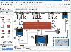 Visual Graph is a standard ActiveX component for developing graphics-related applications of various industries, such as power, coal, chemical, automation monitor, simulation, graphical modeling, graphical topology analysis, vector drawing, tables, geographic information system (GIS), workflow,...
Platforms: Windows
Visual Graph is a standard ActiveX component for developing graphics-related applications of various industries, such as power, coal, chemical, automation monitor, simulation, graphical modeling, graphical topology analysis, vector drawing, tables, geographic information system (GIS), workflow,...
Platforms: Windows
| License: Freeware | Size: 6.66 MB | Download (68): Visual Graph ActiveX Component Download |
Released: June 16, 2012
|
Added: June 16, 2012 | Visits: 479
CatMDEdit is a metadata editor tool for describing resources, mainly geographic information. Developed by IAAA (University of Zaragoza) and GeoSpatiumLab S.L., sponsored by IGN Spain. Technical details: Java, XML, multiplatform, multilingual.
Platforms: Windows, Mac, Linux
| License: Freeware | Size: 80.58 MB | Download (49): CatMDEdit - metadata editor Download |
Released: June 25, 2012
|
Added: June 25, 2012 | Visits: 309
The Research Geographic Information Kernel developed by Charles Ehlschlaeger and team.
Platforms: Windows, Mac, Linux
| License: Freeware | Size: 2.28 MB | Download (51): Ehlschlaeger RGIK Download |
Released: June 08, 2012
|
Added: June 08, 2012 | Visits: 450
Mapyrus is software to plot Geographic Information System data to PostScript, PDF, SVG and web image files. Mapyrus combines a BASIC-like scripting language, reading GIS datasets and running as either a utility program, a Java Servlet, or as a webser
Platforms: Windows, Mac, Linux
| License: Freeware | Size: 3.27 MB | Download (48): mapyrus Download |
Added: June 04, 2013 | Visits: 273
* Retrieve user's geographic information based on her ip address. This module is based on a relative accurate IP database from http://www.maxmind.com/app/geolitecity, which is free and will be updated regularly. Every time a user logs in, her ip address and geographic information will be updated...
Platforms: PHP
| License: Freeware | Size: 20.48 KB | Download (44): GeoUser Download |
Released: August 16, 2012
|
Added: August 16, 2012 | Visits: 1.087
 The Speak Logic Information Analysis for Internet Explorer enables users to analyze information and communications in Internet Explorer. While reading a website or webpage, if a user identifies information that’s needed to be analyzed, the user can analyze that information or flag it to analyze...
Platforms: Windows
The Speak Logic Information Analysis for Internet Explorer enables users to analyze information and communications in Internet Explorer. While reading a website or webpage, if a user identifies information that’s needed to be analyzed, the user can analyze that information or flag it to analyze...
Platforms: Windows
| License: Freeware | Size: 29.92 MB | Download (63): Speak Logic Information Analysis for Internet Explorer Download |
Released: July 15, 2012
|
Added: July 15, 2012 | Visits: 1.068
 The Speak Logic Information Analysis for Internet Explorer enables users to analyze information and communications in Internet Explorer. While reading a website or webpage, if a user identifies information that’s needed to be analyzed, the user can analyze that information or flag it to analyze...
Platforms: Windows
The Speak Logic Information Analysis for Internet Explorer enables users to analyze information and communications in Internet Explorer. While reading a website or webpage, if a user identifies information that’s needed to be analyzed, the user can analyze that information or flag it to analyze...
Platforms: Windows
| License: Freeware | Size: 32.85 MB | Download (51): Speak Logic Information Analysis for Internet Explorer V Download |
Released: September 17, 2021
|
Added: November 18, 2023 | Visits: 4.155
 OzGIS is an extensive system for the analysis and display of geographically
referenced data. About 150 menus provide an enormous range of options for:
. importing data from databases, spreadsheets and Geographic Information
Systems (GISs) or downloaded from Census Bureaux or mapping...
Platforms: Windows, Windows 8, Windows 7, Windows Server
OzGIS is an extensive system for the analysis and display of geographically
referenced data. About 150 menus provide an enormous range of options for:
. importing data from databases, spreadsheets and Geographic Information
Systems (GISs) or downloaded from Census Bureaux or mapping...
Platforms: Windows, Windows 8, Windows 7, Windows Server
| License: Freeware | Size: 313 KB | Download (1146): OzGIS Download |
Added: August 17, 2008 | Visits: 1.005
IPSearchLight is a software component used to identify the geographic location of website visitors, often within a few miles from the exact location. The process utilizes each visitor's IP address; this technique is silent and unintrusive. IPSearchLight is ideal for practical applications like...
Platforms: Windows
| License: Freeware | Size: 8.74 KB | Download (447): IPSearchLight GeoLocator for ASP.NET 2.0 Download |
Added: September 17, 2010 | Visits: 1.164
PostGIS adds support for geographic objects to the PostgreSQL object-relational database. In effect, PostGIS "spatially enables" the PostgreSQL server, allowing it to be used as a backend spatial database for geographic information systems (GIS), much like ESRIs SDE or Oracles Spatial extension....
Platforms: *nix
| License: Freeware | Size: 1.4 MB | Download (98): PostGIS Download |
Added: January 25, 2010 | Visits: 1.233
ArcExplorer is a lightweight GIS data viewer developed by ESRI. This freely available software offers an easy way to perform basic GIS functions. ArcExplorer is used for a variety of display, query, and data retrieval applications and supports a wide variety of standard data sources. It can be...
Platforms: Mac
| License: Freeware | Size: 13.3 MB | Download (161): ArcExplorer Download |