


Wgs84 software
Wgs84
Added: September 05, 2013 | Visits: 428
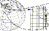
 SATGLOBE4e - Draws an idealized satellite view of earth scaled to match the WGS84 ellipsoid.This file renders a fully manipulatable satellite view of earth at a resolution of four pixels per degree, with added international political boundaries and gridlines. The imagery was obtained from NASA,...
Platforms: Matlab
SATGLOBE4e - Draws an idealized satellite view of earth scaled to match the WGS84 ellipsoid.This file renders a fully manipulatable satellite view of earth at a resolution of four pixels per degree, with added international political boundaries and gridlines. The imagery was obtained from NASA,...
Platforms: Matlab
| License: Freeware | Size: 1.23 MB | Download (47): WGS84 Ellipsoidal Earth Plotted at 4 pixels Per Degree Download |
Released: December 31, 2019
|
Added: January 08, 2020 | Visits: 1.276
 Geodata International - World-wide database of countries with georeferenced towns, municipalities, postal codes and administrative units with WGS84 and UTM coordinates and elevations for geocoding, proximity search, navigation, distance calculation. Often is it necessarily, for an address...
Platforms: Windows, Mac, *nix, Windows 8, Windows 7, iOS, Android, iPhone,iPad
Geodata International - World-wide database of countries with georeferenced towns, municipalities, postal codes and administrative units with WGS84 and UTM coordinates and elevations for geocoding, proximity search, navigation, distance calculation. Often is it necessarily, for an address...
Platforms: Windows, Mac, *nix, Windows 8, Windows 7, iOS, Android, iPhone,iPad
| License: Data Only | Cost: $165.00 USD | Size: 2.4 MB | Download (114): Geodata International Download |
Released: April 21, 2014
|
Added: July 16, 2014 | Visits: 995
 Geodata International - World-wide database of countries with georeferenced towns, municipalities, postal codes and administrative units with WGS84 and UTM coordinates and elevations for geocoding, proximity search, navigation, distance calculation. Often is it necessarily, for an address...
Platforms: Windows, Mac, *nix, DOS, Windows 8, Windows Phone, Windows 7, Windows Server, Android, Handheld, OS/2, BlackBerry,Palm,Java
Geodata International - World-wide database of countries with georeferenced towns, municipalities, postal codes and administrative units with WGS84 and UTM coordinates and elevations for geocoding, proximity search, navigation, distance calculation. Often is it necessarily, for an address...
Platforms: Windows, Mac, *nix, DOS, Windows 8, Windows Phone, Windows 7, Windows Server, Android, Handheld, OS/2, BlackBerry,Palm,Java
| License: Demo | Cost: $205.00 USD | Size: 785.78 KB | Download (91): Geodaten International Download |
Added: August 14, 2008 | Visits: 1.758
 CoordTrans converts geographic positions between different coordinate systems.Convert between UTM and WGS84.Convert between UTM and NAD27 / NAD83.And more... grids from 17 countries supported. Convert geographic coordinates (latitude / longitude) between different datums.
Platforms: Windows
CoordTrans converts geographic positions between different coordinate systems.Convert between UTM and WGS84.Convert between UTM and NAD27 / NAD83.And more... grids from 17 countries supported. Convert geographic coordinates (latitude / longitude) between different datums.
Platforms: Windows
| License: Shareware | Cost: $19.95 USD | Size: 669 KB | Download (744): CoordTrans Download |
Added: March 03, 2010 | Visits: 1.362
Geo::Inverse is a Perl module to calculate geographic distance from a lat & lon pair. SYNOPSIS use Geo::Inverse; my $obj = Geo::Inverse->new(); # default "WGS84" my ($lat1,$lon1,$lat2,$lon2)=(38.87, -77.05, 38.95, -77.23); my ($faz, $baz, $dist)=$obj->inverse($lat1,$lon1,$lat2,$lon2);...
Platforms: *nix
| License: Freeware | Size: 4.1 KB | Download (152): Geo::Inverse Download |
Added: September 13, 2010 | Visits: 903
Geo::Ellipsoids is a package for standard Geo:: ellipsoid a, b, f and 1/f values. SYNOPSIS use Geo::Ellipsoids; my $obj = Geo::Ellipsoids->new(); $obj->set(WGS84); #default print "a=", $obj->a, "n"; print "b=", $obj->b, "n"; print "f=", $obj->f, "n"; print "i=", $obj->i, "n"; print...
Platforms: *nix
| License: Freeware | Size: 7.17 KB | Download (109): Geo::Ellipsoids Download |
Released: September 14, 2011
|
Added: October 03, 2011 | Visits: 1.718
 For the implementation of the INSPIRE directive all so far in Germany available geo references with Gauss-Krueger / DHDN coordinates now must be converted to UTM / ETRS89 coordinates for future use. BetaDLL supports the development of geodetic software on various platforms for this...
Platforms: Windows, Mac, *nix, Windows CE, Pocket PC, iPhone,iPod,Palm,Handheld/Mobile Other,Java
For the implementation of the INSPIRE directive all so far in Germany available geo references with Gauss-Krueger / DHDN coordinates now must be converted to UTM / ETRS89 coordinates for future use. BetaDLL supports the development of geodetic software on various platforms for this...
Platforms: Windows, Mac, *nix, Windows CE, Pocket PC, iPhone,iPod,Palm,Handheld/Mobile Other,Java
| License: Shareware | Cost: $685.00 USD | Size: 1.04 MB | Download (854): BetaDLL Download |
Added: May 10, 2013 | Visits: 412
The function assumes the WGS84 model.Latitude is customary geodetic (not geocentric).Inputs may be scalars, vectors, or matrices of the same size and shape. Outputs will have that same size and shape.Usage[lat,lon,alt] = ecef2lla(x,y,z)lat = geodetic latitude (radians)lon = longitude (radians)alt...
Platforms: Windows, Mac, *nix, Matlab, Solaris
| License: Freeware | Download (57): ECEF2LLA 4-27-2006 Download |
Added: June 20, 2013 | Visits: 362
Makes a geoTiff using gdal_translate with the supplied top left and bottom right lat long in WGS84. Can be used in contunction with getTile to save tiles as GeoTiffs
Platforms: Matlab
| License: Freeware | Size: 10 KB | Download (46): makeGeoTiff Download |
Added: May 19, 2013 | Visits: 427
In 1975, Vincenty published a rapidly converging algorithm for computing the distance between points on an ellipsoidal earth. The algorithm is precise to within a few millimeters. Since then, his algorithm has since seen significant implementation in geodesy and engineering. After adjusting the...
Platforms: Matlab
| License: Freeware | Size: 10 KB | Download (44): Geodetic distance on WGS84 earth ellipsoid Download |
Added: August 18, 2013 | Visits: 381
In 1975, Vincenty published a rapidly converging algorithm for computing the distance between points on an ellipsoidal earth. The algorithm is precise to within a few millimeters. Since then, his algorithm has since seen significant implementation in geodesy and engineering. After adjusting the...
Platforms: PHP
| License: Freeware | Size: 10 KB | Download (39): Vectorized geodetic distance and azimuth on the WGS84 earth ellipsoid Download |
Added: April 09, 2006 | Visits: 4.391
 AllTrans can be used for world wide professional coordinate transformations between international and national coordinate systems with or without geodetic datum change.
Transformations between State-Plane-Coordinates (NAD83, NAD27, Transverse Mercator, Lambert, Soldner-Cassini, Mercator, EOV,...
Platforms: Windows
AllTrans can be used for world wide professional coordinate transformations between international and national coordinate systems with or without geodetic datum change.
Transformations between State-Plane-Coordinates (NAD83, NAD27, Transverse Mercator, Lambert, Soldner-Cassini, Mercator, EOV,...
Platforms: Windows
| License: Demo | Cost: $99.00 USD | Size: 4.41 MB | Download (470): AllTrans Download |
Released: July 13, 2017
|
Added: August 30, 2017 | Visits: 4.514
 TRANSDAT geosoftware executes coordinate transformations and geodetic datum shifts between many coordinate and reference systems of America, Australasia, Europe, Germany special and world-wide, with high precision and high speed: 1.The current and historical coordinate and reference systems of...
Platforms: Windows, Windows 8, Windows 7, Windows Server
TRANSDAT geosoftware executes coordinate transformations and geodetic datum shifts between many coordinate and reference systems of America, Australasia, Europe, Germany special and world-wide, with high precision and high speed: 1.The current and historical coordinate and reference systems of...
Platforms: Windows, Windows 8, Windows 7, Windows Server
| License: Shareware | Cost: $170.00 USD | Size: 4.43 MB | Download (325): TRANSDAT Download |
Added: March 03, 2006 | Visits: 3.061
 Geodata of the European and International countries with municipalities and postal codes. Georeferences as UTM- and geographic coordinates (WGS84, ETRS89). Suitable for branch searches, periphery searches and distance computations. These countries are available: Albania, Andorra, Belgium, Bosnia,...
Platforms: DOS, OS/2, BeOS, Palm OS, Windows, Mac, *nix, Windows CE
Geodata of the European and International countries with municipalities and postal codes. Georeferences as UTM- and geographic coordinates (WGS84, ETRS89). Suitable for branch searches, periphery searches and distance computations. These countries are available: Albania, Andorra, Belgium, Bosnia,...
Platforms: DOS, OS/2, BeOS, Palm OS, Windows, Mac, *nix, Windows CE
| License: Shareware | Cost: $195.00 USD | Size: 229 KB | Download (133): Geo data Europe and International Download |
Released: December 30, 2019
|
Added: January 08, 2020 | Visits: 3.837
 ORTWIN is a program for the state-wide inquiry of the localities, postal codes and telephone selections in Germany. It finds postal zip codes, telephone pre selections, coordinates and ground level elevations. The program determines municipal codes, local center points, car license codes,...
Platforms: Windows, Windows 8, Windows 7, Windows Server
ORTWIN is a program for the state-wide inquiry of the localities, postal codes and telephone selections in Germany. It finds postal zip codes, telephone pre selections, coordinates and ground level elevations. The program determines municipal codes, local center points, car license codes,...
Platforms: Windows, Windows 8, Windows 7, Windows Server
| License: Shareware | Cost: $120.00 USD | Size: 4.88 MB | Download (180): ORTWIN Download |
Released: December 30, 2019
|
Added: January 08, 2020 | Visits: 3.186
 TOPOWIN is a state-wide register of the German Topographic Cartographies, the German Basic Cartography and of localities with geo references in different coordinate systems. It is also a topographic information system. In the division of planning and execution of economical and scientific...
Platforms: Windows, Windows 8, Windows 7, Windows Server
TOPOWIN is a state-wide register of the German Topographic Cartographies, the German Basic Cartography and of localities with geo references in different coordinate systems. It is also a topographic information system. In the division of planning and execution of economical and scientific...
Platforms: Windows, Windows 8, Windows 7, Windows Server
| License: Shareware | Cost: $125.00 USD | Size: 4.56 MB | Download (271): TOPOWIN Download |
Added: April 28, 2006 | Visits: 2.860
 Geodata of international countries with locals, municipalities and postal codes. Georeferences as UTM- and geographic coordinates (WGS84, ETRS89). Suitable for branch searches, periphery searches and distance computations. These countries are available: Albania, Andorra, Belgium, Bosnia,...
Platforms: DOS, OS/2, BeOS, Palm OS, Windows, Mac, *nix, Windows CE
Geodata of international countries with locals, municipalities and postal codes. Georeferences as UTM- and geographic coordinates (WGS84, ETRS89). Suitable for branch searches, periphery searches and distance computations. These countries are available: Albania, Andorra, Belgium, Bosnia,...
Platforms: DOS, OS/2, BeOS, Palm OS, Windows, Mac, *nix, Windows CE
| License: Shareware | Cost: $195.00 USD | Size: 1.67 MB | Download (120): Geo Data International (English) Download |
Added: August 14, 2008 | Visits: 1.336
 Geo data international world wide with towns, town quarters and postal codes. Georeferences as UTM- and geographic coordinates (WGS84) and elevations. Suitable for branch searches, periphery searches and distance computations. Australia, Austria, Belgium, Bulgaria, Canada, Denmark, Estonia,...
Platforms: Windows
Geo data international world wide with towns, town quarters and postal codes. Georeferences as UTM- and geographic coordinates (WGS84) and elevations. Suitable for branch searches, periphery searches and distance computations. Australia, Austria, Belgium, Bulgaria, Canada, Denmark, Estonia,...
Platforms: Windows
| License: Shareware | Cost: $195.00 USD | Size: 371 KB | Download (101): Geodaten International Admin (Deutsch) Download |
Added: March 07, 2010 | Visits: 1.056
Geo::Coder::YahooJapan is a simple wrapper for Yahoo Japan Geocoder API. SYNOPSIS use Geo::Coder::YahooJapan; $r = lookup( $address_in_japanese_characters ); my ($lat, $lng) = ( $r->{latitude}, $r->{longitude} ); # coordinate in WGS87. # if you want to get result in TOKYO datum, specify...
Platforms: *nix
| License: Freeware | Size: 4.1 KB | Download (98): Geo::Coder::YahooJapan Download |
Added: February 03, 2010 | Visits: 1.862
Geo::ECEF is a Perl module that converts between ECEF (earth centered earth fixed) coordinates and latitude, longitude and height above ellipsoid. SYNOPSIS use Geo::ECEF; my $obj=Geo::ECEF->new(); #WGS84 is the default my ($x, $y, $z)=$obj->ecef(39.197807, -77.108574, 55); #Lat (deg), Lon...
Platforms: *nix
| License: Freeware | Size: 5.12 KB | Download (184): Geo::ECEF Download |