


Usgs Topographic Maps software
Usgs Topographic Maps
Released: July 01, 2012
|
Added: July 01, 2012 | Visits: 509
 Topos US is an app that provides access to download and view high resolution USGS topographic maps for the United States.
REGARDING MAP DATES:
You will often see a date on a downloaded map that seems pretty old. This is the date of last physical survey. This could be a long time ago. Often...
Topos US is an app that provides access to download and view high resolution USGS topographic maps for the United States.
REGARDING MAP DATES:
You will often see a date on a downloaded map that seems pretty old. This is the date of last physical survey. This could be a long time ago. Often...
Platforms: Mac
| License: Commercial | Cost: $2.99 USD | Size: 716.8 KB | Download (49): Topos US Download |
Added: August 04, 2008 | Visits: 2.757
This free program allows you to plan and record your trips with a GPS receiver and share your local knowledge of trails with others, you can also use the program to print topographic maps with these trails, either on a single page or, as a mosaic, on many sheets of paper. GPS Mapping Sofware...
Platforms: Windows
| License: Freeware | Size: 1024 KB | Download (626): Wissenbach Map Download |
Released: October 20, 2012
|
Added: October 20, 2012 | Visits: 695
 Features:
View 24K or 100K topographic maps and other topographic data.
Displays maps in 2-D or 3-D, including elevation profiles.
View and rotate maps at any angle.
Create waypoints and routes on your computer and transfer maps, waypoints, routes, tracks and geotagged photos between your...
Features:
View 24K or 100K topographic maps and other topographic data.
Displays maps in 2-D or 3-D, including elevation profiles.
View and rotate maps at any angle.
Create waypoints and routes on your computer and transfer maps, waypoints, routes, tracks and geotagged photos between your...
Platforms: Mac
| License: Freeware | Size: 51 MB | Download (67): Garmin BaseCamp for Mac OS Download |
Released: October 05, 2005
|
Added: June 25, 2006 | Visits: 4.213
 A volume of data with map names, map numbers, corner coordinates and completing data of all official topographic maps of the Federal Republic of Germany. TK25: Data base table with data of the maps on a scale 1:25000. TK50: Table with data of the maps on a scale 1:50000. TK100: Table with data of...
Platforms: DOS, OS/2, BeOS, Palm OS, Windows, Mac, *nix, Windows CE
| License: Shareware | Cost: $30.00 USD | Size: 254 KB | Download (256): Amtliche Topografische Karten Deutschland Download |
Added: April 28, 2006 | Visits: 2.998
 A volume of data with map names, map numbers, corner coordinates and completing data of all official topographic maps of the Federal Republic of Germany. TK25: Data base table with data of the maps on a scale 1:25000. TK50: Table with data of the maps on a scale 1:50000. TK100: Table with data of...
Platforms: DOS, OS/2, BeOS, Palm OS, Windows, Mac, *nix, Windows CE
| License: Shareware | Cost: $30.00 USD | Size: 1.55 MB | Download (110): TopoDaten Deutschland (Deutsch) Download |
Released: July 03, 2012
|
Added: July 03, 2012 | Visits: 606
 A volume of data with map names, map numbers, corner coordinates and completing data of all official topographic maps of the Federal Republic of Germany. TK25: Data base table with data of the maps on a scale 1:25000. TK50: Table with data of the maps on a scale 1:50000. TK100: Table with data of...
Platforms: All
| License: Freeware | Size: 51.2 KB | Download (51): Geodaten German Topo Download |
Released: August 25, 2012
|
Added: August 25, 2012 | Visits: 631
 GPS Mapping Software for Windows, Loading topographic maps, realtime navigation, track recording, manage GPS devices and more. The software can be used with various map formats including: GeoTiff, BSB Nautical Charts, AutoCad DXF files, ESRI Shapefiles. Using calibration you can also use scanned...
Platforms: Windows
| License: Shareware | Cost: $149.00 USD | Size: 11.13 MB | Download (48): Eye4Software GPS Mapping Studio Download |
Released: June 02, 2012
|
Added: June 02, 2012 | Visits: 344
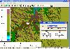
Mapster is a program for creating custom topographic maps of arbitrary size for printing.Great for hikers, etc..
Platforms: Windows, Mac, BSD, Linux
| License: Freeware | Size: 148.27 KB | Download (49): Mapster Download |
Released: November 14, 2012
|
Added: November 14, 2012 | Visits: 744
About Outdoor Navigator
- Maps and Charts for Handheld PDAs
– Palms, Pocket PCs, Smart Phones Hike, Boat, Fish, Explore the USA
- Detailed Maps via the Internet from Maptech –Under $100
– GPS Ready
– Hi-Tech Outdoor Navigation Made Easy – Over 60,000 Maps
Maptech (Amesbury, MA)...
Platforms: Mac
| License: Demo | Cost: $0.00 USD | Size: 645.12 KB | Download (59): Outdoor Navigator 1.2 Download |
Added: July 30, 2013 | Visits: 395
Topographica is a software package for computational modeling of neural maps. The goal is to help researchers understand brain function at the level of the topographic maps that make up sensory and motor systems. Topographica's full documentation can be found at http://topographica.org/....
Platforms: *nix
| License: Freeware | Size: 983.04 KB | Download (44): Topographica for Linux Download |
Released: May 23, 2020
|
Added: June 27, 2020 | Visits: 703
 Universal Maps Downloader is a tool that help you to get small tile images from Google Maps, Openstreetmap, Yandex Maps, The national map, Yahoo Maps, Mapquest, Gaode map, Tencent Maps, Baidu Maps, Tianditu, 360ditu, Arcgis Online Maps, OneMap for Singapore, Whereis for Australia, mapy.cz, Mappy,...
Platforms: Windows, Windows 8, Windows 7
| License: Shareware | Cost: $59.95 USD | Size: 8.85 MB | Download (67): Universal Maps Downloader |
Released: November 01, 2011
|
Added: November 30, 2011 | Visits: 1.145
 Global Mapper is more than just a utility; it has built in functionality for distance and area calculations, raster blending, feathering, spectral analysis and contrast adjustment, elevation querying, line of sight calculations, cut-and-fill volume calculations, as well as advanced capabilities...
Platforms: Windows, Other
| License: Shareware | Cost: $399.00 USD | Size: 11.24 MB | Download (110): Create Better Maps with Global Mapper 13 Download |
Released: December 30, 2019
|
Added: January 08, 2020 | Visits: 3.185
 TOPOWIN is a state-wide register of the German Topographic Cartographies, the German Basic Cartography and of localities with geo references in different coordinate systems. It is also a topographic information system. In the division of planning and execution of economical and scientific...
Platforms: Windows, Windows 8, Windows 7, Windows Server
| License: Shareware | Cost: $125.00 USD | Size: 4.56 MB | Download (271): TOPOWIN Download |
Added: August 09, 2008 | Visits: 1.416
If you professionally work as a topographer, engineer or use AutoCad a lot, this plug-in for AutoCad could be useful as it has been especially designed to create topographical maps.With this free tool you can define all the trigonomic parameters needed to represent the terrain. You have at your...
Platforms: Windows
| License: Freeware | Size: 1024 B | Download (223): Pprotopo Download |
Released: June 28, 2005
|
Added: September 07, 2006 | Visits: 5.777
 Deval Panorama Studio converts all type of panoramic pictures and 3D objects to the DevalVR format, this one is the most powerful viewer on Internet. With only 135KB views all these types of multimedia resources: 3D topographic maps, panoramic pictures, audio, video, etc... Visits our web to view...
Platforms: Windows
| License: Shareware | Cost: $72.55 USD | Size: 1.95 MB | Download (622): Deval Panorama Studio Download |
Released: December 30, 2019
|
Added: January 08, 2020 | Visits: 3.836
 ORTWIN is a program for the state-wide inquiry of the localities, postal codes and telephone selections in Germany. It finds postal zip codes, telephone pre selections, coordinates and ground level elevations. The program determines municipal codes, local center points, car license codes,...
Platforms: Windows, Windows 8, Windows 7, Windows Server
| License: Shareware | Cost: $120.00 USD | Size: 4.88 MB | Download (180): ORTWIN Download |
Added: August 19, 2008 | Visits: 3.673
 Fugawi Global Navigator and Fugawi Marine ENC are the ideal PC software tool for route planning, GPS programming, and real-time GPS navigation on land, sea and in the air. With Fugawi Global Navigator you can navigate in real time using the widest variety of digital maps, such as NOAA RNC,...
Platforms: Windows
| License: Demo | Cost: $119.95 USD | Size: 40.05 MB | Download (1120): Fugawi Global Navigator Download |
Released: July 26, 2012
|
Added: July 26, 2012 | Visits: 436
 ORTWIN is a program for the state-wide inquiry of the localities, postal codes and telephone selections in Germany. It finds postal zip codes, telephone pre selections, coordinates and ground level elevations. The program determines municipal codes, local center points, car license codes,...
Platforms: Windows
| License: Shareware | Cost: $155.00 USD | Size: 4.81 MB | Download (57): ORTWIN (English) Download |
Released: August 23, 2012
|
Added: August 23, 2012 | Visits: 570
ExpertGPS is the ultimate mapping software for Garmin, Magellan, and Lowrance GPS owners. ExpertGPS displays your waypoints, routes, and tracks on USGS topo maps and aerial photos.
Using the powerful mapping tools in ExpertGPS, you can draw your route directly on a map, search for nearby...
Platforms: Windows
| License: Shareware | Cost: $74.95 USD | Size: 9.1 MB | Download (441): ExpertGPS Download |
Added: May 22, 2010 | Visits: 1.537
Maps project is a topographal map and aerial photo generator and viewer. Maps allows users to generate topographical maps and aerial photographs of any region in the United States. It uses data provided by the USGS through the geoserver system. The interactive view lets you move around,...
Platforms: *nix
| License: Freeware | Size: 11.26 KB | Download (139): Maps Download |