


Topo software
Topo
Added: November 12, 2013 | Visits: 624
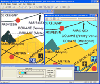
 Topo Nederland is a software based on a geography game on the C64. Fly with your helicopter to places to get points. Controls: w: up s: down a: left d: right j: dec speed k: inc speed
Platforms: *nix
Topo Nederland is a software based on a geography game on the C64. Fly with your helicopter to places to get points. Controls: w: up s: down a: left d: right j: dec speed k: inc speed
Platforms: *nix
| License: Freeware | Size: 890.88 KB | Download (34): Topo Nederland Download |
Released: July 07, 2004
|
Added: October 14, 2006 | Visits: 2.718
 MagicMap is a software for extracting color layers from scanned images - topo maps and logos.
Platforms: Windows
MagicMap is a software for extracting color layers from scanned images - topo maps and logos.
Platforms: Windows
| License: Demo | Cost: $95.00 USD | Size: 3.38 MB | Download (353): MagicMap Download |
Released: July 03, 2012
|
Added: July 03, 2012 | Visits: 607
 A volume of data with map names, map numbers, corner coordinates and completing data of all official topographic maps of the Federal Republic of Germany. TK25: Data base table with data of the maps on a scale 1:25000. TK50: Table with data of the maps on a scale 1:50000. TK100: Table with data of...
Platforms: All
A volume of data with map names, map numbers, corner coordinates and completing data of all official topographic maps of the Federal Republic of Germany. TK25: Data base table with data of the maps on a scale 1:25000. TK50: Table with data of the maps on a scale 1:50000. TK100: Table with data of...
Platforms: All
| License: Freeware | Size: 51.2 KB | Download (51): Geodaten German Topo Download |
Added: September 05, 2013 | Visits: 506
function alt_km=ITU_P1511(lat,long)computes altitude of a site at given lat,long coordinatesby means of bicubic interpolation using itu topo 0.5 degrees resolutionmatrix.refer to ITU-R Recommendation P 1511.INPUTSlat: latitude + = North, -=southlong: longitude, positive degrees East.Required...
Platforms: Matlab
| License: Freeware | Size: 10 KB | Download (54): Altitude in Km above sea level for a given pair of coordinates (lat,long) Download |
Released: December 30, 2019
|
Added: January 08, 2020 | Visits: 3.186
 TOPOWIN is a state-wide register of the German Topographic Cartographies, the German Basic Cartography and of localities with geo references in different coordinate systems. It is also a topographic information system. In the division of planning and execution of economical and scientific...
Platforms: Windows, Windows 8, Windows 7, Windows Server
TOPOWIN is a state-wide register of the German Topographic Cartographies, the German Basic Cartography and of localities with geo references in different coordinate systems. It is also a topographic information system. In the division of planning and execution of economical and scientific...
Platforms: Windows, Windows 8, Windows 7, Windows Server
| License: Shareware | Cost: $125.00 USD | Size: 4.56 MB | Download (271): TOPOWIN Download |
Added: August 18, 2008 | Visits: 1.355
 Allows you to connect your hand held Global Positioning System (GPS) unit to your computer, download your waypoints, and plot them in AutoCAD or export them in .dxf Also plots the points on free public domain Aerial photos and topo maps. Works on most Garmin and Magellan GPS units, and AutoCAD...
Platforms: Windows
Allows you to connect your hand held Global Positioning System (GPS) unit to your computer, download your waypoints, and plot them in AutoCAD or export them in .dxf Also plots the points on free public domain Aerial photos and topo maps. Works on most Garmin and Magellan GPS units, and AutoCAD...
Platforms: Windows
| License: Shareware | Cost: $345.00 USD | Size: 9.9 MB | Download (543): GPS2CAD Download |
Added: August 27, 2008 | Visits: 1.091
USAPhotoMaps downloads aerial photo and topo map data from Microsoft's free TerraServer Web site, saves it on your hard drive, and creates seamless maps from it. You can - Scroll and zoom, See the latitude/longitude, Add waypoints, routes, and text, Jump to any waypoint or latitude/longitude in...
Platforms: Windows
| License: Freeware | Size: 314 KB | Download (505): USAPhotoMaps Download |
Released: July 13, 2012
|
Added: July 13, 2012 | Visits: 698
Civil Calculator - Civil Engineering calculation software, performs calculations for hydrology, open channels, culverts, gravity sewer, pressure pipe, traffic, road geometry, topo surveying, earthwork, pavement, concrete floors and unit conversions. Available in two versions x86 for 32 bit...
Platforms: Windows
| License: Commercial | Cost: $79.00 USD | Size: 15.26 MB | Download (49): CE CALC - Civil Calculator Download |
Released: June 19, 2012
|
Added: June 19, 2012 | Visits: 809
Civil Engineering design surveying calculation software - surveying calculations for curve geometry, topographic surveying, and unit conversions. Covers calculations for horizontal curves, vertical curves, spiral curves, lattitudes and departures, azimuths, northings and eastings, area...
Platforms: Windows
| License: Shareware | Cost: $40.00 USD | Size: 6.96 MB | Download (500): CE CALC - Surveying Calculator Download |
Added: August 30, 2013 | Visits: 265
ploting Climentine lunar topography data(topogrd2.dat)
Platforms: Matlab
| License: Freeware | Size: 10 KB | Download (40): Climentine topo data Download |
Added: January 25, 2010 | Visits: 859
GPSy is a sophisticated Macintosh GPS communications and GIS mapping program. GPSy connects your Macintosh to a broad range of Global Positioning System (GPS) navigational units and has advanced mapping, logging, and data transfer features. GPSy has extensive support for USGS DRG topo maps,...
Platforms: Mac
| License: Demo | Cost: $0.00 USD | Download (104): GPSy Download |
Released: March 01, 2010
|
Added: April 22, 2010 | Visits: 2.522
Mapyx Quo is an intuitive, easy to learn and, surprisingly simple-to-use digital mapping program which enables you to connect your GPS to your PC and manage all your waypoints, routes and tracks. View information such as elevation, distance, speed, ETA and many more. Quo supports numerous...
Platforms: Windows, Windows CE
| License: Freeware | Size: 44.95 MB | Download (7378): Mapyx Quo Download |
Released: December 09, 2023
|
Added: December 23, 2023 | Visits: 1.134
 Offline Map Maker is a tool that help you to get offline tile images from Google Maps, Openstreetmap, Yandex Maps, Yahoo Maps, Mapquest, Gaode map, Tencent Maps, Baidu Maps, Tianditu, Arcgis Online, OneMap, Whereis, mapy.cz, Mappy, Waze, Sentinel-2 map, Strava Gloabal Heatmap, Wikimapia,...
Platforms: Windows 8, Windows 7, Windows
Offline Map Maker is a tool that help you to get offline tile images from Google Maps, Openstreetmap, Yandex Maps, Yahoo Maps, Mapquest, Gaode map, Tencent Maps, Baidu Maps, Tianditu, Arcgis Online, OneMap, Whereis, mapy.cz, Mappy, Waze, Sentinel-2 map, Strava Gloabal Heatmap, Wikimapia,...
Platforms: Windows 8, Windows 7, Windows
| License: Shareware | Cost: $79.00 USD | Size: 31.11 MB | Download (309): Offline Map Maker Download |
Released: October 20, 2012
|
Added: October 20, 2012 | Visits: 697
 Features:
View 24K or 100K topographic maps and other topographic data.
Displays maps in 2-D or 3-D, including elevation profiles.
View and rotate maps at any angle.
Create waypoints and routes on your computer and transfer maps, waypoints, routes, tracks and geotagged photos between your...
Platforms: Mac
Features:
View 24K or 100K topographic maps and other topographic data.
Displays maps in 2-D or 3-D, including elevation profiles.
View and rotate maps at any angle.
Create waypoints and routes on your computer and transfer maps, waypoints, routes, tracks and geotagged photos between your...
Platforms: Mac
| License: Freeware | Size: 51 MB | Download (67): Garmin BaseCamp for Mac OS Download |
Released: August 23, 2012
|
Added: August 23, 2012 | Visits: 573
ExpertGPS is the ultimate mapping software for Garmin, Magellan, and Lowrance GPS owners. ExpertGPS displays your waypoints, routes, and tracks on USGS topo maps and aerial photos.
Using the powerful mapping tools in ExpertGPS, you can draw your route directly on a map, search for nearby...
Platforms: Windows
| License: Shareware | Cost: $74.95 USD | Size: 9.1 MB | Download (441): ExpertGPS Download |
Released: December 09, 2012
|
Added: December 09, 2012 | Visits: 440
Thanks to the data grabbed from fourmilab.ch, this widget allows you to choose between several viewpoints of the earth, then look at the sunlit… live! You can choose:
* Images refresh rate
* Images source
* Several viewpoints of your choice
WHAT'S NEW
What’s New in this Version - no...
Platforms: Mac
| License: Freeware | Size: 419.84 KB | Download (51): Earth View Download |
Released: July 01, 2012
|
Added: July 01, 2012 | Visits: 511
Topos US is an app that provides access to download and view high resolution USGS topographic maps for the United States.
REGARDING MAP DATES:
You will often see a date on a downloaded map that seems pretty old. This is the date of last physical survey. This could be a long time ago. Often...
Platforms: Mac
| License: Commercial | Cost: $2.99 USD | Size: 716.8 KB | Download (49): Topos US Download |
Released: October 25, 2012
|
Added: October 25, 2012 | Visits: 479
About 93 Photo Street
A photo map displays your images arranged by location instead of by time. With 93 Photo Street you can create gorgeous photo maps for the web without learning HTML or a complicated graphics program.
- Download free maps of any US city and county
- Or use your own map images...
Platforms: Mac
| License: Shareware | Cost: $0.00 USD | Size: 3.7 MB | Download (52): 93 Photo Street 1.2 Download |
Released: November 07, 2012
|
Added: November 07, 2012 | Visits: 439
Garmin BaseCamp... A 3D mapping application that allows you to transfer waypoints, tracks, and routes between your Mac and Garmin device and manage your data using topographic Garmin maps that include digital elevation model (DEM) data, such as Topo U.S. 24K, Topo U.S. 24K National Parks (version...
Platforms: Mac
| License: Freeware | Size: 65.7 MB | Download (54): Garmin BaseCamp Download |
Added: August 28, 2013 | Visits: 560
VIVID Creates a Personalized ColormapVIVID(...) Creates a colormap with custom settings Inputs:M - (optional) an integer between 1 and 256 specifying the number of colors in the colormap. Default is 128.MINMAX - (optional) is a 1x2 vector with values between 0 and 1 representing the intensity...
Platforms: Matlab
| License: Shareware | Cost: $0.00 USD | Size: 10 KB | Download (42): Vivid Colormap Download |