


Terrain Genetation software
Terrain Genetation
Added: February 04, 2010 | Visits: 726
 OpenAnno project is an opensource strategy game. By now the game is not playable but there is already a techdemo for you to play around with. The game will be playable under Windows, Linux and MacOSX. We are still searching for talented artists and programmers - we still ne a lot of code, a...
Platforms: *nix
| License: Freeware | Size: 10.4 MB | Download (100): OpenAnno Download |
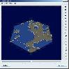
Added: July 07, 2010 | Visits: 850
Fracplanet is an interactive tool for creating random fractal planets and terrain areas with oceans, rivers, lakes and icecaps. The results can be saved in POV-Ray format. The code is licensed under the GPL. Fracplanet project uses Qt and OpenGL. Whats New in This Release: - The main...
Platforms: *nix
| License: Freeware | Size: 68.61 KB | Download (135): Fracplanet Download |
Added: January 25, 2010 | Visits: 551
In Ophiuchus players must pilot an advanced space craft through level after level of alien terrain. Along the way they must pick up newer and more advanced weapons and armor in order to complete their quest. Players have access to shields, missiles, cannons and other various weapons to make their...
Platforms: Mac
| License: Freeware | Size: 2.1 MB | Download (95): Ophiuchus Download |
Added: January 25, 2010 | Visits: 636
To this end, the United Human Federation (UHF) has been rapidly re-designing some of our all-terrain light transport freighter-walkers to carry our few mobile defensive weapons left over from the Times of War several centuries ago. We are also designing a whole new generation of giant marching...
Platforms: Mac
| License: Shareware | Cost: $0.00 USD | Size: 7.1 MB | Download (97): Youngs Modulus Download |
Released: October 09, 2015
|
Added: January 07, 2016 | Visits: 3.756
 Eye4Software Hydromagic is hydrographic survey software for Windows. It can be used to generare depth maps using a GPS or RTK receiver and an echosounder or fishfinder.
After recording the sounding, you can generate DTM's (Digital Terrain Models), depth contours, 3D views and cross-sections....
Eye4Software Hydromagic is hydrographic survey software for Windows. It can be used to generare depth maps using a GPS or RTK receiver and an echosounder or fishfinder.
After recording the sounding, you can generate DTM's (Digital Terrain Models), depth contours, 3D views and cross-sections....
Platforms: Windows, Windows 8, Windows 7, Windows Server
| License: Demo | Cost: $1549.93 USD | Size: 83.02 MB | Download (170): Eye4Software Hydromagic Download |
Released: November 16, 2012
|
Added: November 16, 2012 | Visits: 492
 The goal of VTP is to foster the creation of tools for easily constructing any part of the real world in interactive, 3D digital form.
This goal will require a synergetic convergence of the fields of CAD, GIS, visual simulation, surveying and remote sensing. VTP gathers information and tracks...
The goal of VTP is to foster the creation of tools for easily constructing any part of the real world in interactive, 3D digital form.
This goal will require a synergetic convergence of the fields of CAD, GIS, visual simulation, surveying and remote sensing. VTP gathers information and tracks...
Platforms: Mac, Linux
| License: Freeware | Size: 2.2 MB | Download (492): Virtual Terrain Project for Mac OS X and Linux Download |
Released: October 22, 2012
|
Added: October 22, 2012 | Visits: 589
IrriPro is the only software that let you design an irrigation system only by drawing the elements: now it's possible, thanks to the INDO technology (Irrigation Network Data Object) developed by Irriworks, to draw the elements of a system (such as outlets, pipes, etc) and of a terrain, not only...
Platforms: Windows
| License: Freeware | Size: 161 MB | Download (467): IrriPro Download |
Released: June 18, 2012
|
Added: June 18, 2012 | Visits: 477
 The goal of VTP is to foster the creation of tools for easily constructing any part of the real world in interactive, 3D digital form.
This goal will require a synergetic convergence of the fields of CAD, GIS, visual simulation, surveying and remote sensing. VTP gathers information and tracks...
The goal of VTP is to foster the creation of tools for easily constructing any part of the real world in interactive, 3D digital form.
This goal will require a synergetic convergence of the fields of CAD, GIS, visual simulation, surveying and remote sensing. VTP gathers information and tracks...
Platforms: Windows
| License: Freeware | Size: 1024 KB | Download (420): Virtual Terrain Project for Windows Download |
Released: August 18, 2012
|
Added: August 18, 2012 | Visits: 394
A UAV simulator that allows you to control an unmanned aerial vehicle, flying over a large 3D city scape or a mountain terrain.
- iDrone features a target practice mode where you control the vehicle and destroy targest placed randomly throughout the city.
- iDrone features a mission mode where...
Platforms: Mac
| License: Freeware | Size: 27 MB | Download (465): iDrone for Mac OS Download |
Released: September 17, 2012
|
Added: September 17, 2012 | Visits: 650
 Global Mapper is more than just a utility; it has built in functionality for distance and area calculations, raster blending, feathering, spectral analysis and contrast adjustment, elevation querying, line of sight calculations, cut-and-fill volume calculations, as well as advanced capabilities...
Platforms: Windows
| License: Demo | Cost: $349.00 USD | Size: 30 MB | Download (547): Global Mapper x64 Download |
Released: August 25, 2012
|
Added: August 25, 2012 | Visits: 598
 Global Mapper is more than just a utility; it has built in functionality for distance and area calculations, raster blending, feathering, spectral analysis and contrast adjustment, elevation querying, line of sight calculations, cut-and-fill volume calculations, as well as advanced capabilities...
Platforms: Windows
| License: Demo | Cost: $349.00 USD | Size: 39.6 MB | Download (537): Global Mapper Download |
Released: December 26, 2012
|
Added: December 26, 2012 | Visits: 1.938
Drive the moto through ice mountains in frozen decor, full of damaged terrain and hills. You got to get over them to the finish line as soon as possible. After every level you win a challenge and experience in driving a powerful motorcycle. Don’t crush the moto or you will lose a life.
Platforms: Windows
| License: Freeware | Size: 1.92 MB | Download (282): Ice Rider Download |
Released: October 12, 2012
|
Added: October 12, 2012 | Visits: 345
 Drone is a UAV simulator that allows you to control an unmanned aerial vehicle, flying over a large 3D city scape or a mountain terrain. iDrone features a target practice mode where you control the vehicle and destroy targest placed randomly throughout the city. iDrone features a mission mode...
Platforms: Windows, Mac
| License: Shareware | Cost: $4.99 USD | Size: 25.97 MB | Download (486): iDrone Download |
Released: June 01, 2012
|
Added: June 01, 2012 | Visits: 445
 The goal of VTP is to foster the creation of tools for easily constructing any part of the real world in interactive, 3D digital form.
This goal will require a synergetic convergence of the fields of CAD, GIS, visual simulation, surveying and remote sensing. VTP gathers information and tracks...
The goal of VTP is to foster the creation of tools for easily constructing any part of the real world in interactive, 3D digital form.
This goal will require a synergetic convergence of the fields of CAD, GIS, visual simulation, surveying and remote sensing. VTP gathers information and tracks...
Platforms: Mac, Linux
| License: Freeware | Size: 2.2 MB | Download (422): Virtual Terrain Project for Mac OS X and Linux 1.1 Download |
Released: November 23, 2012
|
Added: November 23, 2012 | Visits: 416
 The goal of VTP is to foster the creation of tools for easily constructing any part of the real world in interactive, 3D digital form.
This goal will require a synergetic convergence of the fields of CAD, GIS, visual simulation, surveying and remote sensing. VTP gathers information and tracks...
The goal of VTP is to foster the creation of tools for easily constructing any part of the real world in interactive, 3D digital form.
This goal will require a synergetic convergence of the fields of CAD, GIS, visual simulation, surveying and remote sensing. VTP gathers information and tracks...
Platforms: Windows
| License: Freeware | Size: 1024 KB | Download (496): Virtual Terrain Project for Windows 1.1 Download |
Released: June 15, 2012
|
Added: June 15, 2012 | Visits: 342
BadEvil is 3rd person, massive, multiplayer action with a nice terrain.
Platforms: Windows, Mac, BSD, Linux
| License: Freeware | Size: 4.47 MB | Download (49): BadEvil Download |
Released: July 16, 2012
|
Added: July 16, 2012 | Visits: 448
 A console game based on an existing online Java game 'Fly The Copter', where you navigate a helicopter through a rough terrain and avoid collision.
Platforms: Mac, BSD, Linux
| License: Freeware | Size: 20.91 KB | Download (42): FlightThrill Download |
Released: October 15, 2012
|
Added: October 15, 2012 | Visits: 628
Height Map Editor is a program meant for editing, generating and manipulating height maps (terrains) that can be used in terrain rendering engines, or even as clouds.
Platforms: Windows, Mac, Linux
| License: Freeware | Size: 253.5 KB | Download (79): Height Map Editor Download |
Added: October 14, 2013 | Visits: 456
Sandbox simulation game in which the player shapes terrain using weather effects. Developed as an educational tool to teach elementary and middle school students about the mechanics of erosion.
Platforms: *nix
| License: Shareware | Cost: $0.00 USD | Size: 3.15 MB | Download (63): Sedimentality Download |
Released: September 21, 2012
|
Added: September 21, 2012 | Visits: 227
 A collection of Java ports of open source terrain and solar system generation packages. Code has been extensively refactored, extended and documented. GPL License with exception for required libraries.
Platforms: Windows, Mac, Linux
| License: Freeware | Size: 9.9 MB | Download (49): TerraJ Download |