


Satellites software
Satellites
Released: November 14, 2012
|
Added: November 14, 2012 | Visits: 309
 satellites.xml All TV satellites and transponders in one xml file. Up-to-date. You can generate your own satellites.xml file with DreamBoxTools
Platforms: Windows, Mac, Other, Pocket PC, Android, BlackBerry, iPhone, iPod, iTouch, Palm
satellites.xml All TV satellites and transponders in one xml file. Up-to-date. You can generate your own satellites.xml file with DreamBoxTools
Platforms: Windows, Mac, Other, Pocket PC, Android, BlackBerry, iPhone, iPod, iTouch, Palm
| License: Freeware | Size: 636 KB | Download (55): satellites.xml Download |
Added: October 06, 2010 | Visits: 956
 gDVB is a DVB channels manager that allows you to scan different satellites, save your favorite channels list, and view local files. *NOTE* The 0.5 release is some kind of not-finished monster, so therer non-translated parts. Some semi-implementations and other nasty stuff. Is rather better...
Platforms: *nix
gDVB is a DVB channels manager that allows you to scan different satellites, save your favorite channels list, and view local files. *NOTE* The 0.5 release is some kind of not-finished monster, so therer non-translated parts. Some semi-implementations and other nasty stuff. Is rather better...
Platforms: *nix
| License: Freeware | Size: 81.92 KB | Download (151): gDVB Download |
Added: February 11, 2006 | Visits: 6.608
 Planet's Orbits (for Windows 98/ME/2000/XP) is an accurate digital orrery with a wealth of functionality. The program uses the DE404 ephemeris (accurate for dates between 2000 B.C. and 6000 AD) for the calculation of planetary (except Pluto) and lunar positions. The calculation of the positions...
Platforms: Windows
Planet's Orbits (for Windows 98/ME/2000/XP) is an accurate digital orrery with a wealth of functionality. The program uses the DE404 ephemeris (accurate for dates between 2000 B.C. and 6000 AD) for the calculation of planetary (except Pluto) and lunar positions. The calculation of the positions...
Platforms: Windows
| License: Shareware | Cost: $25.00 USD | Size: 15.25 MB | Download (497): Planet's Orbits Download |
Released: January 08, 2014
|
Added: January 18, 2014 | Visits: 10.635
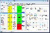 The program "Satellite Antenna Alignment" is used to calculate the angles necessary for installing satellite dishes. The main difference from similar software is the possibility to calculate the position for all satellites at once. Thus, you get a clear picture about what satellites can be...
Platforms: Windows, Windows 8, Windows 7
The program "Satellite Antenna Alignment" is used to calculate the angles necessary for installing satellite dishes. The main difference from similar software is the possibility to calculate the position for all satellites at once. Thus, you get a clear picture about what satellites can be...
Platforms: Windows, Windows 8, Windows 7
| License: Demo | Cost: $0.00 USD | Size: 1.24 MB | Download (1880): Satellite Antenna Alignment Download |
Released: June 16, 2008
|
Added: July 24, 2008 | Visits: 1.487
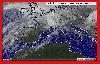 Upgrade 2.1.2 support connection MODEM/ADSL/WI-FI/PROXY SERVER/LAN. Create a public meteo-point with RealMeteo and a PC -
The meteo forecast and the satellite earth pictures about weather available on web, are a topic more interesting for many peoples and companies. To be able to project this...
Platforms: Windows
Upgrade 2.1.2 support connection MODEM/ADSL/WI-FI/PROXY SERVER/LAN. Create a public meteo-point with RealMeteo and a PC -
The meteo forecast and the satellite earth pictures about weather available on web, are a topic more interesting for many peoples and companies. To be able to project this...
Platforms: Windows
| License: Commercial | Cost: $12.00 USD | Size: 7.95 MB | Download (159): RealMeteo Download |
Added: March 24, 2010 | Visits: 1.188
GPS::SpaceTrack is a package for calculating the position of GPS satellites. SYNOPSIS use GPS::SpaceTrack; my $obj=GPS::SpaceTrack->new(filename=>"gps.tle"); print join("t", qw{Count PRN ELEV Azim SNR USED}), "n"; foreach ($obj->getsatellitelist({lat=>38.870997, lon=>-77.05596})) { print...
Platforms: *nix
| License: Freeware | Size: 52.22 KB | Download (117): GPS::SpaceTrack Download |
Added: July 10, 2010 | Visits: 1.480
GPS::PRN is a package for PRN - Object ID conversions. SYNOPSIS use GPS::PRN; my $obj = GPS::PRN->new(); print "PRN: ", $obj->prn_oid(22231), "n"; print "OID: ", $obj->oid_prn(1), "n"; This module maps GPS PRN number to Satellite OID and vice versa. Object Identification Number (OID)...
Platforms: *nix
| License: Freeware | Size: 4.1 KB | Download (230): GPS::PRN Download |
Released: January 27, 2010
|
Added: February 02, 2010 | Visits: 1.804
 Weather Defender is a software program that tracks weather in real-time with street-level accuracy. It works by connecting your desktop computer to a national network of radar and weather satellites and continuously scanning for weather threats.
Life-saving features include: street-level...
Platforms: Windows
Weather Defender is a software program that tracks weather in real-time with street-level accuracy. It works by connecting your desktop computer to a national network of radar and weather satellites and continuously scanning for weather threats.
Life-saving features include: street-level...
Platforms: Windows
| License: Demo | Cost: $0.00 USD | Size: 63.23 MB | Download (210): Weather Defender Download |
Released: August 10, 2011
|
Added: August 29, 2011 | Visits: 1.479
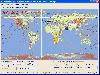
![]() Satellite Tracking Software that allows you to track the International Space Station and other satellites in real time. Easy to use. Radar system alerts you to satellites that is within viewing range.
Platforms: Windows
Satellite Tracking Software that allows you to track the International Space Station and other satellites in real time. Easy to use. Radar system alerts you to satellites that is within viewing range.
Platforms: Windows
| License: Freeware | Size: 977.54 KB | Download (221): DESA Satellite Tracker Download |
Released: July 14, 2012
|
Added: July 14, 2012 | Visits: 540
 GEOPoint is an easy to use satellite antenna pointing calculator, for geostationary communications satellites. It calculates the azimuth and elevation pointing angles from a given location on the earth towards a specified geostationary satellite. The program also calculates polarisation tilt...
Platforms: Windows
GEOPoint is an easy to use satellite antenna pointing calculator, for geostationary communications satellites. It calculates the azimuth and elevation pointing angles from a given location on the earth towards a specified geostationary satellite. The program also calculates polarisation tilt...
Platforms: Windows
| License: Freeware | Size: 2.1 MB | Download (406): GEOPoint Download |
Released: November 08, 2012
|
Added: November 08, 2012 | Visits: 647
 GPSLite is an easy,efficient and powerful positioning tool for mobile devices,you can get the Latitude,Longitude,Altitude ,Speed,Local time,Local Date ,Number of satellites being tracked,status of the GPS receiver etc...Key features: Full support for Windows Mobile 5.0 or Windows Mobile 6.0 Very...
Platforms: Windows
GPSLite is an easy,efficient and powerful positioning tool for mobile devices,you can get the Latitude,Longitude,Altitude ,Speed,Local time,Local Date ,Number of satellites being tracked,status of the GPS receiver etc...Key features: Full support for Windows Mobile 5.0 or Windows Mobile 6.0 Very...
Platforms: Windows
| License: Shareware | Cost: $9.95 USD | Size: 81.92 KB | Download (47): GPSLite for Windows Mobile 5.0 Download |
Released: October 05, 2012
|
Added: October 05, 2012 | Visits: 667
ClockWatch Star Sync tracks up to twelve GPS satellites simultaneously, acquiring precise time, distributing it to client computers and synchronizing them to +/- 0.01 second.
Deploying Star Sync units in different local networks around the globe maintains time synchronization across your...
Platforms: Windows
| License: Freeware | Download (52): ClockWatch Star Sync Download |
Released: October 14, 2012
|
Added: October 14, 2012 | Visits: 390
 This program is designed to predict the tracks of satellites both as paths above the earth, and as images produced by these satellites when scanning the ground. It was designed for use during the early stages of my weather satellite receiving activities, when clouds and interference prevented...
Platforms: Windows
This program is designed to predict the tracks of satellites both as paths above the earth, and as images produced by these satellites when scanning the ground. It was designed for use during the early stages of my weather satellite receiving activities, when clouds and interference prevented...
Platforms: Windows
| License: Demo | Cost: $28.95 USD | Size: 1.5 MB | Download (465): WXtrack Download |
Released: June 04, 2012
|
Added: June 04, 2012 | Visits: 405
JAVA project represents the realization of modern astronomical algorithms related to the orbital movement of planets, satellites and small bodies in the solar system by solving Kepler's equation and additional astronomical and mathematical libraries
Platforms: Windows, Mac, Linux
| License: Freeware | Size: 656.23 KB | Download (49): JKepler Download |
Released: December 08, 2012
|
Added: December 08, 2012 | Visits: 530
About Armageddon: First Strike
Defend your cities against nuclear missiles, bombers, satellites, and smart missiles.
Platforms: Mac
| License: Freeware | Size: 4.3 MB | Download (51): Armageddon: First Strike 1.1 Download |
Added: May 10, 2013 | Visits: 822
World Wind lets you zoom from satellite altitude into any place on Earth. Leveraging Landsat satellite imagery and Shuttle Radar Topography Mission data, World Wind lets you experience Earth terrain in visually rich 3D, just as if you were really there. Virtually visit any place in the world....
Platforms: Windows, C/C++,
| License: Freeware | Download (74): World Wind Download |
Added: June 14, 2013 | Visits: 404
Polar orbiting remote sensing satellites have an orbital inclination of about 9 degrees to the vertical. Because of this georeferenced satellite scenes are not straight but slanting (rotated). It is generally useful to have a vector containing the boundary of the image. Since an image can...
Platforms: Matlab
| License: Freeware | Size: 10 KB | Download (40): GeoTiff Outliner Download |
Added: May 25, 2013 | Visits: 391
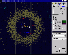
This program plots the position of different satellites around the earth depending on their coordinates, you only have to change the coordinates in the satellite position to get the new constellation.
Platforms: Matlab
| License: Shareware | Cost: $0.00 USD | Size: 10 KB | Download (53): Satellite Constellations Download |
Added: November 11, 2013 | Visits: 361
Something wakes Lucy up in the middle of the night. It's the stars! And they need help! Join her in this trip connecting the stars and making them glow. All around the sky there are constellations to join but you will soon encounter difficulties such as satellites and black holes A game that...
Platforms: Mac
| License: Commercial | Cost: $0.99 USD | Size: 6.7 MB | Download (39): Star Connect Download |
Added: October 22, 2013 | Visits: 501
The Night Sky is a magical app that enables you to identify stars, planets, galaxies, constellations and even satellites. This Mac version of The Night Sky enables you to view the stars, planets, galaxies, constellations and satellites from any location in the world no matter where you are...
Platforms: Mac
| License: Commercial | Cost: $3.99 USD | Size: 6.5 MB | Download (44): The Night Sky Download |