


Plotting Map Coordinates software
Plotting Map Coordinates
Released: November 07, 2014
|
Added: November 19, 2014 | Visits: 820
 Importation/Exportation: Import/export trails to gpx file. Unlimited number of trails, and TrackPoints. Export to gpx, Excel, PDF, XPS and KML/KMZ.
Data table: Very flexible data table that allows sorting by columns, with inheritance of data, attributes, etc.
Presentation on map: View...
Platforms: Windows, Windows 8, Windows 7, Windows Server
Importation/Exportation: Import/export trails to gpx file. Unlimited number of trails, and TrackPoints. Export to gpx, Excel, PDF, XPS and KML/KMZ.
Data table: Very flexible data table that allows sorting by columns, with inheritance of data, attributes, etc.
Presentation on map: View...
Platforms: Windows, Windows 8, Windows 7, Windows Server
| License: Freeware | Size: 27.05 MB | Download (611): ediTrail Download |
Released: September 25, 2008
|
Added: September 29, 2008 | Visits: 2.369
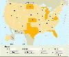
 Dongsoft Interactive Flash Maps for websites, interactive map applications, presentations, and more.
The innovation of this fully-clickable map will revolutionize your website navigation and provide visitors with a simple and seamless method of accessing information. Using the map as a central...
Platforms: Windows, Windows Vista
Dongsoft Interactive Flash Maps for websites, interactive map applications, presentations, and more.
The innovation of this fully-clickable map will revolutionize your website navigation and provide visitors with a simple and seamless method of accessing information. Using the map as a central...
Platforms: Windows, Windows Vista
| License: Shareware | Cost: $39.95 USD | Size: 148.44 KB | Download (583): USA Flash Map Download |
Released: December 07, 2008
|
Added: March 10, 2009 | Visits: 10.940
 XML-driven World Map in Flash is a powerful, full-featured, and flexible mapping solution to present any kind of business or personal data worldwide. It took web-mapping experience, intelligence and time to deliver a solution we are proud of.
The main World Map benefits are:
1....
Platforms: OS/2, Windows, Mac, *nix, MS-DOS,AS/400
XML-driven World Map in Flash is a powerful, full-featured, and flexible mapping solution to present any kind of business or personal data worldwide. It took web-mapping experience, intelligence and time to deliver a solution we are proud of.
The main World Map benefits are:
1....
Platforms: OS/2, Windows, Mac, *nix, MS-DOS,AS/400
| License: Shareware | Cost: $199.99 USD | Size: 120 KB | Download (570): World Map in Flash Download |
Added: August 09, 2008 | Visits: 1.606
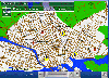
 This site provides address searching and street map facilities for the UK. We currently have street maps for Greater London and road atlas maps for the whole of mainland Britain (we're working on getting Northern Ireland). Any suggestions or comments are welcome.
Platforms: Windows
This site provides address searching and street map facilities for the UK. We currently have street maps for Greater London and road atlas maps for the whole of mainland Britain (we're working on getting Northern Ireland). Any suggestions or comments are welcome.
Platforms: Windows
| License: Freeware | Download (554): The UK Street Map Page Download |
Released: October 25, 2012
|
Added: October 25, 2012 | Visits: 799
 StatPlanet Map Maker is a free program for creating highly interactive Flash maps which can be published online. A stand-alone offline version is also included. Data can be imported automatically, so new interactive maps can be created within minutes. Maps are completely customizable. Use the...
Platforms: Windows
StatPlanet Map Maker is a free program for creating highly interactive Flash maps which can be published online. A stand-alone offline version is also included. Data can be imported automatically, so new interactive maps can be created within minutes. Maps are completely customizable. Use the...
Platforms: Windows
| License: Freeware | Size: 7.4 MB | Download (534): StatPlanet Map Maker Download |
Added: June 02, 2006 | Visits: 3.136
 Site Map Pro - Create a sitemap for any web site.
Site Map Pro will examine a web site, mapping all the pages that it finds.
It will then create a single HTML site map file.
By simply placing the single HTML file on your web site, you will be providing full site map facilities, making your...
Platforms: Windows
Site Map Pro - Create a sitemap for any web site.
Site Map Pro will examine a web site, mapping all the pages that it finds.
It will then create a single HTML site map file.
By simply placing the single HTML file on your web site, you will be providing full site map facilities, making your...
Platforms: Windows
| License: Shareware | Cost: $39.00 USD | Size: 2.78 MB | Download (528): Site Map Pro Download |
Added: August 30, 2008 | Visits: 1.869
 Flash based map software that provides easy way to integrate interactive maps into any web application. It consists of Flash map engine (any maps can be loaded into it) and JavaScript bridge. JavaScript bridge provides connectivity functions - for example Flash map can be connected to database...
Platforms: Windows, *nix
Flash based map software that provides easy way to integrate interactive maps into any web application. It consists of Flash map engine (any maps can be loaded into it) and JavaScript bridge. JavaScript bridge provides connectivity functions - for example Flash map can be connected to database...
Platforms: Windows, *nix
| License: Shareware | Cost: $69.00 USD | Size: 639 KB | Download (524): Loris Vector Map Engine Download |
Released: October 16, 2012
|
Added: October 16, 2012 | Visits: 1.017
 USA Real Estate Map Pro is a premium class software for mapping: real estate properties, contact listings, offices and other geo spatial data. Interactive Real Estate map is rather simple to integrate with database listings: both to specify the states and counties that should be active on map,...
Platforms: Windows, Mac, OS/2, Unix, Linux, MS-DOS, AS/400
USA Real Estate Map Pro is a premium class software for mapping: real estate properties, contact listings, offices and other geo spatial data. Interactive Real Estate map is rather simple to integrate with database listings: both to specify the states and counties that should be active on map,...
Platforms: Windows, Mac, OS/2, Unix, Linux, MS-DOS, AS/400
| License: Shareware | Cost: $399.00 USD | Size: 10.42 MB | Download (520): USA Real Estate Map Pro Download |
Released: May 20, 2009
|
Added: May 27, 2009 | Visits: 2.910
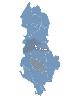 Albania Flash Map Locator for websites, presentations and more. Easy adjustment.
Variants of using a map locator:
- Real-Estate websites
- Quick access to contact organization data, having affiliated network in Albania
With this fully-clickable map you will be able to improve navigation...
Platforms: Windows, Mac
Albania Flash Map Locator for websites, presentations and more. Easy adjustment.
Variants of using a map locator:
- Real-Estate websites
- Quick access to contact organization data, having affiliated network in Albania
With this fully-clickable map you will be able to improve navigation...
Platforms: Windows, Mac
| License: Demo | Cost: $69.00 USD | Size: 152 KB | Download (507): Albania Map Locator Download |
Released: May 25, 2009
|
Added: May 28, 2009 | Visits: 2.952
 Three-level drill-down interactive map of World for websites and web developers. Easy adjustment.
Variants of using a map locator:
- Real-Estate websites
- Quick access to contact organization data, having affiliated network
With this fully-clickable map you will be able to improve...
Platforms: Windows, Mac
Three-level drill-down interactive map of World for websites and web developers. Easy adjustment.
Variants of using a map locator:
- Real-Estate websites
- Quick access to contact organization data, having affiliated network
With this fully-clickable map you will be able to improve...
Platforms: Windows, Mac
| License: Demo | Cost: $999.00 USD | Size: 1023 KB | Download (506): 3-Level World Map Download |
Added: August 25, 2008 | Visits: 1.169
Greenfish Relief Map Generator - This utility generates random images which resemble real relief maps. The randomized maps contain settlements with random names, hills, plains, lakes and seasides. The generated images are public domain and can be used anywhere. Note that the generated settlements...
Platforms: Windows
| License: Freeware | Size: 234 KB | Download (492): Greenfish Relief Map Generator Download |
Added: May 27, 2006 | Visits: 3.848
Flash maps US States. With this fully-clickable map you will be able to improve navigation and provide visitors with better and quicker access to information as well as improve the way you present the information. The map can be used "as is" however it is also easily customizable. In just a few...
Platforms: Windows
| License: Demo | Cost: $69.00 USD | Size: 44 KB | Download (484): Zoom Flash Map US States Download |
Released: September 24, 2012
|
Added: September 24, 2012 | Visits: 845
Wallpaper for an amazing 3D arcade game "Adventures of Tuber: Map of Treasures". Getting the map of treasures, our great explorer, Tuber, finds himself in the underwater maze. Tuber’s aim is to find his way to a lost Halloween island. You should solve a series of mind-stretching tasks, using...
Platforms: Windows
| License: Freeware | Size: 4.05 MB | Download (472): Wallpapers: Map of Treasures Download |
Released: September 05, 2012
|
Added: September 05, 2012 | Visits: 716
"Adventures of Tuber: The Map of Treasures" is an amazing 3D arcade game for everybody! Getting the map of treasures, our great explorer, Tuber, finds himself in the underwater maze. Tuber’s aim is to find his way to a lost Halloween island. You should solve a series of mind-stretching tasks,...
Platforms: Windows
| License: Shareware | Cost: $0.00 USD | Size: 19.7 MB | Download (471): Map of Treasures Download |
Released: July 05, 2012
|
Added: July 05, 2012 | Visits: 578
 " The most accurate and handly Altimeter is here. It gives you the altitude wherever you are. Simply start the app and altitude will appear in a second, No setup required. You can also adjust Altitude in Feet or Meter as per your requirement. Special feature saved your Max climb rate value.
...
Platforms: iPhone, iPod
" The most accurate and handly Altimeter is here. It gives you the altitude wherever you are. Simply start the app and altitude will appear in a second, No setup required. You can also adjust Altitude in Feet or Meter as per your requirement. Special feature saved your Max climb rate value.
...
Platforms: iPhone, iPod
| License: Shareware | Cost: $0.99 USD | Download (469): Altimeter Digital GPS + Map Viewer + Cam Download |
Released: December 07, 2012
|
Added: December 07, 2012 | Visits: 533
 USA Flash Map Locator for websites, presentations and more. Easy adjustment.
Variants of using a map locator:
- Real-Estate websites
- Quick access to contact organization data, having affiliated network in USA
With this fully-clickable map you will be able to improve navigation and provide...
Platforms: Windows, Mac
USA Flash Map Locator for websites, presentations and more. Easy adjustment.
Variants of using a map locator:
- Real-Estate websites
- Quick access to contact organization data, having affiliated network in USA
With this fully-clickable map you will be able to improve navigation and provide...
Platforms: Windows, Mac
| License: Demo | Cost: $69.00 USD | Size: 64 KB | Download (469): USA Map Locator Download |
Released: August 01, 2012
|
Added: August 01, 2012 | Visits: 573
 Drag and drop the country names of United States correctly onto the map.
Platforms: Windows
Drag and drop the country names of United States correctly onto the map.
Platforms: Windows
| License: Shareware | Cost: $19.99 USD | Size: 1.25 MB | Download (458): US Interactive Map Quiz Software Download |
Released: September 17, 2012
|
Added: September 17, 2012 | Visits: 506
GISEYE Coordinate Converter software is designed for conversion of coordinates from one map projection into another. List of coordinates and map projection parameters are specified by the user.This software product works under Windows and has an easy-to-use GUI. The application enables to do file...
Platforms: Windows
| License: Shareware | Cost: $29.00 USD | Size: 4.35 MB | Download (458): GISEYE Coordinate Converter Download |
Released: October 08, 2012
|
Added: October 08, 2012 | Visits: 524
 GreatCirc is a tool for calculating Great Circle distances on the earth's surface, and plotting points and great circle paths on a world map.
The "great circle path" is the shortest direct route between two points on the earth's surface. Because the earth is a globe, the shortest path between...
Platforms: Windows
GreatCirc is a tool for calculating Great Circle distances on the earth's surface, and plotting points and great circle paths on a world map.
The "great circle path" is the shortest direct route between two points on the earth's surface. Because the earth is a globe, the shortest path between...
Platforms: Windows
| License: Freeware | Size: 2.2 MB | Download (455): GreatCirc Download |
Released: October 06, 2012
|
Added: October 06, 2012 | Visits: 513
With GeoIPTC you will be able to read the IPTC city information in pictures and get the corresponding coordinates to your photos from several free services and embed this into the pictures in standard tags in a very professional way. You will also create sets of pictures with all the metadata...
Platforms: Windows
| License: Shareware | Cost: $112.00 USD | Size: 7.32 MB | Download (455): GeoIPTC Geolocalisation de Photos Download |