


Pioneer Gps software
Pioneer Gps
Released: August 23, 2012
|
Added: August 23, 2012 | Visits: 573
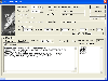
 ExpertGPS is the ultimate mapping software for Garmin, Magellan, and Lowrance GPS owners. ExpertGPS displays your waypoints, routes, and tracks on USGS topo maps and aerial photos.
Using the powerful mapping tools in ExpertGPS, you can draw your route directly on a map, search for nearby...
Platforms: Windows
ExpertGPS is the ultimate mapping software for Garmin, Magellan, and Lowrance GPS owners. ExpertGPS displays your waypoints, routes, and tracks on USGS topo maps and aerial photos.
Using the powerful mapping tools in ExpertGPS, you can draw your route directly on a map, search for nearby...
Platforms: Windows
| License: Shareware | Cost: $74.95 USD | Size: 9.1 MB | Download (441): ExpertGPS Download |
Released: November 28, 2008
|
Added: July 14, 2010 | Visits: 1.193
 LGPSTime will automatically set your PC clock to the time from the GPS receiver connected to the computer. GPS gets its time from GPS satellites, which are controlled and maintained by the US Naval Observatory.
Using time from a GPS, LGPSTime will keep your computer referenced to an atomic...
Platforms: Windows
LGPSTime will automatically set your PC clock to the time from the GPS receiver connected to the computer. GPS gets its time from GPS satellites, which are controlled and maintained by the US Naval Observatory.
Using time from a GPS, LGPSTime will keep your computer referenced to an atomic...
Platforms: Windows
| License: Shareware | Cost: $15.00 USD | Size: 3.29 MB | Download (440): LGPSTime Download |
Released: June 03, 2012
|
Added: June 03, 2012 | Visits: 731
The Genome Positioning System (GPS) is a software tool to study protein-DNA interaction using ChIP-Seq data. GPS builds a probabilistic mixture model to predict the most likely positions of binding events at single-base resolution.
GPS is a Java software, so it runs on multiple platforms,...
Platforms: Windows
| License: Freeware | Download (430): GPS Download |
Released: July 01, 2012
|
Added: July 01, 2012 | Visits: 760
 Atom GPS freeware easily geotags your photos directly from your GPS device or track log. By simply connecting your GPS Device to Atom GPS and selecting your photos you can add their geolocation in one click. This action allows you to write the geolocation data to your photos exifs (information...
Platforms: Windows
Atom GPS freeware easily geotags your photos directly from your GPS device or track log. By simply connecting your GPS Device to Atom GPS and selecting your photos you can add their geolocation in one click. This action allows you to write the geolocation data to your photos exifs (information...
Platforms: Windows
| License: Freeware | Size: 7.58 MB | Download (430): ATOM GPS Download |
Released: June 20, 2012
|
Added: June 20, 2012 | Visits: 784
GPX and TCX file welder is a small, easy to use application specially designed to help you substitute the missing GPS information in Garmin TCX files when devices lacking a GPS receiver are used to collect training data (Garmin FR 60, heartrate and pedometer only).
This application is also...
Platforms: Windows
| License: Freeware | Download (425): GPX and TCX file welder Download |
Released: July 09, 2012
|
Added: July 09, 2012 | Visits: 541
 Automatically extract from a geotagged image’s metadata, and then visually imprint (stamp), the GPS position, location description, altitude, date, date and time, or any combination of these or any other file metadata, onto a photo with no loss in image quality. It is a lossless JPEG process...
Platforms: Windows
Automatically extract from a geotagged image’s metadata, and then visually imprint (stamp), the GPS position, location description, altitude, date, date and time, or any combination of these or any other file metadata, onto a photo with no loss in image quality. It is a lossless JPEG process...
Platforms: Windows
| License: Freeware | Size: 11.9 MB | Download (406): GPStamper Download |
Added: August 08, 2008 | Visits: 2.880
HS GPS is a software library (with full C source code) which provides access to a NMEA-183 compliant GPS receiver via a serial communications port, decoding NMEA sentences: , , , , and . Decoded parameters include: time, date, position, altitude, speed, course and heading, according to standard -...
Platforms: Windows
| License: Freeware | Size: 309 KB | Download (398): HS NMEA GPS C Source Library Download |
Released: July 18, 2012
|
Added: July 18, 2012 | Visits: 796
 Create own true to scale maps, store online maps locally with Vivo techology, map editor, dataexchange with Google Earth by Copy and Paste, GPS enabled coordinates, import of free OpenStreatMap data and GPS Exchange and GPS logger data, compatible with "GPS for Google Earth", area calculation...
Platforms: Windows
Create own true to scale maps, store online maps locally with Vivo techology, map editor, dataexchange with Google Earth by Copy and Paste, GPS enabled coordinates, import of free OpenStreatMap data and GPS Exchange and GPS logger data, compatible with "GPS for Google Earth", area calculation...
Platforms: Windows
| License: Shareware | Cost: $65.00 USD | Size: 6.36 MB | Download (398): Dr. Regener LandMap Vivo Download |
Released: July 21, 2012
|
Added: July 21, 2012 | Visits: 464
![]() Picmeta PhotoTracker automatically geotags photos based on track information from any GPS device (.gpx files). It directly writes GPS EXIF data to .jpg, .tif, .crw, .dng, .nef, .pef, .jp2 formats. For other formats such as .cr2 it creates XMP sidecar files. The EXIFcare technology ensures that...
Platforms: Windows
Picmeta PhotoTracker automatically geotags photos based on track information from any GPS device (.gpx files). It directly writes GPS EXIF data to .jpg, .tif, .crw, .dng, .nef, .pef, .jp2 formats. For other formats such as .cr2 it creates XMP sidecar files. The EXIFcare technology ensures that...
Platforms: Windows
| License: Freeware | Size: 2.36 MB | Download (387): Picmeta PhotoTracker Download |
Added: May 26, 2006 | Visits: 4.206
This program is a demo application for BitLevelGPS software library that provides a PC-based user application with access to a NMEA-183 compliant GPS receiver via a serial communications port. It provides navigational data update once per second, decoding NMEA sentences: $GPGGA (Global...
Platforms: Windows
| License: Freeware | Size: 300 KB | Download (335): BitLevelGPS Demo Download |
Added: August 23, 2006 | Visits: 4.358
 ZylGPSReceiver is a Delphi component that communicates with a serial GPS receiver.
This component works with any NMEA compatible receiver connected to one of the serial ports.
You can use it also with USB devices, because these devices usually have a driver that redirects the
input from the...
Platforms: Windows
ZylGPSReceiver is a Delphi component that communicates with a serial GPS receiver.
This component works with any NMEA compatible receiver connected to one of the serial ports.
You can use it also with USB devices, because these devices usually have a driver that redirects the
input from the...
Platforms: Windows
| License: Shareware | Cost: $99.99 USD | Size: 212 KB | Download (329): ZylGPSReceiver Download |
Released: July 13, 2017
|
Added: August 30, 2017 | Visits: 4.514
 TRANSDAT geosoftware executes coordinate transformations and geodetic datum shifts between many coordinate and reference systems of America, Australasia, Europe, Germany special and world-wide, with high precision and high speed: 1.The current and historical coordinate and reference systems of...
Platforms: Windows, Windows 8, Windows 7, Windows Server
TRANSDAT geosoftware executes coordinate transformations and geodetic datum shifts between many coordinate and reference systems of America, Australasia, Europe, Germany special and world-wide, with high precision and high speed: 1.The current and historical coordinate and reference systems of...
Platforms: Windows, Windows 8, Windows 7, Windows Server
| License: Shareware | Cost: $170.00 USD | Size: 4.43 MB | Download (325): TRANSDAT Download |
Added: February 04, 2006 | Visits: 4.837
 It is a PC Clock synchronization program. It is alternative solution to synchronizing with atomic clock using NTP(SNTP) and Internet. The program works in the interactive mode or in background. The program can be used as NMEA and COM port tester. It outputs a port receiving buffer, extracts all...
Platforms: Windows
It is a PC Clock synchronization program. It is alternative solution to synchronizing with atomic clock using NTP(SNTP) and Internet. The program works in the interactive mode or in background. The program can be used as NMEA and COM port tester. It outputs a port receiving buffer, extracts all...
Platforms: Windows
| License: Shareware | Cost: $10.00 USD | Size: 446 KB | Download (288): GPS Time and Test Download |
Released: April 02, 2009
|
Added: April 07, 2009 | Visits: 2.208
 This component helps you to manipulate EXIF, IPTC and GPS information in JPEG and TIFF images plus known RAW formats (Canon CRW, Adobe DNG, Canon CR2, Fujifilm RAF, Minolta MRW, Nikon NEF, Pentax PEF, Sony ARW and Sony SR2). You can Change/Read/Write ALL EXIF or IPTC fields in JPEG images. The...
Platforms: Windows
This component helps you to manipulate EXIF, IPTC and GPS information in JPEG and TIFF images plus known RAW formats (Canon CRW, Adobe DNG, Canon CR2, Fujifilm RAF, Minolta MRW, Nikon NEF, Pentax PEF, Sony ARW and Sony SR2). You can Change/Read/Write ALL EXIF or IPTC fields in JPEG images. The...
Platforms: Windows
| License: Shareware | Cost: $49.95 USD | Size: 1.39 MB | Download (266): AiS EXIF Info ActiveX Download |
Added: July 23, 2006 | Visits: 3.533
 ZylGPSReceiverAX is an ActiveX control that communicates with a serial GPS receiver.
This control works with any NMEA compatible receiver connected to one of the serial ports.
You can use it also with USB devices, because these devices usually have a driver that redirects
the input from the...
Platforms: Windows
ZylGPSReceiverAX is an ActiveX control that communicates with a serial GPS receiver.
This control works with any NMEA compatible receiver connected to one of the serial ports.
You can use it also with USB devices, because these devices usually have a driver that redirects
the input from the...
Platforms: Windows
| License: Shareware | Cost: $99.99 USD | Size: 485 KB | Download (260): ZylGPSReceiverAX Download |
Added: January 05, 2006 | Visits: 3.135
 NavTools GPS is a small and easy to use application to connect your PC or laptop to an existing GPS (NMEA 0183 serial connection) installation. Position cata will automatically be displayed and logged on your screen, and voyage data can be exchanged and shared with the NavTools Route voyage...
Platforms: Windows
NavTools GPS is a small and easy to use application to connect your PC or laptop to an existing GPS (NMEA 0183 serial connection) installation. Position cata will automatically be displayed and logged on your screen, and voyage data can be exchanged and shared with the NavTools Route voyage...
Platforms: Windows
| License: Shareware | Cost: $25.00 USD | Size: 1.5 MB | Download (255): NavTools GPS Download |
Released: November 20, 2015
|
Added: April 20, 2016 | Visits: 3.094
 The Eye4Software Coordinate Calculator is an easy to use tool to perform map or GPS coordinate conversions. The software can be used to transform a single coordinate or a batch of coordinates read from a comma separated, database or ESRI shapefiles. The software is shipped with a MS Access...
Platforms: Windows, Windows 7
The Eye4Software Coordinate Calculator is an easy to use tool to perform map or GPS coordinate conversions. The software can be used to transform a single coordinate or a batch of coordinates read from a comma separated, database or ESRI shapefiles. The software is shipped with a MS Access...
Platforms: Windows, Windows 7
| License: Shareware | Cost: $119.00 USD | Size: 8.96 MB | Download (249): Eye4Software Coordinate Calculator Download |
Added: July 10, 2010 | Visits: 1.481
GPS::PRN is a package for PRN - Object ID conversions. SYNOPSIS use GPS::PRN; my $obj = GPS::PRN->new(); print "PRN: ", $obj->prn_oid(22231), "n"; print "OID: ", $obj->oid_prn(1), "n"; This module maps GPS PRN number to Satellite OID and vice versa. Object Identification Number (OID)...
Platforms: *nix
| License: Freeware | Size: 4.1 KB | Download (230): GPS::PRN Download |
Added: August 14, 2008 | Visits: 1.841
GPS (Global Positioning System) receivers tell you where you are anywhere on the planet! The Global Positioning System (GPS) is a collection of 24 earth-orbiting satellites and these satellites allow any person who owns a GPS receiver to determine his or her precise longitude, latitude and...
Platforms: ALL
| License: Freeware | Download (223): How a GPS Receiver Works Download |
Released: November 02, 2010
|
Added: November 12, 2010 | Visits: 1.467
 GLIM is mobile instant messenger application for Nokia mobile phones under Symbian OS. Now supports phones only with 3rd edition.
GLIM supports Jabber/GTalk and ICQ protocols. You can use several logins simultaneously. In registered version it may be used for several protocols at same time....
Platforms: Symbian
GLIM is mobile instant messenger application for Nokia mobile phones under Symbian OS. Now supports phones only with 3rd edition.
GLIM supports Jabber/GTalk and ICQ protocols. You can use several logins simultaneously. In registered version it may be used for several protocols at same time....
Platforms: Symbian
| License: Shareware | Cost: $10.00 USD | Size: 198.82 KB | Download (222): GLIM Download |