


Noaa software
Noaa
Added: January 25, 2010 | Visits: 757
 CAMEO® is a system of software applications used widely to plan for and respond to chemical emergencies. It is one of the tools developed by EPA's Chemical Emergency Preparedness and Prevention Office (CEPPO) and the National Oceanic and Atmospheric Administration Office of Response and...
Platforms: Mac
CAMEO® is a system of software applications used widely to plan for and respond to chemical emergencies. It is one of the tools developed by EPA's Chemical Emergency Preparedness and Prevention Office (CEPPO) and the National Oceanic and Atmospheric Administration Office of Response and...
Platforms: Mac
| License: Freeware | Size: 1.6 MB | Download (201): MARPLOT Download |
Released: September 20, 2012
|
Added: September 20, 2012 | Visits: 495
 DX_Central is a desktop application for those interested in observing the earth's sun or it's effect on radio propagation. This small application provides images of the sun and vital, timely information about solar activity in a way that is concise and easy to use. Information displayed is from...
Platforms: Windows
DX_Central is a desktop application for those interested in observing the earth's sun or it's effect on radio propagation. This small application provides images of the sun and vital, timely information about solar activity in a way that is concise and easy to use. Information displayed is from...
Platforms: Windows
| License: Freeware | Size: 28.6 MB | Download (441): DX Central Download |
Released: June 15, 2012
|
Added: June 15, 2012 | Visits: 478
 DX_Central is a desktop application for those interested in observing the earth's sun or it's effect on radio propagation. This small application provides images of the sun and vital, timely information about solar activity in a way that is concise and easy to use. Information displayed is from...
Platforms: Linux
DX_Central is a desktop application for those interested in observing the earth's sun or it's effect on radio propagation. This small application provides images of the sun and vital, timely information about solar activity in a way that is concise and easy to use. Information displayed is from...
Platforms: Linux
| License: Freeware | Size: 129.5 MB | Download (417): DX Central for Linux Download |
Released: October 16, 2012
|
Added: October 16, 2012 | Visits: 489
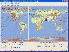
An efficient ENC chart planner. It supports ENC charts in S57 format (available from NOAA), raster charts in BSB format, as well as world wide standard S63 vector charts. PolarView includes Tides and Currents display, using the industry-standard TCD tide database format. PolarView is a...
Platforms: Mac
| License: Freeware | Size: 9.8 MB | Download (47): PolarView NS for Mac OS Download |
Released: August 24, 2012
|
Added: August 24, 2012 | Visits: 541
 Weather Display is the software to get the most from your weather station. Not only does it support a huge range of stations from all the major manufacturers but it's also stacked with features and options. These include real time, auto scale and graph history graphing, FTP of the weather data to...
Platforms: Windows
Weather Display is the software to get the most from your weather station. Not only does it support a huge range of stations from all the major manufacturers but it's also stacked with features and options. These include real time, auto scale and graph history graphing, FTP of the weather data to...
Platforms: Windows
| License: Shareware | Cost: $70.00 USD | Size: 24.51 MB | Download (486): Weather Display 10.3R Build Download |
Released: October 14, 2012
|
Added: October 14, 2012 | Visits: 390
 This program is designed to predict the tracks of satellites both as paths above the earth, and as images produced by these satellites when scanning the ground. It was designed for use during the early stages of my weather satellite receiving activities, when clouds and interference prevented...
Platforms: Windows
This program is designed to predict the tracks of satellites both as paths above the earth, and as images produced by these satellites when scanning the ground. It was designed for use during the early stages of my weather satellite receiving activities, when clouds and interference prevented...
Platforms: Windows
| License: Demo | Cost: $28.95 USD | Size: 1.5 MB | Download (465): WXtrack Download |
Released: August 20, 2012
|
Added: August 20, 2012 | Visits: 450
 OVATION Prime is a seasonal model of the diffuse, monoenergetic, proton, and wave aurora.
The OVATION Prime model is written in IDL and was developed at the Johns Hopkins Applied Physics Laboratory (JHU-APL) by Patrick Newell and co-workers. This current version includes updates to the...
Platforms: Windows, Mac, Linux
OVATION Prime is a seasonal model of the diffuse, monoenergetic, proton, and wave aurora.
The OVATION Prime model is written in IDL and was developed at the Johns Hopkins Applied Physics Laboratory (JHU-APL) by Patrick Newell and co-workers. This current version includes updates to the...
Platforms: Windows, Mac, Linux
| License: Freeware | Size: 23.47 MB | Download (45): OVATION Prime Download |
Released: July 10, 2012
|
Added: July 10, 2012 | Visits: 694
PolarCOM is an integrated NMEA 0183 marine navigation instrument data bridge and multipurpose data display. Available for Apple Mac OS X and Windows systems, it combines background server operation with high quality easy to read and fully customizable digital instrument views. PolarCOM is a...
Platforms: Mac
| License: Freeware | Size: 4.4 MB | Download (52): PolarCOM Download |
Released: August 11, 2012
|
Added: August 11, 2012 | Visits: 509
RadarScope is a specialized display utility for weather enthusiasts and meteorologists that allows you to view NEXRAD Level 3 radar data and severe weather warnings. It can display the latest reflectivity, velocity, and other radar products from any NEXRAD radar site in the United States, Guam...
Platforms: Mac
| License: Commercial | Cost: $29.99 USD | Size: 4.1 MB | Download (54): RadarScope Download |
Released: July 15, 2012
|
Added: July 15, 2012 | Visits: 497
Current Weather condition on your Menu Bar. Additional 6 day Forecast, Radar Maps and Satellite cloud coverage Maps for your Local Region. We are one of the most complete weather app for everyday use.
Note: We value your privacy therefore we do not collect any information whatsoever. The only...
Platforms: Mac
| License: Commercial | Cost: $7.99 USD | Size: 1.9 MB | Download (55): Outside - Weather Reports and Forecasts Download |
Released: November 11, 2012
|
Added: November 11, 2012 | Visits: 670
A very affordable solution for the boater that wants to take the Mac aboard for real-time display of position on full color marine raster format BSB and Softcharts. Plug your GPS into your Mac and watch as your boat moves along in real-time, plotting a track behind the boat and logging your...
Platforms: Mac
| License: Commercial | Cost: $59.99 USD | Size: 6.6 MB | Download (55): GPSNavX Marine Navigation Download |
Added: May 10, 2013 | Visits: 441
phpFreqs is a solution for VHF, Ham and Radio Scanner Users.The system will be able to store radio frequencies in a database to be searchable by users.It will allow for such things as Identifiying Radio Stations in a particular city.Ideally a typical search for "Rock Music" in "Calgary" under...
Platforms: Windows, *nix, PHP, BSD Solaris
| License: Freeware | Download (54): php-freqs Download |
Added: May 10, 2013 | Visits: 524
phpWeatherMap is a set of php scripts to generate weather maps for (almost) every country in the world. Weather data is fetched from the official METAR Airport Weather at weather.noaa.gov. Currently there are more than 5000 weather stations in over 200 countries. You can easily download new maps...
Platforms: Windows, Mac, *nix, PHP, BSD Solaris
| License: Freeware | Download (61): phpWeatherMap Download |
Added: April 07, 2013 | Visits: 463
Appreciable errors in MSIS00 modeled temperatures can occur for altitudes above 75 km if solar flux and magnetic indices deviate significantly from their default values. This routine automatically downloads needed solar flux and magnetic indices from ftp.ngdc.noaa.gov and formats them for input...
Platforms: Matlab
| License: Shareware | Cost: $0.00 USD | Size: 10 KB | Download (41): F10.7 Solar Flux & Ap Indices Download |
Added: March 28, 2013 | Visits: 785
MATLAB implementation of IGRF11 fortran code as function for calculating Earth mean magnetic field. Implementation has been modified to default to GPS reference coordinates with output B components North, East, and Vertical. Spherical harmonic coefficients are derived from downloaded Excel...
Platforms: Matlab
| License: Freeware | Size: 1.01 MB | Download (60): IGRF Magnetic Field Download |
Added: June 08, 2013 | Visits: 434
Innovative applications of MathWorks products to advance our understanding of the universe, measure and predict natural phenomena, manage resources, and mitigate the environmental effects of industrialization.Department of AgridlTCculture and Agri-Food Canada (AAFC)Smithsonian Astrophysical...
Platforms: Matlab
| License: Freeware | Size: 10 KB | Download (42): MATLAB and Simulink in the World: Earth, Ocean, and Planetary Sciences Download |
Added: July 15, 2013 | Visits: 772
sun = sun_position(time, location)This function computes the sun position (zenith and azimuth angle at the observer location) as a function of the observer local time and position.It is an implementation of the algorithm presented by Reda et Andreas in: Reda, I., Andreas, A. (2003) Solar position...
Platforms: Matlab
| License: Freeware | Size: 1.3 MB | Download (57): sun_position.m Download |
Added: April 18, 2013 | Visits: 503
ETOPO2, GEBCOFour Matlab functions to extract the data from two global topographic data base, ETOPO2v2 and GEOBEC.Four Matlab functions are provided to extract the data from two global topographic data base, ETOPO2v2 and GEOBEC. Functions, read_etopo2v2g_f4_nc_v*.m, extract the data from the...
Platforms: Matlab
| License: Freeware | Size: 20.48 KB | Download (45): Read Global Topographic Data Download |
Added: August 24, 2013 | Visits: 341
The goal of the project is provide web developers with an easy to use, lightweight, weather conditions library that pulls live conditions and weather data from the NOAA's public XML weather feeds.The library is written in PHP, using PHP4-friendly functions and object oriented design. Well under...
Platforms: PHP
| License: Freeware | Size: 10 KB | Download (40): PHPWeatherLib(Scripts) Download |
Added: May 21, 2013 | Visits: 276
Solar conditions play a crucial role in HF-propagation conditions. RigReference.com has a widget showing the current conditions based on NOAA data. This data can be used by ham radio operators to determine the best time to make long-range communications on shortwave bands (160 to 10 meters). But...
Platforms: PHP
| License: Shareware | Cost: $0.00 USD | Size: 20.48 KB | Download (39): RigReference HF-Propagation conditions Download |