


Nautical software
Nautical
Released: January 01, 2017
|
Added: January 08, 2017 | Visits: 1.207
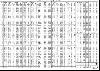 2017 Nautical Almanac in pdf format which includes monthly star charts with the planets' positions. It also includes parallax corrections for the planets.
Supplementary tables such as Increments and Corrections, Refraction and Dip are available at navsoft.com/downloads.html.
This Almanac...
Platforms: Windows, Windows 8, Windows 7, Windows Server
2017 Nautical Almanac in pdf format which includes monthly star charts with the planets' positions. It also includes parallax corrections for the planets.
Supplementary tables such as Increments and Corrections, Refraction and Dip are available at navsoft.com/downloads.html.
This Almanac...
Platforms: Windows, Windows 8, Windows 7, Windows Server
| License: Freeware | Size: 1.84 MB | Download (721): Nautical Almanac Download |
Released: August 09, 2012
|
Added: August 09, 2012 | Visits: 645
 Complete 2010 Nautical Almanac in pdf format. Includes star charts showing the planet's positions for each month.
Platforms: Windows, Mac, BlackBerry, Handheld/Mobile Other, Linux, Pocket PC, Other
Complete 2010 Nautical Almanac in pdf format. Includes star charts showing the planet's positions for each month.
Platforms: Windows, Mac, BlackBerry, Handheld/Mobile Other, Linux, Pocket PC, Other
| License: Freeware | Size: 1.51 MB | Download (474): 2010 Nautical Almanac Download |
Added: January 25, 2010 | Visits: 896
 Nautical Calendar is a full featured, stunningly produced Desktop ADvantage calendar based on a nautical theme with motivational saying. The calendar features advanced graphics capability, a super convenient 3-year calendar view, an easy to use weekly planner and a running "To Do" list. Never...
Platforms: Mac
Nautical Calendar is a full featured, stunningly produced Desktop ADvantage calendar based on a nautical theme with motivational saying. The calendar features advanced graphics capability, a super convenient 3-year calendar view, an easy to use weekly planner and a running "To Do" list. Never...
Platforms: Mac
| License: Freeware | Download (114): Nautical Calendar Download |
Released: October 14, 2010
|
Added: January 26, 2011 | Visits: 762
 Using the same standards of accuracy as published tables but with a catalogue extending beyond Barnard's Star; it can be used as a sight calculator, a definative astronomical reference or simply to print daily Nautical Almanac pages.
Multiple sights can be plotted/ combined while allowing...
Platforms: Windows
Using the same standards of accuracy as published tables but with a catalogue extending beyond Barnard's Star; it can be used as a sight calculator, a definative astronomical reference or simply to print daily Nautical Almanac pages.
Multiple sights can be plotted/ combined while allowing...
Platforms: Windows
| License: Shareware | Cost: $32.00 USD | Size: 8.46 MB | Download (122): AstroNav Download |
Released: October 09, 2015
|
Added: January 07, 2016 | Visits: 3.759
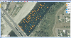 Eye4Software Hydromagic is hydrographic survey software for Windows. It can be used to generare depth maps using a GPS or RTK receiver and an echosounder or fishfinder.
After recording the sounding, you can generate DTM's (Digital Terrain Models), depth contours, 3D views and cross-sections....
Platforms: Windows, Windows 8, Windows 7, Windows Server
Eye4Software Hydromagic is hydrographic survey software for Windows. It can be used to generare depth maps using a GPS or RTK receiver and an echosounder or fishfinder.
After recording the sounding, you can generate DTM's (Digital Terrain Models), depth contours, 3D views and cross-sections....
Platforms: Windows, Windows 8, Windows 7, Windows Server
| License: Demo | Cost: $1549.93 USD | Size: 83.02 MB | Download (170): Eye4Software Hydromagic Download |
Released: November 14, 2012
|
Added: November 14, 2012 | Visits: 746
About Outdoor Navigator
- Maps and Charts for Handheld PDAs
– Palms, Pocket PCs, Smart Phones Hike, Boat, Fish, Explore the USA
- Detailed Maps via the Internet from Maptech –Under $100
– GPS Ready
– Hi-Tech Outdoor Navigation Made Easy – Over 60,000 Maps
Maptech (Amesbury, MA)...
Platforms: Mac
| License: Demo | Cost: $0.00 USD | Size: 645.12 KB | Download (59): Outdoor Navigator 1.2 Download |
Released: August 12, 2012
|
Added: August 12, 2012 | Visits: 428
 Garmin HomePort provides an interface for viewing Garmin marine chart products and managing geographic and nautical data. With HomePort, you can:
• View marine chart products pre-loaded on your GPS device, including BlueChart, BlueChart g2, and Blue
Platforms: Mac
Garmin HomePort provides an interface for viewing Garmin marine chart products and managing geographic and nautical data. With HomePort, you can:
• View marine chart products pre-loaded on your GPS device, including BlueChart, BlueChart g2, and Blue
Platforms: Mac
| License: Shareware | Cost: $29.99 USD | Size: 26.6 MB | Download (91): Garmin HomePort Download |
Added: April 11, 2013 | Visits: 744
In the past several years compact radio navigation receivers have proliferated in the civilian market place, generally under the name of GPS or Global Positioning System. Appearing as handheld units or built into cars, mobile phones, and airplanes, these commercial applications originated from a...
Platforms: Matlab
| License: Freeware | Size: 1.04 MB | Download (45): GPS Navigation Toolbox GNT Download |
Added: May 26, 2013 | Visits: 461
DISTMATLATLON Computes distance matrix between list of coords in X and Y D = DISTMATLATLON(X,Y) for matrices X and Y, with columns [Lat Lon], returns the distance matrix where the (i,j)th entry is the distance between the i'th and j'th row of X and Y respectively. X and Y must have columns in the...
Platforms: Matlab
| License: Freeware | Size: 10 KB | Download (46): Distance Matrix Latitude Longitude Download |
Released: December 09, 2005
|
Added: January 22, 2007 | Visits: 8.648
 Data Doctor Length Area Unit Converter Calculator converts unit of length and area in other available units and computes prices of buying, selling and purchasing property. Software provides accurate, precise and exact cost of properties of any preferred unit. Utility transforms the unit of length...
Platforms: Windows
Data Doctor Length Area Unit Converter Calculator converts unit of length and area in other available units and computes prices of buying, selling and purchasing property. Software provides accurate, precise and exact cost of properties of any preferred unit. Utility transforms the unit of length...
Platforms: Windows
| License: Freeware | Size: 757 KB | Download (1070): Unit Converter Software Download |
Added: August 13, 2008 | Visits: 935
 Geozip calculates distance between US (optionally Canadian) zip codes or geographical coordinates, latitude and longitude. It does take into account the curvature of the earth for calculating. You can choose miles, kilometers or nautical miles output.
Platforms: Windows
Geozip calculates distance between US (optionally Canadian) zip codes or geographical coordinates, latitude and longitude. It does take into account the curvature of the earth for calculating. You can choose miles, kilometers or nautical miles output.
Platforms: Windows
| License: Shareware | Cost: $49.00 USD | Size: 2.32 MB | Download (133): Geozip Download |
Added: November 20, 2010 | Visits: 1.015
DateTime::Astro::Sunrise is a Perl DateTime extension for computing the sunrise/sunset on a given day. SYNOPSIS use DateTime; use DateTime::Astro::Sunrise; ^ my $dt = DateTime->new( year => 2000, month => 6, day => 20, ); my $sunrise = DateTime::Astro::Sunrise ->new(-118,33,undef,1);...
Platforms: *nix
| License: Freeware | Size: 6.14 KB | Download (109): DateTime::Astro::Sunrise Download |
Added: June 12, 2010 | Visits: 1.020
libbsb is a portable C library for reading and writing BSB format image files. Typically used for nautical charts, BSB charts use the .KAP or .CAP extension and store cartographic information in addition to a run-length encoded raster image. libbsb is capable of recovering truncated or otherwise...
Platforms: *nix
| License: Freeware | Size: 153.6 KB | Download (117): libbsb Download |
Added: January 25, 2010 | Visits: 644
WeatherManX connects directly to the National Weather Service to download the lastest weather information. Info includes current conditions, current and extended forecast, severe weather alerts and Nexrad radar images. Multiple Cities - US and International. Current Conditions - Temperature,...
Platforms: Mac
| License: Shareware | Cost: $0.00 USD | Download (94): WeatherManX Download |
Added: January 25, 2010 | Visits: 738
FlightMath was developed with pilots and flight sim fans in mind, to replace the clumsy ASA E6-B Flight Computer. It takes full advantage of the Mac's interface to make the traditionally tedious preflight calculations extremely easy (some say even fun). For instance, instead of fussing with...
Platforms: Mac
| License: Shareware | Cost: $0.00 USD | Download (98): FlightMath Download |
Added: January 25, 2010 | Visits: 678
LatitudeZERO brings the geographical world of latitude and longitude coordinates into FileMaker Pro with our LatitudeZERO plug-in.Use LatitudeZERO to:Calculate the distance between two ZIP codesCalculate the distance between coordinatesReturn results in miles, kilometers or nautical...
Platforms: Mac
| License: Demo | Cost: $0.00 USD | Size: 728 KB | Download (130): LatitudeZERO Download |
Added: January 25, 2010 | Visits: 545
Set sail for adventure with Seven Seas Deluxe, PopCap's swashbuckling action puzzler. Sink pirates with your cannons, or lure them into reefs. You can even trick them into colliding with each other. But watch out for the indestructible Sea Serpent! Unique turn-based gameplay highlights this...
Platforms: Mac
| License: Shareware | Cost: $0.00 USD | Download (100): Seven Seas Deluxe Download |
Added: January 25, 2010 | Visits: 892
VelaClock Deluxe is a world clock widget with a highly configurable user interface. Users can quickly display the time of sunrise, sunset, or twilight, duration of daylight, moonrise, moonset, phase of moon, time zone information and more.VelaClock Deluxe has all the features of the standard...
Platforms: Mac
| License: Demo | Cost: $0.00 USD | Download (106): VelaClock Download |
Added: January 25, 2010 | Visits: 632
Windbuoy is a simple customizable widget that retrieves and displays wind speed, direction, and gust as well as air temp as reported by any one of hundreds of NOAA buoys. Speeds can be reported as m/s, knots or mph; temp as celsius or fahrenheit.
Platforms: Mac
| License: Shareware | Cost: $0.00 USD | Download (99): Windbuoy Download |
Released: August 16, 2012
|
Added: August 16, 2012 | Visits: 473
An original space themed strategy board game for 2 to 4 human or AI players.
Features:
- Fast paced casual strategy game
- Quick to learn, tricky to master
- Randomly generated game constellations make the game infinitely replayable
- Numerous options to customize gameplay
- Unique, antique...
Platforms: Mac
| License: Freeware | Size: 16.1 MB | Download (460): Constellation for Mac OS Download |