


Nad27 software
Nad27
Added: April 09, 2006 | Visits: 4.391
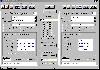 AllTrans can be used for world wide professional coordinate transformations between international and national coordinate systems with or without geodetic datum change.
Transformations between State-Plane-Coordinates (NAD83, NAD27, Transverse Mercator, Lambert, Soldner-Cassini, Mercator, EOV,...
Platforms: Windows
AllTrans can be used for world wide professional coordinate transformations between international and national coordinate systems with or without geodetic datum change.
Transformations between State-Plane-Coordinates (NAD83, NAD27, Transverse Mercator, Lambert, Soldner-Cassini, Mercator, EOV,...
Platforms: Windows
| License: Demo | Cost: $99.00 USD | Size: 4.41 MB | Download (470): AllTrans Download |
Released: July 13, 2017
|
Added: August 30, 2017 | Visits: 4.514
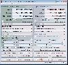
 TRANSDAT geosoftware executes coordinate transformations and geodetic datum shifts between many coordinate and reference systems of America, Australasia, Europe, Germany special and world-wide, with high precision and high speed: 1.The current and historical coordinate and reference systems of...
Platforms: Windows, Windows 8, Windows 7, Windows Server
TRANSDAT geosoftware executes coordinate transformations and geodetic datum shifts between many coordinate and reference systems of America, Australasia, Europe, Germany special and world-wide, with high precision and high speed: 1.The current and historical coordinate and reference systems of...
Platforms: Windows, Windows 8, Windows 7, Windows Server
| License: Shareware | Cost: $170.00 USD | Size: 4.43 MB | Download (325): TRANSDAT Download |
Added: August 14, 2008 | Visits: 1.758
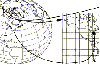 CoordTrans converts geographic positions between different coordinate systems.Convert between UTM and WGS84.Convert between UTM and NAD27 / NAD83.And more... grids from 17 countries supported. Convert geographic coordinates (latitude / longitude) between different datums.
Platforms: Windows
CoordTrans converts geographic positions between different coordinate systems.Convert between UTM and WGS84.Convert between UTM and NAD27 / NAD83.And more... grids from 17 countries supported. Convert geographic coordinates (latitude / longitude) between different datums.
Platforms: Windows
| License: Shareware | Cost: $19.95 USD | Size: 669 KB | Download (744): CoordTrans Download |
Released: May 02, 2014
|
Added: May 14, 2014 | Visits: 740
 TRANSDAT geosoftware executes coordinate transformations and geodetic datum shifts between many coordinate and reference systems of America, Australasia, Europe, Germany special and world-wide, with high precision and high speed: 1.The current and historical coordinate and reference systems of...
Platforms: Windows, Windows 8, Windows 7, Windows Server
TRANSDAT geosoftware executes coordinate transformations and geodetic datum shifts between many coordinate and reference systems of America, Australasia, Europe, Germany special and world-wide, with high precision and high speed: 1.The current and historical coordinate and reference systems of...
Platforms: Windows, Windows 8, Windows 7, Windows Server
| License: Shareware | Cost: $210.00 USD | Size: 2.91 MB | Download (53): TRANSDAT English Download |
Added: August 10, 2008 | Visits: 3.466
 Add GPS support to your C# or VB.NET application.Works with Garmin, Magellan, Navman or any NMEA 0183 enabled GPS. Support for UTM, SPCS (NAD83/NAD27), British National Grid, Swiss Grid, Irish Grid and many more national coordinate systems. Many examples included to get you started. For Windows...
Platforms: Windows, Windows CE
Add GPS support to your C# or VB.NET application.Works with Garmin, Magellan, Navman or any NMEA 0183 enabled GPS. Support for UTM, SPCS (NAD83/NAD27), British National Grid, Swiss Grid, Irish Grid and many more national coordinate systems. Many examples included to get you started. For Windows...
Platforms: Windows, Windows CE
| License: Shareware | Cost: $79.00 USD | Size: 186 KB | Download (540): GpsTools .NET Download |
Released: July 21, 2010
|
Added: September 25, 2010 | Visits: 1.356
 Toolkit to add GPS and coordinate conversion functionality to your software and scripts (GPS API). All NMEA0183 protocol versions are supported and can be filtered by NMEA sentence type and talker ID. Garmin USB PVT support. Information on GPS status can also be retrieved: GPS fix quality,...
Platforms: Windows
Toolkit to add GPS and coordinate conversion functionality to your software and scripts (GPS API). All NMEA0183 protocol versions are supported and can be filtered by NMEA sentence type and talker ID. Garmin USB PVT support. Information on GPS status can also be retrieved: GPS fix quality,...
Platforms: Windows
| License: Shareware | Cost: $99.00 USD | Size: 2.2 MB | Download (125): Eye4Software GPS API Download |
Released: March 29, 2020
|
Added: April 06, 2020 | Visits: 1.136
TRANSDATpro can prove a helpful tool for professionals, providing them with the possibility to perform coordinate transformations fast and easy by use of the coordinate reference systems of their choice.
TRANSDATpro performs Coordinate Transformations fast and with high accuracy. The coordinate...
Platforms: Windows, Windows 8, Windows 7, Windows Server
| License: Shareware | Cost: $270.00 USD | Size: 5.19 MB | Download (131): TRANSDATpro Download |