


Mif software
Mif
Added: August 31, 2008 | Visits: 3.348
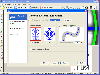
 GeoVisu is a visualization software for geographic data - graphic files, images and GPS. It provides real time GPS navigation (moving map - NMEA 0183 protocol or Garmin USB), displayed with diverse geographic data (MIF, GPX, NMEA, KML/KMZ, SHP, ECW, GeoTiff, MrSID). It can download waypoints,...
Platforms: Windows
GeoVisu is a visualization software for geographic data - graphic files, images and GPS. It provides real time GPS navigation (moving map - NMEA 0183 protocol or Garmin USB), displayed with diverse geographic data (MIF, GPX, NMEA, KML/KMZ, SHP, ECW, GeoTiff, MrSID). It can download waypoints,...
Platforms: Windows
| License: Freeware | Size: 1.5 MB | Download (1383): GeoVisu Download |
Added: August 23, 2008 | Visits: 1.219
In the world of graphic design, it is usual to differentiate between a bitmap and a vectored image. The first, more common, are formed by many pixels, while the second are made up of geometric shapes drawn using set coordinates.WinTopo is a specialized program that works to interpret the content...
Platforms: Windows
| License: Freeware | Size: 2 KB | Download (155): WinTopo Download |
Added: August 07, 2008 | Visits: 1.774
Total GIS Converter is an affordable converter of GIZ files. It converts AEP, GRD, ADF, E00, FLT, APR, SHP, DXF, BT, TOC, RT1, DEM, DLG, ECW, IMG, DGF, GML, SID, MIF, TAB, WOR, DNG, DDF, BIL, TIF, JPEG, TTKPS, TTKGP, TTKLS, LFT, PFT, and TFT files. The target formats are TIFF, PNG, JPEG, BMP....
Platforms: Windows
| License: Shareware | Cost: $99.90 USD | Size: 2.66 KB | Download (648): Total GIS Converter Download |
Added: May 02, 2010 | Visits: 907
RefDB is a reference database and bibliography tool for SGML, XML, and LaTeX/BibTeX documents. RefDB allows users to share databases over a network. RefDB is lightweight and portable to basically all platforms with a decent C compiler. And its released under the GNU General Public License....
Platforms: *nix
| License: Freeware | Size: 2.8 MB | Download (100): RefDB Download |
Added: January 25, 2010 | Visits: 1.104
GENE Graph Export Engine is an advanced XML exporter. GENE Graph Export Engine is a complex convertor/framework for multi-namespace XML transforming and exporting. It is able to convert various XML types including SVG, DocBook, MathML, XSL-FO, and their combinations into a wide area of output...
Platforms: *nix
| License: Freeware | Size: 1.1 MB | Download (96): GENE Graph Export Engine Download |
Added: April 17, 2010 | Visits: 1.248
XML::TMX::Writer is a Perl extension for writing TMX files. SYNOPSIS use XML::TMX::Writer; my $tmx = new XML::TMX::Writer(); $tmx->start_tmx(ID => paulojjs); $tmx->add_tu(SRCLANG => en, en => some text, pt => algum texto); $tmx->add_tu(SRCLANG => en, en => some text, pt => algum...
Platforms: *nix
| License: Freeware | Size: 15.36 KB | Download (132): XML::TMX::Writer Download |
Released: February 03, 2011
|
Added: February 27, 2011 | Visits: 1.166
 Vextractor is a vectorizer program for transforming raster images into vector formats by building centerlines and outlines. This tool could be used for the vectorizing photo, logotypes and other line art images for use in Vector Graphics Design software. You can also vectorize charts, drawings,...
Platforms: Windows
Vextractor is a vectorizer program for transforming raster images into vector formats by building centerlines and outlines. This tool could be used for the vectorizing photo, logotypes and other line art images for use in Vector Graphics Design software. You can also vectorize charts, drawings,...
Platforms: Windows
| License: Shareware | Cost: $99.95 USD | Size: 3.99 MB | Download (309): Vextractor x64 Download |
Released: October 09, 2015
|
Added: January 07, 2016 | Visits: 3.758
 Eye4Software Hydromagic is hydrographic survey software for Windows. It can be used to generare depth maps using a GPS or RTK receiver and an echosounder or fishfinder.
After recording the sounding, you can generate DTM's (Digital Terrain Models), depth contours, 3D views and cross-sections....
Platforms: Windows, Windows 8, Windows 7, Windows Server
Eye4Software Hydromagic is hydrographic survey software for Windows. It can be used to generare depth maps using a GPS or RTK receiver and an echosounder or fishfinder.
After recording the sounding, you can generate DTM's (Digital Terrain Models), depth contours, 3D views and cross-sections....
Platforms: Windows, Windows 8, Windows 7, Windows Server
| License: Demo | Cost: $1549.93 USD | Size: 83.02 MB | Download (170): Eye4Software Hydromagic Download |
Released: July 15, 2012
|
Added: July 15, 2012 | Visits: 862
Depthmap is a single software platform to perform a set of spatial network analyses designed to understand social processes within the built environment. It works at a variety of scales from building through small urban to whole cities or states. At each scale, the aim of the software is to...
Platforms: Windows
| License: Freeware | Size: 3 MB | Download (430): UCL Depthmap Download |
Released: November 07, 2012
|
Added: November 07, 2012 | Visits: 354
 Open3DGRID is an application designed for high-throughput generation of molecular interaction fields or MIFs. Open3DGRID can generate steric potential, electron density and MM / QM electrostatic potential fields; furthermore, it can import GRIDKONT binary files produced by GRID and CoMFA / CoMSIA...
Platforms: Windows
Open3DGRID is an application designed for high-throughput generation of molecular interaction fields or MIFs. Open3DGRID can generate steric potential, electron density and MM / QM electrostatic potential fields; furthermore, it can import GRIDKONT binary files produced by GRID and CoMFA / CoMSIA...
Platforms: Windows
| License: Freeware | Download (466): Open3DGRID x64 Download |
Released: August 17, 2012
|
Added: August 17, 2012 | Visits: 408
 Open3DGRID is an application designed for high-throughput generation of molecular interaction fields or MIFs. Open3DGRID can generate steric potential, electron density and MM / QM electrostatic potential fields; furthermore, it can import GRIDKONT binary files produced by GRID and CoMFA / CoMSIA...
Platforms: Linux
Open3DGRID is an application designed for high-throughput generation of molecular interaction fields or MIFs. Open3DGRID can generate steric potential, electron density and MM / QM electrostatic potential fields; furthermore, it can import GRIDKONT binary files produced by GRID and CoMFA / CoMSIA...
Platforms: Linux
| License: Freeware | Download (434): Open3DGRID for Linux Download |
Released: June 06, 2012
|
Added: June 06, 2012 | Visits: 445
 Open3DGRID is an application designed for high-throughput generation of molecular interaction fields or MIFs. Open3DGRID can generate steric potential, electron density and MM / QM electrostatic potential fields; furthermore, it can import GRIDKONT binary files produced by GRID and CoMFA / CoMSIA...
Platforms: Mac
Open3DGRID is an application designed for high-throughput generation of molecular interaction fields or MIFs. Open3DGRID can generate steric potential, electron density and MM / QM electrostatic potential fields; furthermore, it can import GRIDKONT binary files produced by GRID and CoMFA / CoMSIA...
Platforms: Mac
| License: Freeware | Download (424): Open3DGRID for Mac OS X Download |
Released: June 02, 2012
|
Added: June 02, 2012 | Visits: 327
 Open3DGRID is an application designed for high-throughput generation of molecular interaction fields or MIFs. Open3DGRID can generate steric potential, electron density and MM / QM electrostatic potential fields; furthermore, it can import GRIDKONT binary files produced by GRID and CoMFA / CoMSIA...
Platforms: Windows
Open3DGRID is an application designed for high-throughput generation of molecular interaction fields or MIFs. Open3DGRID can generate steric potential, electron density and MM / QM electrostatic potential fields; furthermore, it can import GRIDKONT binary files produced by GRID and CoMFA / CoMSIA...
Platforms: Windows
| License: Freeware | Download (421): Open3DGRID Download |
Released: July 23, 2012
|
Added: July 23, 2012 | Visits: 485
T2K Pro integrates the rich world of GIS datasets and transfers your Geographic information data into Google earth. T2K Pro handles rich data types and access large volumes of geographic data stored in files and databases; T2K PRO handles raster (imagery), Vector Map data and GPS Tracks/...
Platforms: Windows
| License: Shareware | Cost: $90.00 USD | Size: 20.89 MB | Download (54): T2K Pro Download |
Released: June 25, 2012
|
Added: June 25, 2012 | Visits: 875
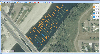
 The free AvisMap Viewer opens most GIS/CAD and raster image file types and most ArcView, ArcExplorer, and MapInfo projects. Besides just opening and viewing files, the Viewer supports an extensive list of features including visual layer properties control, legend control, thematic mapping,...
Platforms: Windows
The free AvisMap Viewer opens most GIS/CAD and raster image file types and most ArcView, ArcExplorer, and MapInfo projects. Besides just opening and viewing files, the Viewer supports an extensive list of features including visual layer properties control, legend control, thematic mapping,...
Platforms: Windows
| License: Freeware | Size: 23.17 MB | Download (449): Free Shapefile Viewer Download |
Released: August 21, 2012
|
Added: August 21, 2012 | Visits: 427
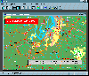 AGIS for Windows is a mapping and simple GIS shareware package. Plot your own geographic data on the map of the world provided without the high cost and steep learning curve usually associated with this kind of software. Create high resolution publication quality images that can be pasted into...
Platforms: Windows
AGIS for Windows is a mapping and simple GIS shareware package. Plot your own geographic data on the map of the world provided without the high cost and steep learning curve usually associated with this kind of software. Create high resolution publication quality images that can be pasted into...
Platforms: Windows
| License: Shareware | Cost: $49.00 USD | Size: 3.57 MB | Download (478): AGIS for Windows Download |
Released: August 21, 2012
|
Added: August 21, 2012 | Visits: 669
 Monitor Asset Manager is a Plug and Play monitor utility that works under all 32-bit versions of Windows. It is fully multi-monitor-capable, and unlike similar reporting utilities queries the monitor directly rather than relying on potentially dubious information stored in the registry.
In...
Platforms: Windows
Monitor Asset Manager is a Plug and Play monitor utility that works under all 32-bit versions of Windows. It is fully multi-monitor-capable, and unlike similar reporting utilities queries the monitor directly rather than relying on potentially dubious information stored in the registry.
In...
Platforms: Windows
| License: Freeware | Download (421): Monitor Asset Manager Download |
Released: October 23, 2012
|
Added: October 23, 2012 | Visits: 571
 Use GPS without GPS receiver! Try this advanced GPS device simulator (virtual GPS receiver). It can be used for development purposes or for testing GPS software before buying. Generates NMEA messages from different data inputs (map or file). Generated NMEA data can be used by mapping or other GPS...
Platforms: Windows
Use GPS without GPS receiver! Try this advanced GPS device simulator (virtual GPS receiver). It can be used for development purposes or for testing GPS software before buying. Generates NMEA messages from different data inputs (map or file). Generated NMEA data can be used by mapping or other GPS...
Platforms: Windows
| License: Shareware | Cost: $39.99 USD | Size: 800 KB | Download (534): Avangardo GPS generator PRO Download |
Released: January 29, 2013
|
Added: January 29, 2013 | Visits: 588
 SWIFT WX Professional runs on any desktop or laptop computer and provides you with up-to-the-minute Radar, Satellite, Storm Warnings, and Hail Reports. It will even alert you up to an hour in advance of approaching rain or thunderstorms, and predict to the nearest minute when those storms will...
Platforms: Windows
SWIFT WX Professional runs on any desktop or laptop computer and provides you with up-to-the-minute Radar, Satellite, Storm Warnings, and Hail Reports. It will even alert you up to an hour in advance of approaching rain or thunderstorms, and predict to the nearest minute when those storms will...
Platforms: Windows
| License: Shareware | Cost: $159.50 USD | Size: 20.45 MB | Download (574): SWIFT WX Professional Download |
Released: November 03, 2012
|
Added: November 03, 2012 | Visits: 271
This is a javadoc doclet which produces PDF output for a given Java API, using another SourceForge project, 'iText'. It requires nothing more than some JAR files for creating PDF files. Forget about all the fuss of having to create MIF output first
Platforms: Windows, Mac, Linux
| License: Freeware | Size: 5.22 MB | Download (47): PDFDoclet Download |