


Mercator software
Mercator
Added: May 02, 2010 | Visits: 1.369
 WorldForge::Mercator is primarily aimed at terrain for multiplayer online games and forms one of the WorldForge core libraries. It is intended to be used as a terrain library on the client, while a subset of features are useful on the server. Mercator is designed in such a way that individual...
Platforms: *nix
WorldForge::Mercator is primarily aimed at terrain for multiplayer online games and forms one of the WorldForge core libraries. It is intended to be used as a terrain library on the client, while a subset of features are useful on the server. Mercator is designed in such a way that individual...
Platforms: *nix
| License: Freeware | Size: 78.85 KB | Download (103): WorldForge::Mercator Download |
Added: August 08, 2010 | Visits: 1.146
Mercator Grid project is a real time strategy game using GIS data. Mercator Grid is a networked real-time strategy game that incorporates actual GIS map terrain and NATO map symbology (MIL-STD-2500B). It can be configured to include several player roles, including fire team leaders and...
Platforms: *nix
| License: Freeware | Download (97): Mercator Grid Download |
Released: August 27, 2012
|
Added: August 27, 2012 | Visits: 700
Mercator is a Point of Sale (POS) application written in Java. It is a OO, multi-purpose transaction engine that supports general retail and quick-order restaurant environments using standard POS peripherals (JavaPOS) and/or menu interface.
Platforms: Windows, Mac, Linux
| License: Freeware | Size: 2.54 MB | Download (56): Mercator, Java Point of Sale Download |
Released: November 20, 2015
|
Added: April 20, 2016 | Visits: 3.093
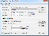 The Eye4Software Coordinate Calculator is an easy to use tool to perform map or GPS coordinate conversions. The software can be used to transform a single coordinate or a batch of coordinates read from a comma separated, database or ESRI shapefiles. The software is shipped with a MS Access...
Platforms: Windows, Windows 7
The Eye4Software Coordinate Calculator is an easy to use tool to perform map or GPS coordinate conversions. The software can be used to transform a single coordinate or a batch of coordinates read from a comma separated, database or ESRI shapefiles. The software is shipped with a MS Access...
Platforms: Windows, Windows 7
| License: Shareware | Cost: $119.00 USD | Size: 8.96 MB | Download (249): Eye4Software Coordinate Calculator Download |
Added: April 09, 2006 | Visits: 4.393
 AllTrans can be used for world wide professional coordinate transformations between international and national coordinate systems with or without geodetic datum change.
Transformations between State-Plane-Coordinates (NAD83, NAD27, Transverse Mercator, Lambert, Soldner-Cassini, Mercator, EOV,...
Platforms: Windows
AllTrans can be used for world wide professional coordinate transformations between international and national coordinate systems with or without geodetic datum change.
Transformations between State-Plane-Coordinates (NAD83, NAD27, Transverse Mercator, Lambert, Soldner-Cassini, Mercator, EOV,...
Platforms: Windows
| License: Demo | Cost: $99.00 USD | Size: 4.41 MB | Download (470): AllTrans Download |
Released: August 19, 2012
|
Added: August 19, 2012 | Visits: 663
 The Eye4Software Coordinate Calculator is an easy to use desktop software tool, to perform gps coordinate conversions from one coordinate system to another. It can also be used to convert coordinates between different map datums. The software can be used to convert a single coordinate, or to...
Platforms: Windows
The Eye4Software Coordinate Calculator is an easy to use desktop software tool, to perform gps coordinate conversions from one coordinate system to another. It can also be used to convert coordinates between different map datums. The software can be used to convert a single coordinate, or to...
Platforms: Windows
| License: Shareware | Cost: $43.51 USD | Size: 1.4 MB | Download (462): Coordinate Calculator Download |
Added: July 25, 2013 | Visits: 437
SimpleDEMViewer reads Digital Elevation Model (DEM) data and shows colored elevation map on a Mac screen. It can make bird's-eye views, stereographs and others. DEMs supported gtopo30, hydro1k, srtm, srtm dted, srtm30plus, etopo2, etopo5, globe, gdem some bil forms, usgs ascii DEMs, DEMs from...
Platforms: Mac
| License: Freeware | Size: 3.09 MB | Download (40): SimpleDEMViewer Download |
Added: September 19, 2013 | Visits: 561
Conic Planet is a CGI application which renders a photo-realistic real-time image of the Earth and other planets. It has support for Azimuthal, Mercator, Mollweide, Orthographic, and Rectangular projections. It also shows the current cloud covering.
Platforms: *nix
| License: Freeware | Size: 71.68 KB | Download (38): Conic Planet Download |
Added: October 13, 2013 | Visits: 408
Realtime Sunlight Wallpaper is a simple but useful application which can retrieve an image from the Internet and set it as a wallpaper every 30 minutes. Watch the sun rise and set all over the world on this real-time, computer-generated illustration of the earth's patterns of sunlight and...
Platforms: *nix
| License: Freeware | Size: 552.96 KB | Download (41): Realtime Sunlight Wallpaper Download |
Added: June 28, 2013 | Visits: 312
TileStache is a Python-based server application that can serve up map tiles based on rendered geographic data. You might be familiar with TileCache, the venerable open source WMS server from MetaCarta. TileStache is similar, but we hope simpler and better-suited to the needs of designers and...
Platforms: *nix
| License: Freeware | Size: 153.6 KB | Download (33): TileStache Download |
Released: February 03, 2004
|
Added: March 24, 2006 | Visits: 3.806
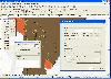 The CANVAS 9 GIS Mapping Edition adds native support for Geographic Information System (GIS) data to Canvas. You can take measurements in geographic coordinates, import industry standard SHAPE and GeoTIFF files into unlimited numbers of automatically aligned overlapping layers and choose among...
Platforms: Windows
The CANVAS 9 GIS Mapping Edition adds native support for Geographic Information System (GIS) data to Canvas. You can take measurements in geographic coordinates, import industry standard SHAPE and GeoTIFF files into unlimited numbers of automatically aligned overlapping layers and choose among...
Platforms: Windows
| License: Shareware | Cost: $549.99 USD | Size: 53.3 MB | Download (188): Canvas GIS Mapping Edition Download |
Released: January 07, 2006
|
Added: July 19, 2006 | Visits: 2.279
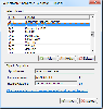
 GeoDataSource Cities Database Gold Edition contains 2.9+ million entries with city names in original language and English, feature type classifications, country names in FIPS and ISO, regions, sub-regions, state or First- Order Administrative Division, county or Second-Order Administrative...
Platforms: DOS, OS/2, BeOS, Palm OS, Windows, Mac, *nix, Windows CE
GeoDataSource Cities Database Gold Edition contains 2.9+ million entries with city names in original language and English, feature type classifications, country names in FIPS and ISO, regions, sub-regions, state or First- Order Administrative Division, county or Second-Order Administrative...
Platforms: DOS, OS/2, BeOS, Palm OS, Windows, Mac, *nix, Windows CE
| License: Shareware | Cost: $1049.95 USD | Size: 164 KB | Download (110): GeoDataSource World Cities Database (Gold Edition) Download |
Added: August 08, 2008 | Visits: 1.172
The Natural Resources Database (NRDB) is a simple to use software tool for developing and distributing environmental databases. Data may be output as resource maps, graphs and reports using simple selections or powerful queries. The program supports UTM and other transverse mercator projections....
Platforms: Windows
| License: Freeware | Size: 2.89 MB | Download (519): Natural Resources Database Download |
Added: August 04, 2008 | Visits: 1.030
GeoDataSource Cities Database Gold Edition contains 2.9+ million entries with city names in original language and English, feature type classifications, country names in FIPS and ISO, regions, sub-regions, state or First-Order Administrative Division, county or Second-Order Administrative...
Platforms: OS/2, Windows, Palm OS, Windows CE, Pocket PC
| License: Shareware | Cost: $1.05 USD | Size: 164 KB | Download (109): GeoDataSource World Cities Database (Gold Edition) May Download |
Added: January 18, 2010 | Visits: 697
Cyphesis is a WorldForge server suitable running small games. It is also designed by be used as an AI subsystem in a network of distributed servers. Worldforge::Cyphesis includes a terrain engine based on the Mercator library, a persistence system based on PostgreSQL, and an AI engine using...
Platforms: *nix
| License: Freeware | Size: 6.8 MB | Download (102): Worldforge::Cyphesis Download |
Added: May 10, 2013 | Visits: 889
Cyphesis is a WorldForge server suitable running small games. It is also designed by be used as an AI subsystem in a network of distributed servers. It includes a terrain engine based on the Mercator library, a persistence system based on PostgreSQL, and an AI engine using goal trees implemented...
Platforms: *nix, Python, BSD
| License: Freeware | Download (104): Cyphesis Download |
Added: August 09, 2010 | Visits: 1.063
PDL::Transform::Cartography Perl module contains useful cartographic projections. SYNOPSIS # make a Mercator map of Earth use PDL::Transform::Cartography; $a = earth_coast(); $a = graticule(10,2)->glue(1,$a); $t = t_mercator; $w = pgwin(xs); $w->lines($t->apply($a)->clean_lines());...
Platforms: *nix
| License: Freeware | Size: 2.1 MB | Download (103): PDL::Transform::Cartography Download |
Added: April 23, 2010 | Visits: 1.666
PROJ.4 is a cartographic projections and datum shifting library written in C. PROJ.4 includes support for many (100+) projections, including Transverse Mercator and Lambert Conformal Conic. Included is a command line program for reprojecting points. It was originally written by Gerald Evenden...
Platforms: *nix
| License: Freeware | Size: 655.36 KB | Download (131): PROJ.4 Download |
Released: July 21, 2010
|
Added: September 25, 2010 | Visits: 1.357
 Toolkit to add GPS and coordinate conversion functionality to your software and scripts (GPS API). All NMEA0183 protocol versions are supported and can be filtered by NMEA sentence type and talker ID. Garmin USB PVT support. Information on GPS status can also be retrieved: GPS fix quality,...
Platforms: Windows
Toolkit to add GPS and coordinate conversion functionality to your software and scripts (GPS API). All NMEA0183 protocol versions are supported and can be filtered by NMEA sentence type and talker ID. Garmin USB PVT support. Information on GPS status can also be retrieved: GPS fix quality,...
Platforms: Windows
| License: Shareware | Cost: $99.00 USD | Size: 2.2 MB | Download (125): Eye4Software GPS API Download |
Released: October 01, 2010
|
Added: October 09, 2010 | Visits: 1.609
 GeoDataSource Cities Database Titanium Edition contains 3.1+ million entries with city names in original language and English, feature type classifications, country names in FIPS and ISO, regions, sub-regions, state or First-Order Administrative Division, county or Second-Order Administrative...
Platforms: OS/2, Windows, Mac, *nix, Palm OS, Windows CE, Pocket PC, Palm OS 3.5,Palm OS 4.1,Palm OS 5,Symbian,MS-DOS,BEOS
GeoDataSource Cities Database Titanium Edition contains 3.1+ million entries with city names in original language and English, feature type classifications, country names in FIPS and ISO, regions, sub-regions, state or First-Order Administrative Division, county or Second-Order Administrative...
Platforms: OS/2, Windows, Mac, *nix, Palm OS, Windows CE, Pocket PC, Palm OS 3.5,Palm OS 4.1,Palm OS 5,Symbian,MS-DOS,BEOS
| License: Demo | Cost: $1649.95 USD | Size: 144.51 KB | Download (824): GeoDataSource World Cities Database Download |