


Marine Coordinates software
Marine Coordinates
Added: August 22, 2008 | Visits: 1.407
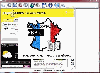
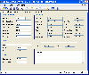 XCBA Cargo Office is a user-friendly Draft Survey and Lashing calculation program for Ships' Officers and Marine Surveyors. XCBA Cargo Office is easily operated using either Keyboard or Mouse. XCBA Cargo Office complies with the latest UN ECE standards for Draught Surveying and CSS Code...
Platforms: Windows
| License: Shareware | Cost: $49.95 USD | Size: 36 MB | Download (163): XCBA Cargo Office Download |
Released: December 31, 2019
|
Added: January 08, 2020 | Visits: 1.304
 The database tables contains geodata of the Federal Republic of Germany with geo referenced towns, municipalities, town quarters and other administrative units, postal codes, telephone preselections, nature areas, landscapes, climatic zones and official topographical cartographies. The data...
Platforms: Windows, Mac, *nix, Windows 8, Windows 7, Windows Server, iOS, Android, iPhone,iPad
| License: Data Only | Cost: $175.00 USD | Size: 3.61 MB | Download (162): Geodata Germany Download |
Released: January 12, 2005
|
Added: June 26, 2006 | Visits: 2.412
 Archim is a program for drawing the graphs of all kinds of functions. You can define a graph explicitly and parametrically, in polar and spherical coordinates, on a plane and in space (surface). Archim will be useful for teachers and students, as well as for everyone who is interested min...
Platforms: Windows
| License: Shareware | Cost: $25.00 USD | Size: 648 KB | Download (161): Archim Download |
Added: January 25, 2010 | Visits: 948
 GPSNavX is the solution for the boater that wants to take the Macintosh aboard for real-time display of position on full color marine Softcharts and BSB raster charts.Just plug your GPS into your Macintosh and watch as your boat moves along in real-time, plotting a track behind the boat and...
Platforms: Mac
| License: Shareware | Cost: $0.00 USD | Download (161): GPSNavX Download |
Released: September 20, 2010
|
Added: September 25, 2010 | Visits: 2.251
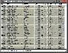
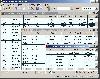
 Maritime Software - Draft Survey, Lashing and Route calculations for Merchant Navy. User-friendly Draft Survey, Lashing Calculations and Route Planning software for Ships' Officers and Marine Surveyors. Mariners Office is easily operated using either Keyboard or Mouse. It complies with the latest...
Platforms: Windows, Other
| License: Shareware | Cost: $199.95 USD | Size: 2.18 MB | Download (159): MarinersOffice Download |
Released: February 09, 2007
|
Added: February 11, 2007 | Visits: 1.762
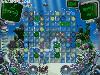 Get into your submarine and go pearl-fishing in addictive underwater action puzzle. You'll meet exotic marine animals and reveal the secrets of seabed while making combos out of colorful pearls. Discover mysterious items and use your ship powers wisely to collect as many pearls as you can....
Platforms: Windows
| License: Demo | Cost: $19.99 USD | Size: 5.56 MB | Download (159): Aquacade Download |
Added: August 27, 2008 | Visits: 1.812
 Arid Ocean is a realistic looking marine life simulation. You can swim around in a virtual ocean, explore the underwater world and view a large number of fish, sharks and dolphins living in the ocean. You can also display information about the life habitat of each species. Various original...
Platforms: Windows
| License: Shareware | Cost: $15.95 USD | Size: 28.96 MB | Download (159): Arid Ocean Download |
Released: November 01, 2023
|
Added: January 03, 2024 | Visits: 584
 [FRANCE] Utility that extracts email addresses and full coordinates from blank pages. After making your selection this small software goes through all the pages and extracts the data from the pages of the site. International languages. The interface is simple and its use is very easy. This...
Platforms: Windows, Mac, *nix, Windows 8, Windows 7, Windows Server, Java,Other
| License: Shareware | Cost: $23.00 USD | Size: 1.66 MB | Download (156): PBPro Download |
Added: March 03, 2006 | Visits: 3.060
 Geodata of the European and International countries with municipalities and postal codes. Georeferences as UTM- and geographic coordinates (WGS84, ETRS89). Suitable for branch searches, periphery searches and distance computations. These countries are available: Albania, Andorra, Belgium, Bosnia,...
Platforms: DOS, OS/2, BeOS, Palm OS, Windows, Mac, *nix, Windows CE
| License: Shareware | Cost: $195.00 USD | Size: 229 KB | Download (133): Geo data Europe and International Download |
Added: August 13, 2008 | Visits: 932
 Geozip calculates distance between US (optionally Canadian) zip codes or geographical coordinates, latitude and longitude. It does take into account the curvature of the earth for calculating. You can choose miles, kilometers or nautical miles output.
Platforms: Windows
| License: Shareware | Cost: $49.00 USD | Size: 2.32 MB | Download (133): Geozip Download |
Released: September 17, 2010
|
Added: September 25, 2010 | Visits: 1.538
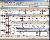
 Route Planner is a Course and Distance calculations program and Waypoint editor. Production of a passage plan prior to departure is a legal requirement. Route Planner assists in the preparation of passage plans by allowing you to prepare, calculate and print full featured passage plan. A very...
Platforms: Windows
| License: Shareware | Cost: $159.95 USD | Size: 2.18 MB | Download (129): Route Planner Download |
Released: May 23, 2014
|
Added: July 02, 2014 | Visits: 3.120
 The database tables contains geodata of the Federal Republic of Germany with geo referenced towns, municipalities, town quarters and other administrative units, postal codes, telephone preselections, nature areas, landscapes, climatic zones and official topographical cartographies. The data...
Platforms: Windows, Mac, *nix, DOS, Windows 8, Windows Phone, Windows 7, Windows Server, Palm OS, Android, Handheld, OS/2, BlackBerry,Java
| License: Demo | Cost: $205.00 USD | Size: 1.79 MB | Download (128): Geodaten Deutschland Download |
Released: January 10, 2012
|
Added: February 04, 2012 | Visits: 1.168
 Copan Pro -- for Windows 98, NT, 2000, ME, XP, Vista, or 7 -- is a very functional and easy-to-use desktop/netbook geomatics engineering tool for computing and managing plane land surveying and mapping coordinates, and drafting survey maps and plans.
It does numerous coordinate geometry...
Copan Pro -- for Windows 98, NT, 2000, ME, XP, Vista, or 7 -- is a very functional and easy-to-use desktop/netbook geomatics engineering tool for computing and managing plane land surveying and mapping coordinates, and drafting survey maps and plans.
It does numerous coordinate geometry...
Platforms: Windows
| License: Demo | Cost: $650.00 USD | Size: 8.78 MB | Download (126): Copan Pro Download |
Released: December 26, 2014
|
Added: January 05, 2015 | Visits: 1.212
 Turns your PC screen into a unique marine aquarium with lifelike tang fish. Tang Fish Screensaver contains 20 tang fish and 1 3D coral reef aquarium background for your enjoyment. Watch the tang fish swing around the aquarium like real fish with realistic water ripple effects. This screensaver...
Platforms: Windows, Windows 7
| License: Shareware | Cost: $9.95 USD | Size: 2.67 MB | Download (116): Tang Fish Screensaver Download |
Added: October 25, 2010 | Visits: 973
Geo::Coordinates::VandH is a Perl module that can convert and manipulate telco V and H coordinates. SYNOPSIS To convert V: 5498 H: 2895 to lat/long coordinates: use Geo::Coordinates::VandH; $blah=new Geo::Coordinates::VandH; ($lat,$lon) = $blah->vh2ll(5498,2895); printf...
Platforms: *nix
| License: Freeware | Size: 4.1 KB | Download (115): Geo::Coordinates::VandH Download |
Added: August 13, 2008 | Visits: 1.232
 Draft Survey and Lashing calculations. Marine Software Bundle is a user-friendly Draught Survey calculation program for Ships' Officers and Marine Surveyors. It is easily operated using either Keyboard or Mouse. Marine Software Bundle complies with the latest UN ECE standards for Draught...
Platforms: Windows
| License: Shareware | Cost: $49.95 USD | Size: 38.31 MB | Download (114): Marine Software Bundle 2007 Download |
Released: December 31, 2019
|
Added: January 08, 2020 | Visits: 1.272
 Geodata International - World-wide database of countries with georeferenced towns, municipalities, postal codes and administrative units with WGS84 and UTM coordinates and elevations for geocoding, proximity search, navigation, distance calculation. Often is it necessarily, for an address...
Platforms: Windows, Mac, *nix, Windows 8, Windows 7, iOS, Android, iPhone,iPad
| License: Data Only | Cost: $165.00 USD | Size: 2.4 MB | Download (114): Geodata International Download |
Added: July 12, 2010 | Visits: 1.309
Geo::Coordinates::OSGB is a Perl module that can convert coordinates from Lat/Long to UK Grid. A UK-specific implementation of co-ordinate conversion, following formulae from the Ordnance Survey of Great Britain (hence the name). SYNOPSIS use Geo::Coordinates::OSGB qw(ll2grid grid2ll); #...
Platforms: *nix
| License: Freeware | Size: 4.1 KB | Download (113): Geo::Coordinates::OSGB Download |
Added: May 03, 2013 | Visits: 1.000
Given a vector of x- and y-coordinates of a data set, allows the user to select a subset of the data with the mouse and change the coordinates of that subset much as he/she moves icons around a desktop. There are three modes of selecting the data - 'lasso-ing' the data much like in MS Paint, a...
Platforms: Matlab
| License: Shareware | Cost: $0.00 USD | Size: 10 KB | Download (106): snare Download |
Added: May 15, 2010 | Visits: 773
Tk::Canvas Perl module can create and manipulate Canvas widgets. SYNOPSIS $canvas = $parent->Canvas(?options?); STANDARD OPTIONS -background -highlightthickness -insertwidth -state -borderwidth -insertbackground -relief -tile -cursor -insertborderwidth -selectbackground -takefocus...
Platforms: *nix
| License: Freeware | Size: 5.7 MB | Download (105): Tk::Canvas Download |