


Lat software
Lat
Released: September 10, 2012
|
Added: September 10, 2012 | Visits: 681
 Based on the 'Holy Grail' of compressor/limiters, the Fairchild 670. With a faithful reproduction of every control, this is an incredibly accurate model that captures every nuance of one of the best Fairchild units available. The original unit delivers a truly magic touch that makes everything...
Platforms: Mac
Based on the 'Holy Grail' of compressor/limiters, the Fairchild 670. With a faithful reproduction of every control, this is an incredibly accurate model that captures every nuance of one of the best Fairchild units available. The original unit delivers a truly magic touch that makes everything...
Platforms: Mac
| License: Freeware | Size: 15 MB | Download (688): T-RackS 3 Singles Vintage Tube Compressor/Limiter model 670 for Mac OS Download |
Released: December 25, 2012
|
Added: December 25, 2012 | Visits: 664
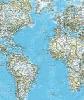 This is a comprehensive database of world city names with latitude and longitude for all the cities and places of each of the continent's every country and region. This enormous collection has some 2.79 million cities and places of the planet earth. The size of the package is 43 megabyte zip file...
| License: Commercial | Cost: $59.00 USD | Size: 41.34 MB | Download (69): World City Names, Latitude & Longitude Download |
Released: June 01, 2012
|
Added: June 01, 2012 | Visits: 481
 For many countries street coordinates are present with coverage degrees upto 100 percent. The geo data offered here are in high-precision quality and are present in different coordinate and reference systems. Street coordinates or also called street section coordinates are meaning the summary of...
Platforms: Windows, Edition 2005,Edition 2005
For many countries street coordinates are present with coverage degrees upto 100 percent. The geo data offered here are in high-precision quality and are present in different coordinate and reference systems. Street coordinates or also called street section coordinates are meaning the summary of...
Platforms: Windows, Edition 2005,Edition 2005
| License: Demo | Cost: $710.00 USD | Size: 182 KB | Download (49): Geo Data International Streets Download |
Released: July 14, 2012
|
Added: July 14, 2012 | Visits: 538
 For the area of the Federal Republic of Germany more than 19 million house coordinates with a coverage of 100% are available. The geo data offered here are in high-precision quality and are present in different coordinate and reference systems. House Coordinates or also called Geo Coded Building...
| License: Demo | Cost: $1250.00 USD | Size: 111 KB | Download (49): Geodaten German Houses (deutsch) Download |
Released: December 11, 2012
|
Added: December 11, 2012 | Visits: 525
 For the area of the Federal Republic of Germany more than 2,7 million street coordinates with a coverage of 100% are available. The geo data offered here are in high-precision quality and are present in different coordinate and reference systems. Street coordinates or also called street section...
| License: Demo | Cost: $625.00 USD | Size: 68 KB | Download (54): Geo data German Streets (English) Download |
Released: October 25, 2012
|
Added: October 25, 2012 | Visits: 450
 For many countries street coordinates are present with coverage degrees upto 100 percent. The geo data offered here are in high-precision quality and are present in different coordinate and reference systems. Street coordinates or also called street section coordinates are meaning the summary of...
| License: Demo | Cost: $625.00 USD | Size: 66 KB | Download (51): Geodaten International Streets (Deutsch) Download |
Released: July 04, 2012
|
Added: July 04, 2012 | Visits: 431
 For many countries house coordinates are present with coverage degrees upto 100 percent. The geo data offered here are in high-precision quality and are present in different coordinate and reference systems. House Coordinates or also called Geo Coded Building Addresses are meaning the connection...
| License: Demo | Cost: $1250.00 USD | Size: 111 KB | Download (49): Geodaten International Houses (English) Download |
Released: June 19, 2012
|
Added: June 19, 2012 | Visits: 448
 For many countries house coordinates are present with coverage degrees upto 100 percent. The geo data offered here are in high-precision quality and are present in different coordinate and reference systems. House Coordinates or also called Geo Coded Building Addresses are meaning the connection...
| License: Demo | Cost: $1250.00 USD | Size: 111 KB | Download (49): Geodaten International Houses (deutsch) Download |
Released: October 10, 2012
|
Added: October 10, 2012 | Visits: 518
 For the area of the Federal Republic of Germany more than 2,7 million street coordinates with a coverage of 100% are available. The geo data offered here are in high-precision quality and are present in different coordinate and reference systems. Street coordinates or also called street section...
| License: Demo | Cost: $625.00 USD | Size: 68 KB | Download (55): Geodaten German Streets (deutsch) Download |
Released: December 16, 2012
|
Added: December 16, 2012 | Visits: 357
CharDiff is a novel file and directory comparator.
CharDiff displays differences between files with character precision in your web browser and doing so overlays the compared files:
You can see the files in a single integrated view, with characters particular to one file or the other...
Platforms: Windows
| License: Shareware | Cost: $28.00 USD | Size: 219 KB | Download (47): CharDiff Download |
Released: July 18, 2012
|
Added: July 18, 2012 | Visits: 386
TiVec is a data processing program that enables the user to process Tiger Line files from the Census Bureau and convert them to MID/MIF or SHP/DBF files for use with major GIS and mapping suites. At the same time, it allows the user to select Lat/Long or Lambert projections, separate Tiger...
Platforms: Windows
| License: Shareware | Cost: $119.00 USD | Size: 1.12 MB | Download (404): TiVec Download |
Released: September 26, 2012
|
Added: September 26, 2012 | Visits: 760
 Send scheduled, personalized, bulk SMS from a desktop application customizable with your BRAND. This desktop application is completely customizable and allows you to send scheduled, personalized, bulk SMS, from you PC to anywhere in the world, easier, quicker, and cheaper than your mobile phone...
Platforms: Windows
Send scheduled, personalized, bulk SMS from a desktop application customizable with your BRAND. This desktop application is completely customizable and allows you to send scheduled, personalized, bulk SMS, from you PC to anywhere in the world, easier, quicker, and cheaper than your mobile phone...
Platforms: Windows
| License: Freeware | Size: 33.38 MB | Download (67): Customized SMS Desktop Download |
Released: November 09, 2012
|
Added: November 09, 2012 | Visits: 297
METAGRAF is an Application written in pure Java (platform independent) to create any kind of graphics, including text and images, and that outputs a MetaPost file that can be converted in PostScript, PDF ...etc., or can be included directly in any TeX/LaT
Platforms: Windows, Mac, Linux
| License: Freeware | Size: 1.9 MB | Download (49): METAGRAF-3D Download |
Released: July 21, 2012
|
Added: July 21, 2012 | Visits: 336
OSM XML to CSV conversion. POI only, polygons (and polylines, but not recommended) are approximated by centroid. Result is a 3-column table with lon, lat and value (for a particular key to be chosen beforehand).
Platforms: Windows, Mac, Linux
| License: Freeware | Size: 10.08 KB | Download (54): osm2csv Download |
Released: July 02, 2012
|
Added: July 02, 2012 | Visits: 431
Spanish Dictionary is a Spanish-English dictionary with the functions of looking up words, Spanish pronunciation, and memorizing words. When you are learning Spanish or learning English as a Spanish, communicating with Spanish or traveling in Spain or Lat
Platforms: Mac
| License: Shareware | Cost: $9.99 USD | Size: 16.4 MB | Download (47): Spanish Dictionary Download |
Added: May 10, 2013 | Visits: 497
Future versions of Location beyond v3 will be dependent on the Geo module.InstallationUnpack in your modules folder (usually /sites/all/modules/) and enable under Administer > Site Building > Modules. Key features "location": - stores human-readable addresses ("123 Main St.") - contains...
Platforms: Windows, Mac, *nix, PHP, BSD Solaris
| License: Freeware | Download (54): location 6.x-3.0-test3 / 5.x-3.0-test3 Download |
Added: May 10, 2013 | Visits: 520
Uses a filter to embed a google map overlayed with a KML file using square brackets like [mykml:homepage (41.88414, -87.63238), 10] The general syntax is [mykml:path-to-kml (lat,lon), zoom]InstallationUnpack in your modules folder (usually /sites/all/modules/) and enable under Administer > Site...
Platforms: Windows, Mac, *nix, PHP, BSD Solaris
| License: Freeware | Download (58): MyKML Filter 5.x-2.0 Download |
Added: May 10, 2013 | Visits: 503
Some of the indicators calculated are GRS80 free air anomalies, EIGEN-CG03C (an remaining topography reduction), normal gravity GRS67 and GRS80.The place of the study that was the base of the research is a region of Canada (lat:56 to 60 deg,long:-120 to -114 deg). Requirements: - MATLAB 7.6 or...
Platforms: Windows, Mac, *nix, Matlab, BSD Solaris
| License: Freeware | Download (63): The Gravity Field of the Earth Download |
Added: May 10, 2013 | Visits: 412
The function assumes the WGS84 model.Latitude is customary geodetic (not geocentric).Inputs may be scalars, vectors, or matrices of the same size and shape. Outputs will have that same size and shape.Usage[lat,lon,alt] = ecef2lla(x,y,z)lat = geodetic latitude (radians)lon = longitude (radians)alt...
Platforms: Windows, Mac, *nix, Matlab, Solaris
| License: Freeware | Download (57): ECEF2LLA 4-27-2006 Download |
Added: May 10, 2013 | Visits: 343
JGeocoder is a free geocoder implemented in Java. Geocoding is the process of estimating a latitude and longitude for a given location.This project will consist of 3 major components: - Address parser , which will be responsible for parsing an input address into a standardize format. This is...
Platforms: Windows, Mac, *nix, Java, BSD Solaris
| License: Freeware | Download (59): JGeocoder Download |