


Grib software
Grib
Released: August 01, 2012
|
Added: August 01, 2012 | Visits: 466
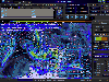
 Program to download, view and manage Grib file weather forecasts. These are freely available on the internet and are highly compressed so can easily be downloaded over slow internet links. Will also generate emails to download custom area forecasts from Saildocs.com Passage plans can also be set...
Platforms: Windows
Program to download, view and manage Grib file weather forecasts. These are freely available on the internet and are highly compressed so can easily be downloaded over slow internet links. Will also generate emails to download custom area forecasts from Saildocs.com Passage plans can also be set...
Platforms: Windows
| License: Shareware | Cost: $20.00 USD | Size: 5.53 MB | Download (469): BallGate Grib File Viewer Download |
Added: May 14, 2013 | Visits: 424
 MATLAB-CDI is a collection of MATLAB functions that import/read GRIB and netCDF files through high-level function calls that follows an unified syntax. The package supports a subset of the full GRIB and netCDF format specification typically produced by climate models.Technically speaking,...
Platforms: Matlab
MATLAB-CDI is a collection of MATLAB functions that import/read GRIB and netCDF files through high-level function calls that follows an unified syntax. The package supports a subset of the full GRIB and netCDF format specification typically produced by climate models.Technically speaking,...
Platforms: Matlab
| License: Freeware | Size: 5.7 MB | Download (39): NetCDF/GRIB reader Download |
Released: June 15, 2012
|
Added: June 15, 2012 | Visits: 439
Customers rank usability and intuitive user interface as a major reason for choosing NaviWeather. You just need two or three minutes working into NaviWerather To discover all of its cutting-edge features and capabilities. It is so easy that even a total newbie in gib file viewing and weather...
Platforms: Windows
| License: Shareware | Cost: $34.00 USD | Size: 25.7 MB | Download (46): NaviWeather Download |
Released: December 19, 2012
|
Added: December 19, 2012 | Visits: 648
PolarView is an efficient cross platform ENC chart planner. It supports ENC charts in S57 format (available from NOAA), raster charts in BSB format, as well as world wide standard S63 vector charts. PolarView includes Tides and Currents display, using the industry-standard TCD tide database...
Platforms: Mac
| License: Freeware | Size: 6.2 MB | Download (64): PolarView Download |
Released: May 17, 2014
|
Added: August 09, 2014 | Visits: 900
 ATMOGRAPH is advanced weather model data visualization and analysis software for meteorologists, storm chasers, aviators, forecasters, and enthusiasts alike, allowing users to import custom GRIB data and choose from a built-in list of weather models including the GFS, NAM, HRRR, HRW, RAP, NAVGEM,...
Platforms: Windows, Windows 8, Windows 7
ATMOGRAPH is advanced weather model data visualization and analysis software for meteorologists, storm chasers, aviators, forecasters, and enthusiasts alike, allowing users to import custom GRIB data and choose from a built-in list of weather models including the GFS, NAM, HRRR, HRW, RAP, NAVGEM,...
Platforms: Windows, Windows 8, Windows 7
| License: Shareware | Cost: $200.00 USD | Size: 8.75 MB | Download (38): ATMOGRAPH ModelVis Download |
Added: June 11, 2010 | Visits: 1.006
GeoServer project connects your information to the Geospatial Web. With GeoServer, you can publish and edit data using open standards. Your information is made available in a large variety of formats as maps/images or actual geospatial data. GeoServers transactional capabilities offer robust...
Platforms: *nix
| License: Freeware | Size: 25.9 MB | Download (105): GeoServer Download |
Released: October 16, 2012
|
Added: October 16, 2012 | Visits: 488
An efficient ENC chart planner. It supports ENC charts in S57 format (available from NOAA), raster charts in BSB format, as well as world wide standard S63 vector charts. PolarView includes Tides and Currents display, using the industry-standard TCD tide database format. PolarView is a...
Platforms: Mac
| License: Freeware | Size: 9.8 MB | Download (47): PolarView NS for Mac OS Download |
Released: July 01, 2012
|
Added: July 01, 2012 | Visits: 503
A very affordable solution for the boater that wants to take the Mac aboard for real-time display of position on full color marine raster format BSB and Softcharts. Plug your GPS into your Mac and watch as your boat moves along in real-time, plotting a track behind the boat and logging your...
Platforms: Mac
| License: Freeware | Size: 1.5 MB | Download (45): GPSNavX for Mac OS Download |
Released: July 18, 2012
|
Added: July 18, 2012 | Visits: 379
 Due to participation from research centre CERENA in the international desertwatch project (homepage software needed to be made to handle the extensive databases necessary to this project successfull completion.
ECMWF Parser was one such case and by now the most compreheensive tool built for...
Platforms: Windows
Due to participation from research centre CERENA in the international desertwatch project (homepage software needed to be made to handle the extensive databases necessary to this project successfull completion.
ECMWF Parser was one such case and by now the most compreheensive tool built for...
Platforms: Windows
| License: Freeware | Size: 10.1 MB | Download (49): ECMWF Parser Download |
Released: December 09, 2012
|
Added: December 09, 2012 | Visits: 342
 Viperfish is intended for the sailor looking to improve his weather forecasting. Viperfish provides the ability to visualise and modify GRIB (weather prediction) files, it can plot routes and provides routing based on coming weather and boat performance.
Platforms: Windows, Mac, Linux
Viperfish is intended for the sailor looking to improve his weather forecasting. Viperfish provides the ability to visualise and modify GRIB (weather prediction) files, it can plot routes and provides routing based on coming weather and boat performance.
Platforms: Windows, Mac, Linux
| License: Freeware | Size: 6.58 MB | Download (50): Viperfish Download |
Released: July 10, 2012
|
Added: July 10, 2012 | Visits: 694
PolarCOM is an integrated NMEA 0183 marine navigation instrument data bridge and multipurpose data display. Available for Apple Mac OS X and Windows systems, it combines background server operation with high quality easy to read and fully customizable digital instrument views. PolarCOM is a...
Platforms: Mac
| License: Freeware | Size: 4.4 MB | Download (52): PolarCOM Download |
Released: November 11, 2012
|
Added: November 11, 2012 | Visits: 670
A very affordable solution for the boater that wants to take the Mac aboard for real-time display of position on full color marine raster format BSB and Softcharts. Plug your GPS into your Mac and watch as your boat moves along in real-time, plotting a track behind the boat and logging your...
Platforms: Mac
| License: Commercial | Cost: $59.99 USD | Size: 6.6 MB | Download (55): GPSNavX Marine Navigation Download |
Added: July 25, 2013 | Visits: 451
With this widget you select the category you want, and all entries with this category, will be shown on the sidebar instead the main blog. You will have then a small blog on the sidebar for those special entries. For each entry, you have the link to the post page. You can select the number of...
Platforms: PHP
| License: Freeware | Size: 10 KB | Download (46): Alkivia SidePosts Download |
Added: November 18, 2013 | Visits: 208
Pydap is an implementation of the Opendap/DODS protocol, written from scratch. You can use Pydap to access scientific data on the internet without having to download it; instead, you work with special array and iterable objects that download data on-the-fly as necessary, saving bandwidth and...
Platforms: Mac
| License: Freeware | Size: 3.01 MB | Download (40): Pydap Download |