


Gpx software
Gpx
Added: January 25, 2010 | Visits: 1.472
 HoudahGPS allows you to transfer track log and waypoint data from your Garmin, Magellan or Wintec GPS devices. It connects via USB to the Garmin and Magellan devices. It interfaces with the Wintec WBT-100, WBT-101 and WBT-201 devices using Bluetooth. HoudahGPS may also be used to convert between...
Platforms: Mac
| License: Freeware | Download (122): HoudahGPS Download |
Released: August 23, 2012
|
Added: August 23, 2012 | Visits: 667
 All-in-one software for creation of custom GPS maps compatible with Garmin GPS units. Mapwel supports routing, ESRI shapefiles, OpenStreetMap OSM, Google Earth KML and KMZ, cGPSmapper MP and GPX files. Mapwel custom GPS mapping capability and user icons editor are often used in forestry,...
Platforms: Windows
| License: Shareware | Cost: $45.00 USD | Size: 12.28 MB | Download (454): Mapwel Download |
Released: November 23, 2012
|
Added: November 23, 2012 | Visits: 524
 The main purpose of this popular tool is to quickly and easily resize photos from a digital camera to a smaller size for further use (especially to share the photos on web or by email). Nevertheless, Jpeg Resampler 2010 also offers many other features such as
* convert between image formats...
The main purpose of this popular tool is to quickly and easily resize photos from a digital camera to a smaller size for further use (especially to share the photos on web or by email). Nevertheless, Jpeg Resampler 2010 also offers many other features such as
* convert between image formats...
Platforms: Windows
| License: Freeware | Size: 1.3 MB | Download (55): JPEG Resampler Download |
Released: June 25, 2012
|
Added: June 25, 2012 | Visits: 873
 The free AvisMap Viewer opens most GIS/CAD and raster image file types and most ArcView, ArcExplorer, and MapInfo projects. Besides just opening and viewing files, the Viewer supports an extensive list of features including visual layer properties control, legend control, thematic mapping,...
Platforms: Windows
| License: Freeware | Size: 23.17 MB | Download (449): Free Shapefile Viewer Download |
Released: October 20, 2012
|
Added: October 20, 2012 | Visits: 695
 Features:
View 24K or 100K topographic maps and other topographic data.
Displays maps in 2-D or 3-D, including elevation profiles.
View and rotate maps at any angle.
Create waypoints and routes on your computer and transfer maps, waypoints, routes, tracks and geotagged photos between your...
Features:
View 24K or 100K topographic maps and other topographic data.
Displays maps in 2-D or 3-D, including elevation profiles.
View and rotate maps at any angle.
Create waypoints and routes on your computer and transfer maps, waypoints, routes, tracks and geotagged photos between your...
Platforms: Mac
| License: Freeware | Size: 51 MB | Download (67): Garmin BaseCamp for Mac OS Download |
Released: August 13, 2012
|
Added: August 13, 2012 | Visits: 460
Allows you to load custom points of interest into your unit. The input files can be downloaded from the internet or you can create your own. With POI Loader, you can configure the unit to alert you when you are within a certain distance of a point or if you are driving over a certain speed near a...
Platforms: Mac
| License: Freeware | Size: 10.3 MB | Download (52): Garmin POI Loader for Mac OS Download |
Released: July 10, 2012
|
Added: July 10, 2012 | Visits: 421
Allows you to transfer track log and waypoint data from your Garmin, Magellan or Wintec GPS devices. It connects via USB to the Garmin and Magellan devices. It interfaces with the Wintec WBT-100, WBT-101 and WBT-201 devices using Bluetooth.
HoudahGPS may also be used to convert between the GPX,...
Platforms: Mac
| License: Freeware | Size: 1.3 MB | Download (53): HoudahGPS for Mac OS Download |
Released: November 26, 2012
|
Added: November 26, 2012 | Visits: 552
Let this software and a GPS logger do the hard work of assigning precise Places metadata to your photos. Why import ungeotagged pictures into iPhoto, when its so straightforward to GPS-enable your favorite camera?
Geotagalogs sophisticated automatic geotagging technology combines locations from...
Platforms: Mac
| License: Freeware | Size: 13.8 MB | Download (498): Geotagalog for Mac OS Download |
Released: October 22, 2012
|
Added: October 22, 2012 | Visits: 421
An intuitive geocache management and planning tool. Manage all your Geocaches from one place. Send only the caches you want to your GPS receiver. When you're done Geocaching, download them to Geocache Manager to automatically update your finds. Import Geocaches from queries, .loc or .gpx files....
Platforms: Mac
| License: Freeware | Size: 5 MB | Download (503): Geocache Manager for Mac OS Download |
Released: October 16, 2012
|
Added: October 16, 2012 | Visits: 488
An efficient ENC chart planner. It supports ENC charts in S57 format (available from NOAA), raster charts in BSB format, as well as world wide standard S63 vector charts. PolarView includes Tides and Currents display, using the industry-standard TCD tide database format. PolarView is a...
Platforms: Mac
| License: Freeware | Size: 9.8 MB | Download (47): PolarView NS for Mac OS Download |
Released: June 13, 2012
|
Added: June 13, 2012 | Visits: 451
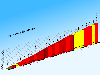 CycloGraph is a handy program to help you plot the gradient of roads using distances and heights. An Open Source alternative to Salitaker for plotting the profile of the roads you are planning to do with your bicycle. It also can import routes from kml. FEATURES: · import kml files · open...
Platforms: Windows
| License: Freeware | Size: 16.2 MB | Download (504): CycloGraph Download |
Released: June 07, 2012
|
Added: June 07, 2012 | Visits: 475
 Gpi2Gps converts Waypoints from Garmin GPI file format (i.e. Garmin POI Loader) to Google Earth (KMZ) or GPS compatible format (GPX) in a few steps. With GPI to GPs converter you are able to transform from GPI to GPs. Download your waypoints from your GPS or Palm PDAs and save it in .GPI format...
Platforms: Windows
| License: Demo | Cost: $20.00 USD | Size: 635 KB | Download (68): GPI to GPs converter Download |
Released: November 02, 2012
|
Added: November 02, 2012 | Visits: 517
 The main purpose of this popular tool is to quickly and easily resize photos from a digital camera to a smaller size for further use (especially to share the photos on web or by email). Nevertheless, Jpeg Resampler 2010 also offers many other features such as * convert between image formats (JPG,...
Platforms: Windows
| License: Freeware | Size: 1.3 MB | Download (52): JPEG Resampler 2010 Download |
Released: December 22, 2012
|
Added: December 22, 2012 | Visits: 471
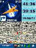 Run.GPS Trainer UV is the perfect tool to take along doing all sorts of sports like running, skiing, hiking, and many more. Run.GPS Trainer UV is compatible with most PocketPCs and Smartphones (requires Windows Mobile 2003 Pocket PC, Windows Mobile 5 or Windows Mobile 6). Recording *...
Platforms: Windows, Pocket PC
| License: Shareware | Cost: $33.99 USD | Size: 6.29 MB | Download (606): Run.GPS Trainer UV Download |
Released: July 18, 2012
|
Added: July 18, 2012 | Visits: 795
 Create own true to scale maps, store online maps locally with Vivo techology, map editor, dataexchange with Google Earth by Copy and Paste, GPS enabled coordinates, import of free OpenStreatMap data and GPS Exchange and GPS logger data, compatible with "GPS for Google Earth", area calculation...
Platforms: Windows
| License: Shareware | Cost: $65.00 USD | Size: 6.36 MB | Download (398): Dr. Regener LandMap Vivo Download |
Released: December 11, 2012
|
Added: December 11, 2012 | Visits: 289
Python script for Geocachers. Takes GPX file (eg from Geotoad), downloads waypoints to Garmin Etrex, and produces OpenOffice quick-reference document with the descriptions and hints.
Platforms: Windows, Mac, BSD, Linux
| License: Freeware | Size: 5.52 KB | Download (49): Cache and Carry Download |
Released: December 25, 2012
|
Added: December 25, 2012 | Visits: 288
 ForeRunner X01 toolkit provides an easy access to Forerunner 201/301/305/305E GPS-units. There are multiple command line tools to read data from GPS into database and tools to export data in different formats like gpx and tcx.
Platforms: Windows, Mac, BSD, Linux
| License: Freeware | Size: 3.01 MB | Download (50): Forerunner X01 Toolkit Download |
Released: August 20, 2012
|
Added: August 20, 2012 | Visits: 375
GPSBabel reads, writes, and manipulates GPS waypoints in a variety of formats. Over 100 supported formats include GPX, Magellan and Garmin serial and USB protocols, Geocaching *.loc, Garmin Mapsource, and Magellan Mapsend. For Windows, Linux, Mac.
Platforms: Windows, Mac, BSD, Linux
| License: Freeware | Size: 1.05 MB | Download (45): GPSBabel Download |
Released: November 05, 2012
|
Added: November 05, 2012 | Visits: 312
Java base GPS Waypoint manipulation.Provides a toolkit for managing a variety of GPS Waypoint input formats like GPX, used by ExpertGPS and GeoCaching.com, as well as conversion formats for certain GPS devices.Similar in goals to gpsbabel.
Platforms: Windows, Mac, Linux
| License: Freeware | Size: 4.58 MB | Download (43): GPS Blender Download |
Released: November 19, 2012
|
Added: November 19, 2012 | Visits: 395
Read GPS files in .gpx xml format. Calculate velocity, glide, distance information.Convert to .srt format to be embeded in a video.
Platforms: Windows, Mac, Linux
| License: Freeware | Size: 7.79 MB | Download (47): gpx2srt Download |