


Gps Maps Michelin software
Gps Maps Michelin
Released: March 14, 2018
|
Added: June 20, 2018 | Visits: 804
 With Final Selection you can make the selection of your photos as you have always wanted!
- Create your selection of photos using the colors, give them a score using the stars and order them by dragging them to the position you want
- Save your projects for future revisions
- Add custom...
With Final Selection you can make the selection of your photos as you have always wanted!
- Create your selection of photos using the colors, give them a score using the stars and order them by dragging them to the position you want
- Save your projects for future revisions
- Add custom...
Platforms: Windows 8, Windows 7, Windows
| License: Freeware | Size: 11.67 MB | Download (155): Final Selection Download |
Added: July 11, 2010 | Visits: 1.234
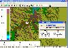
 GPSMap is a Java application that displays maps and shows your position with the aid of a GPS device. GPSMap project can track paths, load overlays (such as shape files), and download maps from the MapBlast and Expedia servers. Whats New in This Release: - Serial communication on Windows...
Platforms: *nix
| License: Freeware | Size: 4.4 MB | Download (153): GPSMap Download |
Added: January 25, 2010 | Visits: 1.402
GPSUtility displays GPS data including speed, bearing, position and satellite information.
Platforms: Mac
| License: Freeware | Download (148): GPSUtility Download |
Released: December 12, 2023
|
Added: December 23, 2023 | Visits: 1.238
 Universal Maps Downloader is a tool that help you to get small tile images from Google Maps, Openstreetmap, Yandex Maps, Yahoo Maps, Mapquest, Gaode map, Tencent Maps, Baidu Maps, Tianditu, Arcgis Online, OneMap, Whereis, mapy.cz, Mappy, Waze, Sentinel-2 map, Strava Gloabal Heatmap, Wikimapia,...
Platforms: Windows 8, Windows 7, Windows
| License: Shareware | Cost: $69.00 USD | Size: 30.7 MB | Download (147): Universal Maps Downloader |
Added: May 22, 2010 | Visits: 1.537
Maps project is a topographal map and aerial photo generator and viewer. Maps allows users to generate topographical maps and aerial photographs of any region in the United States. It uses data provided by the USGS through the geoserver system. The interactive view lets you move around,...
Platforms: *nix
| License: Freeware | Size: 11.26 KB | Download (139): Maps Download |
Added: May 13, 2010 | Visits: 1.342
GPS::Lowrance is a Perl module connect to Lowrance and Eagle GPS devices. REQUIREMENTS The following modules are required to use this module: Carp::Assert GPS::Lowrance::LSI 0.23 Parse::Binary::FixedFormat Win32::SerialPort or Device::SerialPort If you will be using the...
Platforms: *nix
| License: Freeware | Size: 22.53 KB | Download (139): GPS::Lowrance Download |
Added: August 14, 2008 | Visits: 1.315
Puzzle Maps are interactive educational games, small in size and portable, no installation required just unzip and run. The player must find the "?" in the correct location and double-click on it to place the name there. Currently four puzzle maps are available: Boroughs of Greater London;...
Platforms: Windows
| License: Freeware | Size: 450 KB | Download (138): Puzzle Maps Download |
Added: January 25, 2010 | Visits: 850
MacENC is the professional solution for the mariner that wants to take the Mac aboard for real-time display of position on the vector format S-57/S-63 ENCs (Electronic Navigational Charts) AND raster format BSB and Softcharts. Plug your GPS into your Mac and watch as your vessel moves along in...
Platforms: Mac
| License: Demo | Cost: $0.00 USD | Download (134): MacENC Download |
Added: August 06, 2008 | Visits: 1.438
WEB MAPS allows you to search maps of any country, state, city or province. You just enter the desired image search criteria (e.g. LOS ANGELES CALIFORNIA) and select the number of diferent maps you want to obtain. WEB MAPS will search the web for criteria coincidences and display the images in...
Platforms: Windows
| License: Shareware | Cost: $15.00 USD | Size: 1.91 MB | Download (131): WEB MAPS Download |
Released: March 29, 2020
|
Added: April 06, 2020 | Visits: 1.133
TRANSDATpro can prove a helpful tool for professionals, providing them with the possibility to perform coordinate transformations fast and easy by use of the coordinate reference systems of their choice.
TRANSDATpro performs Coordinate Transformations fast and with high accuracy. The coordinate...
Platforms: Windows, Windows 8, Windows 7, Windows Server
| License: Shareware | Cost: $270.00 USD | Size: 5.19 MB | Download (131): TRANSDATpro Download |
Released: January 12, 2012
|
Added: February 04, 2012 | Visits: 1.498
 Bubble maps software does scatter plot and circle charts in Excel, useful for advanced business analysis.
Excel provides the ability to draw bubble maps and scatter plots, but they are less refined than a bubble map you can make with the Smart Bubble Charts software. In Excel: (1) Chart...
Bubble maps software does scatter plot and circle charts in Excel, useful for advanced business analysis.
Excel provides the ability to draw bubble maps and scatter plots, but they are less refined than a bubble map you can make with the Smart Bubble Charts software. In Excel: (1) Chart...
Platforms: Windows
| License: Shareware | Cost: $54.65 USD | Size: 16.32 MB | Download (126): Bubble Maps Software Download |
Released: July 21, 2010
|
Added: September 25, 2010 | Visits: 1.353
 Toolkit to add GPS and coordinate conversion functionality to your software and scripts (GPS API). All NMEA0183 protocol versions are supported and can be filtered by NMEA sentence type and talker ID. Garmin USB PVT support. Information on GPS status can also be retrieved: GPS fix quality,...
Platforms: Windows
| License: Shareware | Cost: $99.00 USD | Size: 2.2 MB | Download (125): Eye4Software GPS API Download |
Added: January 25, 2010 | Visits: 2.079
Warcraft III Bonus Maps are extra maps that were first released with the demo of Warcraft III, however people that purchased the real game and didn't want to download the demo to get these maps can now download them individually.
Platforms: Mac
| License: Freeware | Size: 150 KB | Download (123): Warcraft III Bonus Maps Download |
Added: August 19, 2010 | Visits: 1.228
GPS::Babel is a Perl interface to gpsbabel. SYNOPSIS use GPS::Babel; my $babel = GPS::Babel->new(); # Read an OZIExplorer file into a data structure my $data = $babel->read(route.ozi, ozi); # Convert a file automatically choosing input and output # format based on extension...
Platforms: *nix
| License: Freeware | Size: 10.24 KB | Download (121): GPS::Babel Download |
Added: March 24, 2010 | Visits: 1.187
GPS::SpaceTrack is a package for calculating the position of GPS satellites. SYNOPSIS use GPS::SpaceTrack; my $obj=GPS::SpaceTrack->new(filename=>"gps.tle"); print join("t", qw{Count PRN ELEV Azim SNR USED}), "n"; foreach ($obj->getsatellitelist({lat=>38.870997, lon=>-77.05596})) { print...
Platforms: *nix
| License: Freeware | Size: 52.22 KB | Download (117): GPS::SpaceTrack Download |
Added: June 21, 2010 | Visits: 1.471
QLandkarte can view and upload map files, track and waypoint data to your Garmin GPS receiver. Garmins MapSource software is hardly the only reason for me to boot into Windows and it does not look like Garmin ever wants to address Linux users by writing a portable piece of software. So I...
Platforms: *nix
| License: Freeware | Size: 972.8 KB | Download (116): QLandkarte Download |
Added: September 18, 2010 | Visits: 1.599
GPS::Lowrance::Trail is a Perl module to convert between GDM16 Trails and other formats. Installation: Installation is pretty standard: perl Makefile.PL make make test make install There is no test suite to speak of. One will be added in a later version. SYNOPSIS use...
Platforms: *nix
| License: Freeware | Size: 8.19 KB | Download (113): GPS::Lowrance::Trail Download |
Added: August 12, 2008 | Visits: 1.503
 GPS library VB (.NET) toolkit reads and decodes standard GPS NMEA 183 sentences from the RS232 serial port as well as computes great circle distances and bearings. Runs as a background thread unattended. Works with Bluetooth and USB. The most current GPS data is always available on demand....
Platforms: Windows
| License: Shareware | Cost: $105.00 USD | Size: 303 KB | Download (113): MarshallSoft GPS Component for VB Download |
Released: November 01, 2011
|
Added: November 30, 2011 | Visits: 1.145
 Global Mapper is more than just a utility; it has built in functionality for distance and area calculations, raster blending, feathering, spectral analysis and contrast adjustment, elevation querying, line of sight calculations, cut-and-fill volume calculations, as well as advanced capabilities...
Platforms: Windows, Other
| License: Shareware | Cost: $399.00 USD | Size: 11.24 MB | Download (110): Create Better Maps with Global Mapper 13 Download |
Added: January 25, 2010 | Visits: 1.309
GPS Connect is a freeware program for Mac OS X which offers connectivity to Garmin GPS receivers. The intended use is to backup waypoints from the GPS to your computer. Downloaded waypoints may be saved in a native file format or exported to a variety of other formats such as tab-delimited,...
Platforms: Mac
| License: Freeware | Size: 1.2 MB | Download (108): GPS Connect Download |