


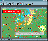
Gps Map Usa software
Gps Map Usa
Released: August 21, 2012
|
Added: August 21, 2012 | Visits: 427
 AGIS for Windows is a mapping and simple GIS shareware package. Plot your own geographic data on the map of the world provided without the high cost and steep learning curve usually associated with this kind of software. Create high resolution publication quality images that can be pasted into...
Platforms: Windows
AGIS for Windows is a mapping and simple GIS shareware package. Plot your own geographic data on the map of the world provided without the high cost and steep learning curve usually associated with this kind of software. Create high resolution publication quality images that can be pasted into...
Platforms: Windows
| License: Shareware | Cost: $49.00 USD | Size: 3.57 MB | Download (478): AGIS for Windows Download |
Released: January 27, 2013
|
Added: January 27, 2013 | Visits: 1.106
 CMC Multimedia Sistem SRL ofera: Sisteme de Monitorizare Vehicule si Localizare prin GPS, Receptoare de ultima generatie GPS, Navigatie prin Sisteme GPS, Sisteme Urmarire GPS Auto, Abonamente GPS si Sisteme de Urmarire a Masinilor, GPS Tracking, Sisteme Navigatie Romania si International,...
Platforms: Windows, Mac, Unix, Linux, Palm OS 6.0, Pocket PC, RIM, Symbian, Handheld/Mobile Other, OpenVMS, Netware, BEOS, Java
CMC Multimedia Sistem SRL ofera: Sisteme de Monitorizare Vehicule si Localizare prin GPS, Receptoare de ultima generatie GPS, Navigatie prin Sisteme GPS, Sisteme Urmarire GPS Auto, Abonamente GPS si Sisteme de Urmarire a Masinilor, GPS Tracking, Sisteme Navigatie Romania si International,...
Platforms: Windows, Mac, Unix, Linux, Palm OS 6.0, Pocket PC, RIM, Symbian, Handheld/Mobile Other, OpenVMS, Netware, BEOS, Java
| License: Freeware | Size: 974 KB | Download (476): Sisteme de Localizare, Monitorizare GPS Download |
Released: September 24, 2012
|
Added: September 24, 2012 | Visits: 846
 Wallpaper for an amazing 3D arcade game "Adventures of Tuber: Map of Treasures". Getting the map of treasures, our great explorer, Tuber, finds himself in the underwater maze. Tuber’s aim is to find his way to a lost Halloween island. You should solve a series of mind-stretching tasks, using...
Platforms: Windows
Wallpaper for an amazing 3D arcade game "Adventures of Tuber: Map of Treasures". Getting the map of treasures, our great explorer, Tuber, finds himself in the underwater maze. Tuber’s aim is to find his way to a lost Halloween island. You should solve a series of mind-stretching tasks, using...
Platforms: Windows
| License: Freeware | Size: 4.05 MB | Download (472): Wallpapers: Map of Treasures Download |
Released: September 05, 2012
|
Added: September 05, 2012 | Visits: 716
"Adventures of Tuber: The Map of Treasures" is an amazing 3D arcade game for everybody! Getting the map of treasures, our great explorer, Tuber, finds himself in the underwater maze. Tuber’s aim is to find his way to a lost Halloween island. You should solve a series of mind-stretching tasks,...
Platforms: Windows
| License: Shareware | Cost: $0.00 USD | Size: 19.7 MB | Download (471): Map of Treasures Download |
Released: July 05, 2012
|
Added: July 05, 2012 | Visits: 578
 " The most accurate and handly Altimeter is here. It gives you the altitude wherever you are. Simply start the app and altitude will appear in a second, No setup required. You can also adjust Altitude in Feet or Meter as per your requirement. Special feature saved your Max climb rate value.
...
Platforms: iPhone, iPod
" The most accurate and handly Altimeter is here. It gives you the altitude wherever you are. Simply start the app and altitude will appear in a second, No setup required. You can also adjust Altitude in Feet or Meter as per your requirement. Special feature saved your Max climb rate value.
...
Platforms: iPhone, iPod
| License: Shareware | Cost: $0.99 USD | Download (469): Altimeter Digital GPS + Map Viewer + Cam Download |
Released: December 07, 2012
|
Added: December 07, 2012 | Visits: 533
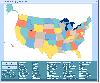
 USA Flash Map Locator for websites, presentations and more. Easy adjustment.
Variants of using a map locator:
- Real-Estate websites
- Quick access to contact organization data, having affiliated network in USA
With this fully-clickable map you will be able to improve navigation and provide...
Platforms: Windows, Mac
USA Flash Map Locator for websites, presentations and more. Easy adjustment.
Variants of using a map locator:
- Real-Estate websites
- Quick access to contact organization data, having affiliated network in USA
With this fully-clickable map you will be able to improve navigation and provide...
Platforms: Windows, Mac
| License: Demo | Cost: $69.00 USD | Size: 64 KB | Download (469): USA Map Locator Download |
Released: October 23, 2012
|
Added: October 23, 2012 | Visits: 656
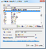
GPS Utility is an easy-to-use application that provides management and manipulation of GPS information. You can use it to transfer data to/from a GPS receiver and store the data in PC files in one of several text formats.
The program converts between different map datums and many coordinate...
Platforms: Windows
| License: Freeware | Size: 1.87 MB | Download (469): GPS Utility Download |
Released: August 19, 2012
|
Added: August 19, 2012 | Visits: 663
 The Eye4Software Coordinate Calculator is an easy to use desktop software tool, to perform gps coordinate conversions from one coordinate system to another. It can also be used to convert coordinates between different map datums. The software can be used to convert a single coordinate, or to...
Platforms: Windows
The Eye4Software Coordinate Calculator is an easy to use desktop software tool, to perform gps coordinate conversions from one coordinate system to another. It can also be used to convert coordinates between different map datums. The software can be used to convert a single coordinate, or to...
Platforms: Windows
| License: Shareware | Cost: $43.51 USD | Size: 1.4 MB | Download (462): Coordinate Calculator Download |
Released: October 24, 2012
|
Added: October 24, 2012 | Visits: 680
 QGIS supports vector, raster, and database formats and lets you browse and create map data on your computer.
Quantum GIS (QGIS) supports many common spatial data formats (e.g. ESRI ShapeFile, geotiff). QGIS supports plugins to do things like display tracks from your GPS.
QGIS aims to be an...
Platforms: Linux
QGIS supports vector, raster, and database formats and lets you browse and create map data on your computer.
Quantum GIS (QGIS) supports many common spatial data formats (e.g. ESRI ShapeFile, geotiff). QGIS supports plugins to do things like display tracks from your GPS.
QGIS aims to be an...
Platforms: Linux
| License: Freeware | Size: 1024 KB | Download (460): Quantum GIS form Linux Download |
Released: August 01, 2012
|
Added: August 01, 2012 | Visits: 573
 Drag and drop the country names of United States correctly onto the map.
Platforms: Windows
Drag and drop the country names of United States correctly onto the map.
Platforms: Windows
| License: Shareware | Cost: $19.99 USD | Size: 1.25 MB | Download (458): US Interactive Map Quiz Software Download |
Released: January 09, 2003
|
Added: October 07, 2006 | Visits: 3.322
USA Online package contains full featured HTML website template with source Adobe Photoshop graphics. It's the easiest and most affordable way to create or professionally re-design your American website. It suits any website related with United States and Americans.
Platforms: Windows, Mac
| License: Commercial | Cost: $45.00 USD | Size: 626 KB | Download (456): USA Online Download |
Released: August 23, 2012
|
Added: August 23, 2012 | Visits: 669
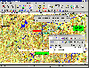
 All-in-one software for creation of custom GPS maps compatible with Garmin GPS units. Mapwel supports routing, ESRI shapefiles, OpenStreetMap OSM, Google Earth KML and KMZ, cGPSmapper MP and GPX files. Mapwel custom GPS mapping capability and user icons editor are often used in forestry,...
Platforms: Windows
All-in-one software for creation of custom GPS maps compatible with Garmin GPS units. Mapwel supports routing, ESRI shapefiles, OpenStreetMap OSM, Google Earth KML and KMZ, cGPSmapper MP and GPX files. Mapwel custom GPS mapping capability and user icons editor are often used in forestry,...
Platforms: Windows
| License: Shareware | Cost: $45.00 USD | Size: 12.28 MB | Download (454): Mapwel Download |
Released: October 11, 2012
|
Added: October 11, 2012 | Visits: 778
 QGIS supports vector, raster, and database formats and lets you browse and create map data on your computer.
Quantum GIS (QGIS) supports many common spatial data formats (e.g. ESRI ShapeFile, geotiff). QGIS supports plugins to do things like display tracks from your GPS.
QGIS aims to be an...
Platforms: Windows
QGIS supports vector, raster, and database formats and lets you browse and create map data on your computer.
Quantum GIS (QGIS) supports many common spatial data formats (e.g. ESRI ShapeFile, geotiff). QGIS supports plugins to do things like display tracks from your GPS.
QGIS aims to be an...
Platforms: Windows
| License: Freeware | Size: 77.3 MB | Download (453): Quantum GIS Download |
Released: August 23, 2012
|
Added: August 23, 2012 | Visits: 573
ExpertGPS is the ultimate mapping software for Garmin, Magellan, and Lowrance GPS owners. ExpertGPS displays your waypoints, routes, and tracks on USGS topo maps and aerial photos.
Using the powerful mapping tools in ExpertGPS, you can draw your route directly on a map, search for nearby...
Platforms: Windows
| License: Shareware | Cost: $74.95 USD | Size: 9.1 MB | Download (441): ExpertGPS Download |
Released: July 24, 2012
|
Added: July 24, 2012 | Visits: 785
 QGIS supports vector, raster, and database formats and lets you browse and create map data on your computer.
Quantum GIS (QGIS) supports many common spatial data formats (e.g. ESRI ShapeFile, geotiff). QGIS supports plugins to do things like display tracks from your GPS.
QGIS aims to be an...
Platforms: Mac
QGIS supports vector, raster, and database formats and lets you browse and create map data on your computer.
Quantum GIS (QGIS) supports many common spatial data formats (e.g. ESRI ShapeFile, geotiff). QGIS supports plugins to do things like display tracks from your GPS.
QGIS aims to be an...
Platforms: Mac
| License: Freeware | Size: 1024 KB | Download (440): Quantum GIS form Mac Download |
Released: June 09, 2012
|
Added: June 09, 2012 | Visits: 341
 OziExplorer is interactive, it allows you to work, on your computer screen, with digital maps that you have purchased or scanned yourself. By using these maps OziExplorer allows you to plan your trip by creating waypoints, routes and tracks on screen and upload these to your GPS.
With...
Platforms: Windows
OziExplorer is interactive, it allows you to work, on your computer screen, with digital maps that you have purchased or scanned yourself. By using these maps OziExplorer allows you to plan your trip by creating waypoints, routes and tracks on screen and upload these to your GPS.
With...
Platforms: Windows
| License: Shareware | Cost: $95.00 USD | Size: 7 MB | Download (431): OziExplorer Download |
Released: June 03, 2012
|
Added: June 03, 2012 | Visits: 729
The Genome Positioning System (GPS) is a software tool to study protein-DNA interaction using ChIP-Seq data. GPS builds a probabilistic mixture model to predict the most likely positions of binding events at single-base resolution.
GPS is a Java software, so it runs on multiple platforms,...
Platforms: Windows
| License: Freeware | Download (430): GPS Download |
Released: July 01, 2012
|
Added: July 01, 2012 | Visits: 759
 Atom GPS freeware easily geotags your photos directly from your GPS device or track log. By simply connecting your GPS Device to Atom GPS and selecting your photos you can add their geolocation in one click. This action allows you to write the geolocation data to your photos exifs (information...
Platforms: Windows
Atom GPS freeware easily geotags your photos directly from your GPS device or track log. By simply connecting your GPS Device to Atom GPS and selecting your photos you can add their geolocation in one click. This action allows you to write the geolocation data to your photos exifs (information...
Platforms: Windows
| License: Freeware | Size: 7.58 MB | Download (430): ATOM GPS Download |
Released: October 17, 2012
|
Added: October 17, 2012 | Visits: 836
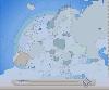 Flash Map of Europe.Suitable for Real-Estate, Dealer Maps, Branch Offices Locators.With this fully-clickable map you will be able to improve navigation and provide visitors with better and quicker access to information as well as improve the way you present the information. The map can be used...
Platforms: Windows
Flash Map of Europe.Suitable for Real-Estate, Dealer Maps, Branch Offices Locators.With this fully-clickable map you will be able to improve navigation and provide visitors with better and quicker access to information as well as improve the way you present the information. The map can be used...
Platforms: Windows
| License: Shareware | Cost: $69.00 USD | Size: 112.64 KB | Download (430): Interactive Flash Map of Europe Download |
Released: October 23, 2012
|
Added: October 23, 2012 | Visits: 475
 Golden SpotsMap of USA for websites, presentations and more. Easy adjustment.
Variants of using a map locator:
- Real-Estate websites
- Quick access to contact organization data, having affiliated network in USA
With this fully-clickable map you will be able to improve navigation and provide...
Platforms: Windows
Golden SpotsMap of USA for websites, presentations and more. Easy adjustment.
Variants of using a map locator:
- Real-Estate websites
- Quick access to contact organization data, having affiliated network in USA
With this fully-clickable map you will be able to improve navigation and provide...
Platforms: Windows
| License: Demo | Cost: $299.00 USD | Size: 461 KB | Download (427): Golden SpotsMap of USA Download |