


Gps Distance software
Gps Distance
Added: September 18, 2010 | Visits: 1.600
 GPS::Lowrance::Trail is a Perl module to convert between GDM16 Trails and other formats. Installation: Installation is pretty standard: perl Makefile.PL make make test make install There is no test suite to speak of. One will be added in a later version. SYNOPSIS use...
Platforms: *nix
| License: Freeware | Size: 8.19 KB | Download (113): GPS::Lowrance::Trail Download |
Added: August 12, 2008 | Visits: 1.503
 GPS library VB (.NET) toolkit reads and decodes standard GPS NMEA 183 sentences from the RS232 serial port as well as computes great circle distances and bearings. Runs as a background thread unattended. Works with Bluetooth and USB. The most current GPS data is always available on demand....
Platforms: Windows
| License: Shareware | Cost: $105.00 USD | Size: 303 KB | Download (113): MarshallSoft GPS Component for VB Download |
Added: January 25, 2010 | Visits: 1.129
TrackRunner is a GPS-enabled exercise logbook.Coupled with a GPS receiver and using LoadMyTracks from ClueTrust to connect to your GPS device, you'll be able to log your workouts and keep track of distance, time, elevation, heart-rate etc. Activities can be organized into categories, and by...
Platforms: Mac
| License: Freeware | Download (112): TrackRunner Download |
Released: November 01, 2011
|
Added: November 30, 2011 | Visits: 1.146
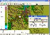 Global Mapper is more than just a utility; it has built in functionality for distance and area calculations, raster blending, feathering, spectral analysis and contrast adjustment, elevation querying, line of sight calculations, cut-and-fill volume calculations, as well as advanced capabilities...
Platforms: Windows, Other
| License: Shareware | Cost: $399.00 USD | Size: 11.24 MB | Download (110): Create Better Maps with Global Mapper 13 Download |
Added: January 25, 2010 | Visits: 1.310
GPS Connect is a freeware program for Mac OS X which offers connectivity to Garmin GPS receivers. The intended use is to backup waypoints from the GPS to your computer. Downloaded waypoints may be saved in a native file format or exported to a variety of other formats such as tab-delimited,...
Platforms: Mac
| License: Freeware | Size: 1.2 MB | Download (108): GPS Connect Download |
Added: January 25, 2010 | Visits: 744
MacCaching is a Geocache Manager support Garmin and Magallen GPS receivers. Caches are managed in Lists which can be groups of caches in a certain area, caches you own, or caches you haven't found yet. An iPod or Palm-based device can be used for Paperless Caching when sending caches to your GPS....
Platforms: Mac
| License: Freeware | Download (104): MacCaching Download |
Added: January 25, 2010 | Visits: 635
Mouse Distance Measurer allows you to display the distance your mouse travels all day long.It measures and displays the distance covered by your mouse in the right side of the menu bar.You can configure your screen dimensions to be as much accurate as possible. You can choose to display distances...
Platforms: Mac
| License: Shareware | Cost: $0.00 USD | Download (104): Mouse Distance Measurer Download |
Added: May 10, 2013 | Visits: 1.090
This project allows someone to track a GPS enabled cell phone using Google maps.For this project it is used a Motorola i355 cell phone on the Sprint/Nextel network. You need to have a data plan so that you can make updates to your website from the cellphone. Project includes J2ME cell phone...
Platforms: Windows, Mac, *nix, PHP, BSD Solaris
| License: Freeware | Download (81): GPS Tracker Download |
Released: October 08, 2012
|
Added: October 08, 2012 | Visits: 581
 Virtual GPS is a GPS simulator software. You can use it to simulate a GPS receiver unit connected to your system. It's ideal when you need GPS input, but you have no signal or for development purposes. It supports various NMEA sentences, so it can be used with any GPS mapping software. You can...
Platforms: Windows, Other
| License: Shareware | Cost: $39.99 USD | Size: 946 KB | Download (74): Virtual GPS Download |
Released: June 07, 2012
|
Added: June 07, 2012 | Visits: 475
 Gpi2Gps converts Waypoints from Garmin GPI file format (i.e. Garmin POI Loader) to Google Earth (KMZ) or GPS compatible format (GPX) in a few steps. With GPI to GPs converter you are able to transform from GPI to GPs. Download your waypoints from your GPS or Palm PDAs and save it in .GPI format...
Platforms: Windows
| License: Demo | Cost: $20.00 USD | Size: 635 KB | Download (68): GPI to GPs converter Download |
Released: September 27, 2012
|
Added: September 27, 2012 | Visits: 556
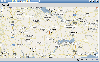
Why use a map website, when all you need is distance calculated? With this compact widget, enter your starting zip code and your ending zip code and results calculated land on the ZipCodeWidget.com web page.
Platforms: Mac
| License: Freeware | Size: 40.96 KB | Download (66): Zip Code Distance Calculator Download |
Released: June 17, 2012
|
Added: June 17, 2012 | Visits: 870
![]() GPS Tracker Data Logger acts as the server and allows you to collect data from an unlimited number of various GPS trackers simultaneously. The obtained data is processed, uniformed and written to a log file or a database. Also, the program has a set of interfaces so other applications can get...
GPS Tracker Data Logger acts as the server and allows you to collect data from an unlimited number of various GPS trackers simultaneously. The obtained data is processed, uniformed and written to a log file or a database. Also, the program has a set of interfaces so other applications can get...
Platforms: Windows
| License: Shareware | Cost: $100.00 USD | Size: 11.83 MB | Download (64): GPS Tracker Data Logger Download |
Added: December 10, 2013 | Visits: 677
Return mahalanobis distance of two data matrices A and B (row = object, column = feature)% @author: Kardi Teknomo% http://people.revoledu.com/kardi/index.htmlSee more explanation in the Mahalanobis Distance tutorial http://people.revoledu.com/kardi/tutorial/...isDistance.html
Platforms: Matlab
| License: Shareware | Cost: $0.00 USD | Size: 10 KB | Download (60): Mahalanobis Distance Download |
Released: September 27, 2012
|
Added: September 27, 2012 | Visits: 709
 Complex of programs FPS provide remote monitoring of GPS receivers and visualize data on a computer operator. The program presented for the free use can track the position of only one GPS-receiver. As GPS receivers can be used smartphone with GPS operating systems to Windows Mobile 5 or 6 and...
Platforms: Windows, Mac, Unix, Linux, Linux Gnome, Linux GPL, Linux Open Source
| License: Freeware | Size: 7.85 MB | Download (57): FPS система GPS мониторинга Download |
Released: June 13, 2012
|
Added: June 13, 2012 | Visits: 899
![]() With the new Icons-Land Vista Style GIS/GPS/Map Icon Set now it is much more comfortable to use local service applications, GPS tracking and GIS applications, and any kind of mapping applications. GIS/GPS/Map Icons are meant to help users to orient oneself when using maps, to facilitate their...
With the new Icons-Land Vista Style GIS/GPS/Map Icon Set now it is much more comfortable to use local service applications, GPS tracking and GIS applications, and any kind of mapping applications. GIS/GPS/Map Icons are meant to help users to orient oneself when using maps, to facilitate their...
Platforms: Windows, Mac, Pocket PC, Java, Handheld/Mobile Other
| License: Demo | Cost: $120.00 USD | Size: 2.53 MB | Download (57): Icons-Land Vista Style GIS/GPS/MAP Icon Set Download |
Released: November 12, 2012
|
Added: November 12, 2012 | Visits: 491
 Create and edit waypoints, tracklogs, routes, and insert scanned images of map. More than 160 GPS models recognized. Garmin, Magellan, Eagle and others
- Most complete free program for GPS devices
- Compatible with more than 160 GPS models
- Support for Garmin, Magellan and others
- Easily...
Create and edit waypoints, tracklogs, routes, and insert scanned images of map. More than 160 GPS models recognized. Garmin, Magellan, Eagle and others
- Most complete free program for GPS devices
- Compatible with more than 160 GPS models
- Support for Garmin, Magellan and others
- Easily...
Platforms: Windows
| License: Freeware | Size: 54.92 MB | Download (57): GPS TrackMaker Download |
Released: December 05, 2012
|
Added: December 05, 2012 | Visits: 483
XDL gives instructors and students tools to conduct online distance learning -- calendars, course material, exams, and more. Based on open Java standards, XDL could be modified for user groups, project management, or other collaborative online projects.
Platforms: Windows, Mac, Linux
| License: Freeware | Size: 8.38 KB | Download (57): XDL: eXtreme Distance Learning Download |
Added: August 18, 2013 | Visits: 524
A collection of utilities for translating GPS coordinates to related coordinate systems (Earth Centere Fixed, Topocentric, UTM) with auxiliary routins for horizon computation and ray ellipsoid intercepts.
Platforms: Matlab
| License: Freeware | Size: 1.28 MB | Download (57): GPS Coordinate Transformations Download |
Released: June 13, 2012
|
Added: June 13, 2012 | Visits: 729
 View maps of Earth and other planets with PrettyMap! See current day and night regions, learn geography by taking the quiz, enjoy 3D elevation surfaces, measure distances between locations and create your own maps with special places! PrettyMap lets you view vector and raster maps and images...
Platforms: Windows, Pocket PC
| License: Shareware | Cost: $19.95 USD | Size: 4.02 MB | Download (56): PrettyMap - World Atlas and Maps, GPS Download |
Released: November 01, 2012
|
Added: November 01, 2012 | Visits: 487
 The Capturix GPS SDK is a ActiveX OCX Control that provide Visual Basic Developers the interface between GPS receivers and their applications. This is a very simple control with a simple configuration methods and very easy to implement. It provides direct support to MapQuest website and creates...
Platforms: Windows
| License: Shareware | Cost: $39.00 USD | Size: 1.02 MB | Download (55): Capturix GPS SDK Download |