


Gis Technology software
Gis Technology
Added: January 27, 2006 | Visits: 6.820
 Software development kit for CAD/CAM/ GIS and graphic software developers. Converts from raster to vector and refines architect, mechanical, tech drawing, maps, math graphs, graphics for books and journals and more. ActiveX and Com Component are also available. Refines vector graphics, creates...
Platforms: Windows
Software development kit for CAD/CAM/ GIS and graphic software developers. Converts from raster to vector and refines architect, mechanical, tech drawing, maps, math graphs, graphics for books and journals and more. ActiveX and Com Component are also available. Refines vector graphics, creates...
Platforms: Windows
| License: Shareware | Cost: $99.00 USD | Size: 2.73 MB | Download (257): Algolab Raster to Vector Conversion CAD/GIS SDK Download |
Released: February 03, 2004
|
Added: March 24, 2006 | Visits: 3.806
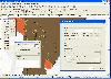 The CANVAS 9 GIS Mapping Edition adds native support for Geographic Information System (GIS) data to Canvas. You can take measurements in geographic coordinates, import industry standard SHAPE and GeoTIFF files into unlimited numbers of automatically aligned overlapping layers and choose among...
Platforms: Windows
The CANVAS 9 GIS Mapping Edition adds native support for Geographic Information System (GIS) data to Canvas. You can take measurements in geographic coordinates, import industry standard SHAPE and GeoTIFF files into unlimited numbers of automatically aligned overlapping layers and choose among...
Platforms: Windows
| License: Shareware | Cost: $549.99 USD | Size: 53.3 MB | Download (188): Canvas GIS Mapping Edition Download |
Released: July 25, 2007
|
Added: September 26, 2007 | Visits: 3.507
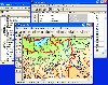
 AvisMap GIS Engine is a comprehensive SDK for the development of custom GIS applications and solutions. This SDK provides several ActiveX (OCX) controls which support Visual Basic, VB.NET, C#, Visual C++ and other ActiveX compatible programming languages, with Microsoft Visual Studio versions 6,...
Platforms: Windows
AvisMap GIS Engine is a comprehensive SDK for the development of custom GIS applications and solutions. This SDK provides several ActiveX (OCX) controls which support Visual Basic, VB.NET, C#, Visual C++ and other ActiveX compatible programming languages, with Microsoft Visual Studio versions 6,...
Platforms: Windows
| License: Shareware | Cost: $199.00 USD | Size: 43.76 MB | Download (157): AvisMap GIS Engine Download |
Added: September 22, 2010 | Visits: 1.580
 GIS::Distance::Polar can do Polar coordinate flat-earth distance calculations. SYNOPSIS my $calc = GIS::Distance::Polar->new(); my $distance = $calc->distance( $lon1, $lat1 => $lon2, $lat2 ); Supposedly this is a formula to better calculate distances at the poles. While implimented, this...
Platforms: *nix
GIS::Distance::Polar can do Polar coordinate flat-earth distance calculations. SYNOPSIS my $calc = GIS::Distance::Polar->new(); my $distance = $calc->distance( $lon1, $lat1 => $lon2, $lat2 ); Supposedly this is a formula to better calculate distances at the poles. While implimented, this...
Platforms: *nix
| License: Freeware | Size: 8.19 KB | Download (165): GIS::Distance::Polar Download |
Added: August 24, 2010 | Visits: 1.495
GIS::Distance::Vincenty Perl module contains Thaddeus Vincenty distance calculations. SYNOPSIS my $calc = GIS::Distance::Vincenty->new(); my $distance = $calc->distance( $lon1, $lat1 => $lon2, $lat2 ); For the benefit of the terminally obsessive (as well as the genuinely needy), Thaddeus...
Platforms: *nix
| License: Freeware | Size: 8.19 KB | Download (125): GIS::Distance::Vincenty Download |
Added: August 18, 2010 | Visits: 1.132
GIS-Knoppix is a bootable Linux CD with pre-installed GIS software. It is based on Knoppix..
Platforms: *nix
| License: Freeware | Size: 700 MB | Download (147): GIS Knoppix Download |
Added: April 10, 2010 | Visits: 1.001
Pagelets Technology project allows developers to embed Java scripting elements inside of text documents in order to generate dynamic text-based output. The idea and functionality behind Pagelets is very similar to Java Server Pages with one huge difference - Pagelets are not tied to the HTTP...
Platforms: *nix
| License: Shareware | Cost: $0.00 USD | Size: 1.6 MB | Download (95): Pagelets Technology Download |
Released: November 10, 2012
|
Added: November 10, 2012 | Visits: 858
Programming without coding technology (PWCT) is a visual programming system enables the developers to develop win32 application 100% without coding at all.
Users will be able to develop several application without any coding knowledge: database, multimedia, AI, text processing and more.
PWCT...
Platforms: Windows
| License: Freeware | Download (62): Programming without coding technology Download |
Released: June 21, 2012
|
Added: June 21, 2012 | Visits: 913
 Commonly referred to as GRASS, this is a free Geographic Information System (GIS) used for geospatial data management and analysis, image processing, graphics/maps production, spatial modeling, and visualization. GRASS is currently used in academic and commercial settings around the world, as...
Platforms: Mac
Commonly referred to as GRASS, this is a free Geographic Information System (GIS) used for geospatial data management and analysis, image processing, graphics/maps production, spatial modeling, and visualization. GRASS is currently used in academic and commercial settings around the world, as...
Platforms: Mac
| License: Freeware | Size: 59 MB | Download (57): Grass GIS for Mac OS X Download |
Released: June 13, 2012
|
Added: June 13, 2012 | Visits: 901
![]() With the new Icons-Land Vista Style GIS/GPS/Map Icon Set now it is much more comfortable to use local service applications, GPS tracking and GIS applications, and any kind of mapping applications. GIS/GPS/Map Icons are meant to help users to orient oneself when using maps, to facilitate their...
Platforms: Windows, Mac, Pocket PC, Java, Handheld/Mobile Other
With the new Icons-Land Vista Style GIS/GPS/Map Icon Set now it is much more comfortable to use local service applications, GPS tracking and GIS applications, and any kind of mapping applications. GIS/GPS/Map Icons are meant to help users to orient oneself when using maps, to facilitate their...
Platforms: Windows, Mac, Pocket PC, Java, Handheld/Mobile Other
| License: Demo | Cost: $120.00 USD | Size: 2.53 MB | Download (57): Icons-Land Vista Style GIS/GPS/MAP Icon Set Download |
Added: July 13, 2013 | Visits: 471
SSR technology is a freely available Web application development and publishing engine (Content Management System, CMS).It's provide powerful API and core function: Very flexible role based user access; Session management; pages and menu management;
Platforms: PHP
| License: Shareware | Cost: $0.00 USD | Size: 706.56 KB | Download (42): SSR Technology Download |
Released: September 07, 2014
|
Added: September 21, 2014 | Visits: 755
![]() With the new Icons-Land GIS/GPS/Map Vector Icons now it is much more comfortable to use local service applications, GPS tracking and GIS applications, and any kind of mapping applications.
GIS/GPS/Map Icons are meant to help users to orient oneself when using maps, to facilitate their...
Platforms: Windows, Mac, Windows 8, Windows 7, iOS
With the new Icons-Land GIS/GPS/Map Vector Icons now it is much more comfortable to use local service applications, GPS tracking and GIS applications, and any kind of mapping applications.
GIS/GPS/Map Icons are meant to help users to orient oneself when using maps, to facilitate their...
Platforms: Windows, Mac, Windows 8, Windows 7, iOS
| License: Demo | Cost: $180.00 USD | Size: 5.56 MB | Download (40): Icons-Land GIS/GPS/MAP Vector Icons Download |
Released: October 02, 2006
|
Added: January 08, 2007 | Visits: 5.024
 Test your touch typing skills with this cool, short test! Learn to type now with a fast and easy software! unique program- guarantees excellent results! Touch Typing Technology has been training people to touch type since 1984. During this time, hundreds of thousands of satisfied customers have...
Platforms: Windows, Mac, *nix
Test your touch typing skills with this cool, short test! Learn to type now with a fast and easy software! unique program- guarantees excellent results! Touch Typing Technology has been training people to touch type since 1984. During this time, hundreds of thousands of satisfied customers have...
Platforms: Windows, Mac, *nix
| License: Freeware | Size: 5.41 MB | Download (453): Touch Typing Technology test Download |
Released: April 22, 2008
|
Added: April 26, 2008 | Visits: 9.518
 The free AvisMap Viewer opens most GIS/CAD and raster image file types and most ArcView, ArcExplorer, and MapInfo projects. Besides just opening and viewing files, the Viewer supports an extensive list of features including visual layer properties control, legend control, thematic mapping,...
Platforms: Windows
The free AvisMap Viewer opens most GIS/CAD and raster image file types and most ArcView, ArcExplorer, and MapInfo projects. Besides just opening and viewing files, the Viewer supports an extensive list of features including visual layer properties control, legend control, thematic mapping,...
Platforms: Windows
| License: Freeware | Size: 22.28 MB | Download (1734): AvisMap Free Viewer Download |
Added: August 04, 2008 | Visits: 1.172
 GIS ObjectLand is a universal Geographic Information System for Windows. Key capabilities: vector-raster maps; multiuser data editing; import and export for MIF/MID (MapInfo), SHP (ArcView), DXF (AutoCAD), DBF (dBASE), CSV; setting access permissions to data for different categories of users;...
Platforms: Windows
GIS ObjectLand is a universal Geographic Information System for Windows. Key capabilities: vector-raster maps; multiuser data editing; import and export for MIF/MID (MapInfo), SHP (ArcView), DXF (AutoCAD), DBF (dBASE), CSV; setting access permissions to data for different categories of users;...
Platforms: Windows
| License: Shareware | Cost: $99.00 USD | Size: 23.54 MB | Download (537): GIS ObjectLand Download |
Added: August 25, 2008 | Visits: 2.762
 History and Guide Book to Lenticular Technology is just that, it is the most comprehensive information directory on lenticular technology ever compiled, from the inventors of Lenticular!It is a must for anyone interested in lenticular technology.
Platforms: DOS, Windows
History and Guide Book to Lenticular Technology is just that, it is the most comprehensive information directory on lenticular technology ever compiled, from the inventors of Lenticular!It is a must for anyone interested in lenticular technology.
Platforms: DOS, Windows
| License: Commercial | Cost: $39.95 USD | Size: 2.25 MB | Download (175): History and Guide Book to Lenticular Technology Download |
Added: August 01, 2008 | Visits: 917
Island Codeworks Backup with DeltaBIT technology is an easy-to-use FTP-based backup program. Instead of backing up to tape or CDROM, it uses available disk space on FTP servers. You can backup and have access to your backups when you're the office, at home or on the road. Island Codeworks...
Platforms: Windows
| License: Shareware | Cost: $35.00 USD | Size: 6.91 MB | Download (445): Island Codeworks Backup Professional with DeltaBIT Technology. Download |
Added: August 07, 2008 | Visits: 1.776
Total GIS Converter is an affordable converter of GIZ files. It converts AEP, GRD, ADF, E00, FLT, APR, SHP, DXF, BT, TOC, RT1, DEM, DLG, ECW, IMG, DGF, GML, SID, MIF, TAB, WOR, DNG, DDF, BIL, TIF, JPEG, TTKPS, TTKGP, TTKLS, LFT, PFT, and TFT files. The target formats are TIFF, PNG, JPEG, BMP....
Platforms: Windows
| License: Shareware | Cost: $99.90 USD | Size: 2.66 KB | Download (648): Total GIS Converter Download |
Added: January 25, 2010 | Visits: 1.233
ArcExplorer is a lightweight GIS data viewer developed by ESRI. This freely available software offers an easy way to perform basic GIS functions. ArcExplorer is used for a variety of display, query, and data retrieval applications and supports a wide variety of standard data sources. It can be...
Platforms: Mac
| License: Freeware | Size: 13.3 MB | Download (161): ArcExplorer Download |
Released: September 11, 2012
|
Added: November 04, 2012 | Visits: 821
 Delphish deletes phishing,malware - Technology by SaferSurf
Protects your computer against phishing, malware. SaferSurf operates the fetching of e-mails and inspects all data transferred between your computer and your mailbox. phishing e-mails and e-mails containing malware are blocked...
Platforms: Windows
Delphish deletes phishing,malware - Technology by SaferSurf
Protects your computer against phishing, malware. SaferSurf operates the fetching of e-mails and inspects all data transferred between your computer and your mailbox. phishing e-mails and e-mails containing malware are blocked...
Platforms: Windows
| License: Demo | Cost: $79.00 USD | Size: 976.56 KB | Download (88): Delphish - Technology by SaferSurf Download |