


Gis Metadata Defined software
Gis Metadata Defined
Released: February 23, 2018
|
Added: May 06, 2018 | Visits: 883
 Deluxe viewer and photo metadata toolkit.
PIE is a free image browser and viewer with perfectly integrated photo metadata and file renaming features. It extracts EXIF, XMP and IPTC information from JPG, TIFF and RAW files and makes it available in a convenient and welcoming interface. Its...
Deluxe viewer and photo metadata toolkit.
PIE is a free image browser and viewer with perfectly integrated photo metadata and file renaming features. It extracts EXIF, XMP and IPTC information from JPG, TIFF and RAW files and makes it available in a convenient and welcoming interface. Its...
Platforms: Windows, Windows 8, Windows 7
| License: Freeware | Size: 11.77 MB | Download (175): PIE Download |
Released: November 08, 2009
|
Added: November 13, 2009 | Visits: 3.492
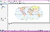 AvisMap Desktop Professional 5 is a professional desktop GIS software for map editing, managing, analysis attribute data, aid decision-making transactions and output map, print tables, 3D modeling, and other functions. As a complete analysis management tool, AvisMap Despro 5 is applicable in land...
Platforms: Windows
| License: Shareware | Cost: $499.00 USD | Size: 22.19 MB | Download (173): AvisMap Deskpro Download |
Added: September 22, 2010 | Visits: 1.576
 GIS::Distance::Polar can do Polar coordinate flat-earth distance calculations. SYNOPSIS my $calc = GIS::Distance::Polar->new(); my $distance = $calc->distance( $lon1, $lat1 => $lon2, $lat2 ); Supposedly this is a formula to better calculate distances at the poles. While implimented, this...
Platforms: *nix
| License: Freeware | Size: 8.19 KB | Download (165): GIS::Distance::Polar Download |
Added: January 25, 2010 | Visits: 1.228
ArcExplorer is a lightweight GIS data viewer developed by ESRI. This freely available software offers an easy way to perform basic GIS functions. ArcExplorer is used for a variety of display, query, and data retrieval applications and supports a wide variety of standard data sources. It can be...
Platforms: Mac
| License: Freeware | Size: 13.3 MB | Download (161): ArcExplorer Download |
Released: March 04, 2003
|
Added: January 18, 2006 | Visits: 2.713
 ExGIS (OCX Control) target applications are GIS (Geographic Information System). Although it is a new kid on the block on GIS market, its highlights implemented quality and a lot of features.
There are a lot of applications that you can develop with our ExGIS components, like :
Marketing...
ExGIS (OCX Control) target applications are GIS (Geographic Information System). Although it is a new kid on the block on GIS market, its highlights implemented quality and a lot of features.
There are a lot of applications that you can develop with our ExGIS components, like :
Marketing...
Platforms: Windows, Windows CE
| License: Shareware | Cost: $599.00 USD | Size: 36.13 MB | Download (158): ExGIS Download |
Released: July 25, 2007
|
Added: September 26, 2007 | Visits: 3.503
 AvisMap GIS Engine is a comprehensive SDK for the development of custom GIS applications and solutions. This SDK provides several ActiveX (OCX) controls which support Visual Basic, VB.NET, C#, Visual C++ and other ActiveX compatible programming languages, with Microsoft Visual Studio versions 6,...
Platforms: Windows
| License: Shareware | Cost: $199.00 USD | Size: 43.76 MB | Download (157): AvisMap GIS Engine Download |
Released: December 30, 2013
|
Added: April 05, 2015 | Visits: 933
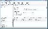
 XPlica for SharePoint is a content migration solution used to migrate contents between SharePoint servers. XPlica supports migration of site collections, webs, libraries, lists, documents, document properties, list items (including file attachments) and associated metadata, while retaining folder...
Platforms: Windows 8, Windows, Windows 7
| License: Commercial | Cost: $1.00 USD | Size: 14.05 MB | Download (154): XPlica for SharePoint Download |
Released: August 20, 2009
|
Added: August 26, 2009 | Visits: 2.820
 The deluxe photo data toolkit for amateur photographers and professionals alike.PIE is an image browser and viewer with perfectly integrated photo metadata and file renaming features. It extracts EXIF, XMP and IPTC information from JPG and RAW files and makes it available in a convenient and...
Platforms: Windows
| License: Shareware | Cost: $35.00 USD | Size: 3.87 MB | Download (150): Picture Information Extractor Download |
Added: August 18, 2010 | Visits: 1.129
GIS-Knoppix is a bootable Linux CD with pre-installed GIS software. It is based on Knoppix..
Platforms: *nix
| License: Freeware | Size: 700 MB | Download (147): GIS Knoppix Download |
Added: September 02, 2010 | Visits: 2.492
Geo::ShapeFile is a Perl extension for handling ESRI GIS Shapefiles. SYNOPSIS use Geo::ShapeFile; my $shapefile = new Geo::ShapeFile("roads"); for(1 .. $shapefile->shapes()) { my $shape = $shapefile->get_shp_record($_); # see Geo::ShapeFile::Shape docs for what to do with $shape my...
Platforms: *nix
| License: Freeware | Size: 276.48 KB | Download (147): Geo::ShapeFile Download |
Released: January 02, 2003
|
Added: May 17, 2006 | Visits: 5.235
 Ecatenate dbLockdown 1.0 is a database tool to protect SQL Server and MSDE databases. The tool encrypts stored procedures, triggers, user defined functions and views, stopping anyone from viewing or editing them. Database scripts encrypted are automatically archived and can be restored at any...
Platforms: Windows
| License: Commercial | Cost: $150.00 USD | Size: 37 MB | Download (146): dbLockdown Download |
Released: June 25, 2012
|
Added: July 25, 2012 | Visits: 2.020
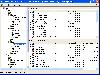
 SPList Export for SharePoint 2010 (SPListX) is a powerful application to export document / picture library contents and associated metadata and list items, including associated file attachments to the Windows File System. Export SharePoint libraries, folders, documents, list items, version...
Platforms: Windows
| License: Commercial | Cost: $799.00 USD | Size: 4.17 MB | Download (140): SPList Export for SharePoint 2007 Download |
Added: June 09, 2010 | Visits: 1.188
Geo::Shapelib is a Perl extension for reading and writing shapefiles as defined by ESRI. SYNOPSIS use Geo::Shapelib qw/:all/; or use Geo::Shapelib qw/:all/; my $shapefile = new Geo::Shapelib { Name => stations, Shapetype => POINT, FieldNames => [Name,Code,Founded]; FieldTypes =>...
Platforms: *nix
| License: Freeware | Size: 266.24 KB | Download (134): Geo::Shapelib Download |
Released: February 15, 2007
|
Added: February 22, 2007 | Visits: 1.956
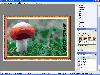 Generate high quality, loseless or lossy JPEG 2000 image documents with the power and ease of automation. Integrates a full-featured inbuilt editor and enhancement tools to give another dimension to your photos. Generate ready-to-use image documents, screensavers, and slide shows by processing...
Platforms: Windows
| License: Shareware | Cost: $50.00 USD | Size: 8.69 MB | Download (133): Oriens JPEG2000 Professional Download |
Released: May 01, 2011
|
Added: May 23, 2011 | Visits: 1.405
 Convert ESRI ShapeFiles (.SHP) geolocation data into AnyMap format to be used with AnyChart. AnyChart Flash Map Converter allows making use of a wide choice of maps with AnyChart Flash Component, a GIS visualization system that recognizes map data in AnyMap format only. AnyChart Flash Map...
Platforms: Windows
| License: Freeware | Size: 1.62 MB | Download (130): AnyChart Flash Map Converter Download |
Added: February 05, 2010 | Visits: 1.765
FLV::Info is an extract metadata from Flash Video files. SYNOPSIS use FLV::Info; my $reader = FLV::Info->new(); $reader->parse(video.flv); my %info = $reader->get_info(); print "$info{video_count} video framesn"; print $reader->report(); This module reads Macromedia FLV files and...
Platforms: *nix
| License: Freeware | Size: 737.28 KB | Download (128): FLV::Info Download |
Released: August 24, 2013
|
Added: September 24, 2013 | Visits: 1.459
Word Metadata Changer is an utility that will help you to view and change the Microsoft Office Word document file properties such as creater,last modified by user,company name,manager,last printed time, total edited time, document created time, etc.
Platforms: Windows, Other
| License: Freeware | Cost: $34.95 USD | Size: 722.66 KB | Download (126): Word Metadata Changer Download |
Added: August 24, 2010 | Visits: 1.493
GIS::Distance::Vincenty Perl module contains Thaddeus Vincenty distance calculations. SYNOPSIS my $calc = GIS::Distance::Vincenty->new(); my $distance = $calc->distance( $lon1, $lat1 => $lon2, $lat2 ); For the benefit of the terminally obsessive (as well as the genuinely needy), Thaddeus...
Platforms: *nix
| License: Freeware | Size: 8.19 KB | Download (125): GIS::Distance::Vincenty Download |
Released: November 28, 2017
|
Added: December 13, 2017 | Visits: 1.045
 SPListX for SharePoint is a powerful application to export document / picture library contents and associated metadata and list items, including associated file attachments to the Windows File System. Export SharePoint libraries, folders, documents, list items, version histories, metadata and...
Platforms: Windows, Windows 8, Windows 7
| License: Free Trial | Cost: $1499.00 USD | Size: 10 B | Download (122): SPListX for SharePoint Download |
Added: January 25, 2010 | Visits: 726
GRASS GIS, commonly referred to as GRASS (Geographic Resources Analysis Support System), is a Geographic Information System (GIS) used for geospatial data management and analysis, image processing, graphics/maps production, spatial modeling, and visualization. GRASS is currently used in academic...
Platforms: Mac
| License: Freeware | Download (116): GRASS GIS Download |