


Gis Imaging software
Gis Imaging
Released: December 15, 2017
|
Added: December 30, 2017 | Visits: 1.050
 VintaSoft Imaging .NET SDK is the impressive and easy-to-use imaging library for viewing, editing, converting, printing and saving images and PDF files in .NET, WPF and WEB.
Open architecture of image codecs allows to decode and encode images, get image metadata, use low level features of...
Platforms: Windows, Windows 7, Windows Server
VintaSoft Imaging .NET SDK is the impressive and easy-to-use imaging library for viewing, editing, converting, printing and saving images and PDF files in .NET, WPF and WEB.
Open architecture of image codecs allows to decode and encode images, get image metadata, use low level features of...
Platforms: Windows, Windows 7, Windows Server
| License: Demo | Cost: $219.95 USD | Size: 78.87 MB | Download (113): VintaSoft Imaging .NET SDK Download |
Released: May 27, 2017
|
Added: August 30, 2017 | Visits: 1.728
 .NET Document Imaging Viewer for ASP.NET, C#, VB.NET. View, annotate, redact, convert, compress, print documents in ASP.NET WebForms, MVC, Ajax
| License: Shareware | Cost: $500.00 USD | Size: 349.61 KB | Download (106): .NET Document Imaging Viewer Download |
Released: February 03, 2004
|
Added: March 18, 2006 | Visits: 4.464
 CANVAS 9 Scientific Imaging Edition offers all the features of the Professional Edition plus advanced image processing tools and direct import of DICOM format files.CANVAS 9 Scientific Imaging Edition is the first product of its kind to incorporate an extensive array of image processing tools to...
Platforms: Mac
CANVAS 9 Scientific Imaging Edition offers all the features of the Professional Edition plus advanced image processing tools and direct import of DICOM format files.CANVAS 9 Scientific Imaging Edition is the first product of its kind to incorporate an extensive array of image processing tools to...
Platforms: Mac
| License: Shareware | Cost: $549.99 USD | Size: 44.6 MB | Download (442): Canvas Scientific Imaging Edition (Mac) Download |
Released: March 12, 2003
|
Added: June 21, 2006 | Visits: 2.795
 CANVAS 9 Scientific Imaging Edition offers all the features of the Professional Edition plus advanced image processing tools and direct import of DICOM format files.CANVAS 9 Scientific Imaging Edition is the first product of its kind to incorporate an extensive array of image processing tools to...
Platforms: Windows
CANVAS 9 Scientific Imaging Edition offers all the features of the Professional Edition plus advanced image processing tools and direct import of DICOM format files.CANVAS 9 Scientific Imaging Edition is the first product of its kind to incorporate an extensive array of image processing tools to...
Platforms: Windows
| License: Shareware | Cost: $549.99 USD | Size: 44.1 MB | Download (181): Canvas Scientific Imaging Edition Download |
Added: August 04, 2008 | Visits: 1.170
 GIS ObjectLand is a universal Geographic Information System for Windows. Key capabilities: vector-raster maps; multiuser data editing; import and export for MIF/MID (MapInfo), SHP (ArcView), DXF (AutoCAD), DBF (dBASE), CSV; setting access permissions to data for different categories of users;...
Platforms: Windows
GIS ObjectLand is a universal Geographic Information System for Windows. Key capabilities: vector-raster maps; multiuser data editing; import and export for MIF/MID (MapInfo), SHP (ArcView), DXF (AutoCAD), DBF (dBASE), CSV; setting access permissions to data for different categories of users;...
Platforms: Windows
| License: Shareware | Cost: $99.00 USD | Size: 23.54 MB | Download (537): GIS ObjectLand Download |
Added: August 07, 2008 | Visits: 1.774
 Total GIS Converter is an affordable converter of GIZ files. It converts AEP, GRD, ADF, E00, FLT, APR, SHP, DXF, BT, TOC, RT1, DEM, DLG, ECW, IMG, DGF, GML, SID, MIF, TAB, WOR, DNG, DDF, BIL, TIF, JPEG, TTKPS, TTKGP, TTKLS, LFT, PFT, and TFT files. The target formats are TIFF, PNG, JPEG, BMP....
Platforms: Windows
Total GIS Converter is an affordable converter of GIZ files. It converts AEP, GRD, ADF, E00, FLT, APR, SHP, DXF, BT, TOC, RT1, DEM, DLG, ECW, IMG, DGF, GML, SID, MIF, TAB, WOR, DNG, DDF, BIL, TIF, JPEG, TTKPS, TTKGP, TTKLS, LFT, PFT, and TFT files. The target formats are TIFF, PNG, JPEG, BMP....
Platforms: Windows
| License: Shareware | Cost: $99.90 USD | Size: 2.66 KB | Download (648): Total GIS Converter Download |
Released: October 24, 2012
|
Added: October 24, 2012 | Visits: 679
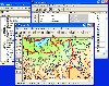
 QGIS supports vector, raster, and database formats and lets you browse and create map data on your computer.
Quantum GIS (QGIS) supports many common spatial data formats (e.g. ESRI ShapeFile, geotiff). QGIS supports plugins to do things like display tracks from your GPS.
QGIS aims to be an...
Platforms: Linux
QGIS supports vector, raster, and database formats and lets you browse and create map data on your computer.
Quantum GIS (QGIS) supports many common spatial data formats (e.g. ESRI ShapeFile, geotiff). QGIS supports plugins to do things like display tracks from your GPS.
QGIS aims to be an...
Platforms: Linux
| License: Freeware | Size: 1024 KB | Download (460): Quantum GIS form Linux Download |
Released: July 24, 2012
|
Added: July 24, 2012 | Visits: 785
 QGIS supports vector, raster, and database formats and lets you browse and create map data on your computer.
Quantum GIS (QGIS) supports many common spatial data formats (e.g. ESRI ShapeFile, geotiff). QGIS supports plugins to do things like display tracks from your GPS.
QGIS aims to be an...
Platforms: Mac
QGIS supports vector, raster, and database formats and lets you browse and create map data on your computer.
Quantum GIS (QGIS) supports many common spatial data formats (e.g. ESRI ShapeFile, geotiff). QGIS supports plugins to do things like display tracks from your GPS.
QGIS aims to be an...
Platforms: Mac
| License: Freeware | Size: 1024 KB | Download (440): Quantum GIS form Mac Download |
Released: September 10, 2012
|
Added: September 10, 2012 | Visits: 764
 PiXCL 10 is the latest version (see the development history here ) of a complete suite of scanner and digital camera image acquisition and advanced image processing APPLICATION development tools, designed for the imaging professional or power user like you. Based on a high level interpreted...
Platforms: Windows
PiXCL 10 is the latest version (see the development history here ) of a complete suite of scanner and digital camera image acquisition and advanced image processing APPLICATION development tools, designed for the imaging professional or power user like you. Based on a high level interpreted...
Platforms: Windows
| License: Freeware | Size: 36.2 MB | Download (51): PiXCL Advanced Imaging Download |
Released: July 09, 2012
|
Added: July 09, 2012 | Visits: 601
 GdPicture Light Imaging SDK - Site License is an ActiveX component to view, acquire, create, edit, print, convert, enhance, and compose bitmap or vectorial image. GdPicture Light OCX supports image formats like TIFF, GIF, JPEG, PNG, WMF, BMP, WBMP, ICO, PDF, PDF/A, PCX, PNM, J2K, HDR, PSD, TGA,...
Platforms: Windows
GdPicture Light Imaging SDK - Site License is an ActiveX component to view, acquire, create, edit, print, convert, enhance, and compose bitmap or vectorial image. GdPicture Light OCX supports image formats like TIFF, GIF, JPEG, PNG, WMF, BMP, WBMP, ICO, PDF, PDF/A, PCX, PNM, J2K, HDR, PSD, TGA,...
Platforms: Windows
| License: Shareware | Cost: $1599.00 USD | Size: 3.94 MB | Download (45): GdPicture Light Imaging Toolkit Site ed. Download |
Released: June 21, 2012
|
Added: June 21, 2012 | Visits: 912
 Commonly referred to as GRASS, this is a free Geographic Information System (GIS) used for geospatial data management and analysis, image processing, graphics/maps production, spatial modeling, and visualization. GRASS is currently used in academic and commercial settings around the world, as...
Platforms: Mac
Commonly referred to as GRASS, this is a free Geographic Information System (GIS) used for geospatial data management and analysis, image processing, graphics/maps production, spatial modeling, and visualization. GRASS is currently used in academic and commercial settings around the world, as...
Platforms: Mac
| License: Freeware | Size: 59 MB | Download (57): Grass GIS for Mac OS X Download |
Released: September 18, 2012
|
Added: September 18, 2012 | Visits: 536
 GdPicture Light Imaging SDK - Site License is an imaging ActiveX component to create, edit, and compose bitmap images. It can read, convert, print and write images in a large variety of formats.
GdPicture Light OCX can be used from any 32 or 64 bit Windows development environment that can call...
Platforms: Windows
GdPicture Light Imaging SDK - Site License is an imaging ActiveX component to create, edit, and compose bitmap images. It can read, convert, print and write images in a large variety of formats.
GdPicture Light OCX can be used from any 32 or 64 bit Windows development environment that can call...
Platforms: Windows
| License: Shareware | Cost: $400.00 USD | Size: 2.91 MB | Download (44): GdPicture Light Imaging SDK - Site License Download |
Released: July 17, 2012
|
Added: July 17, 2012 | Visits: 609
 IC Imaging Control is a family of image acquisition components that offers developers easy programmatic access to WDM video sources: Set and adjust device parameters; save images and sequences; compress data with codecs; overlay graphics and text on live stream; event controlled image processing;...
Platforms: Windows
IC Imaging Control is a family of image acquisition components that offers developers easy programmatic access to WDM video sources: Set and adjust device parameters; save images and sequences; compress data with codecs; overlay graphics and text on live stream; event controlled image processing;...
Platforms: Windows
| License: Commercial | Cost: $0.00 USD | Size: 10.38 MB | Download (49): IC Imaging Control - image acquisition components Download |
Released: October 11, 2012
|
Added: October 11, 2012 | Visits: 777
 QGIS supports vector, raster, and database formats and lets you browse and create map data on your computer.
Quantum GIS (QGIS) supports many common spatial data formats (e.g. ESRI ShapeFile, geotiff). QGIS supports plugins to do things like display tracks from your GPS.
QGIS aims to be an...
Platforms: Windows
QGIS supports vector, raster, and database formats and lets you browse and create map data on your computer.
Quantum GIS (QGIS) supports many common spatial data formats (e.g. ESRI ShapeFile, geotiff). QGIS supports plugins to do things like display tracks from your GPS.
QGIS aims to be an...
Platforms: Windows
| License: Freeware | Size: 77.3 MB | Download (453): Quantum GIS Download |
Released: September 03, 2012
|
Added: September 03, 2012 | Visits: 658
 j2dcg: Java 2D Computer Graphics and Imaging Framework. This framework is targeted for academic use, to reduce the amount of Java / User Interface coding for assignements targeting both raster and vector graphics.
Platforms: Windows, Mac, Linux
j2dcg: Java 2D Computer Graphics and Imaging Framework. This framework is targeted for academic use, to reduce the amount of Java / User Interface coding for assignements targeting both raster and vector graphics.
Platforms: Windows, Mac, Linux
| License: Freeware | Size: 125.38 KB | Download (50): 2D Computer Graphics / Imaging Framework Download |
Released: July 12, 2012
|
Added: July 12, 2012 | Visits: 378
'animal-imaging' is a project to collect and disseminate information on imaging technologies (e.g. CT, MRI, PET, ultrasound) pertinent to the vivo imaging of animals.
Platforms: Windows, Mac, Linux
| License: Freeware | Size: 444.67 KB | Download (43): Animal Imaging Download |
Released: October 02, 2012
|
Added: October 02, 2012 | Visits: 579
GeoTools is an open source java GIS toolkit. Used for OGC based projects via GeoAPI interfaces. Includes two great SLD based renderers, raster access and reprojection. Plugns fo Shapefile, ArcGrid, ArcSDE, Postgis, OracleSpatial, MySQL and many more.
Platforms: Windows, Mac, Linux
| License: Freeware | Size: 44.2 MB | Download (50): GeoTools, the java GIS toolkit Download |
Released: July 24, 2012
|
Added: July 24, 2012 | Visits: 512
The Mechanical Engineering Department at Oregon State University currently has high-resolution x-ray tomography equipment that allows three-dimensional imaging of the interior of objects. Their existing imaging software is command line based and difficult
Platforms: Windows, Mac, Linux
| License: Freeware | Size: 44.92 KB | Download (45): Tomographic Imaging System GUI Download |
Released: October 12, 2012
|
Added: October 12, 2012 | Visits: 558
 * New features of the Cell Imaging version:
· Bottom navigation icons by application area
· Image Gallery
· Easy image sharing
· Full screen image browsing
· Image descriptions
· Full
Platforms: Mac
* New features of the Cell Imaging version:
· Bottom navigation icons by application area
· Image Gallery
· Easy image sharing
· Full screen image browsing
· Image descriptions
· Full
Platforms: Mac
| License: Freeware | Size: 21.1 MB | Download (51): Cell Imaging Download |
Added: September 11, 2013 | Visits: 483
This submission contains a collection of codes in different programming languages that implement the analytical framework proposed inKoay CG, Sarlls JE, doOCozarslan E. * Three Dimensional Analytical Magnetic Resonance Imaging Phantom in the Fourier Domain. Magn Reson Med. 58: 430-436 (2007)The...
Platforms: Matlab
| License: Shareware | Cost: $0.00 USD | Size: 10 KB | Download (51): Three Dimensional Analytical Magnetic Resonance Imaging Phantom in the Fourier Domain Download |