


Geotagging software
Geotagging
Released: August 20, 2009
|
Added: August 26, 2009 | Visits: 2.824
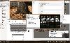
 The deluxe photo data toolkit for amateur photographers and professionals alike.PIE is an image browser and viewer with perfectly integrated photo metadata and file renaming features. It extracts EXIF, XMP and IPTC information from JPG and RAW files and makes it available in a convenient and...
Platforms: Windows
The deluxe photo data toolkit for amateur photographers and professionals alike.PIE is an image browser and viewer with perfectly integrated photo metadata and file renaming features. It extracts EXIF, XMP and IPTC information from JPG and RAW files and makes it available in a convenient and...
Platforms: Windows
| License: Shareware | Cost: $35.00 USD | Size: 3.87 MB | Download (150): Picture Information Extractor Download |
Released: February 23, 2018
|
Added: May 06, 2018 | Visits: 885
 Deluxe viewer and photo metadata toolkit.
PIE is a free image browser and viewer with perfectly integrated photo metadata and file renaming features. It extracts EXIF, XMP and IPTC information from JPG, TIFF and RAW files and makes it available in a convenient and welcoming interface. Its...
Platforms: Windows, Windows 8, Windows 7
Deluxe viewer and photo metadata toolkit.
PIE is a free image browser and viewer with perfectly integrated photo metadata and file renaming features. It extracts EXIF, XMP and IPTC information from JPG, TIFF and RAW files and makes it available in a convenient and welcoming interface. Its...
Platforms: Windows, Windows 8, Windows 7
| License: Freeware | Size: 11.77 MB | Download (175): PIE Download |
Released: May 25, 2018
|
Added: June 25, 2018 | Visits: 3.614
 HoudahGeo is a photo geocoding and geotagging tool for Mac. Use HoudahGeo to attach GPS coordinates and location names to your photos.
HoudahGeo writes EXIF and XMP geotags to JPEG and RAW image files. This creates a permanent record of where a photo was taken. Just like a GPS-enabled camera....
Platforms: Mac
HoudahGeo is a photo geocoding and geotagging tool for Mac. Use HoudahGeo to attach GPS coordinates and location names to your photos.
HoudahGeo writes EXIF and XMP geotags to JPEG and RAW image files. This creates a permanent record of where a photo was taken. Just like a GPS-enabled camera....
Platforms: Mac
| License: Demo | Cost: $39.00 USD | Size: 22.87 MB | Download (837): HoudahGeo Download |
Released: July 01, 2012
|
Added: July 01, 2012 | Visits: 759
 Atom GPS freeware easily geotags your photos directly from your GPS device or track log. By simply connecting your GPS Device to Atom GPS and selecting your photos you can add their geolocation in one click. This action allows you to write the geolocation data to your photos exifs (information...
Platforms: Windows
Atom GPS freeware easily geotags your photos directly from your GPS device or track log. By simply connecting your GPS Device to Atom GPS and selecting your photos you can add their geolocation in one click. This action allows you to write the geolocation data to your photos exifs (information...
Platforms: Windows
| License: Freeware | Size: 7.58 MB | Download (430): ATOM GPS Download |
Released: November 16, 2012
|
Added: November 16, 2012 | Visits: 399
 A geotagging application with a convenient GPS track library. GPS tracks can be downloaded from most of the common GPS loggers, such as: Wintec WBT-201, Holux M-241 and GPSport 245, Columbus V-900, Gisteq Phototrackr and Phototrackr Lite, iBlue 747 and Sony GPS CS-1 and CS-3. The new...
Platforms: Mac
A geotagging application with a convenient GPS track library. GPS tracks can be downloaded from most of the common GPS loggers, such as: Wintec WBT-201, Holux M-241 and GPSport 245, Columbus V-900, Gisteq Phototrackr and Phototrackr Lite, iBlue 747 and Sony GPS CS-1 and CS-3. The new...
Platforms: Mac
| License: Freeware | Size: 68 MB | Download (501): myTracks for Mac OS Download |
Released: August 21, 2012
|
Added: August 21, 2012 | Visits: 418
Allows you to upload your photos to the popular Locr geotagging community. Simply drag your photos into the Dropbox application, or onto its icon, or use the Service menu in any application. Along with the photos, their geotags, their description, as well as any keywords are being sent to the...
Platforms: Mac
| License: Freeware | Size: 819.2 KB | Download (437): Locr DropBox for Mac for Mac OS Download |
Released: July 09, 2012
|
Added: July 09, 2012 | Visits: 541
 Automatically extract from a geotagged image’s metadata, and then visually imprint (stamp), the GPS position, location description, altitude, date, date and time, or any combination of these or any other file metadata, onto a photo with no loss in image quality. It is a lossless JPEG process...
Platforms: Windows
Automatically extract from a geotagged image’s metadata, and then visually imprint (stamp), the GPS position, location description, altitude, date, date and time, or any combination of these or any other file metadata, onto a photo with no loss in image quality. It is a lossless JPEG process...
Platforms: Windows
| License: Freeware | Size: 11.9 MB | Download (406): GPStamper Download |
Released: October 12, 2012
|
Added: October 12, 2012 | Visits: 488
 Still using folders to organize your photos? Explore your photo collection via logical views...year, camera, exposure, keywords. Find photos by keywords, camera data (Exif data) and IPTC/XMP data(author, headline, city, copyright, etc) . See photos on a map by GeoTagging photo's via simple drag...
Platforms: Windows
Still using folders to organize your photos? Explore your photo collection via logical views...year, camera, exposure, keywords. Find photos by keywords, camera data (Exif data) and IPTC/XMP data(author, headline, city, copyright, etc) . See photos on a map by GeoTagging photo's via simple drag...
Platforms: Windows
| License: Shareware | Cost: $49.95 USD | Size: 20.66 MB | Download (443): DBGallery: Photo DATAbase System Download |
Released: July 04, 2012
|
Added: July 04, 2012 | Visits: 484
Combining the power of Aperture and Google Maps (the mapping engine you know and love), Maperture Pro is a powerful, new edit plug-in that makes geotagging your photos a snap. Expanding upon Maperture's already robust toolset, the Pro version adds an impressive assortment of highly requested...
Platforms: Mac
| License: Shareware | Cost: $39.95 USD | Size: 16.8 MB | Download (53): Maperture Pro Download |
Released: November 18, 2012
|
Added: November 18, 2012 | Visits: 258
Locr DropBox, the new stand-alone application for Mac OS X allows you to upload your photos to the popular Locr geotagging community. Simply drag your photos into the Dropbox application, or onto its icon, or use the Service menu in any application. Along with the photos, their geotags, their...
Platforms: Mac
| License: Freeware | Size: 819.2 KB | Download (50): Locr DropBox Download |
Released: August 08, 2012
|
Added: August 08, 2012 | Visits: 456
Combining the power of Aperture and Google Maps (the mapping engine you know and love), Maperture is a powerful, new edit plug-in that makes geotagging your photos a snap.
Feature List
* Add or update global positioning system (GPS) data to your digital photos
* Scales from a few images to...
Platforms: Mac
| License: Freeware | Size: 8.9 MB | Download (53): Maperture Download |
Added: September 14, 2013 | Visits: 244
This plugin adds a useful filtering feature to sites already using a geotagging plugin.It inserts an interactive map on the views displaying a list of posts (such as category, tag, archive, author and home page). The visitor can then draw a rectangle on the map: the page is refreshed and only...
Platforms: PHP
| License: Freeware | Size: 266.24 KB | Download (43): FranceImage location filter Download |
Released: August 30, 2016
|
Added: October 02, 2016 | Visits: 744
 Have many holiday pictures and want to organize your photos? Yes, we offer you comprehensive picture manager of Google Photos using location.
MyFotoPlaces is built around Google Drive/Photos, so you can find and organize your images by the location.
While Google Drive provides excellent...
Platforms: Windows, Mac, *nix, DOS, Windows 7, Windows Server, Palm OS, Android, Pocket PC, Handheld, Other,BlackBerry,iPhone,iPod,iTouch,Palm,Not Applicable,Java,AS/400
Have many holiday pictures and want to organize your photos? Yes, we offer you comprehensive picture manager of Google Photos using location.
MyFotoPlaces is built around Google Drive/Photos, so you can find and organize your images by the location.
While Google Drive provides excellent...
Platforms: Windows, Mac, *nix, DOS, Windows 7, Windows Server, Palm OS, Android, Pocket PC, Handheld, Other,BlackBerry,iPhone,iPod,iTouch,Palm,Not Applicable,Java,AS/400
| License: Freeware | Download (43): MyFotoPlaces Download |
Released: December 05, 2008
|
Added: December 19, 2008 | Visits: 2.083
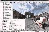 The Panorado 4.0 image viewer/browser offers a comfortable, innovative mouse-oriented interface for panning and zooming. This makes it particularly suitable for viewing panoramic pictures, pictures exceeding the screen size, and HDR (High Dynamic Range) images. As a Windows application, it...
Platforms: Windows
The Panorado 4.0 image viewer/browser offers a comfortable, innovative mouse-oriented interface for panning and zooming. This makes it particularly suitable for viewing panoramic pictures, pictures exceeding the screen size, and HDR (High Dynamic Range) images. As a Windows application, it...
Platforms: Windows
| License: Shareware | Cost: $29.99 USD | Size: 2.72 MB | Download (137): Panorado Download |
Added: August 20, 2008 | Visits: 979
Copiks PhotoMapper helps you organize your photos by adding geographic information to the EXIF - data of the image called geotagging.The information can be inserted manually or using GPS data that you can import to the program.The location, photo thumbnails and GPS polygons can be exported...
Platforms: Windows
| License: Freeware | Size: 4 KB | Download (119): Copiks PhotoMapper Download |
Released: September 08, 2009
|
Added: September 14, 2009 | Visits: 3.883
 PhotoGPSEditor is an easy to use meta-data editor for photo (JPEG, RAW) files, plus it can match data from GPS (gpx or NMEA) files. The program is freeware, however, donations can be made to help support future development. With PhotoGPSEditor you can add location and summary details to a...
Platforms: Mac
PhotoGPSEditor is an easy to use meta-data editor for photo (JPEG, RAW) files, plus it can match data from GPS (gpx or NMEA) files. The program is freeware, however, donations can be made to help support future development. With PhotoGPSEditor you can add location and summary details to a...
Platforms: Mac
| License: Freeware | Size: 2.39 MB | Download (1335): PhotoGPSEditor Download |
Released: January 14, 2010
|
Added: January 16, 2010 | Visits: 3.966
![]() The Picmeta Photo Tracker automatically geotags photos based on track information from any GPS device (.gpx files). It directly writes GPS EXIF data to .jpg, .tif, .crw, .dng, .nef, .pef, .jp2 formats. For other formats such as .cr2 it creates XMP sidecar files. The EXIFcare technology ensures...
Platforms: Windows
The Picmeta Photo Tracker automatically geotags photos based on track information from any GPS device (.gpx files). It directly writes GPS EXIF data to .jpg, .tif, .crw, .dng, .nef, .pef, .jp2 formats. For other formats such as .cr2 it creates XMP sidecar files. The EXIFcare technology ensures...
Platforms: Windows
| License: Freeware | Size: 2.18 MB | Download (192): Picmeta Photo Tracker Download |
Released: September 10, 2010
|
Added: September 24, 2010 | Visits: 1.062
 Did you know that great picture from today's lunch might reveal your exact location (and we're not talking about the address on the menu)?
What about those fun pictures of your kids at school? Think before you post. When you put something online, anyone can see it if it isn't password...
Platforms: Windows
Did you know that great picture from today's lunch might reveal your exact location (and we're not talking about the address on the menu)?
What about those fun pictures of your kids at school? Think before you post. When you put something online, anyone can see it if it isn't password...
Platforms: Windows
| License: Freeware | Size: 2.24 MB | Download (106): Geotag Security Download |
Released: July 20, 2012
|
Added: July 20, 2012 | Visits: 522
With GeopIPTC you will be able to read the IPTC city information in pictures and get the corresponding coordinates to your photos from several free services and embed this into the pictures in standard tags in a very professional way. You will also create sets of pictures with all the metadata...
Platforms: Windows
| License: Shareware | Cost: $104.55 USD | Size: 7.32 MB | Download (382): GeoIPTC Download |
Released: October 06, 2012
|
Added: October 06, 2012 | Visits: 514
With GeoIPTC you will be able to read the IPTC city information in pictures and get the corresponding coordinates to your photos from several free services and embed this into the pictures in standard tags in a very professional way. You will also create sets of pictures with all the metadata...
Platforms: Windows
| License: Shareware | Cost: $112.00 USD | Size: 7.32 MB | Download (455): GeoIPTC Geolocalisation de Photos Download |