


Geographic Information Contact Php software
Geographic Information Contact Php
Released: June 22, 2012
|
Added: June 22, 2012 | Visits: 705
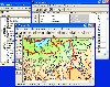
 Thuban is an interactive geographic data viewer (GIS viewer) which features methods to visualize, explore, and analyze geographic information.
Thuban is an Interactive Geographic Data Viewer with the following features:
# Vector Data Support: Shapefile, PostGIS Layer and OGR
# Raster Data...
Thuban is an interactive geographic data viewer (GIS viewer) which features methods to visualize, explore, and analyze geographic information.
Thuban is an Interactive Geographic Data Viewer with the following features:
# Vector Data Support: Shapefile, PostGIS Layer and OGR
# Raster Data...
Platforms: Windows
| License: Freeware | Size: 11.22 MB | Download (429): Thuban for Windows Download |
Released: October 21, 2012
|
Added: October 21, 2012 | Visits: 744
Thuban is an interactive geographic data viewer (GIS viewer) which features methods to visualize, explore, and analyze geographic information.
Thuban is an Interactive Geographic Data Viewer with the following features:
# Vector Data Support: Shapefile, PostGIS Layer and OGR
# Raster Data...
Platforms: Linux
| License: Freeware | Size: 1.18 MB | Download (464): Thuban for Linux Download |
Added: November 28, 2013 | Visits: 466
FMaps is here to answer the lack of user friendly opensource GIS/RS (Geographic Information System/ Remote Sensing) application on the Linux and Gnome compatible platforms.
Platforms: *nix
| License: Freeware | Size: 225.28 KB | Download (38): FMaps Download |
Released: June 21, 2012
|
Added: June 21, 2012 | Visits: 911
 Commonly referred to as GRASS, this is a free Geographic Information System (GIS) used for geospatial data management and analysis, image processing, graphics/maps production, spatial modeling, and visualization. GRASS is currently used in academic and commercial settings around the world, as...
Platforms: Mac
| License: Freeware | Size: 59 MB | Download (57): Grass GIS for Mac OS X Download |
Released: November 05, 2012
|
Added: November 05, 2012 | Visits: 467
About OpenMap
A mapping application and a Java Beans based toolkit for building applications and applets displaying geographic information. Using OpenMap components, you can access data from legacy applications, in-place, in a distributed setting. At its core, OpenMap is a set of Swing components...
Platforms: Mac
| License: Freeware | Size: 18.8 MB | Download (51): OpenMap 4.6.1 Download |
Added: May 10, 2013 | Visits: 547
Information about GET/POST requests, session variables, server information (from php.ini), included files, variables, and much more can be displayed.InstallationUnpack and upload it to the /wp-content/plugins/ directory.Activate the plugin through the 'Plugins' menu in WordPress. Requirements: -...
Platforms: Windows, Mac, *nix, PHP, BSD Solaris
| License: Freeware | Download (56): WP-Debug Download |
Added: June 19, 2013 | Visits: 496
Extract SNMP information via PHP web interface to monitor and optionally create MRTG graphs for the following vendors:- Lucent's LSMS,- Bluecoat,- Zoom Routers,- Windows,- Allot,- Fortinet,- Cyclades,- RMON and any device that support standard MIB2 MIBS
Platforms: PHP
| License: Freeware | Size: 133.12 KB | Download (55): LSMS SNMP to MRTG toolset Download |
Added: August 04, 2008 | Visits: 1.169
 GIS ObjectLand is a universal Geographic Information System for Windows. Key capabilities: vector-raster maps; multiuser data editing; import and export for MIF/MID (MapInfo), SHP (ArcView), DXF (AutoCAD), DBF (dBASE), CSV; setting access permissions to data for different categories of users;...
Platforms: Windows
| License: Shareware | Cost: $99.00 USD | Size: 23.54 MB | Download (537): GIS ObjectLand Download |
Added: August 20, 2008 | Visits: 978
Copiks PhotoMapper helps you organize your photos by adding geographic information to the EXIF - data of the image called geotagging.The information can be inserted manually or using GPS data that you can import to the program.The location, photo thumbnails and GPS polygons can be exported...
Platforms: Windows
| License: Freeware | Size: 4 KB | Download (119): Copiks PhotoMapper Download |
Released: July 23, 2012
|
Added: July 23, 2012 | Visits: 485
T2K Pro integrates the rich world of GIS datasets and transfers your Geographic information data into Google earth. T2K Pro handles rich data types and access large volumes of geographic data stored in files and databases; T2K PRO handles raster (imagery), Vector Map data and GPS Tracks/...
Platforms: Windows
| License: Shareware | Cost: $90.00 USD | Size: 20.89 MB | Download (54): T2K Pro Download |
Released: August 16, 2012
|
Added: August 16, 2012 | Visits: 529
uDig is a user-friendly desktop Internet GIS, a core element in an internet aware Geographic Information System.
The application is an open source spatial data viewer / editor, that comes with a special emphasis on the OpenGIS standards for internet GIS, the Web Map Server and Web Feature Server...
Platforms: Windows
| License: Freeware | Download (439): uDig Download |
Released: October 01, 2012
|
Added: October 01, 2012 | Visits: 949
 Visual Graph is a standard ActiveX component for developing graphics-related applications of various industries, such as power, coal, chemical, automation monitor, simulation, graphical modeling, graphical topology analysis, vector drawing, tables, geographic information system (GIS), workflow,...
Platforms: Windows
| License: Freeware | Size: 6.66 MB | Download (68): Visual Graph ActiveX Component Download |
Released: June 16, 2012
|
Added: June 16, 2012 | Visits: 478
CatMDEdit is a metadata editor tool for describing resources, mainly geographic information. Developed by IAAA (University of Zaragoza) and GeoSpatiumLab S.L., sponsored by IGN Spain. Technical details: Java, XML, multiplatform, multilingual.
Platforms: Windows, Mac, Linux
| License: Freeware | Size: 80.58 MB | Download (49): CatMDEdit - metadata editor Download |
Released: June 25, 2012
|
Added: June 25, 2012 | Visits: 306
The Research Geographic Information Kernel developed by Charles Ehlschlaeger and team.
Platforms: Windows, Mac, Linux
| License: Freeware | Size: 2.28 MB | Download (51): Ehlschlaeger RGIK Download |
Released: June 08, 2012
|
Added: June 08, 2012 | Visits: 446
Mapyrus is software to plot Geographic Information System data to PostScript, PDF, SVG and web image files. Mapyrus combines a BASIC-like scripting language, reading GIS datasets and running as either a utility program, a Java Servlet, or as a webser
Platforms: Windows, Mac, Linux
| License: Freeware | Size: 3.27 MB | Download (48): mapyrus Download |
Added: June 04, 2013 | Visits: 272
* Retrieve user's geographic information based on her ip address. This module is based on a relative accurate IP database from http://www.maxmind.com/app/geolitecity, which is free and will be updated regularly. Every time a user logs in, her ip address and geographic information will be updated...
Platforms: PHP
| License: Freeware | Size: 20.48 KB | Download (44): GeoUser Download |
Added: May 10, 2013 | Visits: 557
ffmpeg-php is an extension for PHP that adds an easy to use, object-oriented API for accessing and retrieving information from video and audio files.It has methods for returning frames from movie files as images that can be manipulated using PHP's image functions. This works well for...
Platforms: Windows, Mac, *nix, PHP, BSD Solaris
| License: Freeware | Download (62): ffmpeg-php Download |
Added: June 09, 2013 | Visits: 394
lastRSS.php is simple yet powerfull PHP class to parse RSS.Features:- All RSS versions supported (0.9, 1.0 and 2.0)- Transparent cache (doesn't cache RSS file directly, neither HTML output, but serialized variable; cached data isn't parsed every time, but you can still access individual fields)-...
Platforms: PHP
| License: Freeware | Size: 10 KB | Download (57): lastRSS.php for Scripts Download |
Added: June 08, 2013 | Visits: 510
This widget allow you to display your contact information (or other such as sms to, email to, note, MEcard and etc) in qr code form.This widget works by displaying a qrcode which was defined by blogger to put contact information. Get qr contact information format from...
Platforms: PHP
| License: Freeware | Size: 10 KB | Download (46): EasyQR Download |
Released: December 19, 2012
|
Added: December 19, 2012 | Visits: 465
 By bundling InTrek Lite and MVP together so you can manage asset, location, contact, events, contributions and volunteer information on a limited budget. InTrek Lite is designed to allow the user to enter and store location information, contact information and asset information into a database....
Platforms: Windows
| License: Shareware | Cost: $200.00 USD | Size: 23.67 MB | Download (595): Volunteer Suite Lite IT Download |