


Geographic Filing System software
Geographic Filing System
Added: June 25, 2006 | Visits: 2.522
 Introduction A-media.nu is a filing system for documents. The software can also be used for jobs involving the comparison of two text pages, for instance when translating. Some of the functions in A-media.nu: Manage thousands of document pages. You can create your own PDF-files with just one...
Platforms: Windows
| License: Commercial | Cost: $47.00 USD | Size: 16.79 MB | Download (508): A-media.nu Download |
Added: November 28, 2013 | Visits: 466
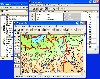
 FMaps is here to answer the lack of user friendly opensource GIS/RS (Geographic Information System/ Remote Sensing) application on the Linux and Gnome compatible platforms.
Platforms: *nix
| License: Freeware | Size: 225.28 KB | Download (38): FMaps Download |
Released: July 01, 2009
|
Added: July 15, 2009 | Visits: 1.718
 The amount of paper that comes through the average letter box is staggering. Bills for this, statements for that, notice for this, another bill for that. Its an endless bombardment of paper, but where can the average household store all of this and find it when they need it?
file@home is the...
The amount of paper that comes through the average letter box is staggering. Bills for this, statements for that, notice for this, another bill for that. Its an endless bombardment of paper, but where can the average household store all of this and find it when they need it?
file@home is the...
Platforms: Windows
| License: Shareware | Cost: $14.50 USD | Size: 9.78 MB | Download (141): file@home Download |
Released: June 21, 2012
|
Added: June 21, 2012 | Visits: 911
 Commonly referred to as GRASS, this is a free Geographic Information System (GIS) used for geospatial data management and analysis, image processing, graphics/maps production, spatial modeling, and visualization. GRASS is currently used in academic and commercial settings around the world, as...
Platforms: Mac
| License: Freeware | Size: 59 MB | Download (57): Grass GIS for Mac OS X Download |
Added: August 04, 2008 | Visits: 1.170
 GIS ObjectLand is a universal Geographic Information System for Windows. Key capabilities: vector-raster maps; multiuser data editing; import and export for MIF/MID (MapInfo), SHP (ArcView), DXF (AutoCAD), DBF (dBASE), CSV; setting access permissions to data for different categories of users;...
Platforms: Windows
| License: Shareware | Cost: $99.00 USD | Size: 23.54 MB | Download (537): GIS ObjectLand Download |
Released: August 16, 2012
|
Added: August 16, 2012 | Visits: 529
uDig is a user-friendly desktop Internet GIS, a core element in an internet aware Geographic Information System.
The application is an open source spatial data viewer / editor, that comes with a special emphasis on the OpenGIS standards for internet GIS, the Web Map Server and Web Feature Server...
Platforms: Windows
| License: Freeware | Download (439): uDig Download |
Released: October 01, 2012
|
Added: October 01, 2012 | Visits: 949
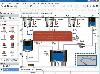 Visual Graph is a standard ActiveX component for developing graphics-related applications of various industries, such as power, coal, chemical, automation monitor, simulation, graphical modeling, graphical topology analysis, vector drawing, tables, geographic information system (GIS), workflow,...
Platforms: Windows
| License: Freeware | Size: 6.66 MB | Download (68): Visual Graph ActiveX Component Download |
Released: June 08, 2012
|
Added: June 08, 2012 | Visits: 447
Mapyrus is software to plot Geographic Information System data to PostScript, PDF, SVG and web image files. Mapyrus combines a BASIC-like scripting language, reading GIS datasets and running as either a utility program, a Java Servlet, or as a webser
Platforms: Windows, Mac, Linux
| License: Freeware | Size: 3.27 MB | Download (48): mapyrus Download |
Released: June 04, 2012
|
Added: June 04, 2012 | Visits: 923
Scan to the Cloud for Free with ScanDrop Lite
OfficeDrop’s ScanDrop Lite scanner software lets you use your scanner to scan up to 15 pages directly into the world’s most popular cloud storage providers:
* Google Docs
* Evernote
* OfficeDrop Cloud Filing System (unlimited scanning into...
Platforms: Mac
| License: Freeware | Size: 5.8 MB | Download (65): ScanDrop Lite Download |
Released: September 01, 2008
|
Added: September 23, 2008 | Visits: 6.376
 The Virtual Filing Cabinet is a simple to use document management system for your computer files and filing cabinets. Creates your filing cabinets on your computer network, and creates crystal tabs, labels, and indexes for your file cabinets.
The Virtual Filing Cabinet includes an Easy Print...
The Virtual Filing Cabinet is a simple to use document management system for your computer files and filing cabinets. Creates your filing cabinets on your computer network, and creates crystal tabs, labels, and indexes for your file cabinets.
The Virtual Filing Cabinet includes an Easy Print...
Platforms: Windows
| License: Shareware | Cost: $99.95 USD | Size: 9.16 MB | Download (379): The Virtual Filing Cabinet Download |
Released: February 09, 2009
|
Added: February 23, 2009 | Visits: 3.713
 PDF Filer is based upon the fact that most structured files can be organized based upon a few pieces of data and that an easy consistent method to enter the data for retrieval is necessary. PDF Filer relates a document to an open screen on the users desktop and retrieves one piece of data from...
Platforms: Windows
| License: Commercial | Cost: $299.00 USD | Size: 19.56 MB | Download (238): PDF Filer Download |
Released: November 12, 2012
|
Added: November 12, 2012 | Visits: 479
With Geodesy.NET, you can quickly and easily convert geographic coordinates from one system to another. Several hundred coordinate system conversions are supported, and all conversions can be done in under three lines of code. Full support is included for both desktops as well as mobile devices!...
Platforms: Windows
| License: Shareware | Cost: $99.00 USD | Size: 61.42 MB | Download (48): Geodesy.NET Download |
Added: August 27, 2008 | Visits: 2.660
Improve system performance security and reliability.* Backup manager* Security settings / cache deleter and overwriter* System folder relocation* Dial-up networking optimizer* Start-up manager* System optimizer* Font manager* Network Settings* Filing system cache optimzer* ISP Performance test*...
Platforms: Windows
| License: Shareware | Cost: $15.00 USD | Size: 844 KB | Download (470): FineTune Power Utility Download |
Added: August 23, 2008 | Visits: 971
Hipoqih is a new geographic location service that lets you detect and follow any person, or yourself, wherever you go anywhere in the world.Basically, the Hipoqih idea is to record georeference markers and receive them in mobile devices like phones, PDAs etc. The geographic location system is...
Platforms: Windows
| License: Freeware | Size: 5 KB | Download (134): Hipoqih Download |
Added: June 21, 2010 | Visits: 847
genromfs project can create romfs images. romfs is a space-efficient, small, read-only filesystem originally for Linux and used by some Linux based projects. It is a block-based filesystem, that means it makes use of block (or sector) accessible storage driver (like disks, CDs, ROM drives). It...
Platforms: *nix
| License: Freeware | Size: 20.48 KB | Download (211): genromfs Download |
Added: January 25, 2010 | Visits: 651
OwlView is a simple thematic mapping application that can combine data exported from a spreadsheet or database with geographic boundaries to produce maps that visually display patterns of spatial distribution within the data. It includes four classification methods (Equal Counts, Equal Ranges,...
Platforms: Mac
| License: Shareware | Cost: $0.00 USD | Download (86): OwlView Download |
Added: January 25, 2010 | Visits: 931
GrassPro is based on the free, open-source product "GRASS 6.0.1 GIS." It offers offers a host of ready-to-use GIS software and utilities, including: MapServer for publishing dynamic, navigable maps with layers over the Internet; PostGIS which enables spatial, geographic support for the included...
Platforms: Mac
| License: Demo | Cost: $0.00 USD | Download (109): GrassPro Download |
Released: August 08, 2012
|
Added: August 08, 2012 | Visits: 493
One of the greatest obstacles to proper business and project management is the lack of control of the avalanche of electronic files being created every minute of the day. In today's business, the sheer volume and reliance on this information is reaching crisis point. Having solved your disk...
Platforms: Windows
| License: Freeware | Size: 7.18 MB | Download (45): VisBiz Download |
Released: August 03, 2012
|
Added: August 03, 2012 | Visits: 510
 ScanAndHost has developed Eureka! the most user friendly, affordable document management solution on the market today. Right from your own office your company can scan and upload files to an online e-cabinet created just for you. All you need is the ScanAndHost Eureka! software, a TWAIN compliant...
Platforms: Windows
| License: Shareware | Cost: $49.95 USD | Size: 5.52 MB | Download (49): Eureka Central Download |
Released: August 27, 2012
|
Added: August 27, 2012 | Visits: 793
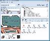
 Staff Files Pro allows you to create documentation that aligns to your company’s human resource management goals and securely store employee files in a virtual file cabinet. Store human resource information in one place using Staff Files Pro’s electronic filing system with intuitive quick-tab...
Platforms: Windows
| License: Demo | Cost: $495.00 USD | Size: 24.09 MB | Download (60): Staff Files Pro Download |