


Geographic Distances software
Geographic Distances
Added: May 10, 2013 | Visits: 431
 It also lets you specify a default geographic location for your entire WordPress blog.InstallationUnpack and upload it to the /wp-content/plugins/ directory.Activate the plugin through the 'Plugins' menu in WordPress. Requirements: - WordPress
Platforms: Windows, Mac, *nix, PHP, BSD Solaris
| License: Freeware | Download (59): Geo Plugin Download |
Added: July 14, 2013 | Visits: 503
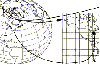
Function that convert geographic coordinates to North azimuthal equal-area map with 25 kmresolution pixel (EASE-Grid projection or NL). That projection is used mainly in remote sensing and cover the northern hemisphere.If you want to know the corresponding pixel in the EASE-Grid projection to a...
Platforms: Matlab
| License: Freeware | Size: 10 KB | Download (51): geo2easeGrid Download |
Added: August 02, 2013 | Visits: 218
slmetric_pw.h is an m-function to compute metrics between two sets of vectors in pairwise way.Main Features:-- It supports about 20 metric types, including Euclidean distance (L2), Normalized Correlation, City-Block distance (L1), Quadratic distance, Minkowski distance, Hamming distance,...
Platforms: Matlab
| License: Shareware | Cost: $0.00 USD | Size: 20.48 KB | Download (42): Computing Pairwise Distances and Metrics Download |
Added: March 30, 2013 | Visits: 168
Input a SAHN tree (e.g. the result of a call to linkage) and the number, n, of clusters into which the SAHN tree is to be partitioned (e.g. by the function cluster). Output is a list of distances where the i'th distance corresponds to cluster i as produced by a call to cluster to produce n...
Platforms: Matlab
| License: Shareware | Cost: $0.00 USD | Size: 10 KB | Download (43): Get Cluster "Distances" Download |
Added: October 20, 2013 | Visits: 358
Use this application to compute and plot Scenario ShakeMaps for a chosen IMR , Earthquake Rupture, and Geographic Region.
Platforms: Mac
| License: Shareware | Cost: $0.00 USD | Size: 25.66 MB | Download (45): Scenario ShakeMap Download |
Added: August 17, 2013 | Visits: 327
Patristic is a Java program that uses as input different tree files and computes their patristic distances. Patristic allows saving and editing in different ways those distances. Patristic provides different graphic views of the results as well as the possibility to save them in the CSV format...
Platforms: Mac
| License: Shareware | Cost: $0.00 USD | Size: 1.55 MB | Download (42): Patristic Download |
Added: July 03, 2013 | Visits: 452
Use this application to compute and plot Scenario ShakeMaps for a chosen IMR , Earthquake Rupture, and Geographic Region.
Platforms: Mac
| License: Freeware | Size: 15.55 MB | Download (37): Scenario ShakeMap Server Download |
Added: November 14, 2013 | Visits: 453
WorldIP is a Firefox add-on, that shows up-to-date information about real physical location of a web server you are currently visiting. WorldIP extension is one of WIPmania's products based on WorldIP geolocation database. The database is more correct than Whois records and Whois-based...
Platforms: *nix
| License: Freeware | Size: 716.8 KB | Download (46): WorldIP for Linux Download |
Added: July 11, 2013 | Visits: 210
A django library that generates SLD documents from geographic models.
Platforms: *nix
| License: Freeware | Size: 20.48 KB | Download (34): django-sld Download |
Added: October 23, 2013 | Visits: 531
Calculate distances on a square grid with optional wormholes (the 'chessboard metric') Algorithm::Metric::Chessboard is a Perl module to calculate distances on a square grid with optional wormholes (the 'chessboard metric'). Calculates the minimum number of moves between two points in a game...
Platforms: *nix
| License: Freeware | Size: 10.24 KB | Download (35): Algorithm::Evolve Download |
Added: November 28, 2013 | Visits: 466
FMaps is here to answer the lack of user friendly opensource GIS/RS (Geographic Information System/ Remote Sensing) application on the Linux and Gnome compatible platforms.
Platforms: *nix
| License: Freeware | Size: 225.28 KB | Download (38): FMaps Download |
Added: November 04, 2006 | Visits: 5.965
 WhereIsIP is an interesting and powerful Internet tool to help you know the geographic location of an internet user who you are interested with . You can use it to find where a member of chatroom or email sender even ICQ friend TRULY come from , or where the website you visited is .
Simplily...
WhereIsIP is an interesting and powerful Internet tool to help you know the geographic location of an internet user who you are interested with . You can use it to find where a member of chatroom or email sender even ICQ friend TRULY come from , or where the website you visited is .
Simplily...
| License: Shareware | Cost: $19.50 USD | Size: 548 KB | Download (756): WhereIsIP Download |
Added: April 18, 2006 | Visits: 2.316
Send advertisements directly to computer screens. Allows targeted advertisement by geographic regions mapped to IP addresses. Reach customers effectively, a popup message will appear on the PC screen. Reach millions by shooting one advertisement. With this latest trend in online marketing you can...
Platforms: Windows
| License: Shareware | Cost: $399.99 USD | Size: 550 KB | Download (142): Imshooter Download |
Added: July 24, 2006 | Visits: 5.482
 Using Gates wrought of arcane magic, we crossed unimaginable distances to settle hundreds of worlds. Now the earth is almost conquest, safe it commander
Platforms: Windows
| License: Freeware | Size: 95.05 MB | Download (2054): Arcane Gate Download |
Released: November 09, 2006
|
Added: November 14, 2006 | Visits: 4.291
 Geo World is a handy application for finding out detailed information about any country in the world. One of its advantages is that you can find the country you were looking for by Internet Country Code, Capital and etc. Also it's supplied with more than 530 images which represent flags and maps...
Platforms: Windows
| License: Shareware | Cost: $25.00 USD | Size: 6.24 MB | Download (324): Geo World Download |
Released: January 02, 2007
|
Added: January 06, 2007 | Visits: 2.636
 Imports gridded data into Microsoft MapPoint, to produce attractive data maps that resemble contour maps.
Input data consists of a value that is defined for various (gridded) geographic coordinates. Common text output formats such as CSV are supported.
Can handle imperfect data, holes,...
Imports gridded data into Microsoft MapPoint, to produce attractive data maps that resemble contour maps.
Input data consists of a value that is defined for various (gridded) geographic coordinates. Common text output formats such as CSV are supported.
Can handle imperfect data, holes,...
Platforms: Windows
| License: Shareware | Cost: $75.00 USD | Size: 2.16 MB | Download (907): GridImp Download |
Released: January 15, 2008
|
Added: April 29, 2008 | Visits: 1.507
 CountryWhois is a utility for identifying the geographic location of an IP address. CountryWhois can be used to analyze server logs, check e-mail address headers, identify online credit card fraud, or in any other instance where you need to quickly and accurately determine the country of origin...
Platforms: Windows
| License: Shareware | Cost: $29.00 USD | Size: 2.39 MB | Download (145): CountryWhois Download |
Released: July 13, 2009
|
Added: July 27, 2009 | Visits: 2.046
 Ever thought about visualizing your network connections in 3D environment? Try Wandering IPs, lightweight tool that monitors TCP connections, identifies remote IP adresses and determines their geographic coordinates. Results are projected on interactive, textured 3D Globe that can be integrated...
Platforms: Windows
| License: Shareware | Cost: $12.95 USD | Size: 721.17 KB | Download (209): Wandering IPs Download |
Added: August 04, 2008 | Visits: 1.169
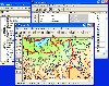 GIS ObjectLand is a universal Geographic Information System for Windows. Key capabilities: vector-raster maps; multiuser data editing; import and export for MIF/MID (MapInfo), SHP (ArcView), DXF (AutoCAD), DBF (dBASE), CSV; setting access permissions to data for different categories of users;...
Platforms: Windows
| License: Shareware | Cost: $99.00 USD | Size: 23.54 MB | Download (537): GIS ObjectLand Download |
Added: August 14, 2008 | Visits: 1.756
 CoordTrans converts geographic positions between different coordinate systems.Convert between UTM and WGS84.Convert between UTM and NAD27 / NAD83.And more... grids from 17 countries supported. Convert geographic coordinates (latitude / longitude) between different datums.
Platforms: Windows
| License: Shareware | Cost: $19.95 USD | Size: 669 KB | Download (744): CoordTrans Download |