


Geographic software
Geographic
Added: November 14, 2013 | Visits: 453
 WorldIP is a Firefox add-on, that shows up-to-date information about real physical location of a web server you are currently visiting. WorldIP extension is one of WIPmania's products based on WorldIP geolocation database. The database is more correct than Whois records and Whois-based...
Platforms: *nix
| License: Freeware | Size: 716.8 KB | Download (46): WorldIP for Linux Download |
Added: July 11, 2013 | Visits: 210
A django library that generates SLD documents from geographic models.
Platforms: *nix
| License: Freeware | Size: 20.48 KB | Download (34): django-sld Download |
Added: November 28, 2013 | Visits: 466
FMaps is here to answer the lack of user friendly opensource GIS/RS (Geographic Information System/ Remote Sensing) application on the Linux and Gnome compatible platforms.
Platforms: *nix
| License: Freeware | Size: 225.28 KB | Download (38): FMaps Download |
Added: November 04, 2006 | Visits: 5.965
 WhereIsIP is an interesting and powerful Internet tool to help you know the geographic location of an internet user who you are interested with . You can use it to find where a member of chatroom or email sender even ICQ friend TRULY come from , or where the website you visited is .
Simplily...
WhereIsIP is an interesting and powerful Internet tool to help you know the geographic location of an internet user who you are interested with . You can use it to find where a member of chatroom or email sender even ICQ friend TRULY come from , or where the website you visited is .
Simplily...
| License: Shareware | Cost: $19.50 USD | Size: 548 KB | Download (756): WhereIsIP Download |
Added: April 18, 2006 | Visits: 2.317
Send advertisements directly to computer screens. Allows targeted advertisement by geographic regions mapped to IP addresses. Reach customers effectively, a popup message will appear on the PC screen. Reach millions by shooting one advertisement. With this latest trend in online marketing you can...
Platforms: Windows
| License: Shareware | Cost: $399.99 USD | Size: 550 KB | Download (142): Imshooter Download |
Released: November 09, 2006
|
Added: November 14, 2006 | Visits: 4.291
 Geo World is a handy application for finding out detailed information about any country in the world. One of its advantages is that you can find the country you were looking for by Internet Country Code, Capital and etc. Also it's supplied with more than 530 images which represent flags and maps...
Platforms: Windows
| License: Shareware | Cost: $25.00 USD | Size: 6.24 MB | Download (324): Geo World Download |
Released: January 02, 2007
|
Added: January 06, 2007 | Visits: 2.636
 Imports gridded data into Microsoft MapPoint, to produce attractive data maps that resemble contour maps.
Input data consists of a value that is defined for various (gridded) geographic coordinates. Common text output formats such as CSV are supported.
Can handle imperfect data, holes,...
Imports gridded data into Microsoft MapPoint, to produce attractive data maps that resemble contour maps.
Input data consists of a value that is defined for various (gridded) geographic coordinates. Common text output formats such as CSV are supported.
Can handle imperfect data, holes,...
Platforms: Windows
| License: Shareware | Cost: $75.00 USD | Size: 2.16 MB | Download (907): GridImp Download |
Released: January 15, 2008
|
Added: April 29, 2008 | Visits: 1.507
 CountryWhois is a utility for identifying the geographic location of an IP address. CountryWhois can be used to analyze server logs, check e-mail address headers, identify online credit card fraud, or in any other instance where you need to quickly and accurately determine the country of origin...
Platforms: Windows
| License: Shareware | Cost: $29.00 USD | Size: 2.39 MB | Download (145): CountryWhois Download |
Released: July 13, 2009
|
Added: July 27, 2009 | Visits: 2.046
 Ever thought about visualizing your network connections in 3D environment? Try Wandering IPs, lightweight tool that monitors TCP connections, identifies remote IP adresses and determines their geographic coordinates. Results are projected on interactive, textured 3D Globe that can be integrated...
Platforms: Windows
| License: Shareware | Cost: $12.95 USD | Size: 721.17 KB | Download (209): Wandering IPs Download |
Added: August 04, 2008 | Visits: 1.169
 GIS ObjectLand is a universal Geographic Information System for Windows. Key capabilities: vector-raster maps; multiuser data editing; import and export for MIF/MID (MapInfo), SHP (ArcView), DXF (AutoCAD), DBF (dBASE), CSV; setting access permissions to data for different categories of users;...
Platforms: Windows
| License: Shareware | Cost: $99.00 USD | Size: 23.54 MB | Download (537): GIS ObjectLand Download |
Added: August 14, 2008 | Visits: 1.756
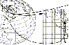 CoordTrans converts geographic positions between different coordinate systems.Convert between UTM and WGS84.Convert between UTM and NAD27 / NAD83.And more... grids from 17 countries supported. Convert geographic coordinates (latitude / longitude) between different datums.
Platforms: Windows
| License: Shareware | Cost: $19.95 USD | Size: 669 KB | Download (744): CoordTrans Download |
Added: August 31, 2008 | Visits: 3.347
GeoVisu is a visualization software for geographic data - graphic files, images and GPS. It provides real time GPS navigation (moving map - NMEA 0183 protocol or Garmin USB), displayed with diverse geographic data (MIF, GPX, NMEA, KML/KMZ, SHP, ECW, GeoTiff, MrSID). It can download waypoints,...
Platforms: Windows
| License: Freeware | Size: 1.5 MB | Download (1383): GeoVisu Download |
Added: August 23, 2008 | Visits: 968
Hipoqih is a new geographic location service that lets you detect and follow any person, or yourself, wherever you go anywhere in the world.Basically, the Hipoqih idea is to record georeference markers and receive them in mobile devices like phones, PDAs etc. The geographic location system is...
Platforms: Windows
| License: Freeware | Size: 5 KB | Download (134): Hipoqih Download |
Added: August 20, 2008 | Visits: 977
Copiks PhotoMapper helps you organize your photos by adding geographic information to the EXIF - data of the image called geotagging.The information can be inserted manually or using GPS data that you can import to the program.The location, photo thumbnails and GPS polygons can be exported...
Platforms: Windows
| License: Freeware | Size: 4 KB | Download (119): Copiks PhotoMapper Download |
Added: August 04, 2008 | Visits: 1.687
Welcome all seismology lovers! Earthquake 3D 3.03 is a geographic tool that continually offers you information about earthquakes (or small seismic movements) that happen all over the world, almost in real time.The program is connected to the Internet to have the information continually updated,...
Platforms: Windows
| License: Freeware | Size: 9 KB | Download (352): Earthquake 3D Download |
Added: August 16, 2008 | Visits: 946
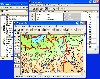
Thuban is an interactive viewer for geographic data (GIS), that offers its users diverse advanced ways and means to view and explore this type of material.It is not only a free geographical information explorer but also of open code. So, you can freely use it and also modify it if you wish. Here...
Platforms: Windows
| License: Freeware | Size: 4 KB | Download (145): Thuban Download |
Added: August 17, 2008 | Visits: 1.003
IPSearchLight is a software component used to identify the geographic location of website visitors, often within a few miles from the exact location. The process utilizes each visitor's IP address; this technique is silent and unintrusive. IPSearchLight is ideal for practical applications like...
Platforms: Windows
| License: Freeware | Size: 8.74 KB | Download (447): IPSearchLight GeoLocator for ASP.NET 2.0 Download |
Released: October 18, 2009
|
Added: December 19, 2009 | Visits: 1.433
 Automatic Geo/GPS location track utility for most parts of the World. Lets you know your and your friends geographic location at all times. Maps are downloaded on a per demand basis. All GPS information is stored to a database and can be readily retrieved based on a given date and time range....
Platforms: Windows, Pocket PC
| License: Shareware | Cost: $15.00 USD | Size: 2.41 MB | Download (156): GeoWatch Download |
Added: April 24, 2010 | Visits: 1.026
WebService::Mappoint is a client SOAP implementation for Mappoint, Microsofts geographic maps web service, based on SOAP::Lite. SYNOPSIS Map fetch example for use with Mappoint 3.0 service. use WebService::Mappoint; use MIME::Base64; my $render = new WebService::Mappoint::Render(); my...
Platforms: *nix
| License: Freeware | Size: 8.19 KB | Download (119): WebService::Mappoint Download |
Added: March 03, 2010 | Visits: 1.360
Geo::Inverse is a Perl module to calculate geographic distance from a lat & lon pair. SYNOPSIS use Geo::Inverse; my $obj = Geo::Inverse->new(); # default "WGS84" my ($lat1,$lon1,$lat2,$lon2)=(38.87, -77.05, 38.95, -77.23); my ($faz, $baz, $dist)=$obj->inverse($lat1,$lon1,$lat2,$lon2);...
Platforms: *nix
| License: Freeware | Size: 4.1 KB | Download (152): Geo::Inverse Download |