


Geocoding software
Geocoding
Added: August 18, 2013 | Visits: 418
 The module makes it possible for other module developers easily to use Yahoo Geocoding API to find geo coordinates for a given address.The module it self don't do anything out of the box, by provides a function to find the geo coordinates.
Platforms: PHP
The module makes it possible for other module developers easily to use Yahoo Geocoding API to find geo coordinates for a given address.The module it self don't do anything out of the box, by provides a function to find the geo coordinates.
Platforms: PHP
| License: Freeware | Size: 10 KB | Download (52): Yahoo Geocoding API Download |
Added: June 26, 2013 | Visits: 440
This project a Objective-C class (aim to be used on the iPhone) to include in your application a reverse geocoding system. Included in the project there is also a Thor http://github.com/wycats/thor script for downloading the cities database and transforming it into a suitable format for the iPhone.
Platforms: Mac
| License: Freeware | Size: 20.48 KB | Download (41): Reverse Geocoding Download |
Released: January 30, 2006
|
Added: November 06, 2006 | Visits: 4.055
 Map Suite Geocode USA is a powerful and feature-rich .NET geocoding engine that comes complete with a highly optimized dataset encompassing the entire United States. Map Suite Geocode USA features a fast, user-friendly .NET interface that enables C# and VB.NET software developers to take a United...
Platforms: Windows
Map Suite Geocode USA is a powerful and feature-rich .NET geocoding engine that comes complete with a highly optimized dataset encompassing the entire United States. Map Suite Geocode USA features a fast, user-friendly .NET interface that enables C# and VB.NET software developers to take a United...
Platforms: Windows
| License: Demo | Cost: $2394.00 USD | Size: 341.13 KB | Download (165): Map Suite Geocode USA Download |
Released: July 31, 2010
|
Added: September 02, 2010 | Visits: 2.897
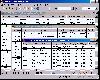
 CDXZipStream is a complete solution for analyzing address and demographic data into Microsoft Excel. CDXZipStream also has built in features for geocoding, mapping, zip code lists by state or county, reverse look-up, calculating distance or finding the zip codes within a specified radius. No...
Platforms: Windows, Other
CDXZipStream is a complete solution for analyzing address and demographic data into Microsoft Excel. CDXZipStream also has built in features for geocoding, mapping, zip code lists by state or county, reverse look-up, calculating distance or finding the zip codes within a specified radius. No...
Platforms: Windows, Other
| License: Shareware | Cost: $29.95 USD | Size: 7.38 MB | Download (133): CDXZipStream Download |
Added: November 08, 2013 | Visits: 390
iOS Library for geocoding an address string into WGS84 (Lon?*A*/Lat?*A*) via Google Maps API
Platforms: Mac
| License: Freeware | Size: 20.48 KB | Download (42): WGS84Encoder Download |
Released: December 29, 2010
|
Added: January 06, 2011 | Visits: 4.325
 OkMap is a GPS and map software that:
-Works with vectorial maps and calibrates raster maps
-Organizes paths by creating waypoints, routes and tracks
-Uploads/downloads data to/from your GPS
-Uses altitude DEM data
-Supports GPS real-time navigation
-Sends/receives vehicles position...
Platforms: Windows
OkMap is a GPS and map software that:
-Works with vectorial maps and calibrates raster maps
-Organizes paths by creating waypoints, routes and tracks
-Uploads/downloads data to/from your GPS
-Uses altitude DEM data
-Supports GPS real-time navigation
-Sends/receives vehicles position...
Platforms: Windows
| License: Freeware | Size: 20.25 MB | Download (1277): OkMap Download |
Added: August 28, 2008 | Visits: 1.455
Panorado Flyer is a simple geocoding tool for linking JPEG image files to the location where the picture was taken, using precise geographical coordinates. It can be lauched from the Windows Explorer's context menu. The coordinates of the place where the photo was taken are stored within the JPEG...
Platforms: Windows
| License: Freeware | Size: 84 KB | Download (557): Panorado Flyer Download |
Released: September 08, 2009
|
Added: September 14, 2009 | Visits: 3.882
 PhotoGPSEditor is an easy to use meta-data editor for photo (JPEG, RAW) files, plus it can match data from GPS (gpx or NMEA) files. The program is freeware, however, donations can be made to help support future development. With PhotoGPSEditor you can add location and summary details to a...
Platforms: Mac
PhotoGPSEditor is an easy to use meta-data editor for photo (JPEG, RAW) files, plus it can match data from GPS (gpx or NMEA) files. The program is freeware, however, donations can be made to help support future development. With PhotoGPSEditor you can add location and summary details to a...
Platforms: Mac
| License: Freeware | Size: 2.39 MB | Download (1334): PhotoGPSEditor Download |
Released: May 25, 2018
|
Added: June 25, 2018 | Visits: 3.614
 HoudahGeo is a photo geocoding and geotagging tool for Mac. Use HoudahGeo to attach GPS coordinates and location names to your photos.
HoudahGeo writes EXIF and XMP geotags to JPEG and RAW image files. This creates a permanent record of where a photo was taken. Just like a GPS-enabled camera....
Platforms: Mac
HoudahGeo is a photo geocoding and geotagging tool for Mac. Use HoudahGeo to attach GPS coordinates and location names to your photos.
HoudahGeo writes EXIF and XMP geotags to JPEG and RAW image files. This creates a permanent record of where a photo was taken. Just like a GPS-enabled camera....
Platforms: Mac
| License: Demo | Cost: $39.00 USD | Size: 22.87 MB | Download (837): HoudahGeo Download |
Released: July 20, 2012
|
Added: July 20, 2012 | Visits: 522
With GeopIPTC you will be able to read the IPTC city information in pictures and get the corresponding coordinates to your photos from several free services and embed this into the pictures in standard tags in a very professional way. You will also create sets of pictures with all the metadata...
Platforms: Windows
| License: Shareware | Cost: $104.55 USD | Size: 7.32 MB | Download (382): GeoIPTC Download |
Released: October 06, 2012
|
Added: October 06, 2012 | Visits: 513
With GeoIPTC you will be able to read the IPTC city information in pictures and get the corresponding coordinates to your photos from several free services and embed this into the pictures in standard tags in a very professional way. You will also create sets of pictures with all the metadata...
Platforms: Windows
| License: Shareware | Cost: $112.00 USD | Size: 7.32 MB | Download (455): GeoIPTC Geolocalisation de Photos Download |
Released: December 31, 2019
|
Added: January 08, 2020 | Visits: 1.276
 Geodata International - World-wide database of countries with georeferenced towns, municipalities, postal codes and administrative units with WGS84 and UTM coordinates and elevations for geocoding, proximity search, navigation, distance calculation. Often is it necessarily, for an address...
Platforms: Windows, Mac, *nix, Windows 8, Windows 7, iOS, Android, iPhone,iPad
Geodata International - World-wide database of countries with georeferenced towns, municipalities, postal codes and administrative units with WGS84 and UTM coordinates and elevations for geocoding, proximity search, navigation, distance calculation. Often is it necessarily, for an address...
Platforms: Windows, Mac, *nix, Windows 8, Windows 7, iOS, Android, iPhone,iPad
| License: Data Only | Cost: $165.00 USD | Size: 2.4 MB | Download (114): Geodata International Download |
Released: April 21, 2014
|
Added: July 16, 2014 | Visits: 995
 Geodata International - World-wide database of countries with georeferenced towns, municipalities, postal codes and administrative units with WGS84 and UTM coordinates and elevations for geocoding, proximity search, navigation, distance calculation. Often is it necessarily, for an address...
Platforms: Windows, Mac, *nix, DOS, Windows 8, Windows Phone, Windows 7, Windows Server, Android, Handheld, OS/2, BlackBerry,Palm,Java
Geodata International - World-wide database of countries with georeferenced towns, municipalities, postal codes and administrative units with WGS84 and UTM coordinates and elevations for geocoding, proximity search, navigation, distance calculation. Often is it necessarily, for an address...
Platforms: Windows, Mac, *nix, DOS, Windows 8, Windows Phone, Windows 7, Windows Server, Android, Handheld, OS/2, BlackBerry,Palm,Java
| License: Demo | Cost: $205.00 USD | Size: 785.78 KB | Download (91): Geodaten International Download |
Released: October 11, 2012
|
Added: October 11, 2012 | Visits: 347
 GeoDress is a program for reverse geocoding of JPEG pictures with a simple GUI and even a command-line interface.
Platforms: Windows, Mac, Linux
GeoDress is a program for reverse geocoding of JPEG pictures with a simple GUI and even a command-line interface.
Platforms: Windows, Mac, Linux
| License: Freeware | Size: 762.98 KB | Download (51): GeoDress Download |
Released: September 16, 2012
|
Added: September 16, 2012 | Visits: 357
The suite of Python-based shell tools for geocoding images from GPS logs (GPX)
Platforms: Windows, Mac, Linux
| License: Freeware | Size: 31.02 KB | Download (44): pygeotag Download |
Added: August 06, 2013 | Visits: 376
This module extends OpenLayers CCK input widget allowing to mark a location on the map by simply providing its address. A future version will also include support for reverse geocoding.The integration with Token module allows to auto-fill other text CCK fields on the node submission page with...
Platforms: PHP
| License: Freeware | Size: 10 KB | Download (46): OpenLayers Geocoder Download |
Added: July 04, 2013 | Visits: 685
he "Yandex maps" module shows locative data using the Yandex maps API (http://api.yandex.ru/maps/).Yandex maps are the good Google Maps alternative for Russia and other eastern Europe countries.This module utilizes it's API and the main features are: * shows node locations in the blocks (using...
Platforms: PHP
| License: Freeware | Size: 20.48 KB | Download (43): Yandex maps Download |
Added: July 19, 2013 | Visits: 280
A very lightweight Objective-C wrapper around Yahoo's Geocoding service.
Platforms: Mac
| License: Freeware | Size: 10.24 KB | Download (36): objc-geocoder Download |
Added: July 07, 2013 | Visits: 403
GeoDress is a program for reverse geocoding of JPEG pictures with a simple GUI and even a command-line interface. Features check existing coordinates of your pictures catch the addresses of your geocoded pictures write the addresses to the EXIF user comment of the picture export picture...
Platforms: *nix
| License: Freeware | Size: 839.68 KB | Download (36): GeoDress For Linux Download |
Added: August 17, 2013 | Visits: 276
Pygeocode leverages multiple public geocoding APIs including Google's Geocoding API and Yahoo's Place Finder. Having several APIs available is specially useful when the user has reached one API's rate limit or when an API returns ambiguous results, or no results at all.
Platforms: *nix
| License: Shareware | Cost: $0.00 USD | Size: 10.24 KB | Download (38): pygeocode Download |