


Geo Coding software
Geo Coding
Released: July 13, 2012
|
Added: July 13, 2012 | Visits: 790
 Geo Data German Admin contains geodata of the Federal Republic of Germany with geo referenced towns, municipalities, town quarters and other administrative units, postal codes, telephone preselections, nature areas, landscapes, climatic zones and official topographical cartographies.
The data...
Platforms: Windows
Geo Data German Admin contains geodata of the Federal Republic of Germany with geo referenced towns, municipalities, town quarters and other administrative units, postal codes, telephone preselections, nature areas, landscapes, climatic zones and official topographical cartographies.
The data...
Platforms: Windows
| License: Freeware | Download (459): Geo Data German Admin (formerly Geodaten German Houses) Download |
Added: August 10, 2008 | Visits: 970
 The database contain geodata of the Federal Republic of Germany with geo referenced towns, municipalities, town quarters, administrative units, postal codes, telephone preselections, nature areas, landscapes, climatic zones. The data contain coordinates for navigation and geo-coding, proximity...
Platforms: Windows
The database contain geodata of the Federal Republic of Germany with geo referenced towns, municipalities, town quarters, administrative units, postal codes, telephone preselections, nature areas, landscapes, climatic zones. The data contain coordinates for navigation and geo-coding, proximity...
Platforms: Windows
| License: Shareware | Cost: $195.00 USD | Size: 1.51 MB | Download (88): Geo Data German Admin Download |
Released: October 18, 2012
|
Added: October 18, 2012 | Visits: 643
 The database tables contains geodata of the Federal Republic of Germany with geo referenced towns, municipalities, town quarters and other administrative units, postal codes, telephone preselections and nature areas, landscapes and climatic zones. The data contain coordinates for navigation and...
Platforms: All
The database tables contains geodata of the Federal Republic of Germany with geo referenced towns, municipalities, town quarters and other administrative units, postal codes, telephone preselections and nature areas, landscapes and climatic zones. The data contain coordinates for navigation and...
Platforms: All
| License: Shareware | Cost: $195.00 USD | Size: 1.63 MB | Download (59): Geodaten German Admin Download |
Released: August 15, 2012
|
Added: August 15, 2012 | Visits: 885
Geodata of the European and International countries offers you municipalities and postal codes. Georeferences as UTM- and geographic coordinates (WGS84, ETRS89). Suitable for branch searches, periphery searches and distance computations.
International Geo Data with geo referenced localities and...
Platforms: Windows
| License: Freeware | Download (54): Geo Data International Admin (English) Download |
Released: July 15, 2012
|
Added: July 15, 2012 | Visits: 851
Geodata of the European and International countries offers you municipalities and postal codes. Georeferences as UTM- and geographic coordinates (WGS84, ETRS89). Suitable for branch searches, periphery searches and distance computations.
International Geo Data with geo referenced localities and...
Platforms: Windows
| License: Freeware | Download (50): Geo Data International Admin Download |
Released: May 23, 2014
|
Added: July 02, 2014 | Visits: 3.123
 The database tables contains geodata of the Federal Republic of Germany with geo referenced towns, municipalities, town quarters and other administrative units, postal codes, telephone preselections, nature areas, landscapes, climatic zones and official topographical cartographies. The data...
Platforms: Windows, Mac, *nix, DOS, Windows 8, Windows Phone, Windows 7, Windows Server, Palm OS, Android, Handheld, OS/2, BlackBerry,Java
The database tables contains geodata of the Federal Republic of Germany with geo referenced towns, municipalities, town quarters and other administrative units, postal codes, telephone preselections, nature areas, landscapes, climatic zones and official topographical cartographies. The data...
Platforms: Windows, Mac, *nix, DOS, Windows 8, Windows Phone, Windows 7, Windows Server, Palm OS, Android, Handheld, OS/2, BlackBerry,Java
| License: Demo | Cost: $205.00 USD | Size: 1.79 MB | Download (128): Geodaten Deutschland Download |
Released: October 18, 2009
|
Added: December 19, 2009 | Visits: 1.437
 Automatic Geo/GPS location track utility for most parts of the World. Lets you know your and your friends geographic location at all times. Maps are downloaded on a per demand basis. All GPS information is stored to a database and can be readily retrieved based on a given date and time range....
Platforms: Windows, Pocket PC
Automatic Geo/GPS location track utility for most parts of the World. Lets you know your and your friends geographic location at all times. Maps are downloaded on a per demand basis. All GPS information is stored to a database and can be readily retrieved based on a given date and time range....
Platforms: Windows, Pocket PC
| License: Shareware | Cost: $15.00 USD | Size: 2.41 MB | Download (156): GeoWatch Download |
Released: December 31, 2019
|
Added: January 08, 2020 | Visits: 1.308
 The database tables contains geodata of the Federal Republic of Germany with geo referenced towns, municipalities, town quarters and other administrative units, postal codes, telephone preselections, nature areas, landscapes, climatic zones and official topographical cartographies. The data...
Platforms: Windows, Mac, *nix, Windows 8, Windows 7, Windows Server, iOS, Android, iPhone,iPad
The database tables contains geodata of the Federal Republic of Germany with geo referenced towns, municipalities, town quarters and other administrative units, postal codes, telephone preselections, nature areas, landscapes, climatic zones and official topographical cartographies. The data...
Platforms: Windows, Mac, *nix, Windows 8, Windows 7, Windows Server, iOS, Android, iPhone,iPad
| License: Data Only | Cost: $175.00 USD | Size: 3.61 MB | Download (162): Geodata Germany Download |
Released: December 30, 2019
|
Added: January 08, 2020 | Visits: 3.838
 ORTWIN is a program for the state-wide inquiry of the localities, postal codes and telephone selections in Germany. It finds postal zip codes, telephone pre selections, coordinates and ground level elevations. The program determines municipal codes, local center points, car license codes,...
Platforms: Windows, Windows 8, Windows 7, Windows Server
ORTWIN is a program for the state-wide inquiry of the localities, postal codes and telephone selections in Germany. It finds postal zip codes, telephone pre selections, coordinates and ground level elevations. The program determines municipal codes, local center points, car license codes,...
Platforms: Windows, Windows 8, Windows 7, Windows Server
| License: Shareware | Cost: $120.00 USD | Size: 4.88 MB | Download (180): ORTWIN Download |
Released: July 26, 2012
|
Added: July 26, 2012 | Visits: 437
 ORTWIN is a program for the state-wide inquiry of the localities, postal codes and telephone selections in Germany. It finds postal zip codes, telephone pre selections, coordinates and ground level elevations. The program determines municipal codes, local center points, car license codes,...
Platforms: Windows
ORTWIN is a program for the state-wide inquiry of the localities, postal codes and telephone selections in Germany. It finds postal zip codes, telephone pre selections, coordinates and ground level elevations. The program determines municipal codes, local center points, car license codes,...
Platforms: Windows
| License: Shareware | Cost: $155.00 USD | Size: 4.81 MB | Download (57): ORTWIN (English) Download |
Released: March 15, 2008
|
Added: April 30, 2008 | Visits: 4.647
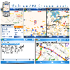 With MobiumGPS , your Windows Mobile device is turned into an advanced Mobile Navigation System with turn-by-turn voice announcements and detailed driving directions. You can search over 15 million point of interests (POIs) - places like hotels, restaurants, shopping malls and other tourist...
Platforms: Windows
With MobiumGPS , your Windows Mobile device is turned into an advanced Mobile Navigation System with turn-by-turn voice announcements and detailed driving directions. You can search over 15 million point of interests (POIs) - places like hotels, restaurants, shopping malls and other tourist...
Platforms: Windows
| License: Demo | Cost: $9.95 USD | Size: 806.13 KB | Download (1554): Mobium GPS Navigation System Download |
Released: November 08, 2011
|
Added: November 19, 2011 | Visits: 1.144
 SKAIFO is an Outlook Add-In that integrates Skype functionality with Microsoft Outlook. It has full-fledged User Interface inside Outlook so there is no need to switch back and force between Outlook and Skype for your free calling needs.
In addition to calling and receiving phone calls SKAIFO...
Platforms: Windows
SKAIFO is an Outlook Add-In that integrates Skype functionality with Microsoft Outlook. It has full-fledged User Interface inside Outlook so there is no need to switch back and force between Outlook and Skype for your free calling needs.
In addition to calling and receiving phone calls SKAIFO...
Platforms: Windows
| License: Shareware | Cost: $23.95 USD | Size: 35.93 MB | Download (97): SKAIFO Download |
Released: December 22, 2012
|
Added: December 22, 2012 | Visits: 472
 Run.GPS Trainer UV is the perfect tool to take along doing all sorts of sports like running, skiing, hiking, and many more. Run.GPS Trainer UV is compatible with most PocketPCs and Smartphones (requires Windows Mobile 2003 Pocket PC, Windows Mobile 5 or Windows Mobile 6). Recording *...
Platforms: Windows, Pocket PC
Run.GPS Trainer UV is the perfect tool to take along doing all sorts of sports like running, skiing, hiking, and many more. Run.GPS Trainer UV is compatible with most PocketPCs and Smartphones (requires Windows Mobile 2003 Pocket PC, Windows Mobile 5 or Windows Mobile 6). Recording *...
Platforms: Windows, Pocket PC
| License: Shareware | Cost: $33.99 USD | Size: 6.29 MB | Download (606): Run.GPS Trainer UV Download |
Added: October 10, 2013 | Visits: 598
Set EXIF Data sets, not edits, the EXIF data in an image. Set EXIF Data uses the excellent EXIFtool (comes bundled), a tool which you should install first. What's New in This Release: [ read full changelog ] New: ?*A* Added the ability to add or subtract a fixed time to/from a batch of photo's....
Platforms: Mac
| License: Freeware | Size: 6.78 MB | Download (42): Set EXIF Data Download |
Released: September 10, 2005
|
Added: September 03, 2006 | Visits: 3.740
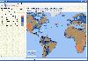 Now you can trace your network activity on world map.
GEO Spider helps you to trace, identify and monitor your network activity on world map. You can trace any website or IP address on your map.
Built on .NET technology GEO Spider uses fast and reliable approach in detecting hostnames, IP...
Platforms: Windows
Now you can trace your network activity on world map.
GEO Spider helps you to trace, identify and monitor your network activity on world map. You can trace any website or IP address on your map.
Built on .NET technology GEO Spider uses fast and reliable approach in detecting hostnames, IP...
Platforms: Windows
| License: Shareware | Cost: $20.00 USD | Size: 10.26 MB | Download (287): GEO Spider Download |
Released: November 09, 2006
|
Added: November 14, 2006 | Visits: 4.295
 Geo World is a handy application for finding out detailed information about any country in the world. One of its advantages is that you can find the country you were looking for by Internet Country Code, Capital and etc. Also it's supplied with more than 530 images which represent flags and maps...
Platforms: Windows
Geo World is a handy application for finding out detailed information about any country in the world. One of its advantages is that you can find the country you were looking for by Internet Country Code, Capital and etc. Also it's supplied with more than 530 images which represent flags and maps...
Platforms: Windows
| License: Shareware | Cost: $25.00 USD | Size: 6.24 MB | Download (324): Geo World Download |
Added: May 08, 2010 | Visits: 890
GEO project is a C++ geometric template class library. Use this library for your graphical, image processing, or scientific applications. GEO has rich set of operations with vectors and matrices, 2D and 3D objects (such as finding convex hull, bounding box), triangulation, tesselation, etc..
Platforms: *nix
| License: Freeware | Size: 29.7 KB | Download (119): GEO Download |
Added: January 09, 2010 | Visits: 1.145
Geo::Lookup::ByTime is a Perl module to lookup location by time. SYNOPSIS use Geo::Lookup::ByTime; $lookup = Geo::Lookup::ByTime->new( @points ); my $pt = $lookup->nearest( $tm ); Given a set of timestamped locations guess the location at a particular time. This is a useful operation...
Platforms: *nix
| License: Freeware | Size: 15.36 KB | Download (94): Geo::Lookup::ByTime Download |
Added: October 01, 2010 | Visits: 1.098
Geo::Raster is a Perl extension for raster algebra. SYNOPSIS use Geo::Raster; or use Geo::Raster qw(:types); or use Geo::Raster qw(:types :logics :db); Geo::Raster is an object-oriented interface to libral, a C library for rasters and raster algebra. Geo::Raster makes using libral easy...
Platforms: *nix
| License: Freeware | Size: 89.09 KB | Download (108): Geo::Raster Download |
Added: June 09, 2010 | Visits: 1.191
Geo::Shapelib is a Perl extension for reading and writing shapefiles as defined by ESRI. SYNOPSIS use Geo::Shapelib qw/:all/; or use Geo::Shapelib qw/:all/; my $shapefile = new Geo::Shapelib { Name => stations, Shapetype => POINT, FieldNames => [Name,Code,Founded]; FieldTypes =>...
Platforms: *nix
| License: Freeware | Size: 266.24 KB | Download (134): Geo::Shapelib Download |