


Geo software
Geo
Added: May 12, 2013 | Visits: 457
 When editing a post or page, you will be able to set a physical location for that post and easily embed a Google map into your post. You can select the location by: 1. Clicking on the map of the world to position the point. 2. Searching for a location, town, city or address. 3. Entering the...
Platforms: PHP
When editing a post or page, you will be able to set a physical location for that post and easily embed a Google map into your post. You can select the location by: 1. Clicking on the map of the world to position the point. 2. Searching for a location, town, city or address. 3. Entering the...
Platforms: PHP
| License: Freeware | Size: 440.32 KB | Download (54): WP Geo Download |
Added: June 13, 2013 | Visits: 1.086
There are a lot of great plugins to prevent spam but especially the effectiv captcha images can annoy your human visitors. Geo Captcha uses the knowledge that a lot of spam is caused from a few countries and prevents them from spamming.Visitors from the countries on your whitelist will never see...
Platforms: PHP
| License: Freeware | Size: 20.48 KB | Download (45): Geo Captcha Download |
Added: August 26, 2013 | Visits: 447
Provides simple functionality for positioning content and users, nodes can also be given an area. Positions are rendered using the geo microformat (http://microformats.org/wiki/geo) in full and teaser nodes and in views listings. Simple Geo can display all geotagged content on a page using Google...
Platforms: PHP
| License: Freeware | Size: 30.72 KB | Download (38): Simple Geo Download |
Added: July 08, 2013 | Visits: 191
It can integrate with Views.InstallationUnpack in your modules folder (usually '/sites/all/modules/')Enable under Administer > Site Building > Modules.
Platforms: PHP
| License: Freeware | Size: 10 KB | Download (51): Geo Taxonomy Download |
Added: June 24, 2013 | Visits: 448
This Flickr plugin for WordPress will allow you to pull in your Flickr photosets and display them as albums on your WordPress site. There is a pretty simple template provided which you can customize to 100% match the look and feel of your own site.The plugin is customizable in a number of...
Platforms: PHP
| License: Shareware | Cost: $0.00 USD | Size: 409.6 KB | Download (51): Add flickr photo with geo tag Download |
Added: June 29, 2013 | Visits: 378
collective.geo.openlayers enables openlayers machinery into Plone. Installation ------------ You can install collective.geo.openlayers as part of a specific project's buildout, by having a buildout configuration such as: :: [buildout] ... eggs = collective.geo.openlayers ... [instance]...
Platforms: *nix
| License: Freeware | Size: 317.44 KB | Download (32): collective.geo.openlayers Download |
Added: November 26, 2013 | Visits: 361
collective.geo.kml provides KML views for georeferenced objects, allowing Plone containers and collections to be visualized in Google Earth. It also provides a map view to Plone Folder and Topic content types to display kml data.
Platforms: *nix
| License: Shareware | Cost: $0.00 USD | Size: 30.72 KB | Download (38): collective.geo.kml Download |
Added: June 19, 2013 | Visits: 296
This Product adds a geospatial index to the zope catalog for collective.geo. OOTB it only adds the index and a searchform, query_spatialcatalog.html, which lets you explore the usage of the index. It is meant to be used in custom products that need a spatial search. It depends on the...
Platforms: *nix
| License: Shareware | Cost: $0.00 USD | Size: 20.48 KB | Download (46): collective.geo.index Download |
Added: September 15, 2013 | Visits: 226
Some web mapping clients like leaflet or polymaps only accept json as an input format. This product produces it. It does not have any user interface, it just provides a GeoJson view for contentitems, folders and collections. To test just append @@geo-json.json at the url.
Platforms: *nix
| License: Shareware | Cost: $0.00 USD | Size: 10.24 KB | Download (32): collective.geo.json Download |
Added: November 02, 2013 | Visits: 390
Geo::Coder::US is a Perl module with geocode (estimate latitude and longitude) for any US address. SYNOPSIS use Geo::Coder::US; Geo::Coder::US->set_db( "geocoder.db" ); my @matches = Geo::Coder::US->geocode( "1600 Pennsylvania Ave., Washington, DC" ); my @matches =...
Platforms: *nix
| License: Freeware | Size: 30.72 KB | Download (33): Geo::Coder::US Download |
Released: December 30, 2019
|
Added: January 08, 2020 | Visits: 3.837
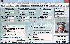
 ORTWIN is a program for the state-wide inquiry of the localities, postal codes and telephone selections in Germany. It finds postal zip codes, telephone pre selections, coordinates and ground level elevations. The program determines municipal codes, local center points, car license codes,...
Platforms: Windows, Windows 8, Windows 7, Windows Server
ORTWIN is a program for the state-wide inquiry of the localities, postal codes and telephone selections in Germany. It finds postal zip codes, telephone pre selections, coordinates and ground level elevations. The program determines municipal codes, local center points, car license codes,...
Platforms: Windows, Windows 8, Windows 7, Windows Server
| License: Shareware | Cost: $120.00 USD | Size: 4.88 MB | Download (180): ORTWIN Download |
Released: December 30, 2019
|
Added: January 08, 2020 | Visits: 3.186
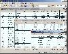
 TOPOWIN is a state-wide register of the German Topographic Cartographies, the German Basic Cartography and of localities with geo references in different coordinate systems. It is also a topographic information system. In the division of planning and execution of economical and scientific...
Platforms: Windows, Windows 8, Windows 7, Windows Server
TOPOWIN is a state-wide register of the German Topographic Cartographies, the German Basic Cartography and of localities with geo references in different coordinate systems. It is also a topographic information system. In the division of planning and execution of economical and scientific...
Platforms: Windows, Windows 8, Windows 7, Windows Server
| License: Shareware | Cost: $125.00 USD | Size: 4.56 MB | Download (271): TOPOWIN Download |
Added: April 28, 2006 | Visits: 2.860
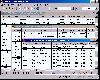
 Geodata of international countries with locals, municipalities and postal codes. Georeferences as UTM- and geographic coordinates (WGS84, ETRS89). Suitable for branch searches, periphery searches and distance computations. These countries are available: Albania, Andorra, Belgium, Bosnia,...
Platforms: DOS, OS/2, BeOS, Palm OS, Windows, Mac, *nix, Windows CE
Geodata of international countries with locals, municipalities and postal codes. Georeferences as UTM- and geographic coordinates (WGS84, ETRS89). Suitable for branch searches, periphery searches and distance computations. These countries are available: Albania, Andorra, Belgium, Bosnia,...
Platforms: DOS, OS/2, BeOS, Palm OS, Windows, Mac, *nix, Windows CE
| License: Shareware | Cost: $195.00 USD | Size: 1.67 MB | Download (120): Geo Data International (English) Download |
Released: May 14, 2010
|
Added: June 03, 2010 | Visits: 1.196
 FastFotoScale is a batch picture processor. It performs: resizing, renaming, organizing thousands images, cropping, converting, editing EXIF information, filtering, sorting, finding duplicates, viewing with date/time/metadata/geo coordinates navigation, creating audio annotations, creating...
Platforms: Windows
FastFotoScale is a batch picture processor. It performs: resizing, renaming, organizing thousands images, cropping, converting, editing EXIF information, filtering, sorting, finding duplicates, viewing with date/time/metadata/geo coordinates navigation, creating audio annotations, creating...
Platforms: Windows
| License: Shareware | Cost: $24.95 USD | Size: 15.92 MB | Download (100): FastFotoScale Download |
Added: August 14, 2008 | Visits: 1.336
 Geo data international world wide with towns, town quarters and postal codes. Georeferences as UTM- and geographic coordinates (WGS84) and elevations. Suitable for branch searches, periphery searches and distance computations. Australia, Austria, Belgium, Bulgaria, Canada, Denmark, Estonia,...
Platforms: Windows
Geo data international world wide with towns, town quarters and postal codes. Georeferences as UTM- and geographic coordinates (WGS84) and elevations. Suitable for branch searches, periphery searches and distance computations. Australia, Austria, Belgium, Bulgaria, Canada, Denmark, Estonia,...
Platforms: Windows
| License: Shareware | Cost: $195.00 USD | Size: 371 KB | Download (101): Geodaten International Admin (Deutsch) Download |
Added: August 01, 2008 | Visits: 1.101
Geodata of the Federal Republic Germany with municipalities, postal codes, telefone preselections. Suitable for branch searches, periphery searches and distance computations. Georeferences as Gauss Krueger, UTM and Geographic Coordinates and also Ground Level Elevations. ORTREF: 12.500 geocoded...
Platforms: Not Applicable
| License: Demo | Cost: $195.00 USD | Size: 313 KB | Download (100): Geo Data German Admin (English) Download |
Added: August 18, 2010 | Visits: 891
Shazou (pronounced Shazoo it is Japanese for mapping) enables the user with one-click to map and geo-locate any website they are currently viewing. Shazou was developed as a tool to improve the awareness for people surfing the internet about where and who they are interacting with every click...
Platforms: *nix
| License: Freeware | Size: 7.17 KB | Download (97): Shazou Download |
Added: February 17, 2010 | Visits: 1.140
Graph::Writer::DrGeo can save the graph output DrGeo scheme script. SYNOPSIS my $g = new Graph; # Add some vertices/edges to $g my $writer = Graph::Writer::DrGeo->new(); $writer->write_graph($g,"graph.scm"); # graph.scm can be evaluated and rendered with Dr.Geo Dr. Geo is a GTK...
Platforms: *nix
| License: Freeware | Size: 8.19 KB | Download (95): Graph::Writer::DrGeo Download |
Added: January 07, 2010 | Visits: 1.158
The Geo Radar released by .CK reminded me of an idea I had had a while ago and provided me with the tools to implement it quickly. This greasemonkey is a simpler version of the radar that displays the 8 closest photos to the actual one in the directions: N, NE, E, SE, S, SW, W, NW. Flickr...
Platforms: *nix
| License: Freeware | Download (105): Flickr Photo Compass Download |
Added: January 25, 2010 | Visits: 1.623
Neopocott is a Neo Geo Pocket Colour emulator for the Macintosh. While compatibility is quite limited at present, this emulator is rapidly developing, and hopefully it should run all the available software in the not too distant future. Additional features can be added to this emulator via...
Platforms: Mac
| License: Freeware | Download (446): Neopocott Download |