


Garmin Gps Units software
Garmin Gps Units
Released: July 11, 2012
|
Added: July 11, 2012 | Visits: 822
![]() Wialon GPS Tracking is an application characterized by its ease of use, reliability, usability, and high operational speed. The general features of the system include fuel consumption monitoring, editable template-base reports, SMS or e-mail alerts and notifications and controllable routes with...
Wialon GPS Tracking is an application characterized by its ease of use, reliability, usability, and high operational speed. The general features of the system include fuel consumption monitoring, editable template-base reports, SMS or e-mail alerts and notifications and controllable routes with...
Platforms: Windows
| License: Demo | Cost: $0.00 USD | Size: 6.45 MB | Download (505): Wialon GPS Tracking Download |
Released: November 10, 2012
|
Added: November 10, 2012 | Visits: 710
 Have a GPS and a laptop? Use this to find your way. Make patterns or a trail to share with others. When the application starts, you may pick your area of operations - be it North America, South America, Europe and Asia, or Australia. Your quadrant is determined by where you are in relation to the...
Platforms: Windows
| License: Freeware | Size: 4.56 MB | Download (503): LAS GPS Monitor LT Download |
Released: November 07, 2012
|
Added: November 07, 2012 | Visits: 621
 With this tool you can add GPS coordinates to vCards - electronic business cards - that you have previously exported from e. g. Microsoft Outlook. Therefore the tool uses the address data contained within the vCards and adds the exact GPS position on that basis to the vCard. This way you can use...
Platforms: Windows
| License: Freeware | Size: 1.47 MB | Download (503): GPS to vCard Download |
Released: September 07, 2012
|
Added: September 07, 2012 | Visits: 682
 GPS Converter will convert GPS coordinates between three different formats: 34.26965, -116.76783; N 34° 16.179', W 116° 46.07'; and N 34° 16' 10.74", W 116° 46' 4.2". Will map the results in Google Maps.
Platforms: Windows
| License: Freeware | Size: 1.14 MB | Download (491): GPS Converter Download |
Released: September 07, 2012
|
Added: September 07, 2012 | Visits: 477
 A powerful and flexible journal application that allows all levels of athletes and fitness enthusiasts to get the most from their training and racing. It allows you to easily and quickly track your training, monitor your progress, and built a history of your training. You can manually enter your...
Platforms: Mac
| License: Freeware | Size: 20 MB | Download (485): iSMARTtrain for Mac OS Download |
Added: August 23, 2008 | Visits: 974
 GPS client library component reads and decodes standard GPS NMEA 183 sentences from the RS232 serial port as well as compute great circle distances and bearings. Several C/C++ example programs with full source code are included.Requires Windows C/C++ compiler.Registration is $105 for email delivery.
Platforms: Windows
| License: Shareware | Cost: $105.00 USD | Size: 327 KB | Download (480): MarshallSoft GPS Component for C C++ Download |
Released: August 21, 2012
|
Added: August 21, 2012 | Visits: 426
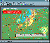 AGIS for Windows is a mapping and simple GIS shareware package. Plot your own geographic data on the map of the world provided without the high cost and steep learning curve usually associated with this kind of software. Create high resolution publication quality images that can be pasted into...
Platforms: Windows
| License: Shareware | Cost: $49.00 USD | Size: 3.57 MB | Download (478): AGIS for Windows Download |
Released: January 27, 2013
|
Added: January 27, 2013 | Visits: 1.105
 CMC Multimedia Sistem SRL ofera: Sisteme de Monitorizare Vehicule si Localizare prin GPS, Receptoare de ultima generatie GPS, Navigatie prin Sisteme GPS, Sisteme Urmarire GPS Auto, Abonamente GPS si Sisteme de Urmarire a Masinilor, GPS Tracking, Sisteme Navigatie Romania si International,...
Platforms: Windows, Mac, Unix, Linux, Palm OS 6.0, Pocket PC, RIM, Symbian, Handheld/Mobile Other, OpenVMS, Netware, BEOS, Java
| License: Freeware | Size: 974 KB | Download (476): Sisteme de Localizare, Monitorizare GPS Download |
Released: October 23, 2012
|
Added: October 23, 2012 | Visits: 655
GPS Utility is an easy-to-use application that provides management and manipulation of GPS information. You can use it to transfer data to/from a GPS receiver and store the data in PC files in one of several text formats.
The program converts between different map datums and many coordinate...
Platforms: Windows
| License: Freeware | Size: 1.87 MB | Download (469): GPS Utility Download |
Released: July 05, 2012
|
Added: July 05, 2012 | Visits: 578
 " The most accurate and handly Altimeter is here. It gives you the altitude wherever you are. Simply start the app and altitude will appear in a second, No setup required. You can also adjust Altitude in Feet or Meter as per your requirement. Special feature saved your Max climb rate value.
...
" The most accurate and handly Altimeter is here. It gives you the altitude wherever you are. Simply start the app and altitude will appear in a second, No setup required. You can also adjust Altitude in Feet or Meter as per your requirement. Special feature saved your Max climb rate value.
...
Platforms: iPhone, iPod
| License: Shareware | Cost: $0.99 USD | Download (469): Altimeter Digital GPS + Map Viewer + Cam Download |
Released: August 23, 2012
|
Added: August 23, 2012 | Visits: 668
 All-in-one software for creation of custom GPS maps compatible with Garmin GPS units. Mapwel supports routing, ESRI shapefiles, OpenStreetMap OSM, Google Earth KML and KMZ, cGPSmapper MP and GPX files. Mapwel custom GPS mapping capability and user icons editor are often used in forestry,...
Platforms: Windows
| License: Shareware | Cost: $45.00 USD | Size: 12.28 MB | Download (454): Mapwel Download |
Released: August 27, 2012
|
Added: August 27, 2012 | Visits: 719
Dimensional Units Conversion is a simple and useful tool built using the Python programming language that can be used to convert different measuring units.
Now you can use of this handy instrument to convert from one unit to another in no time at all.
Platforms: Windows
| License: Freeware | Download (445): Dimensional Units Conversion Download |
Released: August 23, 2012
|
Added: August 23, 2012 | Visits: 571
ExpertGPS is the ultimate mapping software for Garmin, Magellan, and Lowrance GPS owners. ExpertGPS displays your waypoints, routes, and tracks on USGS topo maps and aerial photos.
Using the powerful mapping tools in ExpertGPS, you can draw your route directly on a map, search for nearby...
Platforms: Windows
| License: Shareware | Cost: $74.95 USD | Size: 9.1 MB | Download (441): ExpertGPS Download |
Released: June 03, 2012
|
Added: June 03, 2012 | Visits: 729
The Genome Positioning System (GPS) is a software tool to study protein-DNA interaction using ChIP-Seq data. GPS builds a probabilistic mixture model to predict the most likely positions of binding events at single-base resolution.
GPS is a Java software, so it runs on multiple platforms,...
Platforms: Windows
| License: Freeware | Download (430): GPS Download |
Released: July 01, 2012
|
Added: July 01, 2012 | Visits: 758
 Atom GPS freeware easily geotags your photos directly from your GPS device or track log. By simply connecting your GPS Device to Atom GPS and selecting your photos you can add their geolocation in one click. This action allows you to write the geolocation data to your photos exifs (information...
Platforms: Windows
| License: Freeware | Size: 7.58 MB | Download (430): ATOM GPS Download |
Released: June 20, 2012
|
Added: June 20, 2012 | Visits: 783
GPX and TCX file welder is a small, easy to use application specially designed to help you substitute the missing GPS information in Garmin TCX files when devices lacking a GPS receiver are used to collect training data (Garmin FR 60, heartrate and pedometer only).
This application is also...
Platforms: Windows
| License: Freeware | Download (425): GPX and TCX file welder Download |
Added: August 08, 2008 | Visits: 2.878
HS GPS is a software library (with full C source code) which provides access to a NMEA-183 compliant GPS receiver via a serial communications port, decoding NMEA sentences: , , , , and . Decoded parameters include: time, date, position, altitude, speed, course and heading, according to standard -...
Platforms: Windows
| License: Freeware | Size: 309 KB | Download (398): HS NMEA GPS C Source Library Download |
Added: February 04, 2006 | Visits: 4.836
 It is a PC Clock synchronization program. It is alternative solution to synchronizing with atomic clock using NTP(SNTP) and Internet. The program works in the interactive mode or in background. The program can be used as NMEA and COM port tester. It outputs a port receiving buffer, extracts all...
Platforms: Windows
| License: Shareware | Cost: $10.00 USD | Size: 446 KB | Download (288): GPS Time and Test Download |
Added: January 05, 2006 | Visits: 3.134
 NavTools GPS is a small and easy to use application to connect your PC or laptop to an existing GPS (NMEA 0183 serial connection) installation. Position cata will automatically be displayed and logged on your screen, and voyage data can be exchanged and shared with the NavTools Route voyage...
Platforms: Windows
| License: Shareware | Cost: $25.00 USD | Size: 1.5 MB | Download (255): NavTools GPS Download |
Added: July 10, 2010 | Visits: 1.479
GPS::PRN is a package for PRN - Object ID conversions. SYNOPSIS use GPS::PRN; my $obj = GPS::PRN->new(); print "PRN: ", $obj->prn_oid(22231), "n"; print "OID: ", $obj->oid_prn(1), "n"; This module maps GPS PRN number to Satellite OID and vice versa. Object Identification Number (OID)...
Platforms: *nix
| License: Freeware | Size: 4.1 KB | Download (230): GPS::PRN Download |