


Finding Gps Coordinate software
Finding Gps Coordinate
Added: August 18, 2013 | Visits: 519
 A collection of utilities for translating GPS coordinates to related coordinate systems (Earth Centere Fixed, Topocentric, UTM) with auxiliary routins for horizon computation and ray ellipsoid intercepts.
Platforms: Matlab
| License: Freeware | Size: 1.28 MB | Download (57): GPS Coordinate Transformations Download |
Released: November 20, 2015
|
Added: April 20, 2016 | Visits: 3.087
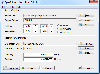 The Eye4Software Coordinate Calculator is an easy to use tool to perform map or GPS coordinate conversions. The software can be used to transform a single coordinate or a batch of coordinates read from a comma separated, database or ESRI shapefiles. The software is shipped with a MS Access...
Platforms: Windows, Windows 7
| License: Shareware | Cost: $119.00 USD | Size: 8.96 MB | Download (249): Eye4Software Coordinate Calculator Download |
Released: August 19, 2012
|
Added: August 19, 2012 | Visits: 661
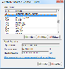 The Eye4Software Coordinate Calculator is an easy to use desktop software tool, to perform gps coordinate conversions from one coordinate system to another. It can also be used to convert coordinates between different map datums. The software can be used to convert a single coordinate, or to...
Platforms: Windows
| License: Shareware | Cost: $43.51 USD | Size: 1.4 MB | Download (462): Coordinate Calculator Download |
Released: August 06, 2012
|
Added: August 06, 2012 | Visits: 1.061
A free application that helps you manages your SCUBA Diving logbooks between your Mac and the Dive Log on iPhone application. You can backup and restore your logbook data from your iPhone or iPod touch and import logbook data from other desktop applications and file formats.
Your diving logbook...
Platforms: Mac
| License: Freeware | Size: 450.56 KB | Download (469): Dive Log Manager for Mac OS Download |
Released: July 21, 2010
|
Added: September 25, 2010 | Visits: 1.351
 Toolkit to add GPS and coordinate conversion functionality to your software and scripts (GPS API). All NMEA0183 protocol versions are supported and can be filtered by NMEA sentence type and talker ID. Garmin USB PVT support. Information on GPS status can also be retrieved: GPS fix quality,...
Platforms: Windows
| License: Shareware | Cost: $99.00 USD | Size: 2.2 MB | Download (125): Eye4Software GPS API Download |
Released: July 13, 2017
|
Added: August 30, 2017 | Visits: 4.507
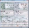
 TRANSDAT geosoftware executes coordinate transformations and geodetic datum shifts between many coordinate and reference systems of America, Australasia, Europe, Germany special and world-wide, with high precision and high speed: 1.The current and historical coordinate and reference systems of...
Platforms: Windows, Windows 8, Windows 7, Windows Server
| License: Shareware | Cost: $170.00 USD | Size: 4.43 MB | Download (325): TRANSDAT Download |
Released: November 17, 2009
|
Added: April 17, 2010 | Visits: 2.522
 CopanMobile for Pocket PC is a very functional and easy-to-use geomatics engineering tool for computing and managing plane surveying and mapping coordinates.
It does numerous coordinate geometry (COGO) calculations, processes and adjusts raw field survey data, computes and adjusts map...
CopanMobile for Pocket PC is a very functional and easy-to-use geomatics engineering tool for computing and managing plane surveying and mapping coordinates.
It does numerous coordinate geometry (COGO) calculations, processes and adjusts raw field survey data, computes and adjusts map...
Platforms: Pocket PC, Windows
| License: Freeware | Size: 662.68 KB | Download (1153): CopanMobile for PocketPC Download |
Released: October 23, 2012
|
Added: October 23, 2012 | Visits: 651
GPS Utility is an easy-to-use application that provides management and manipulation of GPS information. You can use it to transfer data to/from a GPS receiver and store the data in PC files in one of several text formats.
The program converts between different map datums and many coordinate...
Platforms: Windows
| License: Freeware | Size: 1.87 MB | Download (469): GPS Utility Download |
Released: November 07, 2012
|
Added: November 07, 2012 | Visits: 618
 With this tool you can add GPS coordinates to vCards - electronic business cards - that you have previously exported from e. g. Microsoft Outlook. Therefore the tool uses the address data contained within the vCards and adds the exact GPS position on that basis to the vCard. This way you can use...
Platforms: Windows
| License: Freeware | Size: 1.47 MB | Download (503): GPS to vCard Download |
Released: June 13, 2012
|
Added: June 13, 2012 | Visits: 898
![]() With the new Icons-Land Vista Style GIS/GPS/Map Icon Set now it is much more comfortable to use local service applications, GPS tracking and GIS applications, and any kind of mapping applications. GIS/GPS/Map Icons are meant to help users to orient oneself when using maps, to facilitate their...
With the new Icons-Land Vista Style GIS/GPS/Map Icon Set now it is much more comfortable to use local service applications, GPS tracking and GIS applications, and any kind of mapping applications. GIS/GPS/Map Icons are meant to help users to orient oneself when using maps, to facilitate their...
Platforms: Windows, Mac, Pocket PC, Java, Handheld/Mobile Other
| License: Demo | Cost: $120.00 USD | Size: 2.53 MB | Download (57): Icons-Land Vista Style GIS/GPS/MAP Icon Set Download |
Added: September 08, 2013 | Visits: 606
this code will be helpful for finding the co-ordinate values of any gray level...some other result can also be obtained with this code , these are... 1..finding max histogram 2..finding min histogram 3..finding the co=ordinate values if more than one co=ordinate containing the same gray level
Platforms: Matlab
| License: Freeware | Size: 10 KB | Download (53): finding the co-ordinate values of any gray lavel-in_gray_level_image Download |
Released: May 02, 2014
|
Added: May 14, 2014 | Visits: 734
 TRANSDAT geosoftware executes coordinate transformations and geodetic datum shifts between many coordinate and reference systems of America, Australasia, Europe, Germany special and world-wide, with high precision and high speed: 1.The current and historical coordinate and reference systems of...
Platforms: Windows, Windows 8, Windows 7, Windows Server
| License: Shareware | Cost: $210.00 USD | Size: 2.91 MB | Download (53): TRANSDAT English Download |
Released: September 07, 2014
|
Added: September 21, 2014 | Visits: 753
![]() With the new Icons-Land GIS/GPS/Map Vector Icons now it is much more comfortable to use local service applications, GPS tracking and GIS applications, and any kind of mapping applications.
GIS/GPS/Map Icons are meant to help users to orient oneself when using maps, to facilitate their...
With the new Icons-Land GIS/GPS/Map Vector Icons now it is much more comfortable to use local service applications, GPS tracking and GIS applications, and any kind of mapping applications.
GIS/GPS/Map Icons are meant to help users to orient oneself when using maps, to facilitate their...
Platforms: Windows, Mac, Windows 8, Windows 7, iOS
| License: Demo | Cost: $180.00 USD | Size: 5.56 MB | Download (40): Icons-Land GIS/GPS/MAP Vector Icons Download |
Released: March 29, 2020
|
Added: April 06, 2020 | Visits: 1.131
TRANSDATpro can prove a helpful tool for professionals, providing them with the possibility to perform coordinate transformations fast and easy by use of the coordinate reference systems of their choice.
TRANSDATpro performs Coordinate Transformations fast and with high accuracy. The coordinate...
Platforms: Windows, Windows 8, Windows 7, Windows Server
| License: Shareware | Cost: $270.00 USD | Size: 5.19 MB | Download (131): TRANSDATpro Download |
Added: January 15, 2006 | Visits: 4.093
 GPS Software - Download waypoints and routes from Garmin GPS. Upload waypoints and routes to Garmin GPS. Excel and Text files supported! This software is very easy to use!
Platforms: Windows
| License: Shareware | Cost: $29.95 USD | Size: 1.29 MB | Download (203): Frontbase GPS Download |
Added: January 05, 2006 | Visits: 3.132
 NavTools GPS is a small and easy to use application to connect your PC or laptop to an existing GPS (NMEA 0183 serial connection) installation. Position cata will automatically be displayed and logged on your screen, and voyage data can be exchanged and shared with the NavTools Route voyage...
Platforms: Windows
| License: Shareware | Cost: $25.00 USD | Size: 1.5 MB | Download (255): NavTools GPS Download |
Added: August 11, 2006 | Visits: 3.338
GPS Express provides a feature rich interface to serial NMEA-0183 protocol data and works with most NMEA-0183 devices, including GPS Receivers. GPS Express is available in three versions (Standard, Professional, Graphical). STANDARD displays the title, value, and units for each parameter....
Platforms: Windows
| License: Shareware | Cost: $65.00 USD | Size: 2.1 MB | Download (169): GPS Express Standard Edition Download |
Added: August 19, 2010 | Visits: 1.225
GPS::Babel is a Perl interface to gpsbabel. SYNOPSIS use GPS::Babel; my $babel = GPS::Babel->new(); # Read an OZIExplorer file into a data structure my $data = $babel->read(route.ozi, ozi); # Convert a file automatically choosing input and output # format based on extension...
Platforms: *nix
| License: Freeware | Size: 10.24 KB | Download (121): GPS::Babel Download |
Added: March 24, 2010 | Visits: 1.184
GPS::SpaceTrack is a package for calculating the position of GPS satellites. SYNOPSIS use GPS::SpaceTrack; my $obj=GPS::SpaceTrack->new(filename=>"gps.tle"); print join("t", qw{Count PRN ELEV Azim SNR USED}), "n"; foreach ($obj->getsatellitelist({lat=>38.870997, lon=>-77.05596})) { print...
Platforms: *nix
| License: Freeware | Size: 52.22 KB | Download (117): GPS::SpaceTrack Download |
Added: July 10, 2010 | Visits: 1.476
GPS::PRN is a package for PRN - Object ID conversions. SYNOPSIS use GPS::PRN; my $obj = GPS::PRN->new(); print "PRN: ", $obj->prn_oid(22231), "n"; print "OID: ", $obj->oid_prn(1), "n"; This module maps GPS PRN number to Satellite OID and vice versa. Object Identification Number (OID)...
Platforms: *nix
| License: Freeware | Size: 4.1 KB | Download (230): GPS::PRN Download |