


Europe Gps Maps software
Europe Gps Maps
Added: November 14, 2010 | Visits: 1.956
 Crossfire Maps packages includes maps for the Crossfire MUD client. Crossfire is a multi-player graphical arcade and adventure game made for X. It has certain flavours from other games, especially Gauntlet and the rogue-like games (Nethack, Moria, Angband, and Ragnarok). Any number of players...
Platforms: *nix
| License: Freeware | Size: 21.2 MB | Download (165): Crossfire Maps Download |
Released: February 09, 2014
|
Added: March 16, 2014 | Visits: 1.895
 The Vutog GPS Simulator provides a complete suite for all your GPS simulation needs and more. It is designed to assist in developing, testing and debugging GPS Applications and equipment working with the NMEA-0183 protocol. It can be used for testing navigation applications and equipments indoor...
Platforms: Windows, Windows 7
| License: Shareware | Cost: $149.00 USD | Size: 5.75 MB | Download (164): Vutog GPS Simulator Download |
Released: May 28, 2012
|
Added: July 18, 2012 | Visits: 1.074
 RouteConverter displays, modifies, enriches and converts GPS data between over 75 formats. It works without installation under Linux, Mac OS X and Windows, automatically detects the format of a file, supports drag and drop, undo and redo, offers a map view onto the positions of routes, tracks and...
Platforms: Windows, Mac, *nix, Windows 7, Solaris,FreeBSD,OpenBSD,Java
| License: Freeware | Size: 6.61 MB | Download (162): RouteConverter Download |
Added: January 25, 2010 | Visits: 949
GPSNavX is the solution for the boater that wants to take the Macintosh aboard for real-time display of position on full color marine Softcharts and BSB raster charts.Just plug your GPS into your Macintosh and watch as your boat moves along in real-time, plotting a track behind the boat and...
Platforms: Mac
| License: Shareware | Cost: $0.00 USD | Download (161): GPSNavX Download |
Released: October 18, 2009
|
Added: December 19, 2009 | Visits: 1.435
 Automatic Geo/GPS location track utility for most parts of the World. Lets you know your and your friends geographic location at all times. Maps are downloaded on a per demand basis. All GPS information is stored to a database and can be readily retrieved based on a given date and time range....
Platforms: Windows, Pocket PC
| License: Shareware | Cost: $15.00 USD | Size: 2.41 MB | Download (156): GeoWatch Download |
Released: March 14, 2018
|
Added: June 20, 2018 | Visits: 804
 With Final Selection you can make the selection of your photos as you have always wanted!
- Create your selection of photos using the colors, give them a score using the stars and order them by dragging them to the position you want
- Save your projects for future revisions
- Add custom...
With Final Selection you can make the selection of your photos as you have always wanted!
- Create your selection of photos using the colors, give them a score using the stars and order them by dragging them to the position you want
- Save your projects for future revisions
- Add custom...
Platforms: Windows 8, Windows 7, Windows
| License: Freeware | Size: 11.67 MB | Download (155): Final Selection Download |
Added: July 11, 2010 | Visits: 1.234
GPSMap is a Java application that displays maps and shows your position with the aid of a GPS device. GPSMap project can track paths, load overlays (such as shape files), and download maps from the MapBlast and Expedia servers. Whats New in This Release: - Serial communication on Windows...
Platforms: *nix
| License: Freeware | Size: 4.4 MB | Download (153): GPSMap Download |
Added: January 25, 2010 | Visits: 1.402
GPSUtility displays GPS data including speed, bearing, position and satellite information.
Platforms: Mac
| License: Freeware | Download (148): GPSUtility Download |
Released: December 12, 2023
|
Added: December 23, 2023 | Visits: 1.241
 Universal Maps Downloader is a tool that help you to get small tile images from Google Maps, Openstreetmap, Yandex Maps, Yahoo Maps, Mapquest, Gaode map, Tencent Maps, Baidu Maps, Tianditu, Arcgis Online, OneMap, Whereis, mapy.cz, Mappy, Waze, Sentinel-2 map, Strava Gloabal Heatmap, Wikimapia,...
Platforms: Windows 8, Windows 7, Windows
| License: Shareware | Cost: $69.00 USD | Size: 30.7 MB | Download (147): Universal Maps Downloader |
Released: April 21, 2008
|
Added: February 04, 2009 | Visits: 1.484
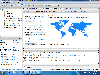
 FusionMaps v3 helps you create animated, interactive and data-driven Flash Maps for your dynamic web applications. Using FusionMaps, you can display geographical data distributed by category, regions or entities. Ideal usage examples are statistical display of data, flight routes, office...
Platforms: Windows, Mac, *nix
| License: Shareware | Cost: $199.00 USD | Size: 26.77 MB | Download (144): FusionMaps Download |
Added: May 22, 2010 | Visits: 1.537
Maps project is a topographal map and aerial photo generator and viewer. Maps allows users to generate topographical maps and aerial photographs of any region in the United States. It uses data provided by the USGS through the geoserver system. The interactive view lets you move around,...
Platforms: *nix
| License: Freeware | Size: 11.26 KB | Download (139): Maps Download |
Added: May 13, 2010 | Visits: 1.343
GPS::Lowrance is a Perl module connect to Lowrance and Eagle GPS devices. REQUIREMENTS The following modules are required to use this module: Carp::Assert GPS::Lowrance::LSI 0.23 Parse::Binary::FixedFormat Win32::SerialPort or Device::SerialPort If you will be using the...
Platforms: *nix
| License: Freeware | Size: 22.53 KB | Download (139): GPS::Lowrance Download |
Added: August 14, 2008 | Visits: 1.315
Puzzle Maps are interactive educational games, small in size and portable, no installation required just unzip and run. The player must find the "?" in the correct location and double-click on it to place the name there. Currently four puzzle maps are available: Boroughs of Greater London;...
Platforms: Windows
| License: Freeware | Size: 450 KB | Download (138): Puzzle Maps Download |
Added: January 25, 2010 | Visits: 851
MacENC is the professional solution for the mariner that wants to take the Mac aboard for real-time display of position on the vector format S-57/S-63 ENCs (Electronic Navigational Charts) AND raster format BSB and Softcharts. Plug your GPS into your Mac and watch as your vessel moves along in...
Platforms: Mac
| License: Demo | Cost: $0.00 USD | Download (134): MacENC Download |
Released: March 29, 2020
|
Added: April 06, 2020 | Visits: 1.133
TRANSDATpro can prove a helpful tool for professionals, providing them with the possibility to perform coordinate transformations fast and easy by use of the coordinate reference systems of their choice.
TRANSDATpro performs Coordinate Transformations fast and with high accuracy. The coordinate...
Platforms: Windows, Windows 8, Windows 7, Windows Server
| License: Shareware | Cost: $270.00 USD | Size: 5.19 MB | Download (131): TRANSDATpro Download |
Added: August 06, 2008 | Visits: 1.438
WEB MAPS allows you to search maps of any country, state, city or province. You just enter the desired image search criteria (e.g. LOS ANGELES CALIFORNIA) and select the number of diferent maps you want to obtain. WEB MAPS will search the web for criteria coincidences and display the images in...
Platforms: Windows
| License: Shareware | Cost: $15.00 USD | Size: 1.91 MB | Download (131): WEB MAPS Download |
Released: January 12, 2012
|
Added: February 04, 2012 | Visits: 1.499
 Bubble maps software does scatter plot and circle charts in Excel, useful for advanced business analysis.
Excel provides the ability to draw bubble maps and scatter plots, but they are less refined than a bubble map you can make with the Smart Bubble Charts software. In Excel: (1) Chart...
Bubble maps software does scatter plot and circle charts in Excel, useful for advanced business analysis.
Excel provides the ability to draw bubble maps and scatter plots, but they are less refined than a bubble map you can make with the Smart Bubble Charts software. In Excel: (1) Chart...
Platforms: Windows
| License: Shareware | Cost: $54.65 USD | Size: 16.32 MB | Download (126): Bubble Maps Software Download |
Released: July 21, 2010
|
Added: September 25, 2010 | Visits: 1.353
 Toolkit to add GPS and coordinate conversion functionality to your software and scripts (GPS API). All NMEA0183 protocol versions are supported and can be filtered by NMEA sentence type and talker ID. Garmin USB PVT support. Information on GPS status can also be retrieved: GPS fix quality,...
Platforms: Windows
| License: Shareware | Cost: $99.00 USD | Size: 2.2 MB | Download (125): Eye4Software GPS API Download |
Added: January 25, 2010 | Visits: 2.079
Warcraft III Bonus Maps are extra maps that were first released with the demo of Warcraft III, however people that purchased the real game and didn't want to download the demo to get these maps can now download them individually.
Platforms: Mac
| License: Freeware | Size: 150 KB | Download (123): Warcraft III Bonus Maps Download |
Added: August 19, 2010 | Visits: 1.228
GPS::Babel is a Perl interface to gpsbabel. SYNOPSIS use GPS::Babel; my $babel = GPS::Babel->new(); # Read an OZIExplorer file into a data structure my $data = $babel->read(route.ozi, ozi); # Convert a file automatically choosing input and output # format based on extension...
Platforms: *nix
| License: Freeware | Size: 10.24 KB | Download (121): GPS::Babel Download |