


Esri Shape File software
Esri Shape File
Released: November 04, 2008
|
Added: November 18, 2008 | Visits: 2.674
 The Advanced points manager imports points to AutoCAD drawing from different data sources. OLE-DB database, SHP (ESRI shape file), GPX (GPS eXchange format), KML (Keyhole Markup Language), GML (Geography Markup Language), TXT, CSV. Additional options: savable configurations, point coordinate...
Platforms: Windows
| License: Demo | Cost: $119.00 USD | Size: 609.83 KB | Download (187): Advanced Points Manager Download |
Released: May 07, 2017
|
Added: May 18, 2017 | Visits: 609
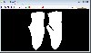 Converting raster image data file of a part / pattern into a vector shape file without manual digitizing. Supporting image scanning twain device to acquire image data as a input.
Contains advanced image processing feature to remove noise in the original raster image.
Contains image size...
Converting raster image data file of a part / pattern into a vector shape file without manual digitizing. Supporting image scanning twain device to acquire image data as a input.
Contains advanced image processing feature to remove noise in the original raster image.
Contains image size...
Platforms: Windows, Windows 8, Windows 7, Windows Server
| License: Shareware | Cost: $120.00 USD | Size: 4.99 MB | Download (77): Cheewoo Shape Tracer Download |
Released: March 01, 2010
|
Added: April 22, 2010 | Visits: 2.519
 Mapyx Quo is an intuitive, easy to learn and, surprisingly simple-to-use digital mapping program which enables you to connect your GPS to your PC and manage all your waypoints, routes and tracks. View information such as elevation, distance, speed, ETA and many more. Quo supports numerous...
Platforms: Windows, Windows CE
| License: Freeware | Size: 44.95 MB | Download (7377): Mapyx Quo Download |
Released: February 01, 2015
|
Added: February 23, 2015 | Visits: 2.231
 Manco Shapefile Editor is a powerful tool for creating and editing shapefiles, with easy, almost “on the fly”, geometry and data editing and possibility of direct creation of the shapefiles from the image files by image processing algorithms. This product is constantly developing and you will...
Platforms: Windows, Windows 7
| License: Shareware | Cost: $100.00 USD | Size: 6.14 MB | Download (110): Manco Shapefile Editor Download |
Added: August 31, 2008 | Visits: 1.030
 Graphical Field Management of GPS Measurements, Import of ESRI-Shape and GPS files, EU conform Field Protocol as PDF, True-of-scale Print in free selectable scale; All Fields in a single farmmap; Edits Fields, Individual coloring, Field splitting; Recognizes restricted areas; Calculation of Areas...
Platforms: Windows
| License: Demo | Cost: $418.00 USD | Size: 5.57 MB | Download (500): DeltaGIS Map Edition Download |
Released: December 29, 2010
|
Added: January 06, 2011 | Visits: 4.321
 OkMap is a GPS and map software that:
-Works with vectorial maps and calibrates raster maps
-Organizes paths by creating waypoints, routes and tracks
-Uploads/downloads data to/from your GPS
-Uses altitude DEM data
-Supports GPS real-time navigation
-Sends/receives vehicles position...
OkMap is a GPS and map software that:
-Works with vectorial maps and calibrates raster maps
-Organizes paths by creating waypoints, routes and tracks
-Uploads/downloads data to/from your GPS
-Uses altitude DEM data
-Supports GPS real-time navigation
-Sends/receives vehicles position...
Platforms: Windows
| License: Freeware | Size: 20.25 MB | Download (1277): OkMap Download |
Added: August 13, 2013 | Visits: 395
In large scale mapping projects with numerous satellite images, it is useful to have a vector file depicting the boundary of the images. This script when run from the folder containing the images, it automatically detects the geotiffs and extracts their image area boundary and constructs a...
Platforms: Matlab
| License: Freeware | Size: 10 KB | Download (49): GeoTiff PathRow Download |
Released: October 23, 2012
|
Added: October 23, 2012 | Visits: 570
 Use GPS without GPS receiver! Try this advanced GPS device simulator (virtual GPS receiver). It can be used for development purposes or for testing GPS software before buying. Generates NMEA messages from different data inputs (map or file). Generated NMEA data can be used by mapping or other GPS...
Platforms: Windows
| License: Shareware | Cost: $39.99 USD | Size: 800 KB | Download (534): Avangardo GPS generator PRO Download |
Added: July 07, 2013 | Visits: 524
In geomatic projects, it is often required to generate a regular grid containing points at pre determined intervals. Such grids could be used as a reference to georectify toposheets.This script when run asks for the bounding box of the study area in latitude and longitude, the sampling density or...
Platforms: Matlab
| License: Freeware | Size: 10 KB | Download (39): Interpolation of Latitude and Longitude within specified bounding box Download |
Added: October 20, 2013 | Visits: 422
EpiGrass 1.5.1 / 2.0 Beta 3 EpiGrass is a simulator of epidemics over networks. EpiGrass is a scientific tool created for simulations and scenario analysis in Network epidemiology. For an in depth description of Epigrass capabilities, please refer to the documentation. EpiGrass can interact...
Platforms: *nix
| License: Freeware | Size: 4 MB | Download (37): EpiGrass Download |
Released: October 20, 2006
|
Added: November 07, 2006 | Visits: 2.333
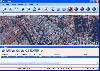
 T2K or tiles2kml enables you to efficiently load large set of imagery or raster maps very quickly into GoogleEarth using Region-Based Network Links. This method has an onRegion option, which specifies to load the Region data only when the Region is active. So only the needed set of data is loaded...
Platforms: Windows
| License: Shareware | Cost: $40.00 USD | Size: 8.39 MB | Download (585): Tiles2kml Download |
Released: August 29, 2008
|
Added: September 12, 2008 | Visits: 2.584
 Map Export is a GIS developer oriented tool for downloading and exporting background image.
For a long time, as a GIS developer, Its well known that to find perfect background images is a suffering and painful task. But since the growing up of Google Map, things have been changed. Google Map...
Map Export is a GIS developer oriented tool for downloading and exporting background image.
For a long time, as a GIS developer, Its well known that to find perfect background images is a suffering and painful task. But since the growing up of Google Map, things have been changed. Google Map...
Platforms: Windows
| License: Shareware | Cost: $499.95 USD | Size: 2.35 MB | Download (178): Map Export Download |
Added: September 17, 2010 | Visits: 1.162
PostGIS adds support for geographic objects to the PostgreSQL object-relational database. In effect, PostGIS "spatially enables" the PostgreSQL server, allowing it to be used as a backend spatial database for geographic information systems (GIS), much like ESRIs SDE or Oracles Spatial extension....
Platforms: *nix
| License: Freeware | Size: 1.4 MB | Download (98): PostGIS Download |
Added: January 25, 2010 | Visits: 715
Aabel is an integrated package that combines the functions of three full-featured applications in one, providing: A rich variety of statistical methods with a focus on visualization, dynamic data exploration tools for discovering patterns and outliers, and multi-dimensional data filtering for...
Platforms: Mac
| License: Shareware | Cost: $0.00 USD | Download (133): Aabel Download |
Released: July 18, 2012
|
Added: July 18, 2012 | Visits: 384
TiVec is a data processing program that enables the user to process Tiger Line files from the Census Bureau and convert them to MID/MIF or SHP/DBF files for use with major GIS and mapping suites. At the same time, it allows the user to select Lat/Long or Lambert projections, separate Tiger...
Platforms: Windows
| License: Shareware | Cost: $119.00 USD | Size: 1.12 MB | Download (404): TiVec Download |
Released: May 29, 2018
|
Added: July 08, 2017 | Visits: 869
 progeCAD perpetual license offers an affordable way to draw AutoCAD DWG and DXF files - edit existing files or cerate your own - using similar commands and icons as used in previous releases of AutoCAD itself. Many choose progeCAD over AutoCAD LT because of it's low cost (currently less than USD...
Platforms: Windows 8, Windows 7, Windows, Windows Server, Other
| License: Shareware | Cost: $499.00 USD | Size: 512.02 MB | Download (88): progeCAD 2018 Professional CAD Software Download |
Added: August 05, 2013 | Visits: 450
Provides a graphical user interface for the forward and reverse Fourier Shape Descriptor routines in Matlab Central File ID12746. Menu entries are provided for loading and saving x,y data in TAB-seperated text format and for saving and loading shape spectra in the same format. If multiple input...
Platforms: Matlab
| License: Shareware | Cost: $0.00 USD | Size: 40.96 KB | Download (52): Elliptical Fourier Shape Descriptors GUI Download |
Added: September 02, 2010 | Visits: 2.492
Geo::ShapeFile is a Perl extension for handling ESRI GIS Shapefiles. SYNOPSIS use Geo::ShapeFile; my $shapefile = new Geo::ShapeFile("roads"); for(1 .. $shapefile->shapes()) { my $shape = $shapefile->get_shp_record($_); # see Geo::ShapeFile::Shape docs for what to do with $shape my...
Platforms: *nix
| License: Freeware | Size: 276.48 KB | Download (147): Geo::ShapeFile Download |
Released: October 23, 2012
|
Added: October 23, 2012 | Visits: 940
Random shape generator was designed using the Java programming language so that it can generate random shapes and tiles.
You can drag and drop an image, send image / svg or a text / plain link to a written file. Now you can generate the shapes you want in no time at all with the help of this...
Platforms: Windows
| License: Freeware | Download (464): Random shape generator Download |
Released: June 01, 2005
|
Added: September 12, 2011 | Visits: 12.057
 Digital File Cabinet lets you design as many file cabinets as you want. Each with their own drawers and folders. Scan pictures or pages of text into your file cabinet. You can also import existing JPEG files and BMP files. Once your page is scanned, you can zoom, rotate, or crop so it's formatted...
Platforms: Windows
| License: Shareware | Cost: $10.00 USD | Size: 16.25 MB | Download (1093): Digital File Cabinet Download |