


Elevation software
Elevation
Released: September 19, 2012
|
Added: September 19, 2012 | Visits: 878
 Artisans Gardens Landscape Design Symbols in Elevation View B&W for Adobe Illustrator CS3, CS4 and CS5. Landscape design is fundamental to a building concept, as it is the first element seen by the viewer and therefore must be pleasing to the human eye. To achieve this appeal Artisans Gardens...
Platforms: Windows, Mac
Artisans Gardens Landscape Design Symbols in Elevation View B&W for Adobe Illustrator CS3, CS4 and CS5. Landscape design is fundamental to a building concept, as it is the first element seen by the viewer and therefore must be pleasing to the human eye. To achieve this appeal Artisans Gardens...
Platforms: Windows, Mac
| License: Shareware | Cost: $219.00 USD | Size: 18.75 MB | Download (447): Artisans Gardens Landscape Design Symbols in Elevation View B&W Download |
Released: November 17, 2012
|
Added: November 17, 2012 | Visits: 891
Artisans Gardens Landscape Design Symbols in Elevation View Color for Adobe Illustrator CS3, CS4 and CS5. If you want your landscape design to stand out you have to be functional, tasteful and original. To help you achieve this goal Artisans Gardens provides an extensive library of beautifully...
Platforms: Windows, Mac
| License: Shareware | Cost: $249.00 USD | Size: 19.33 MB | Download (479): Artisans Gardens Landscape Design Symbols in Elevation View Color Download |
Added: May 09, 2013 | Visits: 552
Predict the azimuth and elevation of the Sun within +/- 1 degree at any geodetic latitude, longitude and altitude.Function Call: [Az El] = SolarAzEl('2008/02/18 13:10:00',60,15,0)Input List:UTC Date and Time - Use format YYYY/MM/DD hh:mm:ssLatitude - Site Latitude in degrees -90:90 -> S(-)...
Platforms: Matlab
| License: Freeware | Size: 10 KB | Download (47): Solar Azimuth and Elevation Estimation Download |
Added: May 24, 2013 | Visits: 544
Calculates azimuth and elevation angle in the local horizon system for a sky position given in equatorial coordinates (RA Dec J2000).Function Call: [Az El] = RADec2AzEl(350,58, '2008/02/18 13:10:00',60,15,0)Input:RA - Right ascension (J2000) of sky position in degrees (0:360)Dec - Declination...
Platforms: Matlab
| License: Freeware | Size: 10 KB | Download (41): Right ascension/declination to azimuth/elevation Download |
Added: April 08, 2013 | Visits: 327
ELEV = GETELEVATIONANGLE(GR,H1,H2,REFFECTIVE) Determines the elevation angle of a target based on ground range (GR), altitude of the observer (H1) and the altitude of the target (H2), and the effective radius of the Earth (REFFECTIVE). Ground range and rEffective are in meters. Altitudes are in...
Platforms: Matlab
| License: Shareware | Cost: $0.00 USD | Size: 10 KB | Download (39): Spherical Earth Elevation Angle Download |
Released: November 01, 2011
|
Added: November 30, 2011 | Visits: 1.146
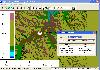 Global Mapper is more than just a utility; it has built in functionality for distance and area calculations, raster blending, feathering, spectral analysis and contrast adjustment, elevation querying, line of sight calculations, cut-and-fill volume calculations, as well as advanced capabilities...
Platforms: Windows, Other
Global Mapper is more than just a utility; it has built in functionality for distance and area calculations, raster blending, feathering, spectral analysis and contrast adjustment, elevation querying, line of sight calculations, cut-and-fill volume calculations, as well as advanced capabilities...
Platforms: Windows, Other
| License: Shareware | Cost: $399.00 USD | Size: 11.24 MB | Download (110): Create Better Maps with Global Mapper 13 Download |
Added: June 27, 2013 | Visits: 389
A really wonderful software to visualise and analyse GPS traces in many different ways (speed and elevation variation, etc.), with different background maps (hiking map, road map, orienteering map, aerial image, cycling map, etc.). It is possible to make KML exports.
Platforms: Mac
| License: Shareware | Cost: $0.00 USD | Size: 13.56 MB | Download (51): chmuk Download |
Added: May 10, 2013 | Visits: 467
It needs as an input the value for wind speed to generate a stochastic sea-surface one-dimensional realization.It uses the Pierson-Moskowitz spectrum. Requirements: - MATLAB 7 or higher
Platforms: Windows, Mac, *nix, Matlab, BSD Solaris
| License: Freeware | Download (58): Sea elevation Download |
Added: July 07, 2013 | Visits: 469
The actual version requires the following MATLAB toolboxes:- Mapping toolbox (for elevation())- Image Processing Toolbox (for imshow())A providing of toolbox independent functions would be greatly acknowledged.You may tweak the sourcecode to adjust the following information:- Receiver Position-...
Platforms: Matlab
| License: Freeware | Size: 92.16 KB | Download (40): Giove-A/B Orbit Simulator Download |
Added: June 18, 2013 | Visits: 452
-function angles=satang4(strSys1,latA,longA,longsat,strSys2,latB,longB)-calculation of satellite angles: elevation, azimuth, and also relative azimuth and baseline orientation if input data-belongs to two sites-Sources:-Digital satellite communications, 2nd Ed. Author Tri Ha, for satellite...
Platforms: Matlab
| License: Freeware | Size: 10 KB | Download (43): satang Download |
Added: August 20, 2013 | Visits: 355
A variation of Matlab's sph2cart, that transforms a vector of radar coordinates (Range, Azimuth, Elevation) to Cartesian coordinates (East, North, Up). Note the different definition of radar coords vs. spherical coords, which require this different function (see exact definitions within the help...
Platforms: Matlab
| License: Shareware | Cost: $0.00 USD | Size: 10 KB | Download (40): rae2xyz Download |
Added: August 02, 2013 | Visits: 436
A variation of Matlab's cart2sph, that transforms a vector of Cartesian coordinates (East, North, Up) to radar coordinates (Range, Azimuth, Elevation). Note the different definition of radar coords vs. spherical coords, which require this different function (see exact definitions within the help...
Platforms: Matlab
| License: Freeware | Size: 10 KB | Download (44): xyz2rae Download |
Added: May 15, 2013 | Visits: 539
A collection of functions for calculating the upslope area and related measurements for a digital elevation model (DEM).Based on the method of Tarboton.See also the upslope area postings on my image processing blog, March-August 2007, http://blogs.mathworks.com/steve.Requires Image Processing...
Platforms: Matlab
| License: Freeware | Size: 307.2 KB | Download (44): Upslope area functions Download |
Added: July 28, 2013 | Visits: 323
RaDec2AzEl will take the Right Ascension and Declination in the topocentric reference frame, site latitude and longitude as well as a time in GMT and output the Azimuth and Elevation in the local horizon reference frame.List of Inputs:Topocentric Right Ascension (Degrees)Topocentric Declination...
Platforms: Matlab
| License: Shareware | Cost: $0.00 USD | Size: 10 KB | Download (39): Convert Right Ascension and Declination to Azimuth and Elevation Download |
Added: June 13, 2013 | Visits: 442
Calculates: Azimuth, Elevation Angle, Slant range, Coverage Angle/Area
Platforms: Matlab
| License: Shareware | Cost: $0.00 USD | Size: 20.48 KB | Download (51): Satellite Calculator Download |
Added: June 22, 2013 | Visits: 433
It needs as an input the value for wind speed to generate a stochastic sea-surface one-dimensional realization.It uses the Pierson-Moskowitz spectrum.
Platforms: Matlab
| License: Freeware | Size: 10 KB | Download (44): Sea elevation Script Download |
Added: July 25, 2013 | Visits: 437
SimpleDEMViewer reads Digital Elevation Model (DEM) data and shows colored elevation map on a Mac screen. It can make bird's-eye views, stereographs and others. DEMs supported gtopo30, hydro1k, srtm, srtm dted, srtm30plus, etopo2, etopo5, globe, gdem some bil forms, usgs ascii DEMs, DEMs from...
Platforms: Mac
| License: Freeware | Size: 3.09 MB | Download (40): SimpleDEMViewer Download |
Added: October 11, 2013 | Visits: 408
The g3DGMV program was designed as a free viewer for Digital Elevation Model (DEM ) and Digital Line Graphs (DLG ) maps. Both of these formats are available from various locations on the web. These maps are rendered by g3DGMV as 3D images that can be manipulated by the user and view from...
Platforms: *nix
| License: Freeware | Size: 296.96 KB | Download (33): G3DGMV Download |
Released: March 01, 2024
|
Added: March 14, 2024 | Visits: 2.699
 IP2Location IP-COUNTRY-REGION-CITY-LATITUDE-LONGITUDE-ZIPCODE-TIMEZONE-ISP-DOMAIN-NETSPEED-AREACODE-WEATHER-MOBILE-ELEVATION-USAGETYPE is commercial IP geolocation database that translates IP address to country, region, city, latitude, longitude, zip code, time zone, ISP name, domain name, net...
Platforms: Windows, Windows 8, Windows 7, Windows Server
IP2Location IP-COUNTRY-REGION-CITY-LATITUDE-LONGITUDE-ZIPCODE-TIMEZONE-ISP-DOMAIN-NETSPEED-AREACODE-WEATHER-MOBILE-ELEVATION-USAGETYPE is commercial IP geolocation database that translates IP address to country, region, city, latitude, longitude, zip code, time zone, ISP name, domain name, net...
Platforms: Windows, Windows 8, Windows 7, Windows Server
| License: Data Only | Cost: $3399.00 USD | Size: 94.54 MB | Download (764): IP2Location Geolocation Database Download |
Released: December 30, 2014
|
Added: December 31, 2014 | Visits: 834
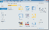 Floor Plan Maker is perfect not only for professional-looking floor plan, office layout, home plan, seating plan, but also garden design, fire and emergency plan, HVAC, elevation diagram... and that is just the beginning!
Platforms: Windows, Windows 8, Windows 7
Floor Plan Maker is perfect not only for professional-looking floor plan, office layout, home plan, seating plan, but also garden design, fire and emergency plan, HVAC, elevation diagram... and that is just the beginning!
Platforms: Windows, Windows 8, Windows 7
| License: Shareware | Cost: $69.00 USD | Size: 39.58 MB | Download (54): Floor Plan Maker Download |