


Dss Satellite software
Dss Satellite
Released: July 15, 2012
|
Added: July 15, 2012 | Visits: 395
 PreviSat is a satellite tracking program designed for observing purposes. Very easy to use, it shows the positions of satellites in real-time or manual mode. PreviSat is able to make predictions of their passes and also Iridium flares.
Platforms: Windows
| License: Freeware | Size: 1.2 MB | Download (389): PreviSat Download |
Released: July 14, 2012
|
Added: July 14, 2012 | Visits: 537
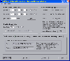 GEOPoint is an easy to use satellite antenna pointing calculator, for geostationary communications satellites. It calculates the azimuth and elevation pointing angles from a given location on the earth towards a specified geostationary satellite. The program also calculates polarisation tilt...
Platforms: Windows
| License: Freeware | Size: 2.1 MB | Download (406): GEOPoint Download |
Released: August 23, 2012
|
Added: August 23, 2012 | Visits: 628
 The Virtual Moon Atlas Pro allows you to explore and analyze the sophisticated natural satellite known as the Moon.
A complex but easy to use software and a 3D image database.
The Virtual Moon Atlas Pro allows you to explore and analyze the sophisticated natural satellite known as the Moon.
A complex but easy to use software and a 3D image database.
Platforms: Windows
| License: Freeware | Download (451): Virtual Moon Atlas Download |
Released: October 26, 2012
|
Added: October 26, 2012 | Visits: 529
 See satellite-eye views of different parts of Europe. See pictures of Spain, England, France, Denmark, Sweden, Ireland, Germany, Italy and more.This 32-bit screen-saver engine rotates photos of different locations of Europe as seen on clear days from the earth's orbit. Over a dozen visual effects...
Platforms: Windows
| License: Shareware | Cost: $14.95 USD | Size: 2.19 MB | Download (46): A View fom Space- Europe Screensaver Download |
Released: August 16, 2012
|
Added: August 16, 2012 | Visits: 761
 Privacyware's award-winning IIS Web Application Firewall and Host Intrusion Prevention solution, ThreatSentry, stops a wide range of web application threats and helps IT departments certify compliance with PCI DSS. ThreatSentry delivers protection from SQL Injection, Directory Traversal,...
Platforms: Windows
| License: Shareware | Cost: $649.00 USD | Size: 9.22 MB | Download (431): ThreatSentry - Web Application Firewall Download |
Released: June 10, 2012
|
Added: June 10, 2012 | Visits: 483
 Once you have made the decision to switch to satellite television software for your computer, you'll need to find a service that is right for you. Not all satellite software is equal, and each service has its strengths and weaknesses. We've compared two of the best to help you make your choice....
Platforms: Windows, Mac, OS/2, Unix, Linux, Linux Console, Linux Gnome, Linux GPL, Linux Open Source, MS-DOS, AS/400
| License: Freeware | Size: 175 KB | Download (57): FTA Files Download |
Released: September 06, 2012
|
Added: September 06, 2012 | Visits: 403
You don?t need a satellite dish, receiver, or any cable or satellite service! All you need is an internet connection and a computer. Watch all these channels anywhere in the world. More than 100,000 users are already enjoying the incredible variety.
Platforms: Windows
| License: Shareware | Cost: $49.00 USD | Size: 883 KB | Download (51): PC Satellite TV BOX Download |
Released: June 12, 2012
|
Added: June 12, 2012 | Visits: 482
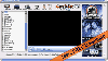
 DreamBoxTools - a program for tuning your DreamBox satellite receiver. Control your receiver right from the computer. Main features: - Lyngsat-to-Dreambox transponders parser. Update satellites.xml directly from the site Lyngsat.com - Satellite filter - Europe, Asia, Atlantic, America, only HD,...
Platforms: Windows, Other, Not Applicable
| License: Freeware | Size: 1013.76 KB | Download (59): DreamBox Tools Download |
Released: October 04, 2012
|
Added: October 04, 2012 | Visits: 1.184
 Dont pay silly money for Satellite TV on PC services, 2000+ TV Channels for Free on your PC + free Lifetime updates. Now!.. Gogglebox TV™ software is New and Updated Jan 2008! with Superb FREE Bonus items. A Simply UNBEATABLE Deal! WORKS WITH ALL VERSIONS OF WINDOWS (95, 98, NT, ME, 2000, XP)....
Platforms: Windows
| License: Freeware | Size: 778 KB | Download (95): Gogglebox TV Free Download |
Released: July 18, 2012
|
Added: July 18, 2012 | Visits: 467
 Catfood Desktate is an eye catching earth simulator that combines satellite imagery, near real time cloud data and optional layers including political borders and place names. The continuously updated result can be set as your desktop wallpaper or used as a screensaver. Desktate features include:...
Platforms: Windows
| License: Shareware | Cost: $19.95 USD | Size: 9.8 MB | Download (46): Catfood Desktate Download |
Released: August 15, 2012
|
Added: August 15, 2012 | Visits: 617
 North America Weather Satellite Screen Saver shows a satellite view of weather conditions in North America when the screen saver activates. Weather bugs will appreciate this real time weather monitor during their computer down time, giving them alternating views of various regions of the North...
Platforms: Windows
| License: Shareware | Cost: $3.99 USD | Size: 910 KB | Download (46): North America Weather Sat Screensaver Download |
Released: January 02, 2013
|
Added: January 02, 2013 | Visits: 689
 SkyGrabber is offline satellite internet downloader. It intercepts satellite data( movie, music, pictures ) that downloadind by other users and saves information in your hard disk. So, you'll get new movie, best music and funny pictures for free. You don't have to keep an online internet...
Platforms: Windows
| License: Shareware | Cost: $25.95 USD | Size: 3.7 MB | Download (455): SkyGrabber Download |
Released: July 18, 2012
|
Added: July 18, 2012 | Visits: 793
 Create own true to scale maps, store online maps locally with Vivo techology, map editor, dataexchange with Google Earth by Copy and Paste, GPS enabled coordinates, import of free OpenStreatMap data and GPS Exchange and GPS logger data, compatible with "GPS for Google Earth", area calculation...
Platforms: Windows
| License: Shareware | Cost: $65.00 USD | Size: 6.36 MB | Download (398): Dr. Regener LandMap Vivo Download |
Released: October 27, 2012
|
Added: October 27, 2012 | Visits: 552
MySatellite can download and combine every Google Maps tile (road map, terrain or satellite) between two chosen Earth coordinates into one big image. Then, for example, that map can be printed out for your own use.
Platforms: Mac
| License: Shareware | Cost: $10.00 USD | Size: 102.4 KB | Download (58): MySatellite Download |
Added: May 10, 2013 | Visits: 496
GPSTk project provides you an open source library for the satellite navigation management. The GPSTk library provides the base functionality for the GPSTk applications and for a number of other independent projects. There are several categories of functions in the GPSTk library: - GPS time....
Platforms: Windows, Mac, *nix, C/C++, BSD Solaris
| License: Freeware | Download (53): GPSTk Library Download |
Added: July 08, 2013 | Visits: 439
SATGLOBE4 - This file is a higher-resolution version of "SATGLOBE," provided at the request of several users. SATGLOBE4 renders a fully manipulatable satellite view of earth at a resolution of four pixels per degree, with added international political boundaries and gridlines. The imagery was...
Platforms: Matlab
| License: Freeware | Size: 1.22 MB | Download (42): SATGLOBE4 - Visualizing Earth from Space: 3-D Rendering of NASA Satellite Imagery Download |
Added: June 18, 2013 | Visits: 449
-function angles=satang4(strSys1,latA,longA,longsat,strSys2,latB,longB)-calculation of satellite angles: elevation, azimuth, and also relative azimuth and baseline orientation if input data-belongs to two sites-Sources:-Digital satellite communications, 2nd Ed. Author Tri Ha, for satellite...
Platforms: Matlab
| License: Freeware | Size: 10 KB | Download (43): satang Download |
Added: August 13, 2013 | Visits: 392
In large scale mapping projects with numerous satellite images, it is useful to have a vector file depicting the boundary of the images. This script when run from the folder containing the images, it automatically detects the geotiffs and extracts their image area boundary and constructs a...
Platforms: Matlab
| License: Freeware | Size: 10 KB | Download (49): GeoTiff PathRow Download |
Added: September 12, 2013 | Visits: 415
A standard problem in satellite retrievals is finding the file day and granule data on the DAAC associated with a particular lat/lon and also finding the Greenwich Mean Time associated with a sounding.This set of files will find file day and granule and GMT for a particular lat/lon based on the...
Platforms: Matlab
| License: Freeware | Size: 10 KB | Download (43): get_granule,get_gmt Download |
Added: August 06, 2013 | Visits: 375
The routine parses a TLE file and extracts informations from a selected satellite.It then calls the SGP4 propagator, converts the orbit in the ECI reference into Earth Centered Earth Fixed and also into Lat Long Heigth.This subroutine includes an example of the ENVISAT satellite in which the...
Platforms: Matlab
| License: Freeware | Size: 143.36 KB | Download (50): SAT_ORBIT Script Download |