


Digital Terrain Model Contact Php software
Digital Terrain Model Contact Php
Released: November 07, 2014
|
Added: November 19, 2014 | Visits: 819
 Importation/Exportation: Import/export trails to gpx file. Unlimited number of trails, and TrackPoints. Export to gpx, Excel, PDF, XPS and KML/KMZ.
Data table: Very flexible data table that allows sorting by columns, with inheritance of data, attributes, etc.
Presentation on map: View...
Importation/Exportation: Import/export trails to gpx file. Unlimited number of trails, and TrackPoints. Export to gpx, Excel, PDF, XPS and KML/KMZ.
Data table: Very flexible data table that allows sorting by columns, with inheritance of data, attributes, etc.
Presentation on map: View...
Platforms: Windows, Windows 8, Windows 7, Windows Server
| License: Freeware | Size: 27.05 MB | Download (611): ediTrail Download |
Released: August 05, 2011
|
Added: August 29, 2011 | Visits: 932
 In FastTerrain you are able to create, edit and visualize in 3D space digital terrain models. The program includes functionalities for break-lines and holes insertion as well as volume calculations and contours lines creation. With FastTerrain you can estimate excavation volumes by using digital...
Platforms: Windows
| License: Shareware | Cost: $171.56 USD | Size: 30.35 MB | Download (1542): FastTerrain Download |
Released: January 05, 2002
|
Added: March 18, 2006 | Visits: 3.061
 The 'X' in Digital 'X' Model represents 'T' in terrain model, 'G' in ground or geological model.
Rockmates Digital 'X' Model I ( DXM I ) creates contours isopachytes from a triangular mesh. Contours can be labelled, and printed. Lists of coordinates in text files can be read, triangulated and...
The 'X' in Digital 'X' Model represents 'T' in terrain model, 'G' in ground or geological model.
Rockmates Digital 'X' Model I ( DXM I ) creates contours isopachytes from a triangular mesh. Contours can be labelled, and printed. Lists of coordinates in text files can be read, triangulated and...
Platforms: Windows
| License: Shareware | Cost: $86.00 USD | Size: 364 KB | Download (487): DXM Download |
Released: November 25, 2012
|
Added: November 25, 2012 | Visits: 635
 Acumen is a simple, robust digital library system using PHP, MySQL, and Apache. Easy to set up and administer, does not complicate workflows, supports all browsers, and automatically creates and updates its own index database.
Platforms: Mac, Linux
| License: Freeware | Size: 2.26 MB | Download (48): Acumen Digital Library Sytem Download |
Released: September 27, 2009
|
Added: October 01, 2009 | Visits: 2.203
 There is not any professional program on internet like this and you can get it without any effort. I think this could be a handicap because it's dificult to believe, but it's true; try it and you'll be surprised.
It's not only a program to calculate a delaunay triangulation but you can input...
There is not any professional program on internet like this and you can get it without any effort. I think this could be a handicap because it's dificult to believe, but it's true; try it and you'll be surprised.
It's not only a program to calculate a delaunay triangulation but you can input...
Platforms: Windows
| License: Freeware | Size: 12.28 MB | Download (307): LanDTM Download |
Released: October 09, 2015
|
Added: January 07, 2016 | Visits: 3.755
 Eye4Software Hydromagic is hydrographic survey software for Windows. It can be used to generare depth maps using a GPS or RTK receiver and an echosounder or fishfinder.
After recording the sounding, you can generate DTM's (Digital Terrain Models), depth contours, 3D views and cross-sections....
Eye4Software Hydromagic is hydrographic survey software for Windows. It can be used to generare depth maps using a GPS or RTK receiver and an echosounder or fishfinder.
After recording the sounding, you can generate DTM's (Digital Terrain Models), depth contours, 3D views and cross-sections....
Platforms: Windows, Windows 8, Windows 7, Windows Server
| License: Demo | Cost: $1549.93 USD | Size: 83.02 MB | Download (170): Eye4Software Hydromagic Download |
Added: May 15, 2013 | Visits: 538
A collection of functions for calculating the upslope area and related measurements for a digital elevation model (DEM).Based on the method of Tarboton.See also the upslope area postings on my image processing blog, March-August 2007, http://blogs.mathworks.com/steve.Requires Image Processing...
Platforms: Matlab
| License: Freeware | Size: 307.2 KB | Download (44): Upslope area functions Download |
Added: September 02, 2013 | Visits: 348
Calculate hillshade for a digital elevation model (DEM) based on the algorithm posted on http://edndoc.esri.com/arcobjects/9.2/net/...shade_works.htmGenerated By Felix Hebeler, Dept. of Geography, University Zurich, February 2007.
Platforms: Matlab
| License: Shareware | Cost: $0.00 USD | Size: 655.36 KB | Download (44): esri hillshade algorithm Download |
Released: August 05, 2012
|
Added: August 05, 2012 | Visits: 603
 GeoDLL supports the development of geodetic software on various platforms by providing geodetic functions. GeoDLL contains precise calculations on the themes 2D and 3D coordinate transformation, geodetic datum shift and reference system converting, meridian strip changing, user defined coordinate...
Platforms: Windows, Handheld/Mobile Other, Java, Pocket PC
| License: Shareware | Cost: $275.00 USD | Size: 1.7 MB | Download (44): GeoDLL (English) Download |
Released: December 21, 2012
|
Added: December 21, 2012 | Visits: 505
The Matlab SRTM Library is designed to be an easy-to-use interface for importing and manipulating NASA's Shuttle Radar Topography Mission (SRTM) Digital Elevation Model (DEM) dataset.
Platforms: Windows, Mac, Linux
| License: Freeware | Size: 175.61 KB | Download (52): Matlab SRTM Library Download |
Added: August 15, 2013 | Visits: 755
Simple function to calculate melt rates in meter water equivalent per year for a digital elevation model (DEM) based on positive degree days factor (PDD) using seasonal variation.User can specify factors: mean annual temperature, PDD_ice, seasonal variation in degrees and year length.Approach...
Platforms: Matlab
| License: Freeware | Size: 10 KB | Download (46): PDD Melt Download |
Released: May 03, 2014
|
Added: May 14, 2014 | Visits: 669
 GeoDLL supports the development of geodetic software on various platforms by providing geodetic functions. GeoDLL contains precise calculations on the themes 2D and 3D coordinate transformation, geodetic datum shift and reference system converting, meridian strip changing, user defined coordinate...
Platforms: Windows, Mac, *nix, Windows 8, Windows Phone, Windows 7, Windows Server, Android, Handheld, BlackBerry,iPhone,iPod,Palm
| License: Shareware | Cost: $690.00 USD | Size: 2.58 MB | Download (52): GeoDLL English Download |
Added: July 25, 2013 | Visits: 435
SimpleDEMViewer reads Digital Elevation Model (DEM) data and shows colored elevation map on a Mac screen. It can make bird's-eye views, stereographs and others. DEMs supported gtopo30, hydro1k, srtm, srtm dted, srtm30plus, etopo2, etopo5, globe, gdem some bil forms, usgs ascii DEMs, DEMs from...
Platforms: Mac
| License: Freeware | Size: 3.09 MB | Download (40): SimpleDEMViewer Download |
Added: October 11, 2013 | Visits: 405
The g3DGMV program was designed as a free viewer for Digital Elevation Model (DEM ) and Digital Line Graphs (DLG ) maps. Both of these formats are available from various locations on the web. These maps are rendered by g3DGMV as 3D images that can be manipulated by the user and view from...
Platforms: *nix
| License: Freeware | Size: 296.96 KB | Download (33): G3DGMV Download |
Released: August 04, 2012
|
Added: August 04, 2012 | Visits: 1.169
 PHP (recursive acronym for PHP: Hypertext Preprocessor) is a widely-used open source general-purpose scripting language that is especially suited for web development and can be embedded into HTML.
Instead of lots of commands to output HTML (as seen in C or Perl), PHP pages contain HTML with...
PHP (recursive acronym for PHP: Hypertext Preprocessor) is a widely-used open source general-purpose scripting language that is especially suited for web development and can be embedded into HTML.
Instead of lots of commands to output HTML (as seen in C or Perl), PHP pages contain HTML with...
Platforms: Linux
| License: Freeware | Size: 10 MB | Download (51): PHP for Linux Download |
Added: August 21, 2010 | Visits: 1.652
Studs MVC Framework+ contains a port of Apaches Jakarta Struts to PHP, though the libraries included in the rest of the project are much more vast. In order to implement the Struts port, it was necessary to build a core, object-oriented API in the style of the JDK and the Jakarta Commons, a...
Platforms: *nix
| License: Freeware | Size: 112.64 KB | Download (93): Studs MVC Framework+ Download |
Added: July 01, 2013 | Visits: 402
Digital elevation models can be considered just like an intensity images. Regardless of working with digital evevation models or digital images, they can be considered as a 2.5 dimensional surface, in which the row, column and grey level values represent the x, y and z respectively, using...
Platforms: Matlab
| License: Shareware | Cost: $0.00 USD | Size: 20.48 KB | Download (45): Image and Terrain Modeling using Incremental Delaunay Triangulation Download |
Released: December 29, 2010
|
Added: January 06, 2011 | Visits: 4.321
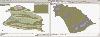
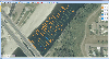
 OkMap is a GPS and map software that:
-Works with vectorial maps and calibrates raster maps
-Organizes paths by creating waypoints, routes and tracks
-Uploads/downloads data to/from your GPS
-Uses altitude DEM data
-Supports GPS real-time navigation
-Sends/receives vehicles position...
OkMap is a GPS and map software that:
-Works with vectorial maps and calibrates raster maps
-Organizes paths by creating waypoints, routes and tracks
-Uploads/downloads data to/from your GPS
-Uses altitude DEM data
-Supports GPS real-time navigation
-Sends/receives vehicles position...
Platforms: Windows
| License: Freeware | Size: 20.25 MB | Download (1277): OkMap Download |
Added: July 07, 2010 | Visits: 849
Fracplanet is an interactive tool for creating random fractal planets and terrain areas with oceans, rivers, lakes and icecaps. The results can be saved in POV-Ray format. The code is licensed under the GPL. Fracplanet project uses Qt and OpenGL. Whats New in This Release: - The main...
Platforms: *nix
| License: Freeware | Size: 68.61 KB | Download (135): Fracplanet Download |
Released: September 17, 2012
|
Added: September 17, 2012 | Visits: 649
 Global Mapper is more than just a utility; it has built in functionality for distance and area calculations, raster blending, feathering, spectral analysis and contrast adjustment, elevation querying, line of sight calculations, cut-and-fill volume calculations, as well as advanced capabilities...
Platforms: Windows
| License: Demo | Cost: $349.00 USD | Size: 30 MB | Download (547): Global Mapper x64 Download |