


Coordinates software
Coordinates
Released: March 04, 2004
|
Added: March 16, 2006 | Visits: 2.398
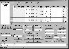
 DMControls.Lens is an efficient fully customizable control easily integrated in Microsoft Visual Studio .NET that enables you to retrieve the magnification scale of screen objects. Either selected bitmap objects or selected screen regions can serve as the source for zooming. There are three modes...
Platforms: Windows
| License: Shareware | Cost: $149.00 USD | Size: 1.08 MB | Download (470): DMControls.Lens .NET control Download |
Released: July 13, 2012
|
Added: July 13, 2012 | Visits: 784
 Geo Data German Admin contains geodata of the Federal Republic of Germany with geo referenced towns, municipalities, town quarters and other administrative units, postal codes, telephone preselections, nature areas, landscapes, climatic zones and official topographical cartographies.
The data...
Geo Data German Admin contains geodata of the Federal Republic of Germany with geo referenced towns, municipalities, town quarters and other administrative units, postal codes, telephone preselections, nature areas, landscapes, climatic zones and official topographical cartographies.
The data...
Platforms: Windows
| License: Freeware | Download (459): Geo Data German Admin (formerly Geodaten German Houses) Download |
Released: September 17, 2012
|
Added: September 17, 2012 | Visits: 503
GISEYE Coordinate Converter software is designed for conversion of coordinates from one map projection into another. List of coordinates and map projection parameters are specified by the user.This software product works under Windows and has an easy-to-use GUI. The application enables to do file...
Platforms: Windows
| License: Shareware | Cost: $29.00 USD | Size: 4.35 MB | Download (458): GISEYE Coordinate Converter Download |
Released: October 06, 2012
|
Added: October 06, 2012 | Visits: 511
With GeoIPTC you will be able to read the IPTC city information in pictures and get the corresponding coordinates to your photos from several free services and embed this into the pictures in standard tags in a very professional way. You will also create sets of pictures with all the metadata...
Platforms: Windows
| License: Shareware | Cost: $112.00 USD | Size: 7.32 MB | Download (455): GeoIPTC Geolocalisation de Photos Download |
Released: August 23, 2012
|
Added: August 23, 2012 | Visits: 485
Copan is a very efficient and easy-to-use geomatics engineering tool for computing and managing plane survey coordinates. It does numerous coordinate geometry (COGO) calculations, processes and adjusts raw field survey data, computes and adjusts map traverse data, performs map checks, calculates...
Platforms: Windows
| License: Freeware | Download (450): Copan Download |
Released: November 01, 2023
|
Added: December 19, 2023 | Visits: 676
 [FRANCE] Utility that extracts email addresses and full contact information from the yellow pages. After making your selection this small software goes through all the pages and extracts the data from the pages of the site. International languages. The interface is simple and its use is very...
Platforms: Windows, Mac, *nix, Windows 8, Windows 7, Windows Server, Java,Other
| License: Shareware | Cost: $23.00 USD | Size: 1.66 MB | Download (447): PJPro Download |
Released: June 05, 2012
|
Added: June 05, 2012 | Visits: 871
InnerSoft CAD is a add-on component for AutoCAD that allows you to Export the values of an Area/ Length property or coordinates to an Excel Sheet.
Import the vertex coordinates for a set of 2D polylines or 3D polylines from an Excel Sheet (you can choose between 3 different methods).
You can...
Platforms: Windows
| License: Freeware | Download (445): InnerSoft CAD for AutoCAD 2011 Download |
Released: September 16, 2012
|
Added: September 16, 2012 | Visits: 596
 InnerSoft CAD is a add-on for AutoCAD. This group of tools will allows you to: Export to a Excel Sheet the values of Area/Length property or coordinates for various AutoCAD entities. Import from a Excel Sheet the vertex coordinates for a set of 2D polylines or 3D polylines (you can choose between...
Platforms: Windows, Other
| License: Shareware | Cost: $70.00 USD | Size: 1.97 MB | Download (444): InnerSoft CAD for AutoCAD 2007 Download |
Released: January 28, 2012
|
Added: February 09, 2012 | Visits: 812
 KMLReduce optimizes the size of KML files by analyzing, reducing, and removing coordinates from polygons contained within the file. This allows you to distribute the KML file online and use less traffic for users and services accessing the fille.
KMLReduce works on KML files that contian...
KMLReduce optimizes the size of KML files by analyzing, reducing, and removing coordinates from polygons contained within the file. This allows you to distribute the KML file online and use less traffic for users and services accessing the fille.
KMLReduce works on KML files that contian...
Platforms: Windows
| License: Shareware | Cost: $24.95 USD | Size: 636.75 KB | Download (437): KMLReduce Download |
Released: July 26, 2012
|
Added: July 26, 2012 | Visits: 493
 XLPoints Plus is the easiest way to massively draw points in AutoCAD and generate 3D models using coordinate data in Excel. Key Features: - Quickly draw points using coordinate data in Excel. - Create new drawings or update existing ones by establishing an open channel with AutoCAD. - Create...
Platforms: Windows
| License: Shareware | Cost: $30.00 USD | Size: 1.66 MB | Download (433): XLPoints Plus Download |
Released: July 18, 2012
|
Added: July 18, 2012 | Visits: 792
 Create own true to scale maps, store online maps locally with Vivo techology, map editor, dataexchange with Google Earth by Copy and Paste, GPS enabled coordinates, import of free OpenStreatMap data and GPS Exchange and GPS logger data, compatible with "GPS for Google Earth", area calculation...
Platforms: Windows
| License: Shareware | Cost: $65.00 USD | Size: 6.36 MB | Download (398): Dr. Regener LandMap Vivo Download |
Released: July 20, 2012
|
Added: July 20, 2012 | Visits: 517
With GeopIPTC you will be able to read the IPTC city information in pictures and get the corresponding coordinates to your photos from several free services and embed this into the pictures in standard tags in a very professional way. You will also create sets of pictures with all the metadata...
Platforms: Windows
| License: Shareware | Cost: $104.55 USD | Size: 7.32 MB | Download (382): GeoIPTC Download |
Released: April 01, 2004
|
Added: September 06, 2006 | Visits: 5.880
Warehouse management software (WMS) automates the flow of information and coordinates key activities in a warehouse or distribution center, in order to maximize efficiency.
Platforms: Windows
| License: Shareware | Cost: $49.00 USD | Size: 8.5 MB | Download (381): Mipsis Warehouse Inventory Management Software Download |
Released: July 13, 2017
|
Added: August 30, 2017 | Visits: 4.507
 TRANSDAT geosoftware executes coordinate transformations and geodetic datum shifts between many coordinate and reference systems of America, Australasia, Europe, Germany special and world-wide, with high precision and high speed: 1.The current and historical coordinate and reference systems of...
Platforms: Windows, Windows 8, Windows 7, Windows Server
| License: Shareware | Cost: $170.00 USD | Size: 4.43 MB | Download (325): TRANSDAT Download |
Released: November 01, 2023
|
Added: December 17, 2023 | Visits: 206
 [MOROCCO] Utility that extracts email addresses and full contact information from the yellow pages. After making your selection this small software goes through all the pages and extracts the data from the pages of the site. International languages. The interface is simple and its use is very...
Platforms: Windows, Mac, *nix, Windows 8, Windows 7, Windows Server, Java,Other
| License: Shareware | Cost: $23.00 USD | Size: 1.68 MB | Download (307): PMaPro Download |
Released: November 20, 2015
|
Added: April 20, 2016 | Visits: 3.087
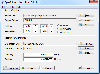 The Eye4Software Coordinate Calculator is an easy to use tool to perform map or GPS coordinate conversions. The software can be used to transform a single coordinate or a batch of coordinates read from a comma separated, database or ESRI shapefiles. The software is shipped with a MS Access...
Platforms: Windows, Windows 7
| License: Shareware | Cost: $119.00 USD | Size: 8.96 MB | Download (249): Eye4Software Coordinate Calculator Download |
Added: August 09, 2008 | Visits: 1.292
Gauss displays lines and surfaces defined algebraically in 3D space in many forms, including z=f(x,y), cylindrical polar coordinates, and parametric definitions with one (giving a line) and two (surface) parameters. View controls move the viewpoint through 3D space, using keyboard and mouse....
Platforms: Windows
| License: Freeware | Size: 962 KB | Download (217): Gauss Download |
Added: May 25, 2006 | Visits: 6.736
 Calc 3D is a collection of mathematical tools for highschool and university. The calculator can do statistics, best fits, function plotting, integration. It handles vectors, matrices, complex numbers, coordinates, regular polygons and intersections. For objects ( like point, line, plane and...
Platforms: Windows
| License: Shareware | Cost: $159.50 USD | Size: 4.13 MB | Download (216): Calc 3D Pro Download |
Released: April 24, 2013
|
Added: May 12, 2013 | Visits: 2.311
 Arm Map Explorer recreates all the functionalities of Google Maps on your desktop while expanding them with new extras. Map Explorer lets you locate and view any place on the planet using dynamic interactive maps. These maps are draggable, which means there is no need for you to click and wait...
Platforms: Windows
| License: Freeware | Size: 5.46 MB | Download (203): Arm Map Explorer Download |
Released: December 30, 2019
|
Added: January 08, 2020 | Visits: 3.971
 SEVENPAR is a tool for the calculation of highly exact transformation parameters for the Spatial Helmert and Molodensky Transformation, which make possible precise coordinate transformations from one reference system into another. The determined transformation parameters can be entered directly...
Platforms: Windows, Windows 8, Windows 7, Windows Server
| License: Shareware | Cost: $145.00 USD | Size: 2.78 MB | Download (194): SEVENPAR Download |