


Breathtaking Satellite Images software
Breathtaking Satellite Images
Released: August 20, 2012
|
Added: August 20, 2012 | Visits: 681
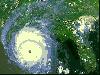
 View amazing satellite images of earth with the free version of google earth software.Google earth is a totally free software which enables you zoom in from satellite,view,rotate or tilt just like a camera of the entire earth inside your pc.It works just point and click on any part of earth or by...
Platforms: Windows
| License: Freeware | Size: 798 KB | Download (529): Free Satellite images Download |
Released: August 11, 2014
|
Added: October 09, 2014 | Visits: 1.061
 Maps Downloader For Google Satellite is a smart tool which can help you download tile satellite images from google map fastly and stably.It can stitch tile images into one big seamless image:Software can stitch tile images into one big seamless image such as GeoTIFF and GeoJPEG. But if the...
Platforms: Windows, Windows 7, Windows Server
| License: Shareware | Cost: $49.95 USD | Size: 4.74 MB | Download (1240): Maps Downloader For Google Satellite |
Released: July 01, 2012
|
Added: July 01, 2012 | Visits: 509
Can you imagine how large an satellite image is, which has dimensions of 86400 pixels wide and 43200 pixels high?This is a simple article which describes the Worlds Largest Satellite Images.See the largest satellite images using a free software which is included inside.This free software will...
Platforms: Windows
| License: Freeware | Size: 590 KB | Download (523): Largest Satellite Images Download |
Added: August 13, 2013 | Visits: 396
In large scale mapping projects with numerous satellite images, it is useful to have a vector file depicting the boundary of the images. This script when run from the folder containing the images, it automatically detects the geotiffs and extracts their image area boundary and constructs a...
Platforms: Matlab
| License: Freeware | Size: 10 KB | Download (49): GeoTiff PathRow Download |
Released: November 06, 2004
|
Added: July 05, 2006 | Visits: 3.085
 Eye in the Sky screensaver contains 43 detailed satellite images of Earth. The following images are included: Antarctica, Argentina, Asian dust cloud over Korea and Japan, Australia, Bahamas, Bosporus Straits - Turkey, Central America, Coral Atolls, Cuba Florida and Bahamas, Cypress, Dasht-e...
Platforms: Windows
| License: Demo | Cost: $11.00 USD | Size: 4.54 MB | Download (117): Eye in the Sky Download |
Added: January 25, 2010 | Visits: 783
X-Sat is a utility that downloads directly from the Internet the latest satellite images among a predefined set of areas (Earth, USA, Europe, Africa, Asia...). You can configure X-Sat to download automatically a given satellite image each time you launch it.
Platforms: Mac
| License: Shareware | Cost: $0.00 USD | Size: 72 KB | Download (171): X-Sat X Download |
Released: September 24, 2012
|
Added: September 24, 2012 | Visits: 531
Simultaneously displays animated radar and satellite images for multiple locations in the United States. The user can configure data source types and visual preferences.
Platforms: Mac
| License: Freeware | Size: 2.6 MB | Download (47): RadSat for Mac OS Download |
Released: July 18, 2012
|
Added: July 18, 2012 | Visits: 501
 QWeather shows the current Satellite images (sky and cloud conditions) (440x300 pixel). The easiest and quickest way to view the current world wide images from The Weather Channel updated every 3 hours. In addition the program can animate the last 12 maps already downloaded. Available maps: North...
Platforms: Windows
| License: Demo | Cost: $19.44 USD | Size: 911 KB | Download (46): QWeather - Quick Weather Download |
Released: October 31, 2023
|
Added: December 23, 2023 | Visits: 88
 google earth images downloader is a tool that help you to get offline satellite tile images from google earth (not google maps), including historical imagery. It can work without google earth installed. After downloading, there are some ways to view the offline maps: You can view downloaded...
Platforms: Windows 8, Windows 7, Windows
| License: Shareware | Cost: $55.00 USD | Size: 29.56 MB | Download (16): google earth images downloader |
Released: July 18, 2012
|
Added: July 18, 2012 | Visits: 467
 Catfood Desktate is an eye catching earth simulator that combines satellite imagery, near real time cloud data and optional layers including political borders and place names. The continuously updated result can be set as your desktop wallpaper or used as a screensaver. Desktate features include:...
Platforms: Windows
| License: Shareware | Cost: $19.95 USD | Size: 9.8 MB | Download (46): Catfood Desktate Download |
Released: October 14, 2012
|
Added: October 14, 2012 | Visits: 389
 This program is designed to predict the tracks of satellites both as paths above the earth, and as images produced by these satellites when scanning the ground. It was designed for use during the early stages of my weather satellite receiving activities, when clouds and interference prevented...
Platforms: Windows
| License: Demo | Cost: $28.95 USD | Size: 1.5 MB | Download (465): WXtrack Download |
Added: June 01, 2013 | Visits: 536
Your Planet Today displays a satellite map of the Earth in the sidebar of your blog. With the Google Maps integration, you can zoom in and pan around. All the satellite images used to generate the map are between 3 and 36 hours old. With this widget you can monitor global weather patterns, dust...
Platforms: PHP
| License: Freeware | Size: 10 KB | Download (41): Your Planet Today widget Download |
Released: January 13, 2014
|
Added: October 09, 2014 | Visits: 844
 Maps Downloader For Google Terrain is a smart tool which can help you download tile satellite images from google map fastly and stably.It can stitch tile images into one big seamless image:Software can stitch tile images into one big seamless image such as GeoTIFF and GeoJPEG. But if the...
Platforms: Windows, Windows 7, Windows Server
| License: Shareware | Cost: $49.95 USD | Size: 4.72 MB | Download (1234): Maps Downloader For Google Terrain |
Added: July 09, 2006 | Visits: 2.766
 The Heavens Declare replaces that boring Windows bootup screen with inspirational Bible verses and breathtaking nature images. The Heavens Declare will randomly display a Bible verse on your screen in place of the Microsoft Windows start up screen. Rather than stare at that boring and meaningless...
| License: Shareware | Cost: $8.95 USD | Size: 890 KB | Download (162): The Heavens Declare Download |
Released: May 10, 2003
|
Added: April 15, 2006 | Visits: 2.911
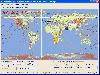
 World Time is a simple to use but intelligent graphical utility that displays in real time, not only the time in cities around the world, but it also features viewable time zones, which displays night and day around the world. World Time features cloud maps, which allow you to view animated cloud...
Platforms: Windows
| License: Shareware | Cost: $1.02 USD | Size: 8.82 MB | Download (139): Trellian Worldtime Download |
Released: September 01, 2008
|
Added: September 06, 2008 | Visits: 2.352
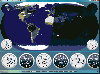 ActiveEarth is a world time clock with a gorgeous day/night merge of NASA's Visible Earth satellite images in flat maps or a globe, with a row of user-definable clocks along the bottom. These clocks are beautiful, scalable, ticking, analog or digital clocks that come in several styles with many...
Platforms: Windows
| License: Demo | Cost: $24.95 USD | Size: 3.54 MB | Download (186): ActiveEarth Download |
Released: June 06, 2012
|
Added: June 06, 2012 | Visits: 699
Weather Pulse is a powerful weather display program for the Internet. Display popular Satellite images from around the globe, share images with your friends and family, stay updated on current and expected weather conditions, it's just plain fun. Displays the current temperature in your Windows...
Platforms: Windows
| License: Freeware | Size: 5 MB | Download (56): Weather Pulse Download |
Released: December 24, 2012
|
Added: December 24, 2012 | Visits: 593
Imagenes satelite is a free satelite images slideshow screensaver for your desktop.View high resolution and beautihigh quality satelite images of earth from space.This screensavers contains full color images that fit automatically on your screen.View satellite images of earth from several...
Platforms: Windows
| License: Freeware | Size: 3.27 MB | Download (46): Satelite Earth Download |
Released: January 12, 2014
|
Added: September 18, 2014 | Visits: 786
 Maps Downloader For Google Map is a smart tool which can help you download tile satellite images from google map fastly and stably.It can stitch tile images into one big seamless image:Software can stitch tile images into one big seamless image such as GeoTIFF and GeoJPEG. But if the exported...
Platforms: Windows, Windows 7, Windows Server
| License: Shareware | Cost: $49.95 USD | Size: 4.71 MB | Download (1243): Maps Dwonloader For Google Map Download |
Released: July 23, 2014
|
Added: September 23, 2014 | Visits: 902
 Maps Downloader For Yahoo Map is a smart tool which can help you download tile satellite images from google map fastly and stably.It can stitch tile images into one big seamless image:Software can stitch tile images into one big seamless image such as GeoTIFF and GeoJPEG. But if the exported...
Platforms: Windows, Windows 7, Windows Server
| License: Shareware | Cost: $49.95 USD | Size: 4.84 MB | Download (1233): Maps Downloader For Yahoo Map |