


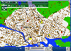
Asia Vector Map software
Asia Vector Map
Added: August 30, 2008 | Visits: 1.864
 Flash based map software that provides easy way to integrate interactive maps into any web application. It consists of Flash map engine (any maps can be loaded into it) and JavaScript bridge. JavaScript bridge provides connectivity functions - for example Flash map can be connected to database...
Platforms: Windows, *nix
| License: Shareware | Cost: $69.00 USD | Size: 639 KB | Download (524): Loris Vector Map Engine Download |
Released: October 14, 2012
|
Added: October 14, 2012 | Visits: 608
 This software offers a solution for users who want an interactive East Asia geography quiz. Simply drag and drop the correct name on East Asia countries on the map. When the user chooses the correct position on the map the country name will be displayed.
Platforms: Windows
| License: Shareware | Cost: $19.99 USD | Size: 1.33 MB | Download (745): East Asia Interactive Map Quiz Software Download |
Added: August 24, 2013 | Visits: 386
 Vector maps of arbitrary areas: free conversion utility With the shapefile-to-pmap converter, you can have vector maps of areas you are interested in converted for PrettyMap. ESRI provides shapefile maps for most areas of the world (however, their on-line service is no longer available)....
Platforms: Mac
| License: Shareware | Cost: $0.00 USD | Size: 6.01 MB | Download (41): PrettyMap vector map converter Download |
Released: October 11, 2012
|
Added: October 11, 2012 | Visits: 601
QLandkarte GT is a handy, easy to use program specially designed to offer users a ultimate outdoor aficionado's tool.
This application offers support for GPS maps in GeoTiff format as well as Garmin's img vector map format.
for WindowsXP, Vista, 7
Platforms: Windows, Windows Vista, 7
| License: Freeware | Download (498): QLandkarte GT Download |
Released: May 01, 2011
|
Added: May 21, 2011 | Visits: 2.586
 Anychart is a flexible Flash based-solution, which allows you to easily display any sort of data dealing with geographical locations. It contains United States Maps with Counties, World Map, etc. XML data file and a set of customizable options make AnyChart Maps a universal solution for web...
Platforms: OS/2, Windows, Mac, *nix, Windows CE, Pocket PC, Palm OS 6.0,Not Applicable,Handheld/Mobile Other,Java,MS-DOS,AS/400
| License: Shareware | Cost: $399.00 USD | Size: 10.27 MB | Download (118): AnyChart Flash Map Component Download |
Released: May 25, 2009
|
Added: May 28, 2009 | Visits: 2.950
 Three-level drill-down interactive map of World for websites and web developers. Easy adjustment.
Variants of using a map locator:
- Real-Estate websites
- Quick access to contact organization data, having affiliated network
With this fully-clickable map you will be able to improve...
Three-level drill-down interactive map of World for websites and web developers. Easy adjustment.
Variants of using a map locator:
- Real-Estate websites
- Quick access to contact organization data, having affiliated network
With this fully-clickable map you will be able to improve...
Platforms: Windows, Mac
| License: Demo | Cost: $999.00 USD | Size: 1023 KB | Download (506): 3-Level World Map Download |
Released: January 19, 2013
|
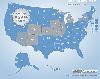
Added: January 19, 2013 | Visits: 952
 Multi-level Drill-down Interactive Map of USA for websites and web developers. Easy adjustment. Complete set includes all States. Variants of using a map product: - Real-Estate websites - Quick access to contact organization data, having affiliated network - Travel websites With this...
Platforms: Windows, Mac
| License: Demo | Cost: $599.00 USD | Size: 2.77 MB | Download (48): Multi-level Map of USA Download |
Released: November 14, 2012
|
Added: November 14, 2012 | Visits: 774
 Multi-level drill-down interactive map of World for websites and web developers. Easy adjustment. Complete set includes all continents. Variants of using a map locator: - Real-Estate websites - Quick access to contact organization data, having affiliated network With this fully-clickable map you...
Platforms: Windows, Mac
| License: Demo | Cost: $299.00 USD | Size: 686 KB | Download (54): Multi-level World Map (Complete set #2) Download |
Released: December 02, 2012
|
Added: December 02, 2012 | Visits: 787
 Multi-level drill-down interactive map of World for websites and web developers. Easy adjustment. Complete set includes all continents, European countries, USA and UK. Variants of using a map locator: - Real-Estate websites - Quick access to contact organization data, having affiliated network...
Platforms: Windows, Mac
| License: Demo | Cost: $799.00 USD | Size: 1024 KB | Download (58): Multi-level World Map (Complete set #1) Download |
Released: November 02, 2012
|
Added: November 02, 2012 | Visits: 724
 USA Flash map Silver Special Edition (include FLA). for web sites, interactive applications, presentations, and more. With this fully-clickable map you will be able to improve navigation and provide visitors with better and quicker access to information as well as improve the way you present the...
Platforms: Windows
| License: Demo | Cost: $59.00 USD | Size: 140 KB | Download (57): Flash Map USA Silver Special Edition (include FLA) Download |
Released: September 09, 2012
|
Added: September 09, 2012 | Visits: 429
GISEYE Vector Converter software for Windows is designed to convert vector data from one presentation format into another. The user has a rich functional that allows him to re-project vector maps into a wide range of available projections, to change vector name file, to combine vector maps by...
Platforms: Windows
| License: Shareware | Cost: $29.00 USD | Size: 9.77 MB | Download (444): GISEYE Vector Converter Download |
Released: June 13, 2012
|
Added: June 13, 2012 | Visits: 727
 View maps of Earth and other planets with PrettyMap! See current day and night regions, learn geography by taking the quiz, enjoy 3D elevation surfaces, measure distances between locations and create your own maps with special places! PrettyMap lets you view vector and raster maps and images...
Platforms: Windows, Pocket PC
| License: Shareware | Cost: $19.95 USD | Size: 4.02 MB | Download (56): PrettyMap - World Atlas and Maps, GPS Download |
Released: August 23, 2012
|
Added: August 23, 2012 | Visits: 667
 All-in-one software for creation of custom GPS maps compatible with Garmin GPS units. Mapwel supports routing, ESRI shapefiles, OpenStreetMap OSM, Google Earth KML and KMZ, cGPSmapper MP and GPX files. Mapwel custom GPS mapping capability and user icons editor are often used in forestry,...
Platforms: Windows
| License: Shareware | Cost: $45.00 USD | Size: 12.28 MB | Download (454): Mapwel Download |
Released: July 23, 2012
|
Added: July 23, 2012 | Visits: 484
T2K Pro integrates the rich world of GIS datasets and transfers your Geographic information data into Google earth. T2K Pro handles rich data types and access large volumes of geographic data stored in files and databases; T2K PRO handles raster (imagery), Vector Map data and GPS Tracks/...
Platforms: Windows
| License: Shareware | Cost: $90.00 USD | Size: 20.89 MB | Download (54): T2K Pro Download |
Released: July 25, 2007
|
Added: September 26, 2007 | Visits: 3.503
 AvisMap GIS Engine is a comprehensive SDK for the development of custom GIS applications and solutions. This SDK provides several ActiveX (OCX) controls which support Visual Basic, VB.NET, C#, Visual C++ and other ActiveX compatible programming languages, with Microsoft Visual Studio versions 6,...
Platforms: Windows
| License: Shareware | Cost: $199.00 USD | Size: 43.76 MB | Download (157): AvisMap GIS Engine Download |
Released: November 25, 2012
|
Added: November 25, 2012 | Visits: 626
 GENtle is a software for DNA and amino acid editing, database management, plasmid maps, restriction and ligation, alignments, sequencer data import, calculators, gel image display, PCR, and much more.
It is free software under GPLv2+.
Requested Features:
- Import of Vector NTI...
GENtle is a software for DNA and amino acid editing, database management, plasmid maps, restriction and ligation, alignments, sequencer data import, calculators, gel image display, PCR, and much more.
It is free software under GPLv2+.
Requested Features:
- Import of Vector NTI...
Platforms: Mac
| License: Freeware | Size: 3.7 MB | Download (600): GENtle for Mac OS X Download |
Released: July 12, 2012
|
Added: July 12, 2012 | Visits: 639
 GENtle is a software for DNA and amino acid editing, database management, plasmid maps, restriction and ligation, alignments, sequencer data import, calculators, gel image display, PCR, and much more.
It is free software under GPLv2+.
Requested Features:
- Import of Vector NTI...
GENtle is a software for DNA and amino acid editing, database management, plasmid maps, restriction and ligation, alignments, sequencer data import, calculators, gel image display, PCR, and much more.
It is free software under GPLv2+.
Requested Features:
- Import of Vector NTI...
Platforms: Linux
| License: Freeware | Size: 1.7 MB | Download (529): GENtle for Linux Download |
Released: September 02, 2012
|
Added: September 02, 2012 | Visits: 694
 GENtle is a software for DNA and amino acid editing, database management, plasmid maps, restriction and ligation, alignments, sequencer data import, calculators, gel image display, PCR, and much more.
It is free software under GPLv2+.
Requested Features:
- Import of Vector NTI...
GENtle is a software for DNA and amino acid editing, database management, plasmid maps, restriction and ligation, alignments, sequencer data import, calculators, gel image display, PCR, and much more.
It is free software under GPLv2+.
Requested Features:
- Import of Vector NTI...
Platforms: Windows
| License: Freeware | Size: 2.7 MB | Download (512): GENtle for Windows Download |
Released: September 07, 2014
|
Added: September 21, 2014 | Visits: 754
![]() With the new Icons-Land GIS/GPS/Map Vector Icons now it is much more comfortable to use local service applications, GPS tracking and GIS applications, and any kind of mapping applications.
GIS/GPS/Map Icons are meant to help users to orient oneself when using maps, to facilitate their...
With the new Icons-Land GIS/GPS/Map Vector Icons now it is much more comfortable to use local service applications, GPS tracking and GIS applications, and any kind of mapping applications.
GIS/GPS/Map Icons are meant to help users to orient oneself when using maps, to facilitate their...
Platforms: Windows, Mac, Windows 8, Windows 7, iOS
| License: Demo | Cost: $180.00 USD | Size: 5.56 MB | Download (40): Icons-Land GIS/GPS/MAP Vector Icons Download |
Released: August 07, 2012
|
Added: August 07, 2012 | Visits: 641
![]() Icons-Land Company advertises exclusive set of icons - Points of Interest Vector Icons. The images are represented in 4 variations of colors (green, blue, red, orange) and 2 variations of backgrounds (plain and circled). Colors variety helps distinguishing the same objects on the map by different...
Icons-Land Company advertises exclusive set of icons - Points of Interest Vector Icons. The images are represented in 4 variations of colors (green, blue, red, orange) and 2 variations of backgrounds (plain and circled). Colors variety helps distinguishing the same objects on the map by different...
Platforms: Windows
| License: Demo | Cost: $150.00 USD | Size: 1.48 MB | Download (57): Icons-Land POI Vector Icons Download |