


Arc Gis software
Arc Gis
Released: March 12, 2012
|
Added: April 02, 2012 | Visits: 1.077
 Visualize your data in 3D! Quick, easy and inexpensive. Graph Earth enables management, marketing and other business professionals to create stunning visual representations of their data, all without the time and costs associated with a full-featured GIS. Viewable by Everyone! Create one of a...
Platforms: Windows
Visualize your data in 3D! Quick, easy and inexpensive. Graph Earth enables management, marketing and other business professionals to create stunning visual representations of their data, all without the time and costs associated with a full-featured GIS. Viewable by Everyone! Create one of a...
Platforms: Windows
| License: Demo | Cost: $24.95 USD | Size: 469 KB | Download (96): Graph Earth Download |
Added: January 27, 2006 | Visits: 6.820
 Software development kit for CAD/CAM/ GIS and graphic software developers. Converts from raster to vector and refines architect, mechanical, tech drawing, maps, math graphs, graphics for books and journals and more. ActiveX and Com Component are also available. Refines vector graphics, creates...
Platforms: Windows
Software development kit for CAD/CAM/ GIS and graphic software developers. Converts from raster to vector and refines architect, mechanical, tech drawing, maps, math graphs, graphics for books and journals and more. ActiveX and Com Component are also available. Refines vector graphics, creates...
Platforms: Windows
| License: Shareware | Cost: $99.00 USD | Size: 2.73 MB | Download (257): Algolab Raster to Vector Conversion CAD/GIS SDK Download |
Released: February 03, 2004
|
Added: March 24, 2006 | Visits: 3.806
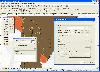 The CANVAS 9 GIS Mapping Edition adds native support for Geographic Information System (GIS) data to Canvas. You can take measurements in geographic coordinates, import industry standard SHAPE and GeoTIFF files into unlimited numbers of automatically aligned overlapping layers and choose among...
Platforms: Windows
The CANVAS 9 GIS Mapping Edition adds native support for Geographic Information System (GIS) data to Canvas. You can take measurements in geographic coordinates, import industry standard SHAPE and GeoTIFF files into unlimited numbers of automatically aligned overlapping layers and choose among...
Platforms: Windows
| License: Shareware | Cost: $549.99 USD | Size: 53.3 MB | Download (188): Canvas GIS Mapping Edition Download |
Released: July 25, 2007
|
Added: September 26, 2007 | Visits: 3.507
 AvisMap GIS Engine is a comprehensive SDK for the development of custom GIS applications and solutions. This SDK provides several ActiveX (OCX) controls which support Visual Basic, VB.NET, C#, Visual C++ and other ActiveX compatible programming languages, with Microsoft Visual Studio versions 6,...
Platforms: Windows
AvisMap GIS Engine is a comprehensive SDK for the development of custom GIS applications and solutions. This SDK provides several ActiveX (OCX) controls which support Visual Basic, VB.NET, C#, Visual C++ and other ActiveX compatible programming languages, with Microsoft Visual Studio versions 6,...
Platforms: Windows
| License: Shareware | Cost: $199.00 USD | Size: 43.76 MB | Download (157): AvisMap GIS Engine Download |
Added: September 22, 2010 | Visits: 1.580
 GIS::Distance::Polar can do Polar coordinate flat-earth distance calculations. SYNOPSIS my $calc = GIS::Distance::Polar->new(); my $distance = $calc->distance( $lon1, $lat1 => $lon2, $lat2 ); Supposedly this is a formula to better calculate distances at the poles. While implimented, this...
Platforms: *nix
GIS::Distance::Polar can do Polar coordinate flat-earth distance calculations. SYNOPSIS my $calc = GIS::Distance::Polar->new(); my $distance = $calc->distance( $lon1, $lat1 => $lon2, $lat2 ); Supposedly this is a formula to better calculate distances at the poles. While implimented, this...
Platforms: *nix
| License: Freeware | Size: 8.19 KB | Download (165): GIS::Distance::Polar Download |
Added: August 24, 2010 | Visits: 1.495
GIS::Distance::Vincenty Perl module contains Thaddeus Vincenty distance calculations. SYNOPSIS my $calc = GIS::Distance::Vincenty->new(); my $distance = $calc->distance( $lon1, $lat1 => $lon2, $lat2 ); For the benefit of the terminally obsessive (as well as the genuinely needy), Thaddeus...
Platforms: *nix
| License: Freeware | Size: 8.19 KB | Download (125): GIS::Distance::Vincenty Download |
Added: August 18, 2010 | Visits: 1.132
GIS-Knoppix is a bootable Linux CD with pre-installed GIS software. It is based on Knoppix..
Platforms: *nix
| License: Freeware | Size: 700 MB | Download (147): GIS Knoppix Download |
Released: June 13, 2012
|
Added: June 13, 2012 | Visits: 901
![]() With the new Icons-Land Vista Style GIS/GPS/Map Icon Set now it is much more comfortable to use local service applications, GPS tracking and GIS applications, and any kind of mapping applications. GIS/GPS/Map Icons are meant to help users to orient oneself when using maps, to facilitate their...
Platforms: Windows, Mac, Pocket PC, Java, Handheld/Mobile Other
With the new Icons-Land Vista Style GIS/GPS/Map Icon Set now it is much more comfortable to use local service applications, GPS tracking and GIS applications, and any kind of mapping applications. GIS/GPS/Map Icons are meant to help users to orient oneself when using maps, to facilitate their...
Platforms: Windows, Mac, Pocket PC, Java, Handheld/Mobile Other
| License: Demo | Cost: $120.00 USD | Size: 2.53 MB | Download (57): Icons-Land Vista Style GIS/GPS/MAP Icon Set Download |
Released: September 07, 2014
|
Added: September 21, 2014 | Visits: 755
![]() With the new Icons-Land GIS/GPS/Map Vector Icons now it is much more comfortable to use local service applications, GPS tracking and GIS applications, and any kind of mapping applications.
GIS/GPS/Map Icons are meant to help users to orient oneself when using maps, to facilitate their...
Platforms: Windows, Mac, Windows 8, Windows 7, iOS
With the new Icons-Land GIS/GPS/Map Vector Icons now it is much more comfortable to use local service applications, GPS tracking and GIS applications, and any kind of mapping applications.
GIS/GPS/Map Icons are meant to help users to orient oneself when using maps, to facilitate their...
Platforms: Windows, Mac, Windows 8, Windows 7, iOS
| License: Demo | Cost: $180.00 USD | Size: 5.56 MB | Download (40): Icons-Land GIS/GPS/MAP Vector Icons Download |
Added: November 06, 2006 | Visits: 3.090
 Arc DVD COPY provides a fast and easy way to backup your precious DVDs to DVD-R/RW, DVD+R/RW or hard drive. With just a few clicks you get completely the same as the DVD movie you bought that can be playback on both PC&Home DVD player in 30 minutes.
Featuring a user-friendly interface that...
Platforms: Windows
Arc DVD COPY provides a fast and easy way to backup your precious DVDs to DVD-R/RW, DVD+R/RW or hard drive. With just a few clicks you get completely the same as the DVD movie you bought that can be playback on both PC&Home DVD player in 30 minutes.
Featuring a user-friendly interface that...
Platforms: Windows
| License: Shareware | Cost: $39.95 USD | Size: 2.07 MB | Download (128): Arc DVD Copy Download |
Added: August 04, 2008 | Visits: 1.172
 GIS ObjectLand is a universal Geographic Information System for Windows. Key capabilities: vector-raster maps; multiuser data editing; import and export for MIF/MID (MapInfo), SHP (ArcView), DXF (AutoCAD), DBF (dBASE), CSV; setting access permissions to data for different categories of users;...
Platforms: Windows
GIS ObjectLand is a universal Geographic Information System for Windows. Key capabilities: vector-raster maps; multiuser data editing; import and export for MIF/MID (MapInfo), SHP (ArcView), DXF (AutoCAD), DBF (dBASE), CSV; setting access permissions to data for different categories of users;...
Platforms: Windows
| License: Shareware | Cost: $99.00 USD | Size: 23.54 MB | Download (537): GIS ObjectLand Download |
Added: August 07, 2008 | Visits: 1.776
Total GIS Converter is an affordable converter of GIZ files. It converts AEP, GRD, ADF, E00, FLT, APR, SHP, DXF, BT, TOC, RT1, DEM, DLG, ECW, IMG, DGF, GML, SID, MIF, TAB, WOR, DNG, DDF, BIL, TIF, JPEG, TTKPS, TTKGP, TTKLS, LFT, PFT, and TFT files. The target formats are TIFF, PNG, JPEG, BMP....
Platforms: Windows
| License: Shareware | Cost: $99.90 USD | Size: 2.66 KB | Download (648): Total GIS Converter Download |
Released: October 24, 2012
|
Added: October 24, 2012 | Visits: 680
 QGIS supports vector, raster, and database formats and lets you browse and create map data on your computer.
Quantum GIS (QGIS) supports many common spatial data formats (e.g. ESRI ShapeFile, geotiff). QGIS supports plugins to do things like display tracks from your GPS.
QGIS aims to be an...
Platforms: Linux
QGIS supports vector, raster, and database formats and lets you browse and create map data on your computer.
Quantum GIS (QGIS) supports many common spatial data formats (e.g. ESRI ShapeFile, geotiff). QGIS supports plugins to do things like display tracks from your GPS.
QGIS aims to be an...
Platforms: Linux
| License: Freeware | Size: 1024 KB | Download (460): Quantum GIS form Linux Download |
Released: July 24, 2012
|
Added: July 24, 2012 | Visits: 785
 QGIS supports vector, raster, and database formats and lets you browse and create map data on your computer.
Quantum GIS (QGIS) supports many common spatial data formats (e.g. ESRI ShapeFile, geotiff). QGIS supports plugins to do things like display tracks from your GPS.
QGIS aims to be an...
Platforms: Mac
QGIS supports vector, raster, and database formats and lets you browse and create map data on your computer.
Quantum GIS (QGIS) supports many common spatial data formats (e.g. ESRI ShapeFile, geotiff). QGIS supports plugins to do things like display tracks from your GPS.
QGIS aims to be an...
Platforms: Mac
| License: Freeware | Size: 1024 KB | Download (440): Quantum GIS form Mac Download |
Released: August 21, 2012
|
Added: August 21, 2012 | Visits: 427
 AGIS for Windows is a mapping and simple GIS shareware package. Plot your own geographic data on the map of the world provided without the high cost and steep learning curve usually associated with this kind of software. Create high resolution publication quality images that can be pasted into...
Platforms: Windows
AGIS for Windows is a mapping and simple GIS shareware package. Plot your own geographic data on the map of the world provided without the high cost and steep learning curve usually associated with this kind of software. Create high resolution publication quality images that can be pasted into...
Platforms: Windows
| License: Shareware | Cost: $49.00 USD | Size: 3.57 MB | Download (478): AGIS for Windows Download |
Released: June 21, 2012
|
Added: June 21, 2012 | Visits: 913
 Commonly referred to as GRASS, this is a free Geographic Information System (GIS) used for geospatial data management and analysis, image processing, graphics/maps production, spatial modeling, and visualization. GRASS is currently used in academic and commercial settings around the world, as...
Platforms: Mac
Commonly referred to as GRASS, this is a free Geographic Information System (GIS) used for geospatial data management and analysis, image processing, graphics/maps production, spatial modeling, and visualization. GRASS is currently used in academic and commercial settings around the world, as...
Platforms: Mac
| License: Freeware | Size: 59 MB | Download (57): Grass GIS for Mac OS X Download |
Released: July 27, 2012
|
Added: July 27, 2012 | Visits: 454
This is most likely the most feature rich image/swf horizontal arc scroller you can buy today. Please view all of the six demo examples and keep in mind *all* we changed were the XML Settings, that's all, they are all using the same swf ! With over 110 XML Settings, highly optimized code, AS2 and...
Platforms: Not Applicable
| License: Commercial | Cost: $8.00 USD | Size: 200 KB | Download (45): Professional Horizontal Arc Scroller AS3 Download |
Released: October 11, 2012
|
Added: October 11, 2012 | Visits: 778
 QGIS supports vector, raster, and database formats and lets you browse and create map data on your computer.
Quantum GIS (QGIS) supports many common spatial data formats (e.g. ESRI ShapeFile, geotiff). QGIS supports plugins to do things like display tracks from your GPS.
QGIS aims to be an...
Platforms: Windows
QGIS supports vector, raster, and database formats and lets you browse and create map data on your computer.
Quantum GIS (QGIS) supports many common spatial data formats (e.g. ESRI ShapeFile, geotiff). QGIS supports plugins to do things like display tracks from your GPS.
QGIS aims to be an...
Platforms: Windows
| License: Freeware | Size: 77.3 MB | Download (453): Quantum GIS Download |
Released: October 25, 2012
|
Added: October 25, 2012 | Visits: 540
Arc Consistency Crossword Compiler (arccc) uses constraint satisfaction algorithms to fill crossword grids given a wordlist. The current implementation can fill simple grids in less than a minute. A word list gleaned from a variety of sources is includ
Platforms: Windows, Mac, Linux
| License: Freeware | Size: 368.96 KB | Download (48): Arc Consistency Crossword Compiler Download |
Released: October 02, 2012
|
Added: October 02, 2012 | Visits: 580
GeoTools is an open source java GIS toolkit. Used for OGC based projects via GeoAPI interfaces. Includes two great SLD based renderers, raster access and reprojection. Plugns fo Shapefile, ArcGrid, ArcSDE, Postgis, OracleSpatial, MySQL and many more.
Platforms: Windows, Mac, Linux
| License: Freeware | Size: 44.2 MB | Download (50): GeoTools, the java GIS toolkit Download |