


JMARS 1.25 |
Company:
Arizona State University
|
Date Added: July 17, 2012 | Visits: 480 |
|
||||||||||
|
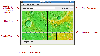
JMARS is an acronym that stands for Java Mission-planning and Analysis for Remote Sensing. It is a geospatial information system (GIS) developed by ASU's Mars Space Flight Facility to provide mission planning and data-analysis tools to NASA's orbiters, instrument team members, students of all ages, and the general public. JMARS provides free and efficient access to more than a terabyte of NASA orbiter data, and has basic image and vector processing features to conveniently compare, plot, and blend data. While JMARS began with a focus on Mars, it has branched out to work with data for Earth and the Moon, for which separate versions now exist. In all its variants, it's free to use and open-sourced, and is actively supported on Mac, Windows, Linux, and Solaris. MARS can do a great many things; here are a few of them: * Take multiple datasets (thermal inertia, mineral composition, digital elevations, etc.) and overlay them into a single, registered multilayer image. * Make topographic profiles, extract surface temperatures (day or night), plot footprints and render remote sensing images from orbiters. * Correlate mineral compositions with topographic data. * Combine surface roughness data with thermal inertia data. * Contour maps may be created. * Groups of layers can be composed by transparency blending or building an HSV/RGB composite. * Plots may be created by drawing multi-segment lines on the map, making it easy to sample elevation, thermal inertia, or other surface properties in an area of interest. * Load and process raw numeric rasters, which may be stretched and colorized on the fly. * Load and process vector data in several common formats. * Edit vector data on the map or in a table. * Use vector processing tools to calculate properties like line bearing or polygonal area. * An SQL-like scripting language provides a powerful transformation and filtering feature. And so on. JMARS provides access to many Mars data products: image footprints and rasters from the THEMIS, MOC, CTX, HiRISE, CRISM, Viking Imaging System, HRSC, and OMEGA instruments; mosaics from THEMIS, Viking, and CTX; topography from MOLA; compositional maps from TES and GRS/HEND; albedo and thermal inertia from TES and Viking. For the Moon, datasets include Clementine UV/VIS multispectral imaging, Lunar Orbiter imaging, Arecibo radar, and laser altimetry topography from Kaguya (Selene) and Lunar Reconnaissance Orbiter. For Earth (in beta-development), datasets include topography and ASTER and MODIS multispectral imaging. With all versions of JMARS (Earth, Moon, and Mars), new and improved datasets are being added continually, as quickly as instrument teams release them and the Planetary Data System makes them available. Finally, if you are a science team member for Mars Odyssey, Mars Reconnaissance Orbiter, or Lunar Reconnaissance Orbiter, you can also use JMARS to plan observations, identify regions of interest, review previously acquired data, and examine datasets from past missions. For more information, see the abstract from the JMARS presentation at the 2009 Fall Meeting of the American Geophysical Union. The following provides links to some of the instruments and missions whose data is available through JMARS
|
| License: Freeware | Size: 52.2 MB |
USER REVIEWS
JMARS RELATED
|
Database Tools
-
GeoDataSource World Cities Database Free Edition January 2011
GeoDataSource Free Cities Edition provides geographical database of world features, cities with place names and region names. Free database of worldwide cities in text format suitable for any applications requiring a comprehensive list of cities... |
||
|
Teaching Tools
-
Grass GIS for Mac OS X 6.4.1-3
Commonly referred to as GRASS, this is a free Geographic Information System (GIS) used for geospatial data management and analysis, image processing, graphics/maps production, spatial modeling, and visualization. GRASS is currently used in... |
59 MB | |
|
Project Management
-
Speak Logic Information Analysis Desktop 1.1
The Speak logic Information Analysis Desktop enables users to analyze manage information in their own desktops. For instance, while reading a webpage, a user may flag specific information, and then later that same information can be identified in... |
30.53 MB | |
|
Miscellaneous Communications Tools
-
Speak Logic Information Analysis for Internet Explorer 1.1
The Speak Logic Information Analysis for Internet Explorer enables users to analyze information and communications in Internet Explorer. While reading a website or webpage, if a user identifies information that’s needed to be analyzed, the user... |
29.92 MB | |
|
Business
-
Speak Logic Information Analysis for Microsoft Office V 2012
The Speak Logic Information Analysis for Microsoft Office enables the analysis of information and communications within Microsoft Word, Microsoft Outlook and Microsoft PowerPoint. For instance, while reading an email, users may find that the... |
30.98 MB | |
|
Business
-
Speak Logic Information Analysis Desktop V 2012
The Speak logic Information Analysis Desktop enables users to analyze manage information in their own desktops. For instance, while reading a webpage, a user may flag specific information, and then later that same information can be identified in... |
31.5 MB | |
|
Business
-
Speak Logic Information Analysis for Microsoft Office 1.1
The Speak Logic Information Analysis for Microsoft Office enables the analysis of information and communications within Microsoft Word, Microsoft Outlook and Microsoft PowerPoint. For instance, while reading an email, users may find that the... |
29.03 MB | |
|
Communication Tools
-
Speak Logic Information Analysis for Internet Explorer V 2012
The Speak Logic Information Analysis for Internet Explorer enables users to analyze information and communications in Internet Explorer. While reading a website or webpage, if a user identifies information that’s needed to be analyzed, the user... |
32.85 MB | |
|
Development Editors
-
Speak Logic Information Analysis for Visual Studio V 2012
The Speak Logic Information Analysis for Visual Studio enables users to analyze information in Visual Studio. The Speak Logic Information Analysis for Visual Studio enables users to analyze codes in Visual Studio. While working in Visual Studio,... |
31.71 MB | |
|
Science
-
GRASS GIS 6.4RC2-1
GRASS GIS, commonly referred to as GRASS (Geographic Resources Analysis Support System), is a Geographic Information System (GIS) used for geospatial data management and analysis, image processing, graphics/maps production, spatial modeling, and... |
NEW DOWNLOADS IN MULTIMEDIA & GRAPHICS, GRAPHICS VIEWERS
|
Multimedia & Graphics
-
DVDFab File Transfer 11.0.5.1
DVDFab File Transfer is a handy and easy to use tool for you to remove converted files on the computer to devices such as iPod, PSP and ZUNE. More devices will be supported in the future. When DVD/Blu-ray/File to iPod, DVD/File to PSP, and... |
160.96 MB | |
|
Multimedia & Graphics
-
EWD 3D 5.7.5
EWD 3D is a 3D CAD program. The software contains the major CAD functions (line, arc, polyline, spline, face, 3D solid, 3D Surface). Support boolean operation, undo/redo, drag/drop, OSNAP. And have good interactive,easy to use UI. Version EWD... |
14.3 MB | |
|
Multimedia & Graphics
-
EasyBanner Free 5.0
EasyBanner Free is free software that makes it easy and simple to create banners in GIF format. The design method is simple and you have the possibility to specify everything in the banner: background, texts, images, styles and animated effects.... |
2.23 MB | |
|
Multimedia & Graphics
-
Free AVI/MPEG/WMV/MP4/FLV Video Joiner 4.4.5
Free AVI/MPEG/WMV/MP4/FLV Video Joiner, a perfect easy-to-use video joining tool, allows the users to easily and quickly join more than one video file of different formats to one file of a specified format including AVI, MP4, FLV, WMV, etc. The... |
6.55 MB | |
|
Multimedia & Graphics
-
Webcam/Screen Video Capture Free 7.5.6
Webcam/Screen Video Capture Free is able to capture video from devices like webcams, IP-cameras, streaming video and more to AVI, MP4, FLV, WMV, MKV, etc., making the quickest and clearest way to communicate reachable for all people. It can record... |
4.25 MB | |
|
Graphics Viewers
-
ACDSee Free 2.2.0
ACDSee Free is a fast and powerful file browser, ideal for viewing RAW images, as well as searching and sorting your media libraries. What can ACDSee Free do for you? View RAW Camera File Formats: RAW image files can be thought of as... |
1.22 MB | |
|
Graphics Viewers
-
Free Photo Slide Show 2.21.1.28
Free Photo Slide Show displays your images continuously without you doing anything. You just point it to a file in folder, say how long to display each picture, select transition effects and then sit back and watch. If a picture is too large or... |
5.15 MB | |
|
Graphics Viewers
-
PhotoStage Free Photo Slideshow Software 7.38
Create a slideshow from your digital photos and videos on Windows and apply effects such as fade, crossfade, zoom and much more. Burn your slideshow to DVD for playback on TV, or as a standalone video file for enjoying on web and portable devices.... |
5.43 MB | |
|
Graphics Viewers
-
Photo Viewer For Win 10 1.0
Ever wondered why your photos doesn't look good on your computer screen when compared with your camera display or phone's display? Do you notice the loss of details on your laptop/desktop display? Ever wanted a simple photo viewer without any... |
1.25 MB | |
|
Graphics Viewers
-
Able RAWer 1.19.5.11
Able RAWer is an easy to use program targeted to view and correct RAW images (photos) taken with digital cameras. Supported formats: raw, crw, cr2, nef, pef, raf, x3f, bay, orf, srf, mrw, dcr. Able RAWer is a utility to read and manipulate raw... |
3.29 MB |